Madera County Road 400 is an approximately twenty-four-mile roadway following the course of the Fresno River in the Sierra Nevada Mountains. Road 400 begins at California State Route 145 near Madera and terminates to the north at Road 415 near Coarsegold. Traditionally Road 400 was known as "River Road" prior to Madera County dropping naming conventions on county highways. Road 400 was part of the original Yosemite Stage Route by the Washburn Brothers which began in 1882. The Yosemite Stage Route would be realigned to the west in 1886 along what is now Road 600 to a rail terminus in Raymond. Parts of Road 400 were realigned in 1974 to make way for the Hensley Lake Reservoir.
Part 1; the history of Madera County Road 400
Road 400 is historically tied to the Wawona Road and Hotel. The Wawona Hotel is located near the Mariposa Grove in the modern southern extent of Yosemite National Park.
The origins of the Wawona Road are tied to the Wawona Hotel but it does predate the complex. The original trail over the South Fork Merced River was plotted out by the Mann Brothers in 1855. The initial toll crossing of the South Fork Merced River was simply a large log which was replaced by a primitive bridge known as "Clark's Crossing" soon after Galen Clark arrived in the area. Galen Clark settled near the South Fork Merced River hoping to cure his tuberculosis. In 1857 Clark along with Milton Mann were the first Europeans to locate the nearby Mariposa Grove of Redwood Sequoias. Clark spent the ensuing years attempting to bolster tourism to the Wawona area and the Mariposa Grove. These earliest efforts by Clark yielded a series of trails which became the earliest vestiges of the Wawona Road and Mariposa Grove Road.
The 1855 Bridge over the South Fork Merced River frequently washed out and often repaired. In 1862 the original South Fork Merced River Bridge was washed out again and the crossing was replaced by felled trees. In 1864 President Lincoln signed law which led to the protection of Yosemite Valley and the Mariposa Grove. In 1868 Galen Clark constructed a new bridge crossing the South Fork Merced River. Clark intended to build a road to Yosemite Valley but ultimately failed to do so. In 1875 Clark's Station and the rest of Clark's property was purchased by the Washburn Brothers who subsequently covered the 1868 Bridge which soon came to be known as the Wawona Covered Bridge. The Wawona Covered Bridge was part of the Wawona Road until a replacement span over the South Fork Merced River was built about 700 feet to the west.
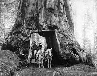
The first structure in the Wawona Hotel complex built by the Washburn Brothers complex dates back to 1876. At the time the Wawona Hotel was built to take advantage of tourism to the nearby Mariposa Grove via the Mariposa Grove Road. The name "Wawona" comes from a similar Mono Tribal word describing a Redwood Sequoia Tree. The Washburn Brothers completed the Wawona Road from their new Hotel to Yosemite Valley by 1879. In 1881 a tunnel was dug through the Wawona Tree in the Mariposa Grove to attract stages to drive through. In 1895 a second tunnel was carved through the California Tree in the Mariposa Grove. A stage wagon in the tunnel through the Wawona Tree can be seen on this 1904 photo.
Despite only being less than 30 miles south of Yosemite Valley the Wawona Hotel was several days away by foot through the wilderness. The Wawona Hotel was becoming popular and interest in a stage road north to Yosemite Valley was becoming a viable concept. Thus, the Yosemite Stage & Turnpike Company was founded in 1882 to facilitate stage route travel from the Wawona Hotel to Yosemite Valley.
The Yosemite Stage & Turnpike Company route took an alignment south/southwest from the Wawona Hotel complex to Madera via mining community of Grub Gulch. Grub Gulch developed after the opening of the Gambetta Mine in 1880. Grub Gulch obtained Post Office service during 1883 and reportedly may have had a population as high as 5,000 residents. Grub Gulch can be seen along the Yosemite Stage Road in a public domain photo from 1885.
The Yosemite Stage Road can be seen connecting the Fresno Big Trees (Mariposa Grove) to Madera on the 1882 Bancroft's Map of California. The original Yosemite Stage Road passed through Fresno Flats (modern Oakhurst) and Coarsegold as it descended through the Sierra Nevada Mountains following much of the eastern bank of the Fresno River towards Madera. Much of this early iteration of the Yosemite Stage Road is now part of Road 400.


The Yosemite Stage Road became popular enough that it drew attention of the Southern Pacific Railroad for the development of a spur line out of Berenda. Raymond was founded as Wild Cat Station and was the north terminus of the San Joaquin Valley & Yosemite Railroad which was opened by the Southern Pacific Railroad in February 1886. The San Joaquin Valley & Yosemite Railroad received its first passengers by March of 1886 and the community of Wild Cat Station became a popular trailhead for stages heading to the Wawona Hotel and Yosemite National Park. Post Office was established in July of 1886 and the community's name was changed to Raymond. The name Raymond was chosen due to the community frequently being the used to ship materials from the nearby Raymond Granite Quarry. Raymond also had a substantial lumber shipping industry sourced by nearby Fresno Flats (modern Oakhurst). The San Joaquin Valley & Yosemite Railroad was shuttered in 1946.
The San Joaquin Valley & Yosemite Railroad and Yosemite Stage Road can be seen connecting Berenda siding north of Madera to Yosemite Valley on the
1891 Thompson Atlas of Fresno County. Major waypoints are shown to be Raymond, Grub Gulch, Fresno Flats and Mariposa Grove. A spur alignment of the Yosemite Stage Road over Miami Mountain is displayed north of Fresno Flats in Township 6S, Range 21E. Much of the Yosemite Stage Road north of Fresno Flats was located in Mariposa County. The 1886 alignment of the Yosemite Stage Road displayed from Raymond follows modern Road 600, California State Route 49, Old Yosemite Road and California State Route 41 to the current boundary Yosemite National Park.


The Fresno River Road from Gateway Drive (former US Route 99) in downtown Madera east to where present Island Drive now lies was adopted into the State Highway System during 1933 as a component of
Legislative Route Number 126. This segment comprises modern Yosemite Avenue within the Madera city limits. The Fresno River Road can be seen partially as Legislative Route Number 126 in/near Madera and a major County Highway towards Coarsegold on the
1935 Division of Highways Map of Madera County.
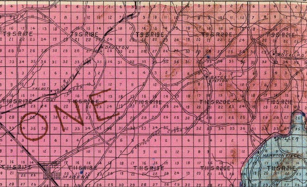
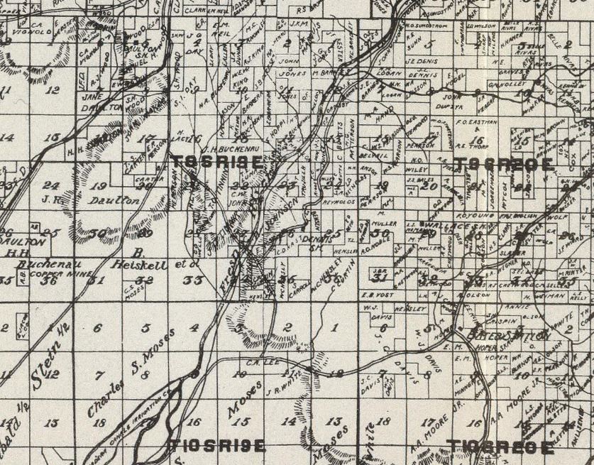
The 1944 United States Geological Survey Map of Raymond displays the Fresno River Road in detail. The highway is noted to be called "River Road." Madera County would drop their highway names near the middle of the twentieth century and replace them with a numbering grid. Major county roads within the Sierra Nevada Mountains were assigned as 200 (formerly North Fork Road), 400 (formerly River Road), 600 (formerly Raymond Road and Grub Gulch Road) and 800 (formerly Bailey Flats Road).


During 1974 the U.S. Army Corps of Engineers completed Hidden Dam along the Fresno River. The site of the dam was located approximately where Road 407 (formerly Hensley Road) once crossed the Fresno River via the "Hensley Bridge." The reservoir was named "Hensley Lake" as a reference to the former bridge. The bridge itself had been named in honor of John Jackson Hensley. The southeast corner of the reservoir would flood portions of existing Road 400 between what now Road 603 and the Hensley Lake Vista. The modern alignment of Road 400 was relocated uphill with the original being abandoned.
Part 2; a drive on Madera County Road 400
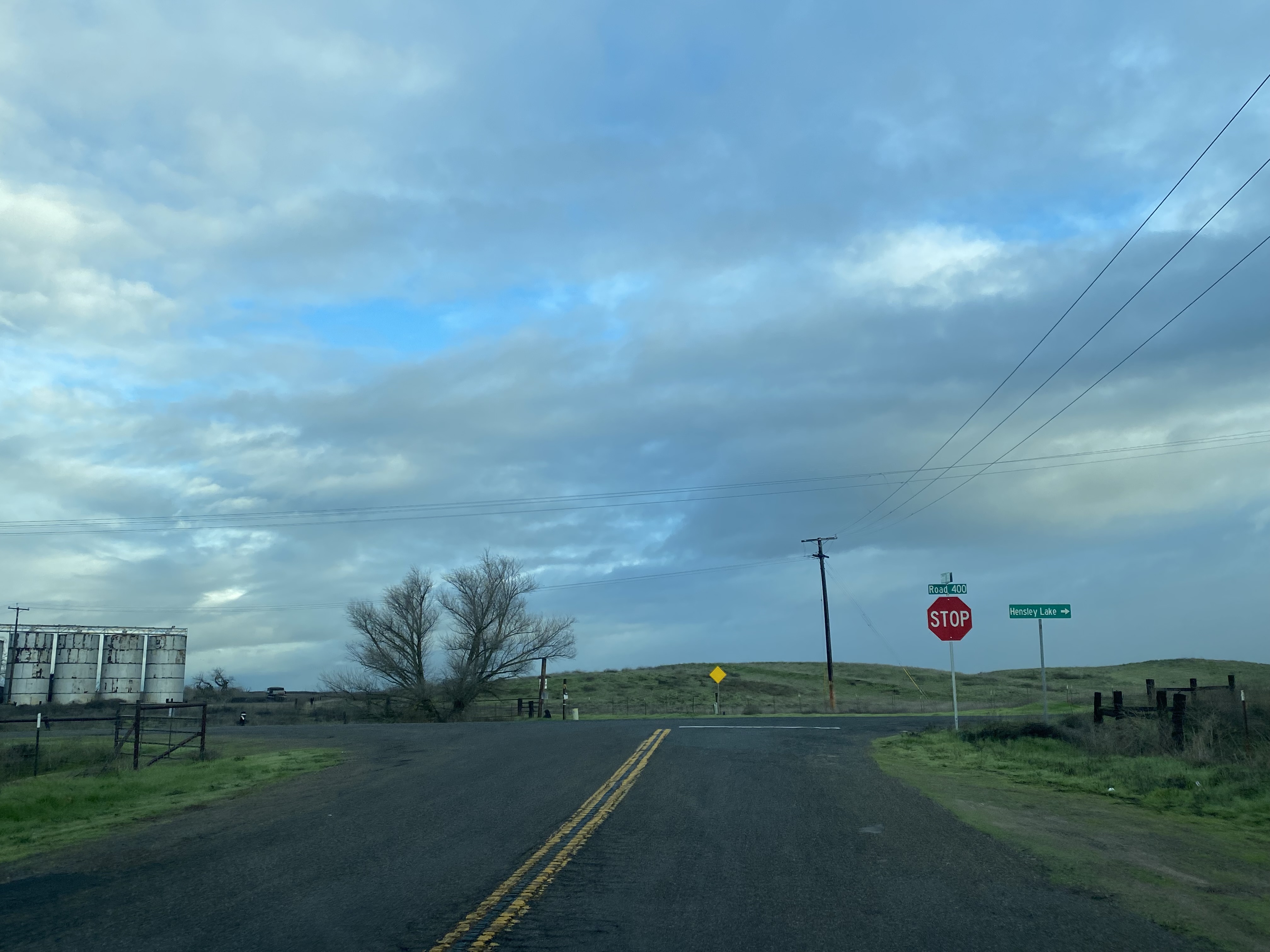
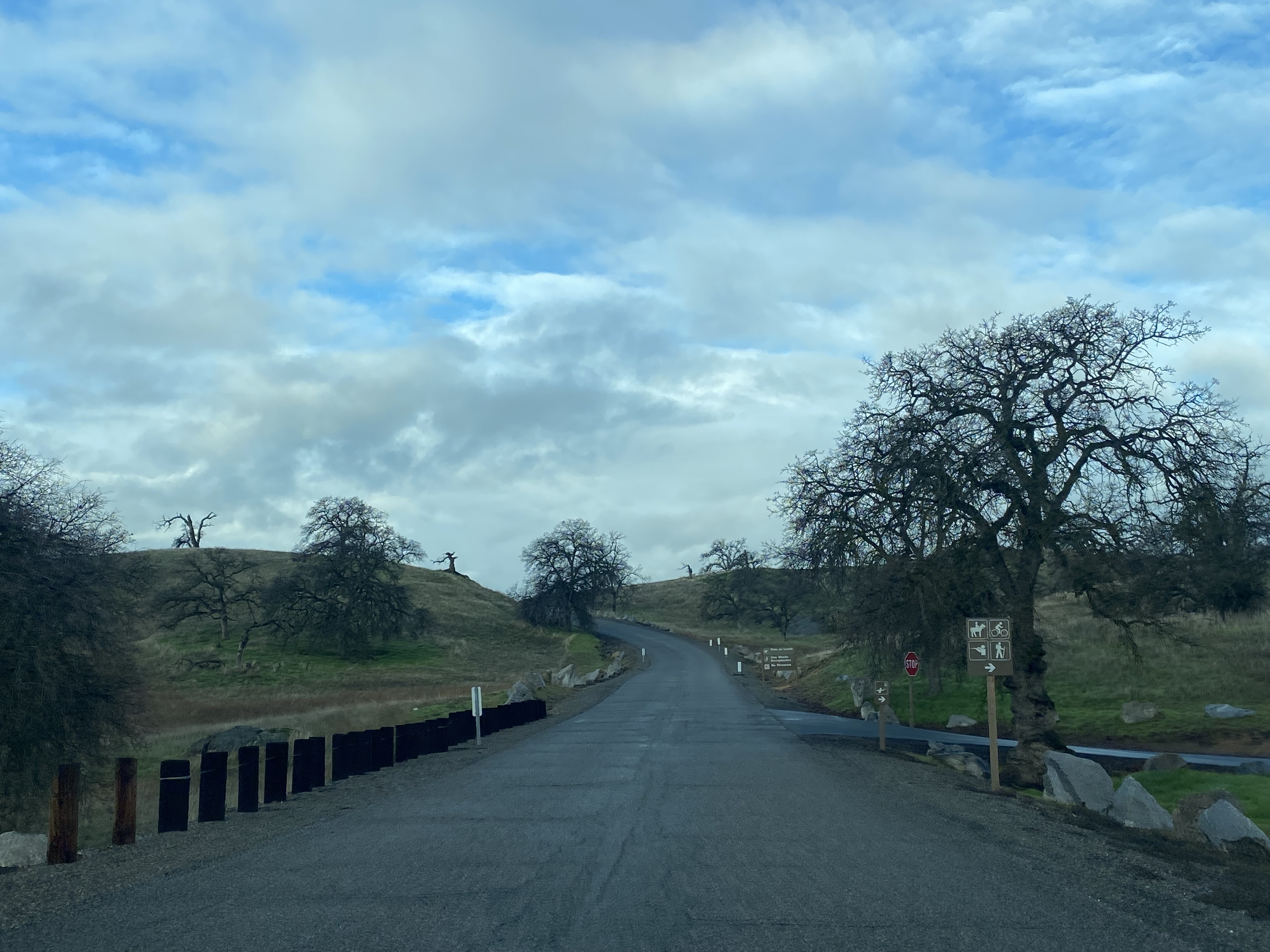
From the northern terminus of Road 33 traffic approaching Road 400 is directed to turn right to access Hensley Lake.
Road 400 north of Road 33 follows the eastern bank of the Fresno River into the Sierra Nevada Foothills where it intersects Road 406.
Road 400 continues north to Road 603 where an Army Corps of Engineers sign for Hidden Lake and Hensley Dam can be found. Traffic is advised that Coarsegold is located 17 miles to the north.
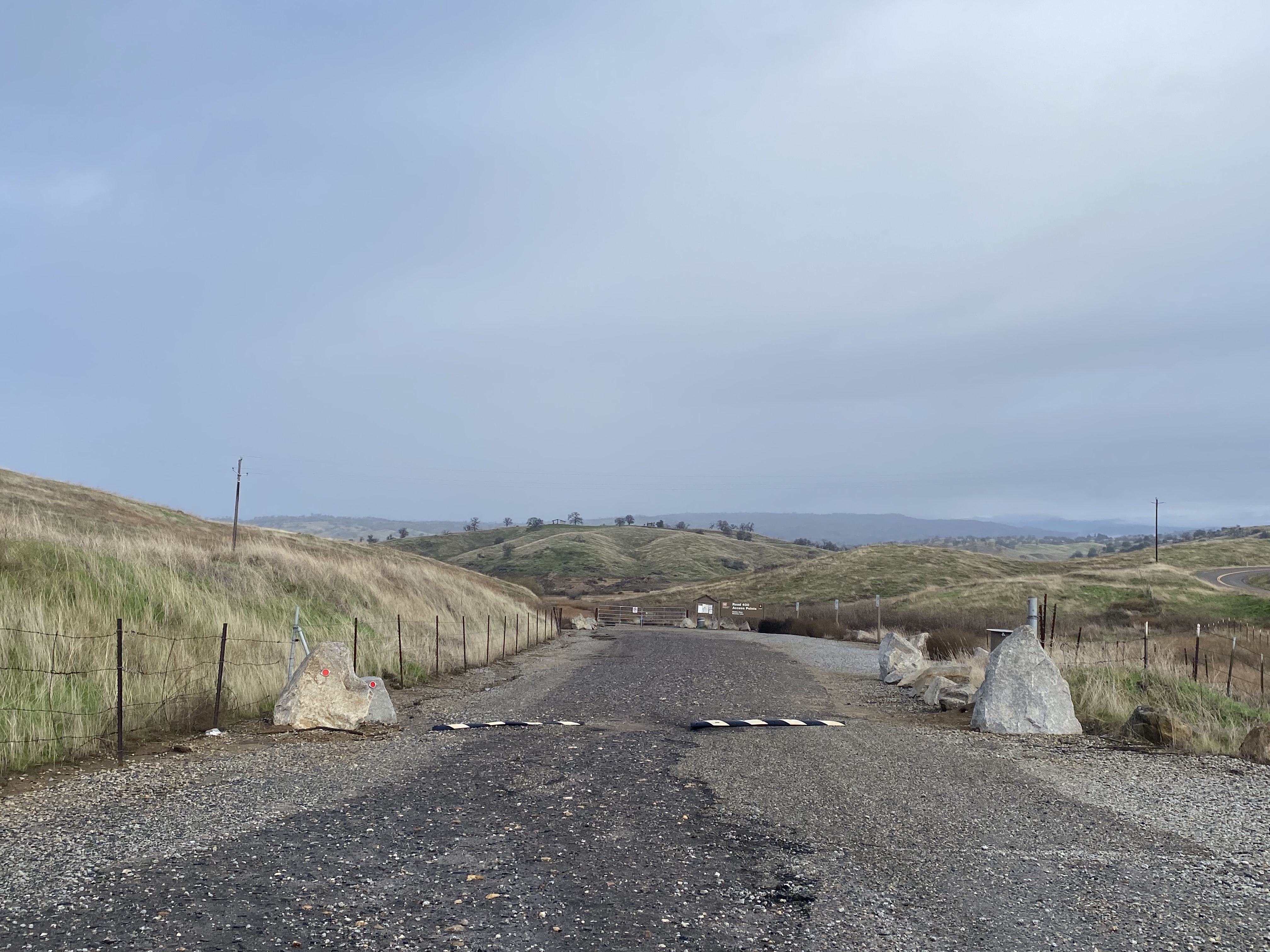
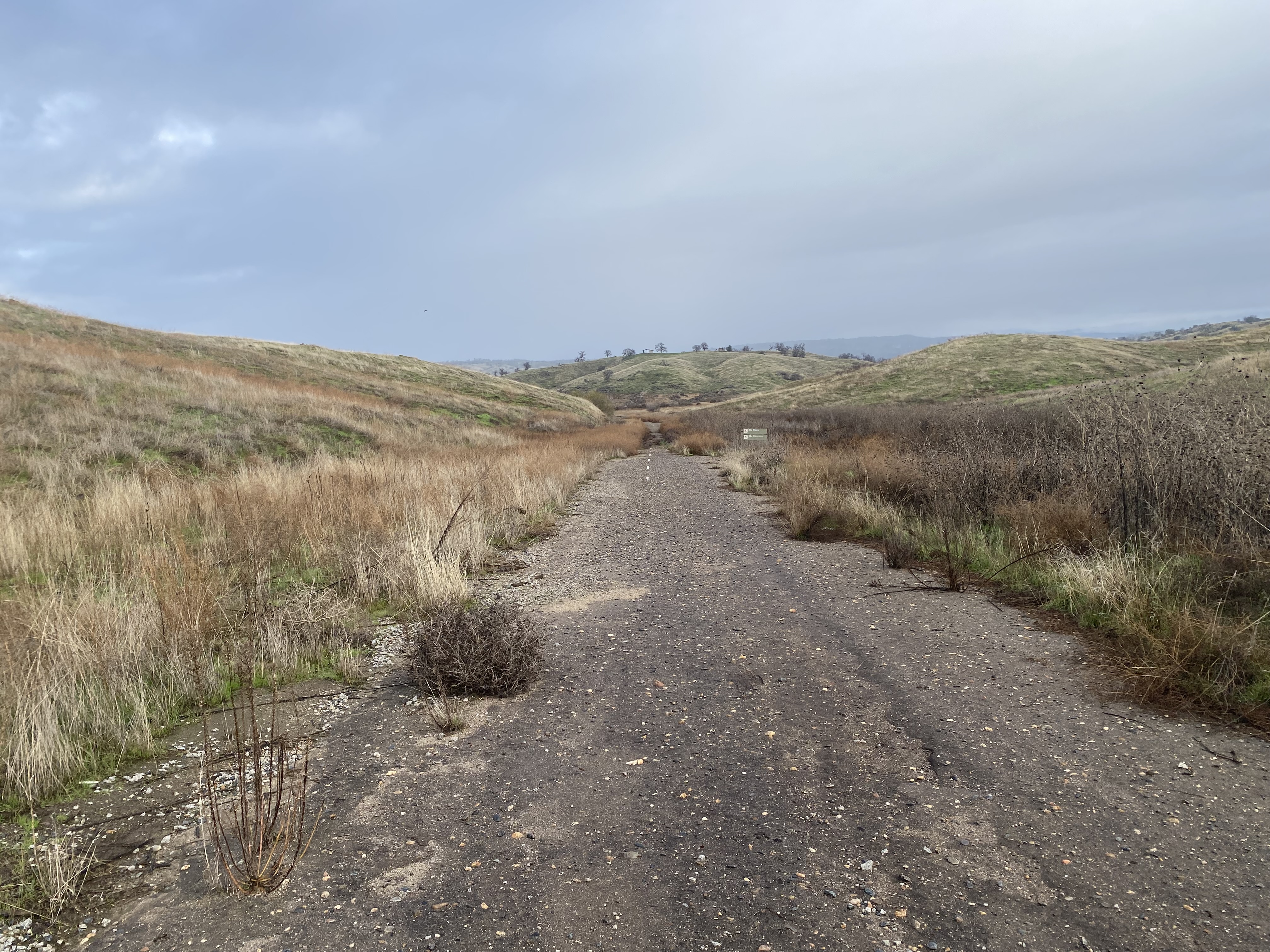
The original Fresno River Road into Hensley Lake can be accessed at the northwest corner of Road 400 and Road 603. The segment still has a white center stripe which has fallen out of wider use since 1974. Traffic on the original road would have intersected Road 407 near the Hensley Bridge in what now the waters of Hensley Lake.
Road 400 north of Road 603 follows the southeast corner of Hensley Lake. At the Road 400 Access Point the opposite end of the original Fresno River Road alignment grade can be found.
Road 400 intersects an access road to the Hensley Lake Vista. Despite Hidden Dam being completed in 1974 the reservoir would not open for public use until 1978.
Road 400 intersects the parking lot for the Buck Ridge Recreation Area north of the Hensley Lake Vista.
The Buck Ridge Trail is an approximately five-mile loop along the eastern ridges above Hensley Lake. The Buck Ridge Trail is open for hiking, hunting, horseback riding and mountain bikes.
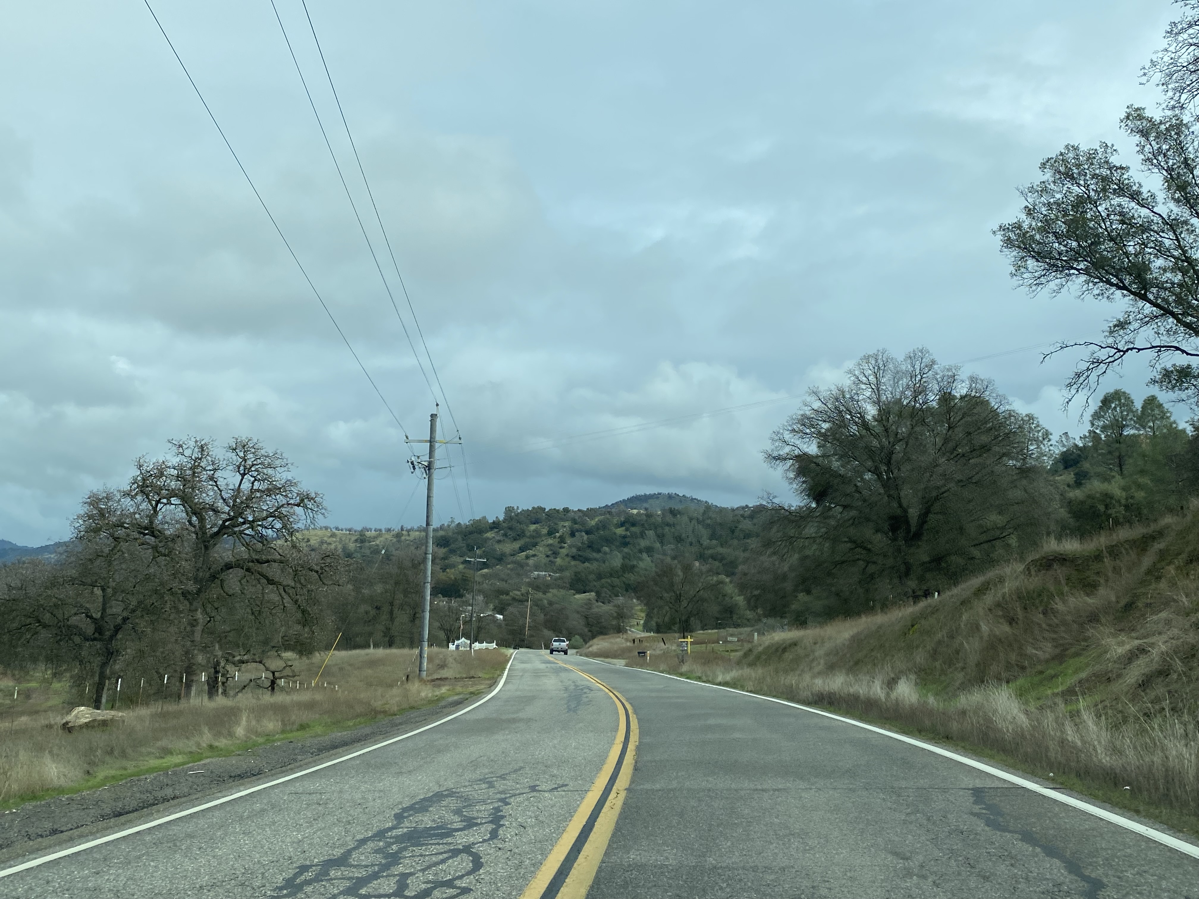
Road 400 north of Hensley Lake continues to climb through the Sierra Nevada Mountains along the Fresno River. A major junction can be found at Yosemite Springs Parkway which permits traffic to access California State Route 41.
Road 400 north of Yosemite Springs Parkway continues to a terminus at Road 415 approximately five miles west of Coarsegold.


.jpg)


Comments