The Harbor Freeway is a major north/south limited access corridor located in the Los Angeles metro area. The Harbor Freeway begins in the Los Angeles neighbor of San Pedro at California State Route 47 and terminates in downtown Los Angeles at US Route 101 as it meets the Four Level Interchange. The Harbor Freeway is approximately twenty-three miles in length with the segment from San Pedro north to Interstate 10 signed as Interstate 110 and the segment through downtown Los Angeles to the Four Level Interchange signed as California State Route 110. The Harbor Freeway corridor was historically tied to US Route 6 and California State Route 11 as it was being developed. Featured as the blog cover is the Harbor Freeway facing south towards the 4th Street overpass sourced from the May/June 1954 California Highways & Public Works.
Part 1; the history Legislative Route 165, the original California State Route 11 and the Harbor Freeway
The genesis of what would ultimately become the Harbor Freeway traces its origins back to the 1924 city of Los Angeles Major Street and Traffic Plan. Part of the 1924 traffic plan called for widening Figueroa Street and extending it to San Pedro as a proposal to enhance access to the Port of Los Angeles. At the time the State and Division of Highways could not become involved in maintenance of roadways in incorporated cities which slowed the pace of the expansion of Figueroa Street
The first three Figueroa Street Tunnels opened between Riverside Drive and Solano Avenue during October of 1931 which routed traffic through Elysian Park. The Figueroa Street Tunnels would ultimately end up becoming a key piece of the future Arroyo Seco Parkway and resolving an official terminus of US Route 66 (US 66) in Los Angeles. Note: this blog is not intended to answer the alignment shifts of US 66 in Los Angeles. More pertaining to the terminus points of US 66 in Los Angeles can be found in the blog below:
1933 was a landmark year in terms of Statewide transportation. The State Legislature removed restrictions that prevented State Funds from being used to maintain urban roadways. This change by the Legislature led to the addition of numerous urban highways being adopted during 1933.
One of the 1933 additions to the State Highway system was Legislative Route Number 165 (LRN 165) which was routed from San Pedro to La Canada Flintridge via Figueroa Street. The addition of LRN 165 made the three completed Figueroa Street Tunnels part of the State Highway system and led into the construction of the fourth southernmost tunnel. LRN 165 and Figueora Street south of US 101/LRN 2 in downtown Los Angeles would in time form the basis for the Harbor Freeway.
Much of the early US Route system around Los Angeles was heavily altered after 1933. During 1934 US 99 was realigned off a multiplex of US 66 from Pasadena-San Bernardino (LRN 9) to a new alignment which took it to Redlands via downtown Los Angeles, Pomona and Colton on LRN 26. The attached sketch map also implies US 66 was aligned through on LRN 165 the Figueroa Street Tunnels, Solano Avenue and Broadway to a terminus at US 101/Sunset Boulevard. The movements of US 99 and US 66 through the Figueroa Street Tunnels did nothing to add a Sign Highway designation south of downtown Los Angeles via LRN 165.
The August 1934 California Highways & Public Works announced the initial run of Sign State Routes. California State Route 11 (CA 11) was announced as a highway aligned from San Pedro north to CA 118/LRN 9 near La Canada Flintridge. CA 11 was entirely concurrent with the full route definition of LRN 165 on Figueroa Street.
The CAhighways.org page on Interstate 110 and California State Route 110 displays a photo of the fourth Figueroa Street Tunnel under construction. Temporary signage showing US 66/US 99 and CA 11 can be seen in front of the tunnel which is looking southbound. The Temporary signage shows US 99/US 66 and California State Route 11 jogging from the fourth Figueroa Street Tunnel onto Solano Street onwards to Broadway.
1935 Legislative Chapter 274 amended the definition of LRN 165 and clarified its routing:
"San Pedro to Route 9 near La Canada via Figueroa Street and Linda Vista Avenue."
The 1935 Division of Highways Map of Los Angeles displays CA 11/LRN 165 following Linda Vista Avenue from CA 118/LRN 9 near La Canada Flintridge south to US 66/LRN 161 in Pasadena at Colorado Street.
The 1935 Division of Highways Map of Los Angeles displays US 66/CA 11 following LRN 161 over the Colorado Street Bridge to Avenue 64 via a temporary routing. US 66/CA 11/LRN 165 can from Avenue 64 can be seen following York Boulevard to the State Maintained segment of Figueroa Street. From York Boulevard US 66/CA 11/LRN 165 picked up US 99 at Avenue 26. US 66/US 99/CA 11/LRN 165 followed Figueroa Street south over the Los Angeles River and a brief jog back to the three completed Figueroa Street Tunnels via Arroyo Seco Boulevard and Riverside Drive. As noted above US 66/US 99/CA 11/LRN 165 followed an interim alignment via Solano Avenue and Broadway to downtown Los Angeles to US 101/LRN 2 at Sunset Boulevard.
The 1935 Division of Highways Map of Los Angeles displays the status construction of CA 11/LRN 165 south of downtown Los Angeles on Figueroa Street. From Broadway a gap in LRN 165 is displayed between US 101/LRN 2 at Sunset Boulevard south to the completed segment of Figueroa Street south of downtown Los Angeles at Bevely Boulevard. It is unclear if CA 11 was signed on temporary routing through downtown Los Angeles at this time to reach the disconnected segment of LRN 165/Figueroa Street.
The 1935 Division of Highways Map of Los Angeles displays a disconnected segment of CA 11/LRN 165 in San Pedro constructed between Wilmington at B Street via Wilmington-San Pedro Road to 9th Street in San Pedro.
The 1936-37 Division of Highways Map displays US 66/CA 11/LRN 165 as complete to State standards between Colorado Street south to York Boulevard.
The February 1936 California Highways & Public Works announced a contract to construct a rail overhead crossing the Los Angeles Railway and Southern Pacific Railroad on CA 11/LRN 165/Figueroa Street as being awarded the past January.
An opening ceremony for the fourth Figueroa Street Tunnel was held on August 4th, 1936, which was featured in the Los Angeles Times. The completion of the fourth Figueroa Street Tunnel connected US US 66/US 99/CA 11/LRN 165 directly to US 101/LRN 2 at Sunset Boulevard.
The August 1936 California Highways & Public Works announced plans for the North Figueroa Street Viaduct and details the planned Arroyo Seco Parkway (LRN 205). The North Figueroa Street Viaduct would eliminate the jog in US 66/US 99/CA 11/LRN 165 on Arroyo Seco Boulevard and Riverside Drive. Note: LRN 205 and the Arroyo Seco Parkway were defined by 1935 Legislative Chapter 426 as a State Highway.
The January 1937 California Highways & Public Works announced construction of CA 11/LRN 165/Figueroa Street between 190th Street south to Lomita Boulevard had been budgeted for the 89th/90th Fiscal Years.
The April 1937 California Highways & Public Works features construction of the North Figueroa Street Viaduct over the Los Angeles River. The North Figueroa Street Viaduct is stated in the article stub to be nearing completion.
A letter dated February 8th, 1937, by the American Association of State Highway Officials (AASHO) Executive Secretary to the State Highway Engineers of; Colorado, Nevada and California announced the approved extension of US 6 from Greeley, Colorado to Long Beach, California. The extension of US 6 to Long Beach was carried via multiplex of US 99/LRN 4 from San Fernando Pass south onto San Fernando Road and US 66/US 99/CA 11/LRN 165 via the Figueroa Street Tunnels to downtown Los Angeles. South of downtown US 6 followed CA 11/LRN 165 via a multiplex on Figueroa Street to US Route 101A/LRN 60 where it would split towards Long Beach.
The 1937-38 Division of Highways Map displays US 6/CA 11/LRN 165 following Figuroa Street south of downtown Los Angeles. A small gap in LRN 165/Figueora Street is displayed south CA 14/LRN 175 near Torrance. US 6 is shown departing Figueroa Street onto US 101A/LRN 60 on State Street to a terminus at CA 15/LRN 167 in Long Beach. CA 11 is shown south of US 101A/LRN 60 following LRN 165 to a terminus in San Pedro at 9th Street.
US 66/US 99/US 6/CA 11/LRN 165 can be seen realigned over the North Figueroa Street Viaduct on the 1938 Division of Highways Map.
The partially completed Figueroa Street/Temple Street grade separation on US 6/CA 11/LRN 165 underpass is shown in the November 1939 California Highways & Public Works. The article stub notes the Arroyo Seco Parkway was anticipated to be completed during 1941.
The November 1940 California Highways & Public Works featured the completed extension of the Arroyo Seco Parkway south to Avenue 22 near the Los Angeles River. The extension of the Arroyo Seco Parkway to Avenue 22 was completed by November 1st, 1940 and include the new interchanges with US 99/US 6 and CA 11.
The completed Arroyo Seco Parkway between Los Angeles and Pasadena is featured in the January 1941 California Highways & Public Works. The Arroyo Seco Parkway is stated to have been dedicated on December 30th, 1940, Governor Culbert L. Olson as the new alignment of US 66 on LRN 205. The Arroyo Seco Parkway is stated to be the first freeway in the western United States serving as a direct limited access link between Los Angeles and Pasadena. The Arroyo Seco Parkway terminated at Avenue 22 where US 66/US 99/US 6/CA 11/LRN 165 continued south into Los Angeles via the North Figueroa Street Viaduct and Figueroa Street Tunnels. US 99 was carried via multiplex of US 66/US 6/CA 11/LRN 165 between Avenue 22 south on the Arroyo Seco Parkway to US 101/LRN 2 at Sunset Boulevard/Macy Boulevard. Note: what had been US 66 co-signed with CA 11/LRN 165 on Figueroa Street was assigned as US 66A upon the completion the Arroyo Seco Parkway.
The April 1941 California Highways & Public Works detailed the planned extension of the Arroyo Seco Parkway south from Avenue 22 to Adobe Street in Los Angeles. The extension of the Arroyo Seco Parkway included incorporating the existing Figueroa Street Tunnels as northbound travel lanes whereas new excavated southbound lanes were in the process of being constructed. The extension of the Arroyo Seco Parkway is stated to be a cooperative project between the State of California and the Federal Government.
The September 1941 California Highways & Public Works notes the Arroyo Seco Parkway extension had been designated a Defense Highway Project. The designation as a Defense Highway Project would ensure the Arroyo Seco Parkway extension was kept as a priority highway project in the event the United States would be pulled into World War II (spoiled, see what transpired on December 7th, 1941).
The November/December 1943 California Highways & Public Works features ongoing construction of the Los Angeles River Bridge along the southbound lanes of the Arroyo Seco Parkway extension to downtown Los Angeles.
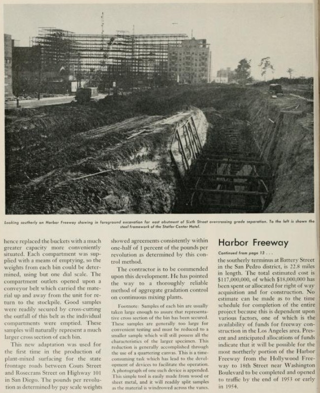
The November/December 1943 California Highways & Public Works announced construction of a new alignment US 6/CA 11/LRN 165 on the Harbor Freeway from Adobe Street south to 5th Street was approved as post-War project. This is the first reference to the Harbor Freeway in any volume of the California Highways & Public Works.
The January/February 1944 California Highways & Public Works features the extension of the Arroyo Seco Parkway south to downtown Los Angeles to Adobe Street. The extension of the Arroyo Seco Parkway moved US 66/US 99/US 6/CA 11/LRN 165 to a new freeway structure between Avenue 22 and Adobe Street. The existing Figueroa Street Tunnels were converted to northbound freeway usage whereas new southbound lanes were routed via the new Los Angeles River Bridge and an excavated cut. The extension of the Arroyo Seco Parkway opened to traffic on December 30th, 1943.
The extended Arroyo Seco Parkway as part of US 66/US 99/US 6/CA 11/LRN 165 can be seen on the 1944 Division of Highways Map.
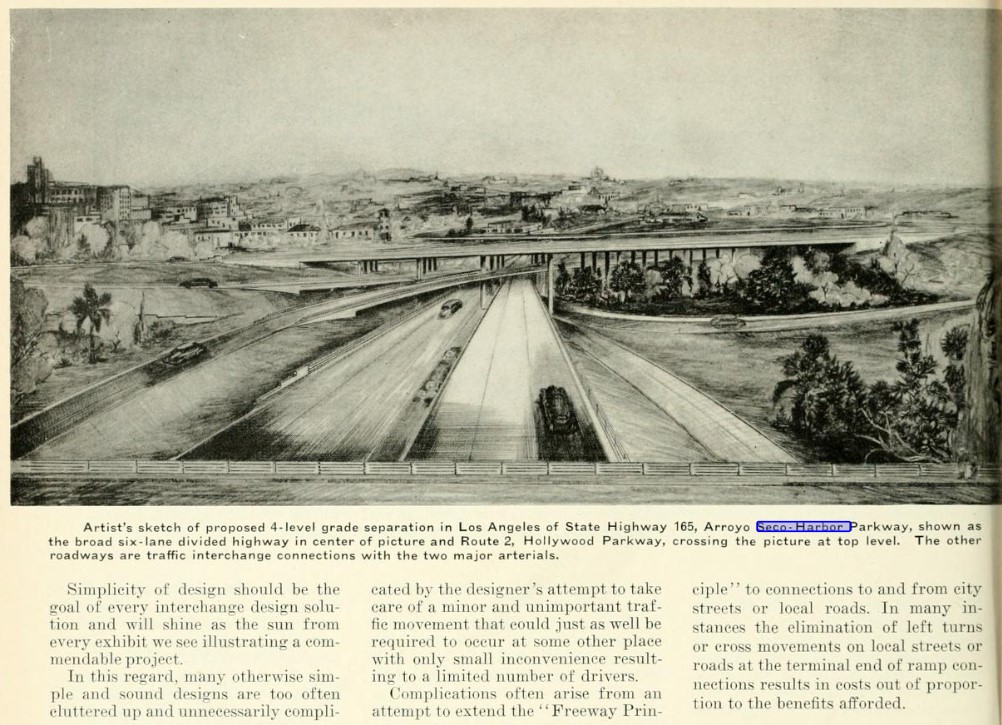
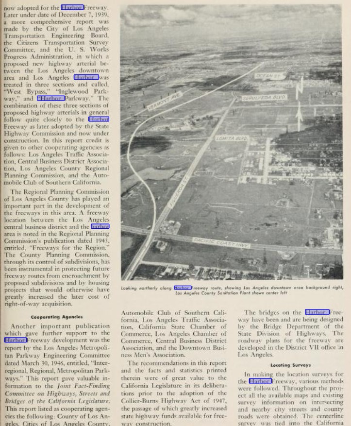
The May/June 1944 California Highways & Public Works features the conceptual Four Level Interchange. The Four Level Interchange as planned would permit direct limited access travel between the Arroyo Seco Parkway, Hollywood Parkway, Santa Ana Parkway and Harbor Parkway. in downtown Los Angeles. The article notes the Harbor Parkway was planned originate in Los Angeles from the Four Level Interchange as a limited access alignment of LRN 165 which would eventually terminate in San Pedro.
1947 Legislative Chapter 1233 changed the definition of LRN 165 by way of dropping Figueroa Street and Linda Vista Avenue from the wording.
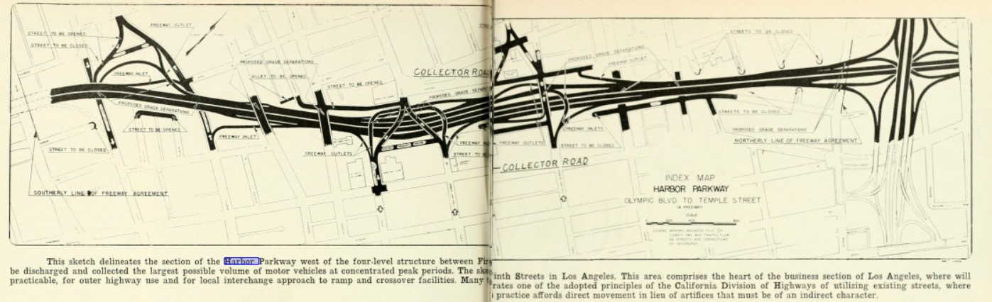
The January/February 1947 California Highways & Public Works provides a detailed sketch of the proposed Harbor Parkway south of the Four Level Interchange in downtown Los Angeles. An attached article stub describes the initial proposed segment of the Harbor Parkway ending at 9th Street.
The November/December 1947 California Highways & Public Works notes the Harbor Parkway south of the Four Level Interchange was now under construction. A sketch of the Harbor Parkway by the Division of Highways Bridge Department is featured.
The January/February 1949 California Highways & Public Works features an update on the construction of the Four Level Interchange. The Four Level Interchange is stated to be nearing completion. The article stub notes the Four Level Interchange would link the Arroyo Seco Parkway via a limited access grade to the Hollywood Parkway and Harbor Parkway. Construction of the Four Level Interchange once complete would eventually link the Arroyo Seco Parkway south from Adobe Street.
"Freeway means a highway in respect to which the owners of abutting land have no right of easement of access to or from their abutting lands or in respect to which such owners have only limited right of easement of access."
Applying the definition of Section 23.5 the article references the Harbor Parkway as being reclassified as the Harbor Freeway.
The planned alignment of the Harbor Freeway between downtown Los Angeles and San Pedro appears on the 1951 Division of Highways Map.
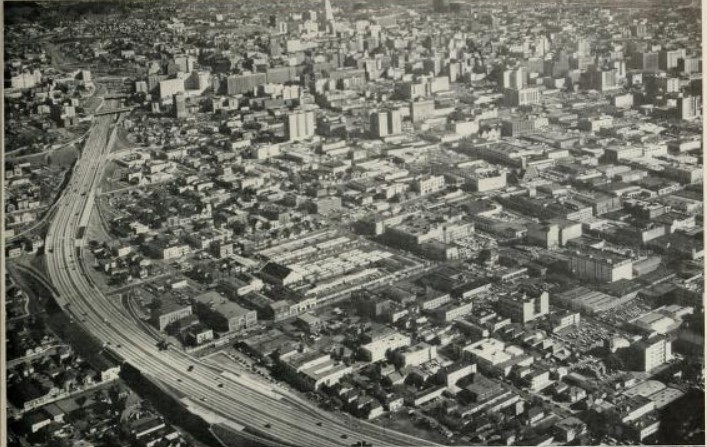
The March/April 1951 California Highways & Public Works provides an update on progress of construction of the Harbor Freeway in downtown Los Angeles. The Harbor Freeway is cited to have been conceptualized over two decades prior as an arterial highway between downtown Los Angeles and San Pedro known as the "West Bypass." Traffic studies cited in the article note the Harbor Freeway was planned as six lanes in width south to Slason Avenue. Numerous scenes of the Harbor Freeway being constructed in downtown Los Angeles are displayed.
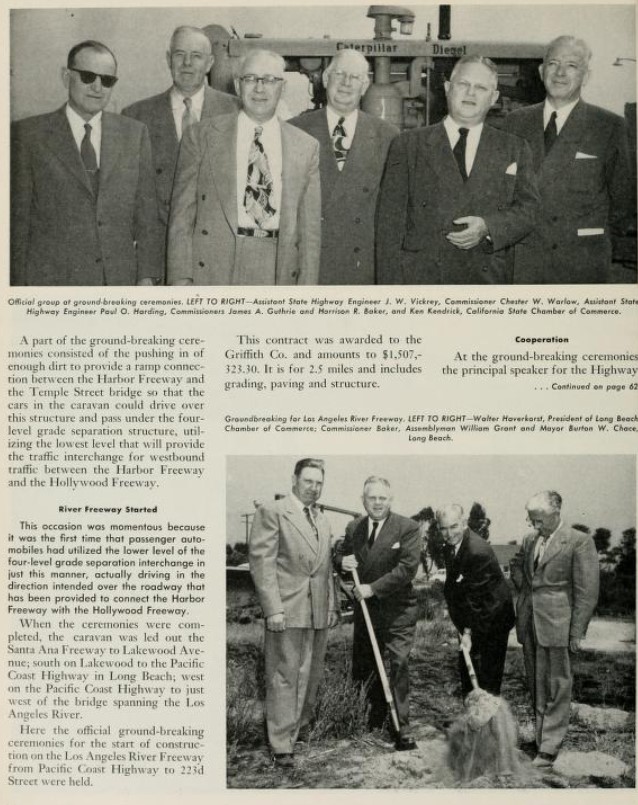
The July/August 1951 California Highways & Public Works announced construction of the Harbor Freeway from the Four Level Interchange south 4th Street had broken ground on June 27th, 1951. The article features the use of the lowest level of the Four Level Interchange by a California Highway Commission automotive caravan.
The September/October 1952 California Highways & Public Works features the opening of the initial 0.6 miles of the Harbor Freeway between the Four Level Interchange and 3rd Street in downtown Los Angeles. The initial segment of the Harbor Freeway is cited to have opened on July 30th, 1952. The article does not make it clear if the initial segment of the Harbor Freeway opened as US 6/CA 11 given no temporary routing back to existing LRN 165 on Figuroa Street is noted.
The March/April 1953 California Highways & Public Works notes the Arroyo Seco Parkway was expected to be completed to the Four Level Interchange and the Harbor Freeway by summer 1953. The completion of the Arroyo Seco Parkway to the Four Level Interchange would provide full freeway access through the structure for the first time.
The 1954 Division of Highways Map displays the completed segment of US 66/US 99/US 6/CA 11/LRN 165 on the Arroyo Seco Parkway to the Four Level Interchange. US 99/US 101/LRN 2 are shown moved to the completed Santa Ana Freeway and Aliso Street Bridge over the Los Angeles River. The completed Ramona Freeway alignment of US 99/US 60/US 70/LRN 26 from the Aliso Street Bridge to Alhambra is displayed. The planned Ramona Freeway extension of US 99/US 60/US 70/LRN 26 can also be seen. It is unclear where US 6/CA 11 detoured from the end of the Harbor Freeway at 3rd Steet to rejoin existing LRN 165 on Figuroa Street.
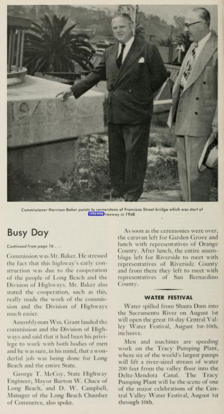
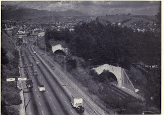
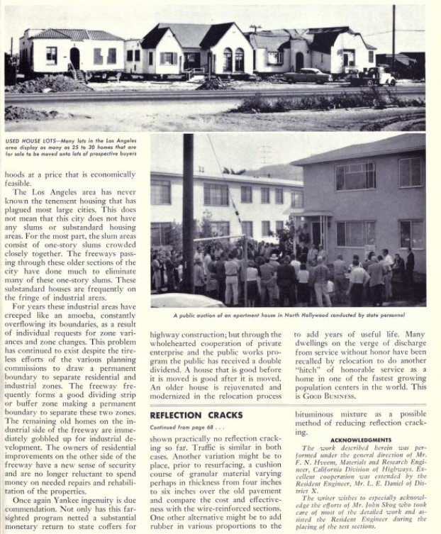
The May/June 1954 California Highways & Public Works features an update on construction of the Harbor Freeway. The Harbor Freeway is cited as opening to Olympic Boulevard on March 24th, 1954 and Washington Boulevard on May 14th, 1954. An extension of the Harbor Freeway south to 23rd Street is stated to have an anticipated opening during November 1954 with an extension south to 42nd Street by November 1955. The article notes the conceptual Harbor Freeway appeared in a April 16th, 1937, Automobile Club of Southern California report on traffic studies in the Los Angeles area. The city of Los Angeles Transportation Engineering Board published their own survey on December 7th, 1939. What was to become the Harbor Freeway was known first as the West Bypass, Inglewood Parkway and Harbor Parkway. The Harbor Parkway would be noted as a freeway between downtown Los Angeles and San Pedro in a 1943 Los Angeles County Regional Planning Commission report titled "Freeways for the Region." During 1946 the Los Angeles Metropolitan Parkway Engineering Committee published a report titled "Regional, Metropolitan Parkways" which was presented to the State Legislature as a rationale for adoption of the 1947 Collier-Burns Highway Act. The 1947 Collier-Burns Highway Act greatly increased the funds available to construct the Harbor Freeway and other major urban freeway corridors.
The 1955 Division of Highways Map depicts US 6/CA 11/LRN 165 realigned onto the Harbor Freeway south to the recently completed segment to 23rd Street in downtown Los Angeles. US 6/CA 11/LRN 165 are shown transitioning to Figueroa Street from the end of the Harbor Freeway at 23rd Street. Note: the Arroyo Seco Parkway was renamed the Pasadena Freeway during November 1954.
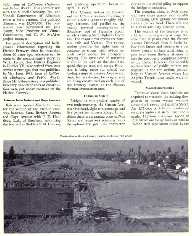
The July/August 1955 California Highways & Public Works features construction of the Harbor Freeway in Wilmington and San Pedro. The construction zone is stated to cover the Harbor Freeway corridor from Battery Street 2.8-miles a short distance north of US 101A/LRN 60 at Pacific Coast Highway. Construction of the San Pedro-Wilmington corridor of the Harbor Freeway is stated to be approximately 60% complete. The San Pedro-Wilmington corridor of the Harbor Freeway is noted to have anticipated completion date targeted for June 18th, 1956.
The 1956 Division of Highways Map displays the Harbor Freeway completed to Santa Barbara Avenue south of downtown Los Angeles. US 6/CA 11/LRN 165 is shown taking a jog on Santa Barbara Avenue from the end of the Harbor Freeway to reach Figueroa Street.
The July/August 1956 California Highways & Public Works announced the southbound lanes of the Harbor Freeway between Wilmington-San Pedro opened to traffic on June 4th, 1956, whereas the northbound lanes opened on June 19th, 1956.
The 1957 Division of Highways Map continues to depict US 6/CA 11 departing the Harbor Freeway at Santa Barbara Avenue to reach Figueroa Street. The completed Harbor Freeway from US 101A/LRN 60 in Wilmington south to Battery Street in San Pedro is displayed. CA 11/LRN 165 is shown following Gaffey Street to a terminus at 9th Street in San Pedro.
The May/June 1957 California Highways & Public Works features an update on the construction of the Harbor Freeway. The Harbor Freeway between Santa Barbara Avenue and 88th Street is stated to have opened to traffic on April 24th, 1957.
The 1958 Division of Highways Map displays US 6/CA 11/LRN 165 taking a temporary detour from the end of the Harbor Freeway via CA 10/LRN 174 via Manchester Avenue to reach Figueroa Street.
The January/February 1959 California Highways & Public Works notes the Harbor Freeway was extended to 124th Street near Compton by late year 1958. Construction on extending the Harbor Freeway to 190th Street is stated to be underway.
The 1959 Division of Highways Map displays US 6/CA 11/LRN 165 transitioning from the end of Harbor Freeway onto Figueroa Street.
The March/April 1961 California Highways & Public Works notes the Harbor Freeway was extended to 190th Street by August 1960. The remainder of the Harbor Freeway from 190th Street south to US 101A/LRN 60 at Pacific Coast Highway is stated to be under construction via two contracts with a target completion during May 1962.
The September/October 1962 California Highways & Public Works notes the southbound lanes of the Harbor Freeway had been opened from 208th Street to US 101A/LRN 60 at Pacific Coast Highway on August 28th, 1962. The northbound lanes of the Harbor Freeway between Pacific Coast Highway and 208th Street are stated to have opened during late September. The final leg of the Harbor brought it to its original planned length of 22.6 miles between the Four Level Interchange in downtown Los Angeles and Battery Street in San Pedro.
The completed Harbor Freeway between the Four Level Interchange and Battery Street in San Pedro appears on the 1963 Division of Highways Map.
The truncation of US 6 from Long Beach to Bishop was approved by the AASHO Executive Committee on June 19th, 1963, in the run up to the 1964 State Highway Renumbering. The truncation of US 6 to Bishop removed it from the Golden State Freeway, Pasadena Freeway and left CA 11 as the only designation on the Harbor Freeway.
US 66 was approved to be truncated from Los Angeles to US 95 in Needles by the AASHO on November 14th, 1963. US 66 was effectively immediately removed from the Pasadena Freeway with signage being truncated to Pasadena. This measure left only CA 11 as the only signed highway on the Pasadena Freeway as US 99 had been shifted to a terminus at the San Bernardino Freeway by way of the Golden State Freeway. Signage of US 66 would not be truncated from Pasadena to US 95 until Interstate 40 was completed through the Bristol Mountains in 1972.
US 66A which was concurrent with CA 11 between the Arroyo Seco Parkway and Pasadena was approved to be deleted by the AASHO Executive Committe on October 20th, 1963.
As part of the 1964 State Highway Renumbering CA 11 was given a new routing definition of "San Pedro to Route 248 (former US 66 at Colorado Boulevard) to Pasadena. Effectively this measure left CA 11 as the only signed highway over the Pasadena Freeway and Harbor Freeway corridors. What had been CA 11 north of the Los Angeles River Viaduct on Figueroa Street and Linda Vista Avenue was redesignated as CA 159. The 1964 Division of Highways Map reflects the changes to US Routes and State Routes in the Pasadena Freeway-Harbor Freeway corridors related to the 1964 State Highway Renumbering.
The March/April 1964 California Highways & Public Works notes the interchange between CA 7/Vincent Thomas Bridge and CA 11/Harbor Freeway is stated to be in design phases. As originally constructed CA 7 upon entering San Pedro via the Vincent Thomas Bridge followed North Street and Pacific Avenue to reach CA 11/Harbor Freeway. The Vincent Thomas Bridge is stated to be part of the greater scope of the Long Beach Freeway.
The March/April 1965 California Highways & Public Works notes that 25% of the right of way needed in San Pedro to construct the extension of CA 11/Harbor Freeway to CA 7 (before Legislative Chapter 1372) and the Vincent Thomas Bridge had been acquired.
1965 Legislative Chapter 1372 deleted CA 159/former CA 11 on Figueroa Street between Interstate 5 and CA 134. The deletion of the Figueroa Street segment added a stipulation that the Linda Vista Avenue segment would be relinquished upon the completion of the Foothill Freeway (Interstate 210). The truncation of CA 159 to solely Linda Vista Avenue can be seen on the 1967 Division of Highways Map.
The CA 11/Harbor Freeway and CA 47/Vincent Thomas Bridge interchange was completed in the San Pedro area on July 9th, 1970. The 1970 Division of Highways Map displays Harbor Freeway/Vincent Thomas Bridge Interchange as completed. Notably despite the Harbor Freeway reaching its modern length CA 11 is still shown to be aligned on Gaffey Street in San Pedro to a southern terminus at 9th Street.
During December 1978 as part of the Surface Transportation Assistance Act the Federal Highway Administration approved the Harbor Freeway from CA 47 to Interstate 10 to be added as a chargeable Interstate corridor. It is unclear when an Interstate number was selected for the Harbor Freeway corridor as it is not referenced in the AASHTO Database.
1981 Legislative Chapter 292 defined all of the original CA 11 on the Pasadena Freeway and Harbor Freeway as "Route 110." CA 110 was applied to the entirety of the Pasadena Freeway and the Harbor Freeway south through downtown Los Angeles to Interstate 10. The Harbor Freeway south of Interstate 10 was assigned as the second iteration of Interstate 110. The Harbor Freeway between US 101 to Interstate 10 is displayed as being signed CA 11 but legislatively CA 110 on the 1982 Caltrans Map. The 1982 Caltrans Map depicts Harbor Freeway south of Interstate 10 is displayed co-signed as Interstate 110 and CA 11. South of the Harbor Freeway/Vincent Thomas Bridge interchange the existing highway on Gaffey Street to 9th Street in San Pedro is shown signed as CA 11 but legislatively CA 110.
The 1986 Caltrans Map displays the entire Harbor Freeway signed as CA 110 and Interstate 110. Notably a second CA 110 segment south of the Harbor Freeway/Vincent Thomas Bridge is displayed in San Pedro.
CA 159/former CA 11 on Linda Vista Avenue was relinquished on July 14th, 1989. Thusly, CA 159 no longer appears on the 1990 Caltrans Map as a traversable highway. The Linda Vista Avenue segment of CA 159 would not be deleted legislatively until 1992 Assembly Bill 3090, Chapter 1243.
2000 Senate Bill 1584, Chapter 270 deleted CA 110 between Glenarm Avenue and Colorado Street in Pasadena. Chapter 270 clarified the definition of Interstate 110/CA 110 as ending at CA 47 in San Pedro. Despite the southern terminus of Interstate 110/CA 110 being designated as CA 47 the highway is shown continuing as CA 110 to 9th Street in San Pedro on the 2005 Caltrans Map.
2008 Assembly Bill 2211, Chapter 669 clarified the Legislative Definition of Interstate 110/CA 110 as beginning at 9th Street in San Pedro. Chapter 669 also added provisions through which CA 110 on Gaffey Street in San Pedro could be relinquished. CA 110 on Gaffey Street in San Pedro was relinquished formally by the California Transportation Commission during June 2009.
During 2010 the Pasadena Freeway was redesignated as the Arroyo Seco Parkway. The Arroyo Seco Parkway was added to the National Register of Historic Places during 2011. 2012 Assembly Bill 2679, Chapter 769 defined the southern terminus of Interstate 110/CA 110 as CA 47 in San Pedro.
Part 2; a drive on the Harbor Freeway
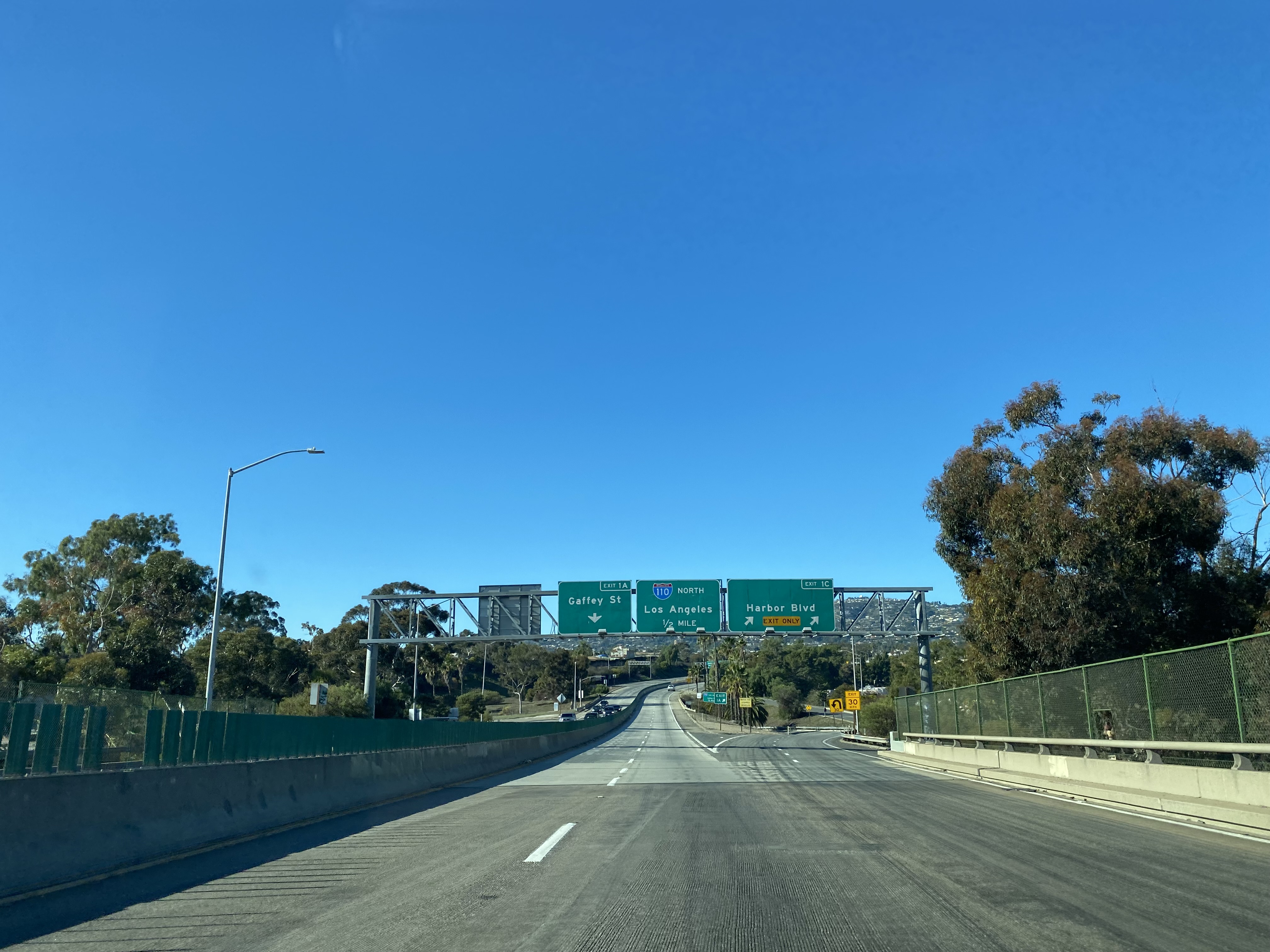
From westbound CA 47 in San Pedro traffic can access the Interstate 110 portion of the Harbor Freeway northbound.
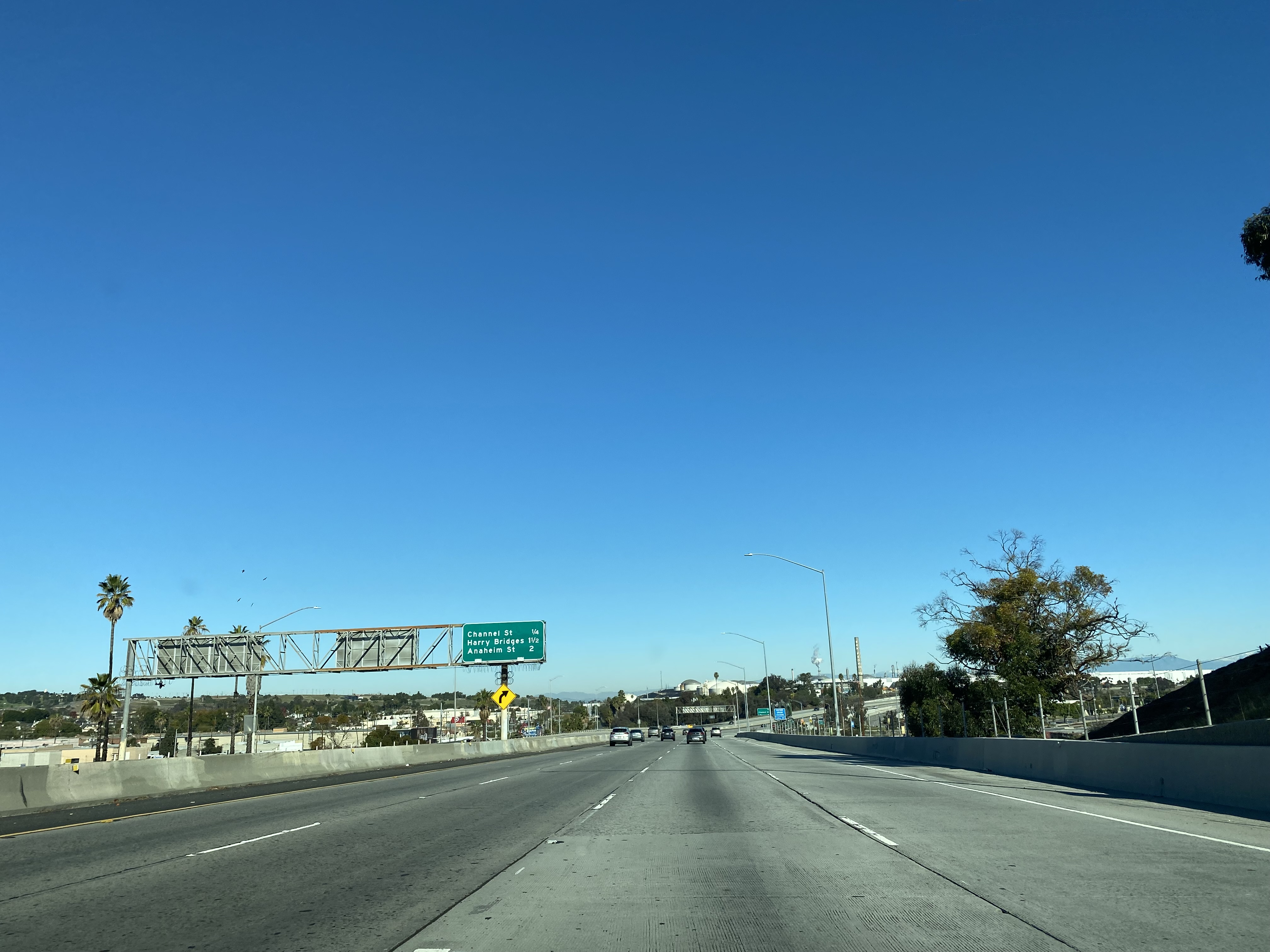
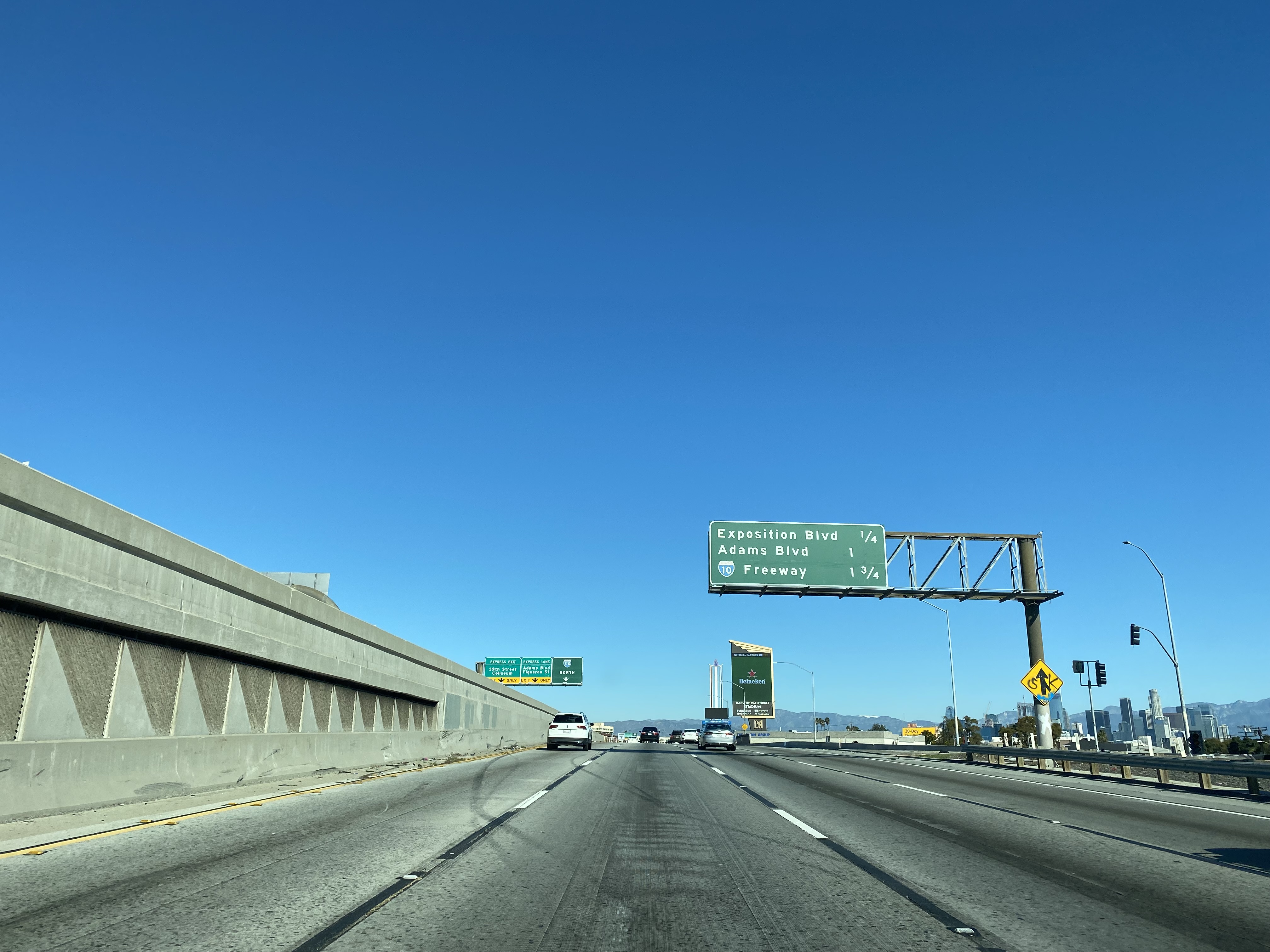
As downtown Los Angeles looms in the distance northbound Harbor Freeway Exit 20C accesses Adams Boulevard.
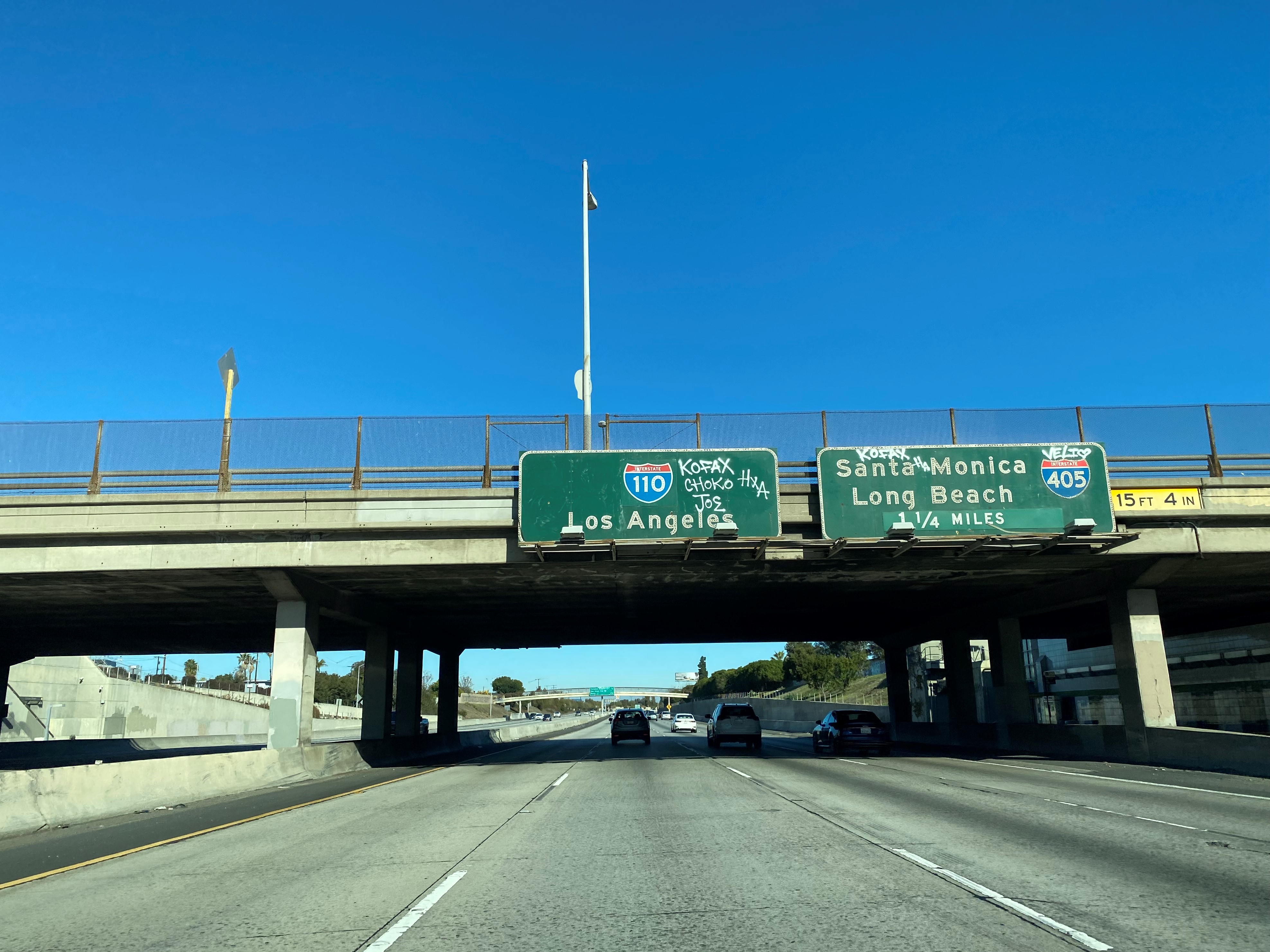
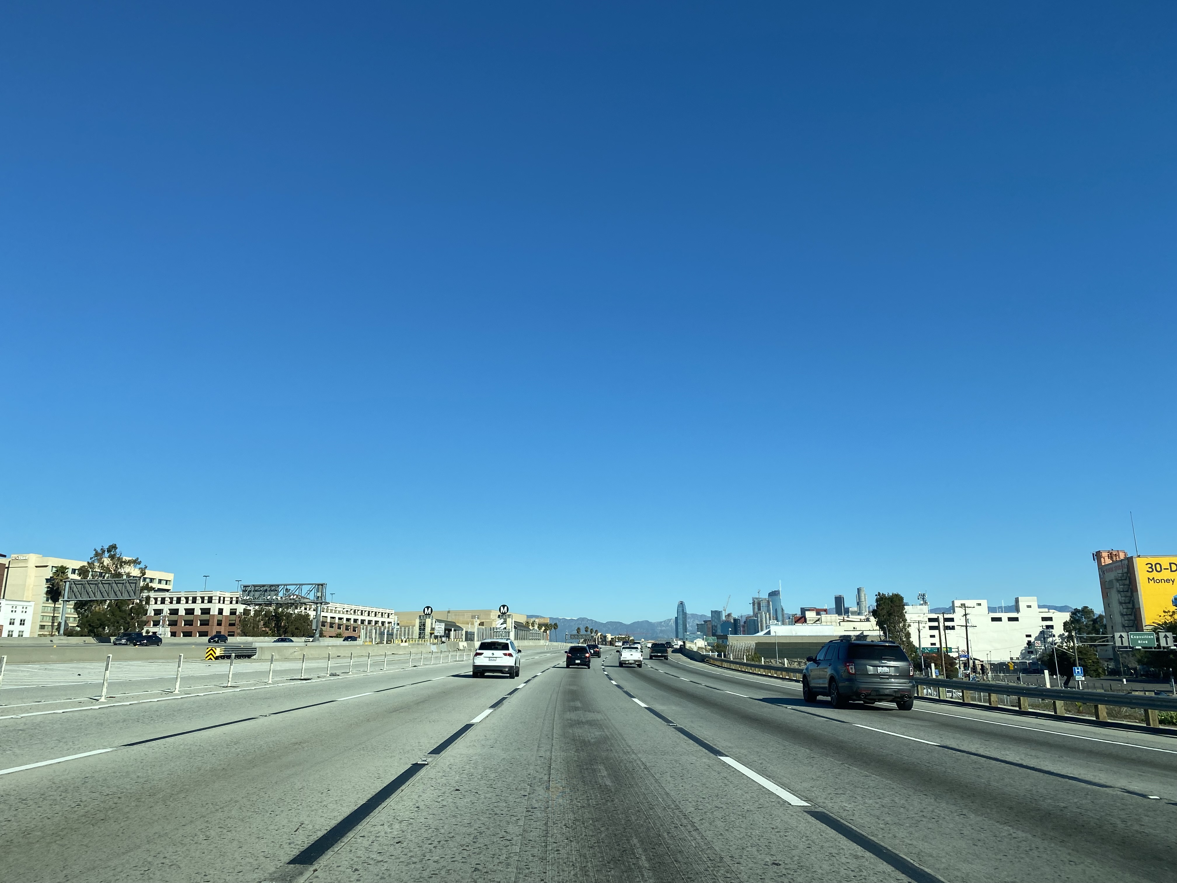
Harbor Freeway northbound Exit 21 accesses Interstate 10/Santa Monica Freeway. Upon crossing Interstate 10 the Harbor Freeway northbound enters downtown Los Angeles and becomes CA 110.
Harbor Freeway northbound traffic heading into downtown Los Angeles via 4th Street and 3rd Street is directed to a right-hand grade separation.
Harbor Freeway northbound Exit 22 accesses James M. Wood Boulevard and 9th Street.
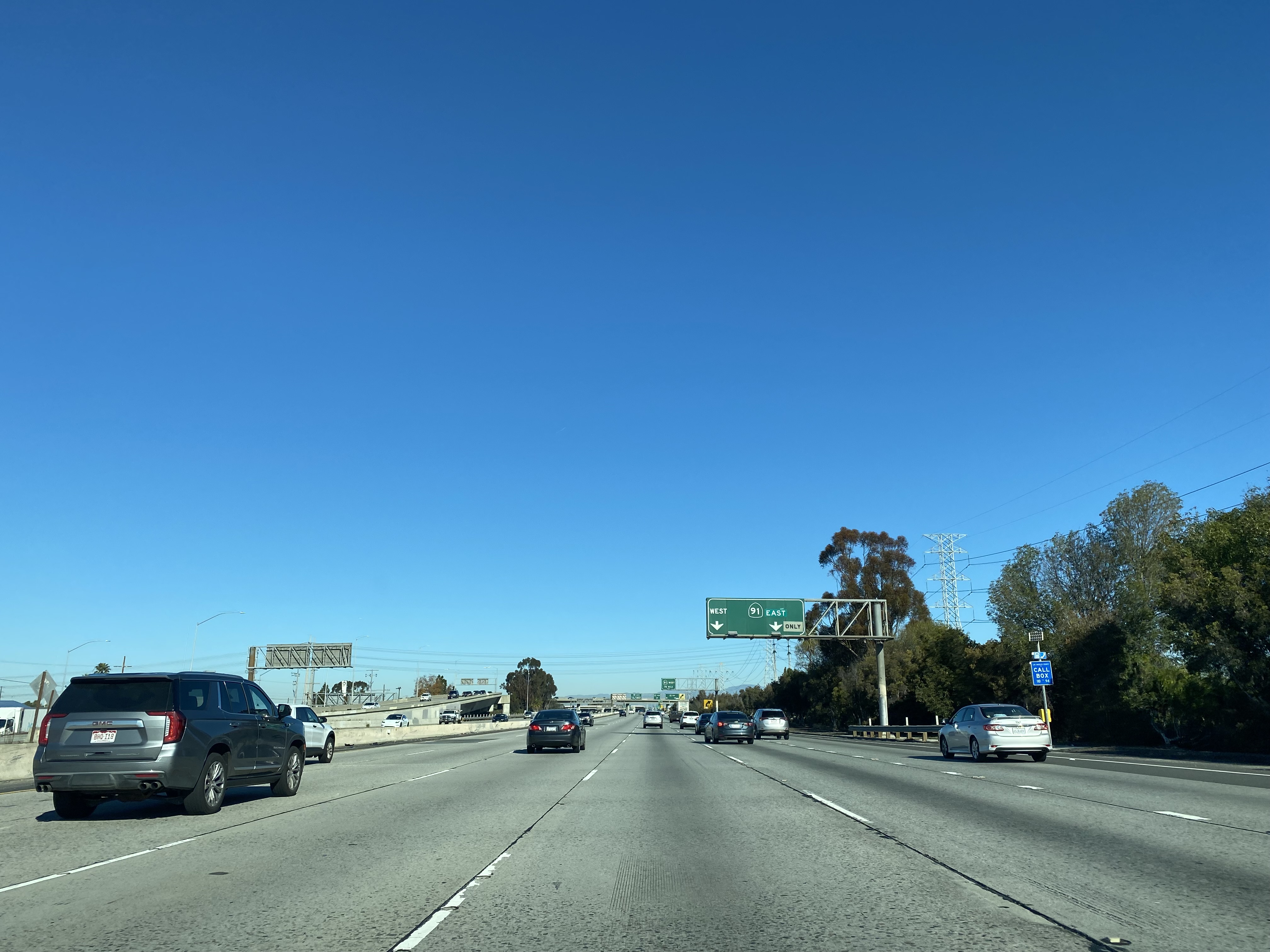
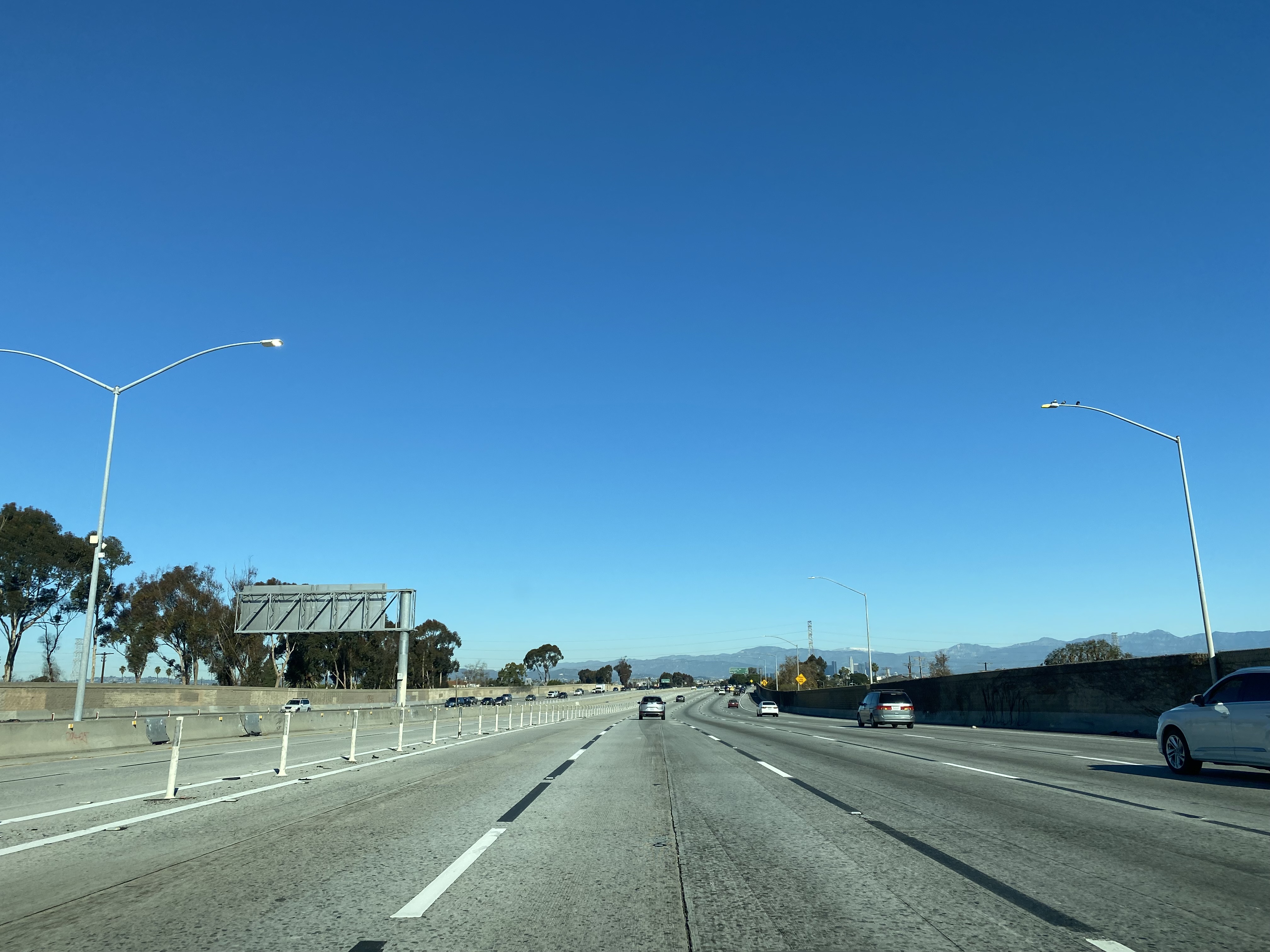
The Harbor Freeway terminates at the Four Level Interchange where CA 110 traffic can access US 101 which exits onto the Hollywood Freeway and Santa Ana Freeway. CA 110 traffic continues northward past the Four Level Interchange onto the Arroyo Seco Parkway. Traffic seeking to access Interstate 5 is advised to stay on CA 110 and the Arroyo Seco Parkway.
The placement of an Interstate 5 reassurance shields at the Four Level Interchange can be traced back to the infamous efforts of Richard Ankrom's so called "Guerrilla Public Service" during 2001.
Part 3; Roadwaywiz on the Harbor Freeway
During September 2020 Dan Murphy of the Roadwaywiz Channel (and Gribblenation) featured a real-time drive on the Harbor Freeway between Interstate 105 and the Four Level Interchange on during a dense fog. Fortunately, the fog lifts on the Harbor Freeway approaching Interstate 10 and downtown Los Angeles.
The Harbor Freeway is discussed during the May 2020 Roadwaywiz Webinar on the freeways of Los Angeles between timestamps 33:42-41:00.
Grand Loop Road is a 140 mile loop highway which traverses the interior of Yellowstone National Park. Grand Loop Road connects all of the major attractions and geological features of Yellowstone National Park along with the entrance roads. Grand Loop Road is a seasonal highway and despite some conjecture never has been part of the US Route System. Part 1; the history of Grand Loop Road The majority of history pertaining to Grand Loop Road was taken from the below National Park Service article: Historic Roads - Yellowstone National Park (U.S. National Park Service) (nps.gov) Yellowstone was declared the first National Park of the United States on March 1st, 1872. The first real highway to access Yellowstone National Park came in 1873 when a tolled facility was constructed from Bozeman, Montana via Yankee Jim Canyon to Mammoth Hot Springs. Numerous attempts were made to fund construction of roadway infrastructure during the early years of Yellows...
Along southbound California State Route 170 (the Hollywood Freeway Extension) approaching the Hollywood Freeway/Ventura Freeway interchange a white California State Route 134 Sign State Route Spade can be observed on guide sign. These white spades were specifically used during the 1956-63 era and have become increasingly rare. This blog is intended to serve as a brief history of the Sign State Route Spade. We also ask you as the reader, is this last 1956-63 era Sign State Route Spade or do you know of others? Part 1; the history of the California Sign State Route Spade Prior to the Sign State Route System, the US Route System and the Auto Trails were the only highways in California signed with reassurance markers. The creation of the US Route System by the American Association of State Highway Officials during November 1926 brought a system of standardized reassurance shields to major highways in California. Early efforts to create a Sign State Route ...
From 2017 through to early 2019 I drove the majority of the California State Route 70; the Feather River Highway from CA 89 southwest to CA 99. CA 70 is an approximately 178.5 mile state highway which starts at US 395 near the Nevada State Line and travels west through the Feather River Canyon to CA 99. CA 70 is often referred to as the Feather River Highway" given it's close association with the river. Historically CA 70 was previously signed as US 40A and CA 24. The Legislative Routes prior to the 1964 California Highway Renumbering that made up the current route of CA 70 are as follows: - Legislative Route Number 21 from US 395 westward to Oroville. - LRN 87 from Oroville south to Marysville. - LRN 232 from Marysville to the current junction with CA 99. CA 70 was even dual signed with CA 99 into Sacramento on what was LRN 232 for a time. The change from US 40A/LRN 21/LRN 87/LRN 232 can be seen by comparing the 1963 State Highway Ma...


Comments