California State Route 38 is a fifty-nine-mile State Highway located entirety in San Bernardino County and a component of the Rim of the World Highway. California State Route 38 begins at California State Route 18 at Bear Valley Dam of the San Bernardino Mountains and follows an easterly course on the north shore of Big Bear Lake. California State Route 38 briefly multiplexes California State Route 18 near Baldwin Lake and branches east towards the 8,443-foot-high Onyx Summit. From Onyx Summit the routing of California State Route 38 reverses course following a largely westward path through the San Bernardino Mountains towards a terminus at Interstate 10 in Redlands. Pictured as the blog cover is California State Route 38 at Onyx Summit the day it opened to traffic on August 12th, 1961.
Part 1; the history of California State Route 38California State Route 38 (CA 38) is generally considered to be the back way through the San Bernardino Mountains to Big Bear Lake of Bear Valley. Big Bear Lake lies at an elevation of 6,743 feet above sea level and is accessed by most via CA 18. The development around Big Bear Lake is tied to the finding of gold in nearby Holcomb Valley by William F. Holcomb and Ben Choteau during May 1860. The Holcomb Valley Gold Rush led to an influx of miners who established the town of Belleville. During the prime of Belleville, it was the largest community in San Bernardino County and drove the migration of additional settlers into the San Bernardino Mountains. Despite Belleville declining drastically by 1870 an established population did center itself around Bear Valley.
During the Holcomb Valley Gold Rush a trail along the Santa River Canyon to the southern flank of Bear Valley was established. During 1888 the Mentone & Big Bear Valley Toll Road Company obtained franchise toll rights to construct a Stage Road from Mentone to Thurman's Ranch. From Thurman's Ranch the Mentone & Big Bear Valley Toll Road ended and travelers would have to continue via burro or on foot to the vicinity of Seven Oaks in the Santa Ana River Canyon. From Seven Oaks travelers could continue the established trail to Bear Valley.
During 1899 Gus Knight partnered with local businessmen in Redlands to form the Bear Valley & Redlands Toll Road Company. The Bear Valley & Redlands Toll Road would be constructed through the Santa Ana River Canyon to Hiram Ranch. From Hiram Ranch the Bear Valley & Redlands Toll Road ascended via Clark's Grade where it entered Bear Valley just west of Big Bear City. A photo of Clark's Grade can be seen Big Bear History Site from Rick Keppler collection here.
During 1910 San Bernardino County opted to purchase all of the franchise toll roads to Bear Valley and improve them. By 1915 San Bernardino County completed work on what was known as the "Rim of the World Highway." The Rim of the World Highway ascended from San Bernardino via Waterman Canyon to Bear Valley via Lake Arrowhead. From Bear Valley the Rim of the World Highway descended via what the Bear Valley & Redlands Toll Road to Redlands.
The entire Rim of the World Highway can be seen on the 1917 California State Automobile Association Map. From Pine Knot Lodge the Rim of the World Highway can be descending Clark's Grade and the Santa Ana River Canyon towards Redlands. Notably the earliest iteration of the Rim of the World Highway can be seen passing through Holcomb Valley.
The earliest component of CA 38 to enter the State Highway System is the segment north of Big Bear Lake. Said segment of roadway was added as an extension of Legislative Route Number 43 (LRN 43) as part of 1917 Legislative Chapter 697. The earliest definition of LRN 43 was as follows:
"...beginning at a point in the Waterman Cyn at the termination of the pavement of the San Bernardino County highway system, thence following the meanderings of the road known as the "Crest Drive" into the Bear Valley, ending at a point directly opposite the most easterly point of Bear Lake."
The earliest iteration of LRN 43 can be seen as a plotted highway north of Big Bear Lake on the 1918 California Highway Commission Map.
The
May 1925 California Highways & Public Works features the new bridge atop Bear Valley Dam as part of LRN 43 and the Rim of the World State Highway. The Bear Valley Dam Bridge was financed by the Forest Service and San Bernardino County as a cutoff of Holcomb Valley. According to the Big Bear History Site once the bridge over Bear Valley Dam was opened to traffic most travelers elected to avoid Clark's Grade.
Big Bear Lake lies along Bear Creek and is impounded by Bear Valley Dam which is a multiple arch structure constructed in 1912. The original Bear Valley Dam lies about 300 feet upstream under the waters of Big Bear Lake and was completed in 1884. The Old Bear Valley Dam only held about 25,000-acre feet of water whereas the 1912 Dam holds up to 73,000-acre feet. Bear Valley was named in 1845 by Benjamin Wilson who led a search party looking for Native Americans suspect of a raid in Riverside. The name "Bear Valley" comes from the numerous California Brown Bears that were observed by Wilson during his expedition.
The
1925 California State Automobile Association Map displays substantial changes to the Rim of the World Highway between Bear Valley and Redlands. From Pine Knot Lodge the primary road is shown descending Clark's Grade to Seven Oaks. The Seven Oaks the primary road to Redlands is shown following what was the trail to Thurman's Ranch via Camp Angelus and the alignment of the Mentone & Big Bear Valley Toll Road.

The bulk of what is now CA 38 was added to the State Highway System as part of 1933 Legislative Chapter 767 which defined
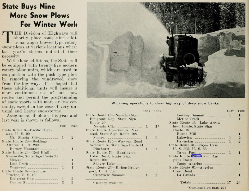
LRN 190. What became CA 38 mostly was largely defined in the second segment of LRN 190:
1. LRN 9 near San Dimas to LRN 26 near Redlands via Highland Avenue.
2. LRN 26 near Redlands to LRN 43 near Big Bear Lake via Barton Falts.
LRN 190 first appears on the
1934 Division of Highways Map with an unbuilt segment east of Camp Angelus to Big Bear Lake. Clark's Grade is shown as the existing connecting highway from the gap in LRN 190 near Camp Angelus and Seven Oaks to Bear Valley.
The
August 1934 California Highways & Public Works announced the initial run of Sign State Routes. CA 18 was announced as a Sign State Route originating at CA 19 near Artesia to US Route 66 in Victorville via Big Bear Lake. The routing of CA 18 had it followed LRN 43 on the northern shore of Big Bear Lake.


The
1935 Gousha Map of California displays a functioning highway existing from Mill Creek to Big Bear Lake via Camp Angelus and Seven Oaks. LRN 190 appears to be displayed following an interim routing via Mountain Home Creek Road between Mountain Home Village and Camp Angelus. From Camp Angelus LRN 190 can be seen aligned through Barton Flats towards Cienega Seca Creek. The interim highway from Camp Angelus to Big Bear Lake is shown following Clark's Grade to the vicinity of Pine Knot Lodge. The older alignment of the Bear Valley & Redlands Toll Road through the Santa Ana River Canyon displayed on the 1917 California State Automobile Association Map is shown existing but with a gap approaching Clark's Grade near Deer Creek.

The
1935 Division of Highways Map of San Bernardino confirms LRN 190 ending near Cienega Seca Creek Road and the interim routing between Camp Angelus and Bear Valley via Clark's Grade. A second stub of LRN 190 can be seen east of Big Bear City terminating near Erwin Lake.
The
November/December 1958 California Highways & Public Works in a District VIII report announced work had commenced on an extension of CA 30 from Big Bear City over planned LRN 190 towards Barton Flats via a then unnamed 8,400-foot-high summit in San Bernardino National Forest. Five miles of CA 30/LRN 190 east of Barton Flats are stated to be in the process of construction.
The Freeway & Expressway System in 1959. Planned CA 30/LRN 190 between US Route 99/US Route 70/LRN 26 in Redlands and LRN 43 was designated as part of the Freeway & Expressway System.
The
1960 Division of Highways Map shows significant progress on construction of LRN 190 east of the Santa Ana River. Notably 1960 Division of Highways Map does not display LRN 190 between Big Bear Lake and Redlands as CA 30.
The
1961 Division of Highways Map displays LRN 190 as complete between US Route 99/US Route 70/LRN 26 in Redlands and CA 30/LRN 43 near Big Bear Lake. The entire corridor is shown to have been assigned as part of the newly designated CA 38.

The
September/October 1961 California Highways & Public Works announced the completion of CA 38/LRN 190 in San Bernardino Mountains during July 1961. The completion of CA 38/LRN 190 in the San Bernardino Mountains is stated to have included numerous contracts administered by the Division of Highways, the Forest Service and Bureau of Public Roads. The new segment of CA 38/LRN 190 is referred to the "Barton Flats to Big Bear Loop" which spanned 16 miles in total length. Construction on closing the gap in LRN 190 began during June 1959. The article notes the entire new segment of CA 38/LRN 190 to be a freeway, but this likely was an intended to read as an "expressway." Opening ceremonies for the completion of CA 38/LRN 190 are stated to have been held on August 12th, 1961, at Onyx Summit. It is unclear why CA 30 was not designated east of Big Bear Lake over LRN 190 as cited in the November/December 1958 California Highways & Public Works.


During the 1964 State Highway Renumbering the Legislative Route Numbers were eliminated as the Sign State Routes were simplified. CA 18 was assigned to the southern shore of Big Bear Lake whereas CA 30 was truncated back to Running Springs. CA 38 was thusly extended over the northern shore of Big Bear Lake to a new terminus at CA 18 at Bear Valley Dam. The newly extended CA 38 can be seen for the first time on the
1964 Division of Highways Map.
CA 38 has changed little in the decades after being completed. During 2011 the 1925 Bear Valley Dam Bridge was replaced by a new span immediately west of the structure. Upon being completed the 1925 span was removed from the top of Bear Valley Dam.
Part 2; a drive on California State Route 38
CA 38 begins at CA 18 on the western shore of Big Bear Lake at Bear Valley Dam. Notably the first guide sign displaying CA 38 is brown given it displays the San Bernardino National Forest locale Big Bear Discovery Center as being 6 miles to the east.
CA 38 begins on North Shore Road immediately west of Bear Valley Dam.
Photos of Bear Valley Dam during the Fall of 2019.
CA 38 on North Shore Road is adorned with "Scenic Highway" placards.

CA 38 on North Shore Road is designated "Lt. Jared M. Landaker US Marine Corps Memorial Highway."
CA 38 follows North Shore Drive into Fawnskin at approximately Postmile 55.57.
CA 38 follows North Shore Road through
Fawnskin. The area around Fawnskin has been popular since the Holcomb Valley Gold Rush. The current Fawnskin community name is thought to have originated during 1891 when hunters killed several fawns and stretched their hides on trees in the community. Fawnskin was known previously as; Grout Bay, Bald Eagle Village, Big Bear Village, Cline-Miller and Oso-Grande. The Fawnskin Lodge was opened in 1924 which led to the modern naming convention sticking.
At Postmile SBR R54.05 CA 38 intersects Polique Canyon Road through which Holcomb Valley can be accessed.
At Postmile SBD 53.16 CA 38 passes by the Big Bear Discovery Center.
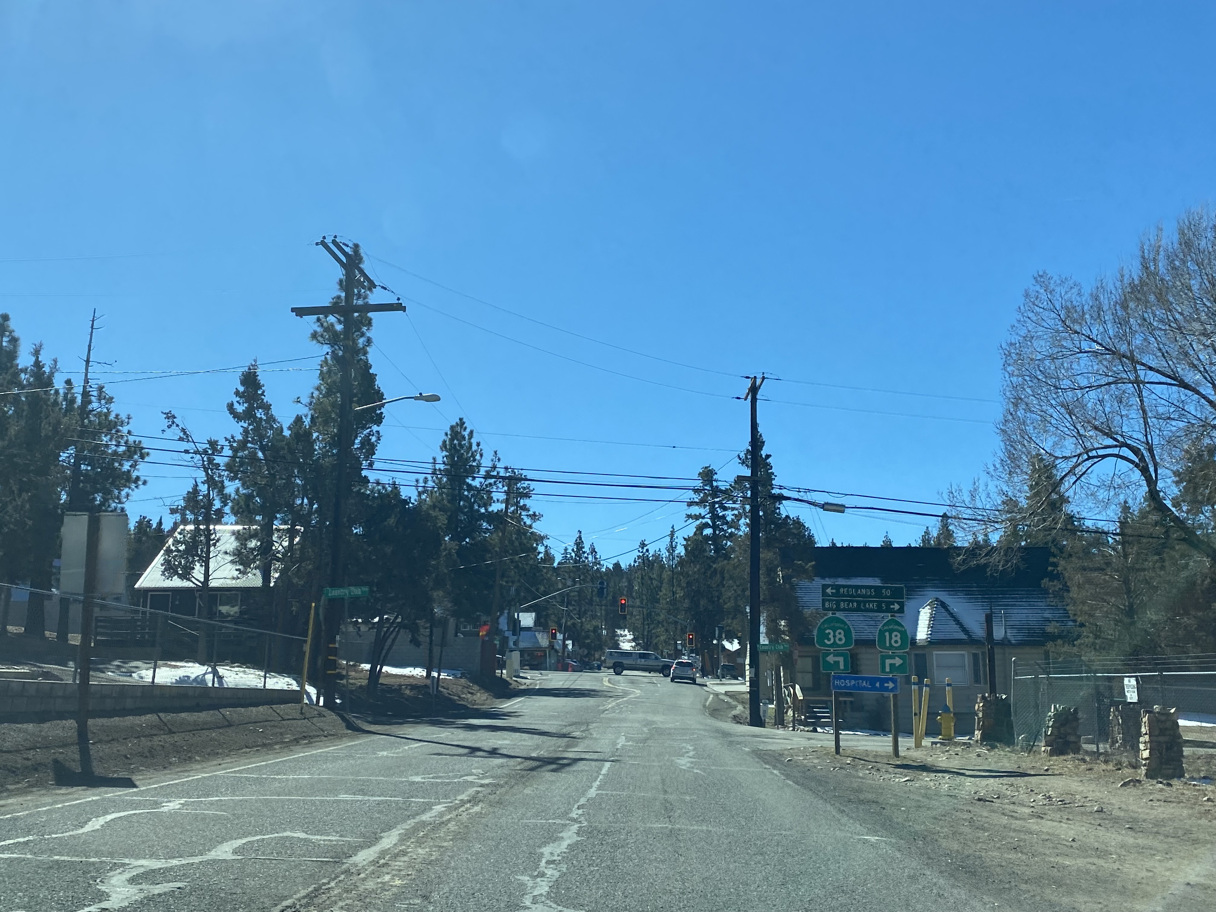
CA 38 continues to follow North Shore Drive eastbound and enters Big Bear City. At Postmile SBD 49.53 CA 38 intersects CA 18 at Greenway Drive and begins a brief multiplex turning southward.
CA 38 multiplexes CA 18 south on Greenway Drive and splits east upon reaching Big Bear Boulevard. Notably neither CA 38 nor CA 18 are signed with directional placards given both highways don't have a true directional orientation.
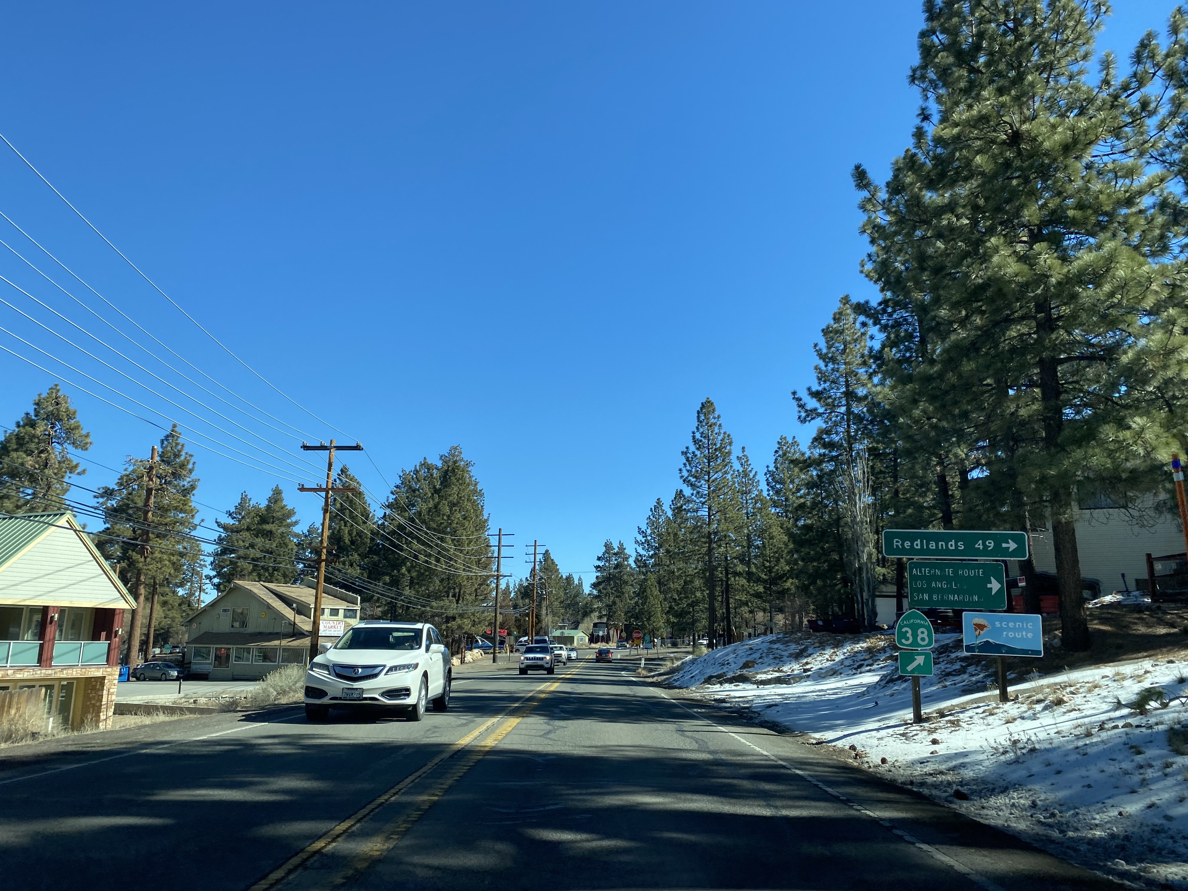
Upon splitting from CA 18 the routing of CA 38 on Big Bear Boulevard is signed 50 miles from Redlands.
At Postmile SBD 48.16 CA 38 splits from Big Bear Boulevard south onto Greenspot Boulevard.
CA 38 traffic entering Greenspot Boulevard is notified there is no gas for 45 miles.
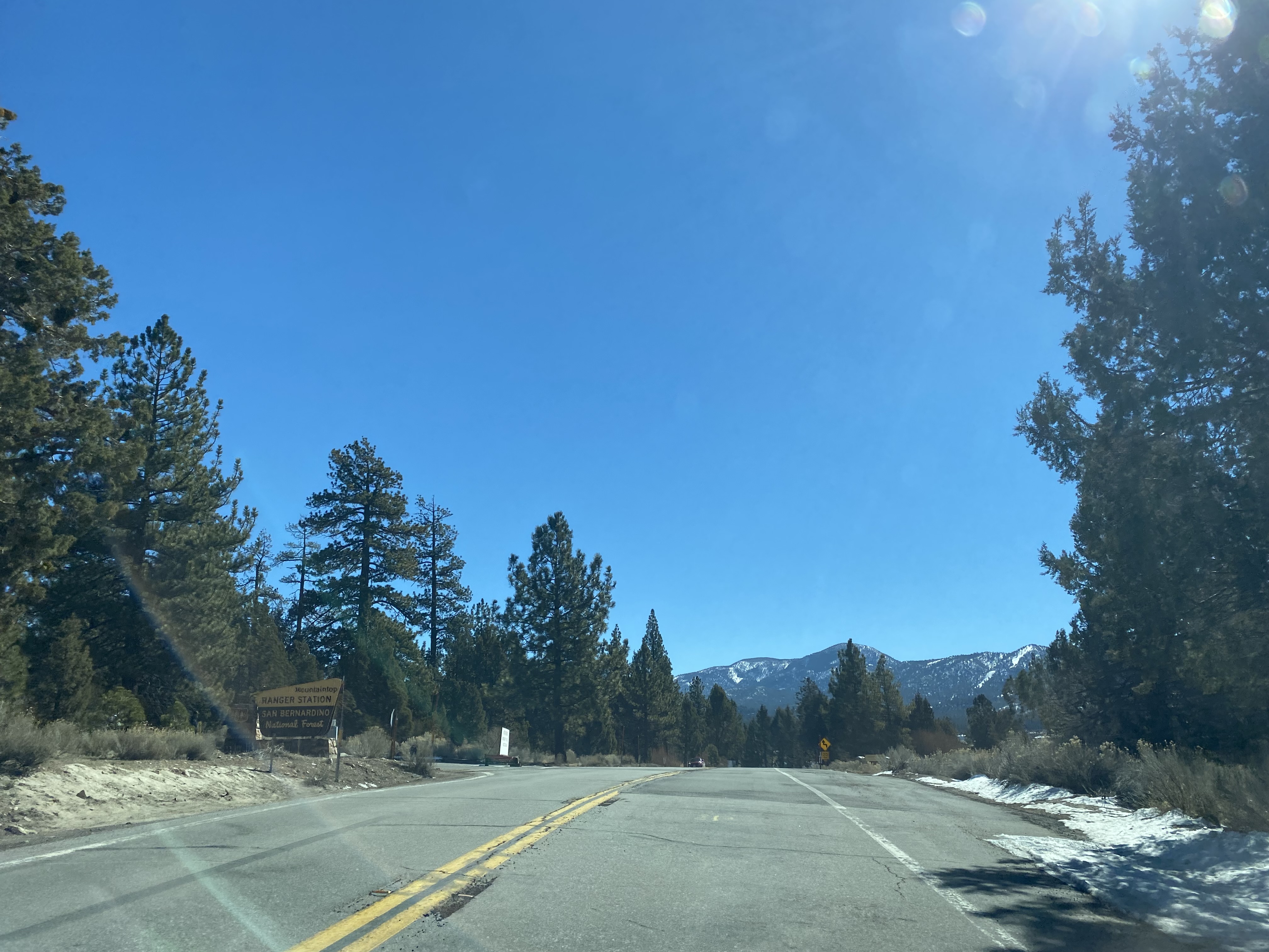
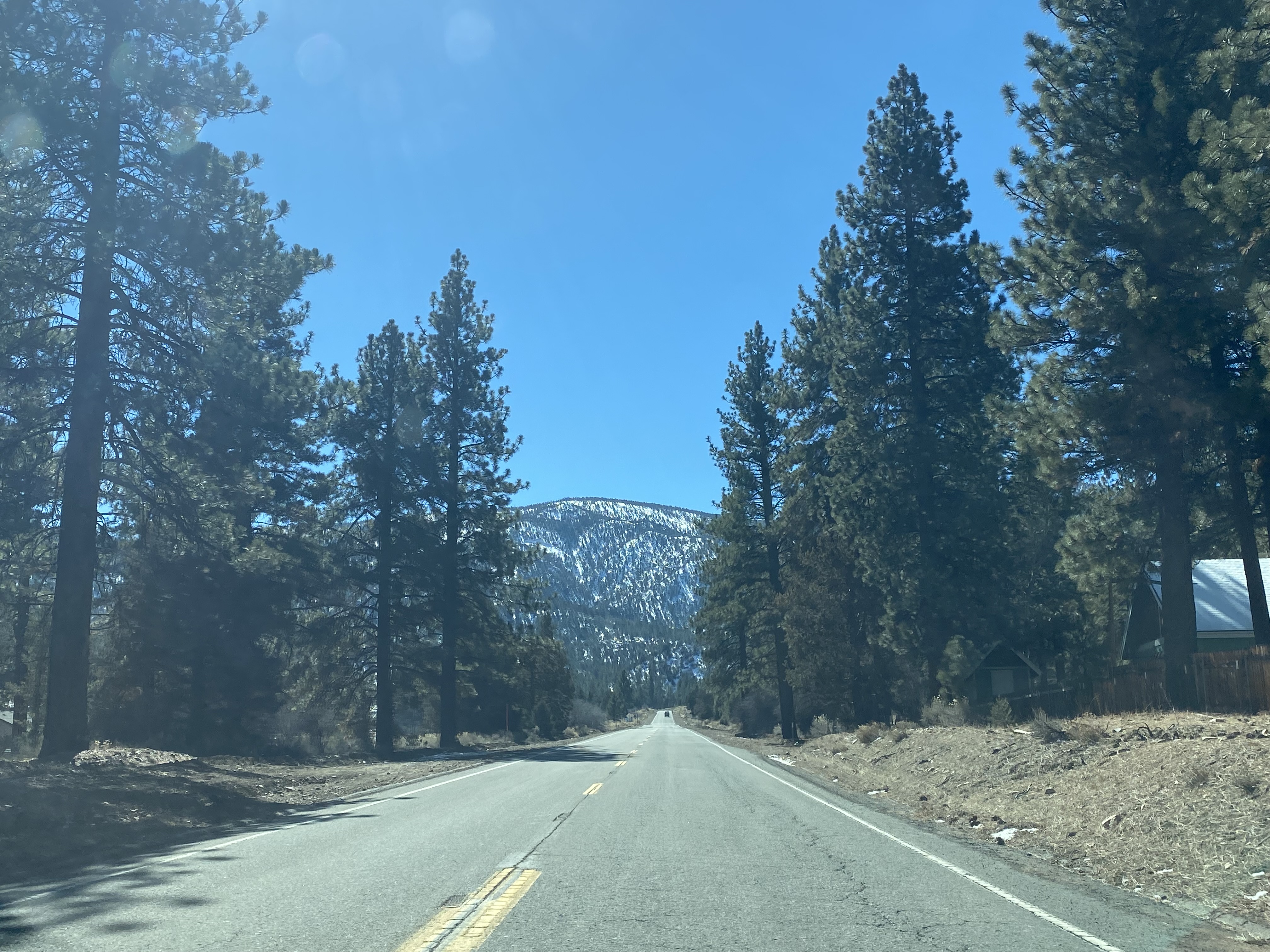
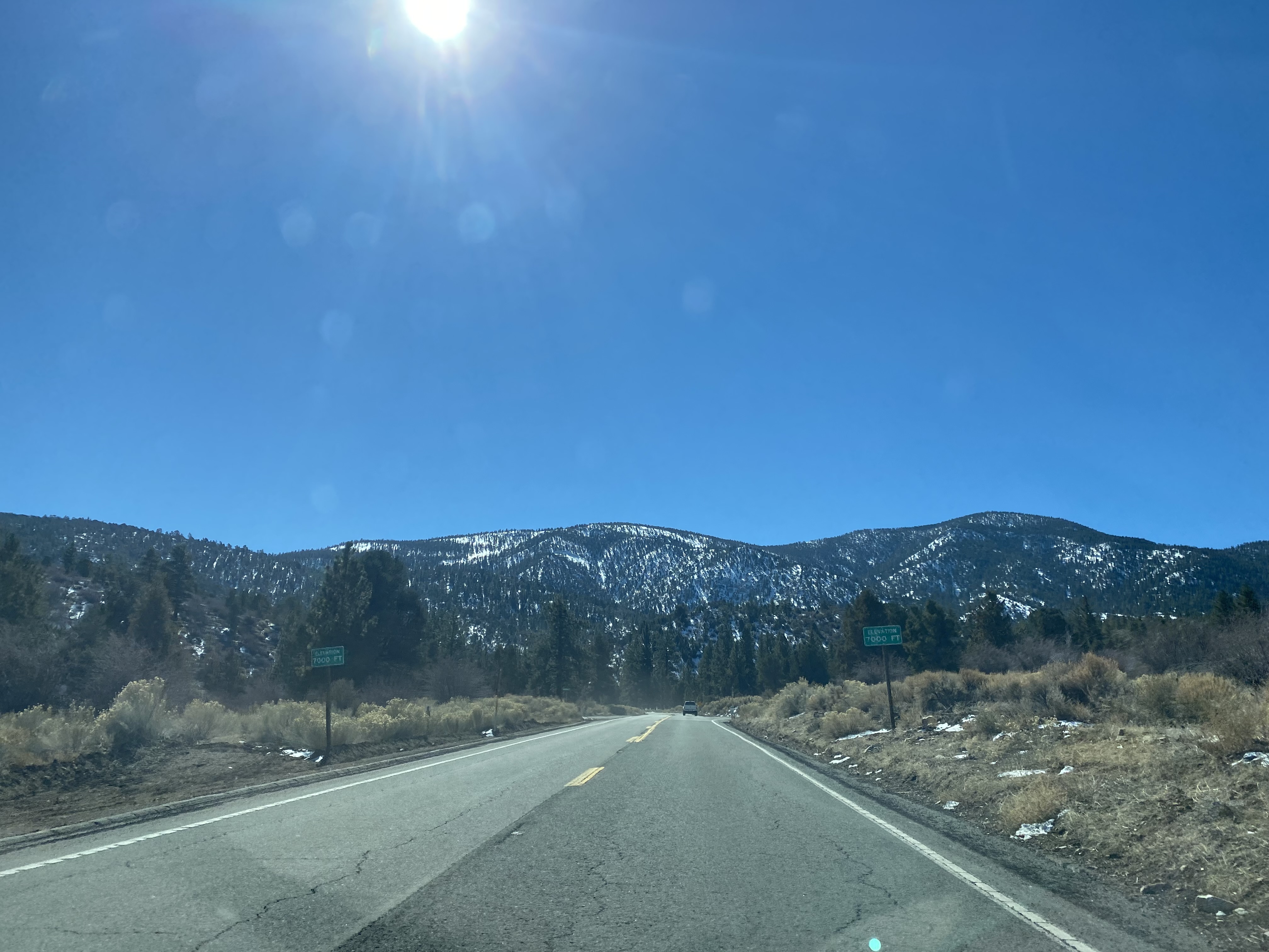
CA 38 departs Bear Valley southward and crosses over the 7,000-foot elevation line. CA 38 departing Bear Valley is signed as the Rim of the World National Forest Scenic Byway.
CA 38 continues southward and climbs to the 8,443-foot-high Onyx Summit at Postmile SBD 39.36. Onyx Summit is one of the second highest all-year highway mountain pass in California only behind Carson Pass (8,574 feet) on CA 88.
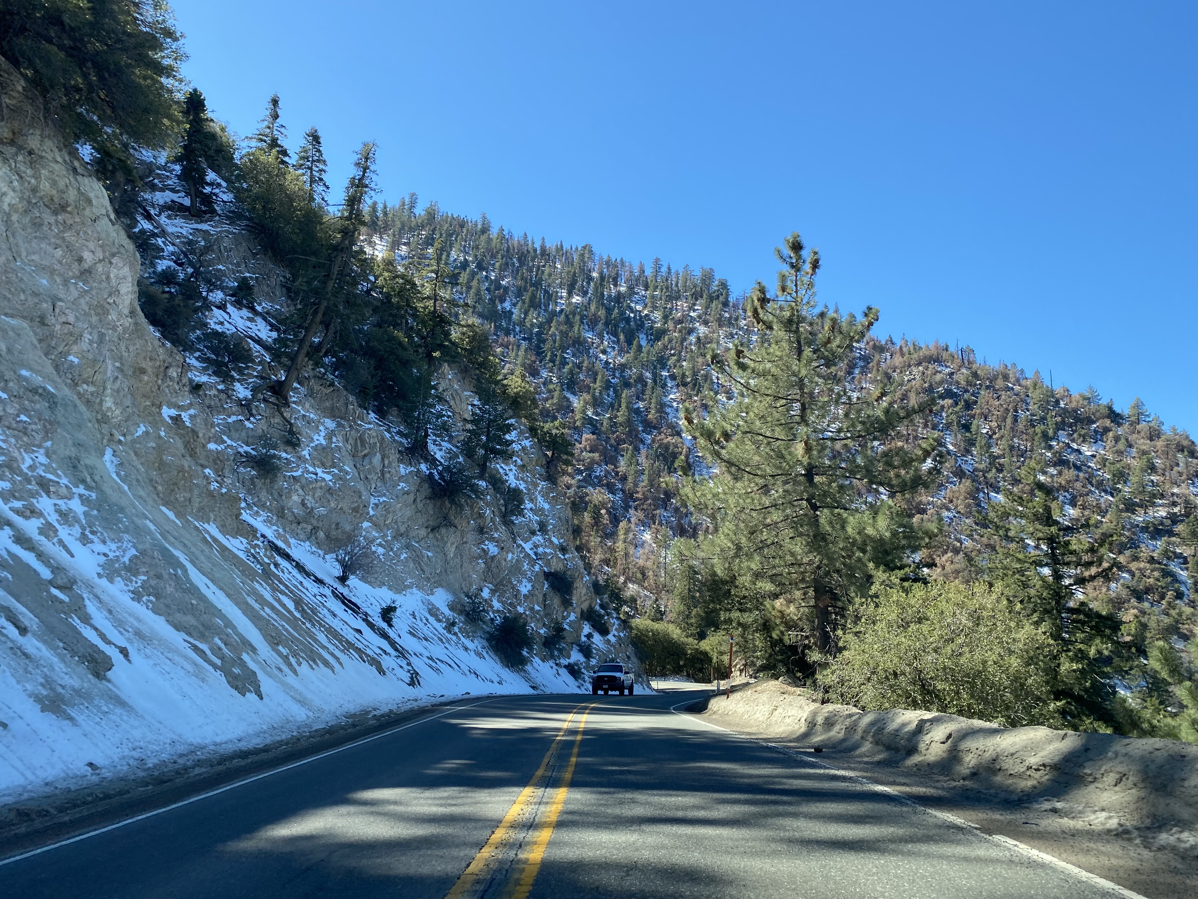
CA 38 from Onyx Summit begins to descend, gradually turning westward as it falls below 7,000-feet above sea level.
CA 38 continues to descend westward and crosses the Santa Ana River at approximately Postmile SBD 30.86.
CA 38 crosses the South Fork Santa Ana River and enters Barton Flats at Postmile 28.63. CA 38 in Barton Flats is signed as 31 miles from Redlands.
CA 38 in Barton Flats is signed as "Detective Jeremiah MacKay Memorial Highway."
At Postmile SBD 26.51 CA 38 westbound intersects Glass Road which traffic can use to access Seven Oaks.
CA 38 westbound passes under a pedestrian bridge from the Will J. Reid Scout Reservation.
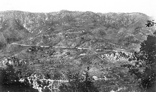
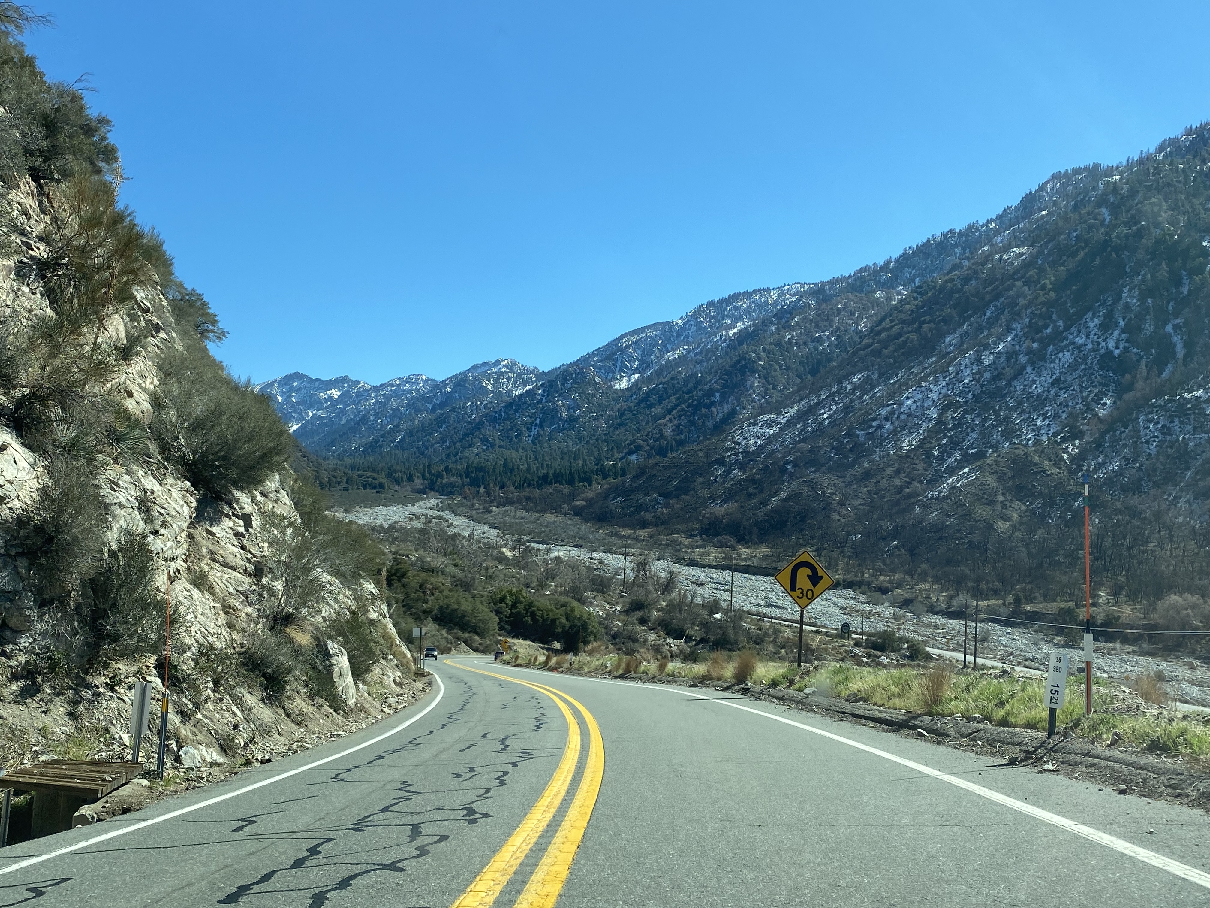
CA 38 westbound emerges onto a view of the Santa Ana River Canyon where Clark's Grade of the original Rim of the World Highway can be observed.
CA 38 westbound descends below 6,000-feet above sea level and passes through Angelus Oaks at Postmile 19.86. Angelus Oaks is a naming consolidation of "Camp Angelus" and "Seven Oaks" when the two Post Offices merged during the 1970s.
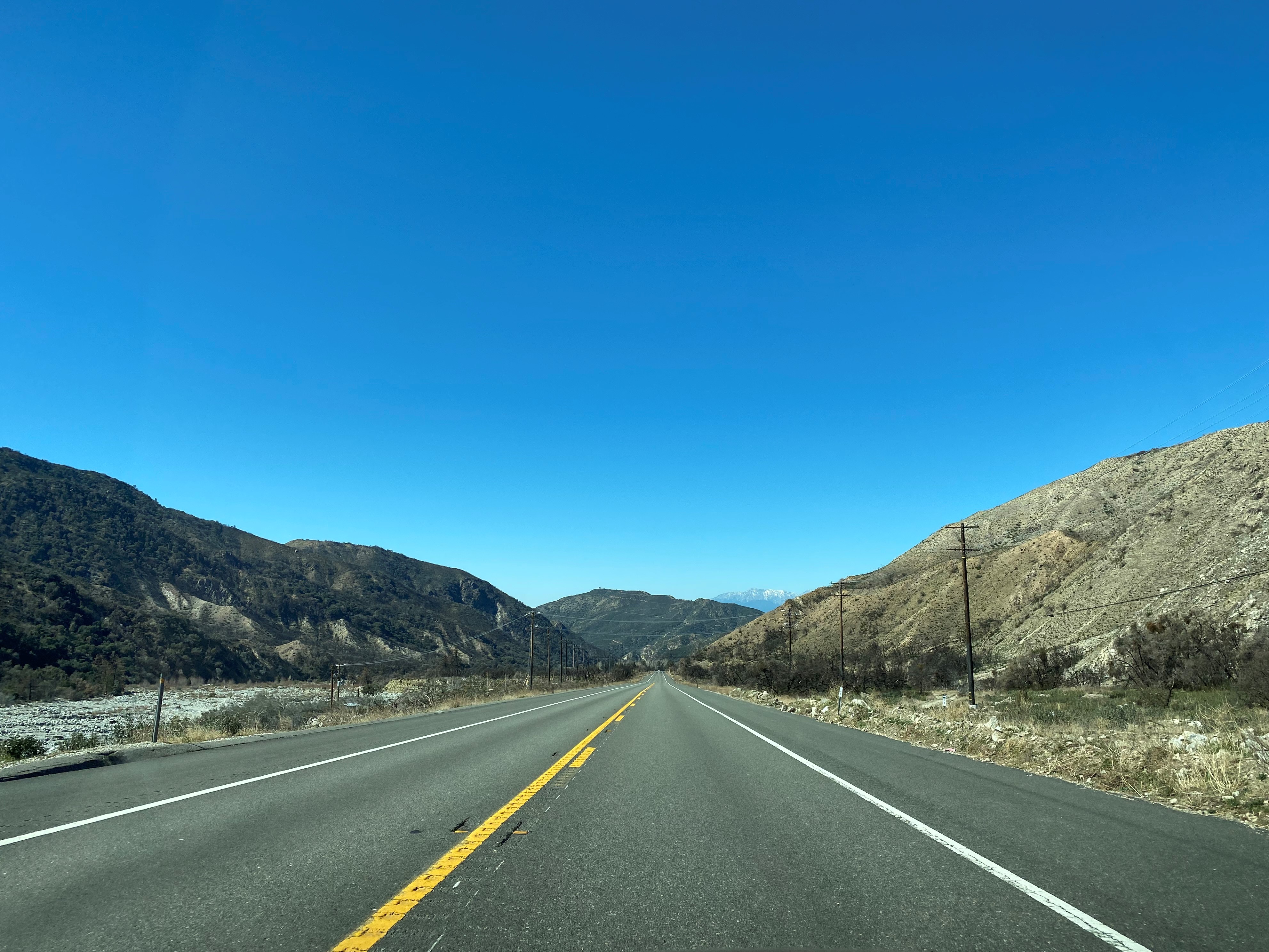
From Angeles Oaks CA 38 begins to descend following the course of Mountain Home Creek and dips below 5,000-feet above sea level.
CA 38 descends to Mill Creek and intersects Valley of the Falls Drive at Postmile SBD 15.09. Valley of the Falls Drive directs traffic towards Forest Falls. CA 38 takes a westward turn and traffic is advised Redlands is 15 miles away.
As CA 38 turns westward a vista of Mill Creek can be found.
At Postmile R12.23 CA 38 westbound passes through Mountain Home Village. Mountain Home Village is located at approximately 3,691-feet above sea level.
CA 38 westbound departing Mountain Home Village is signed as "USFS Firefighter Brent M. Witham Memorial Highway."
CA 38 westbound follows Mill Creek out of the San Bernardino Mountains and San Bernardino National Forest onto Mill Creek Road approaching Mentone. At Postmile SBD 8.6 CA 38 westbound passes by the San Bernardino National Forest Mill Creek Visitor Center.
From the Mill Creek Visitor Center CA 38 is signed as 9 miles from Redlands.
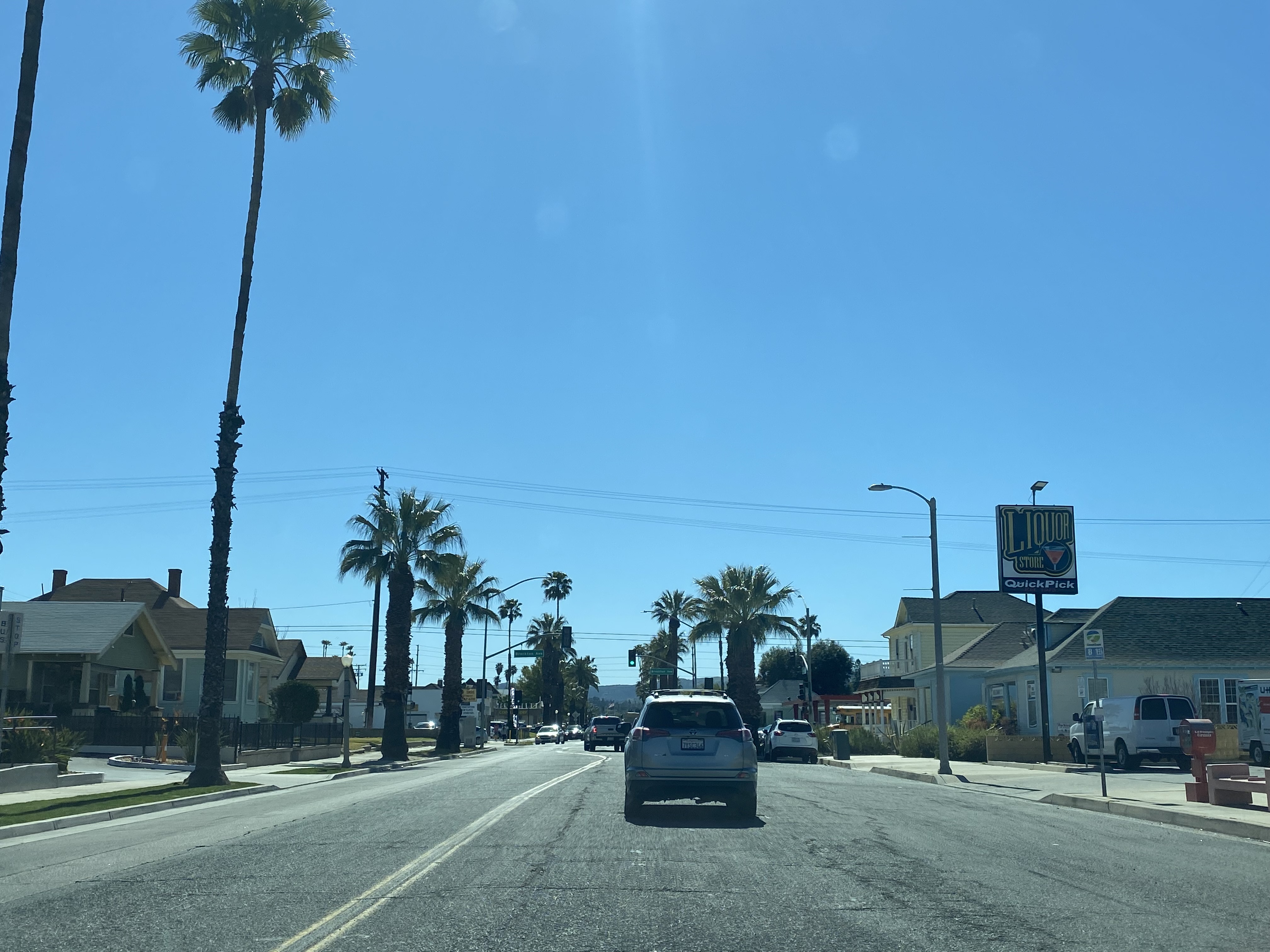
CA 38 westbound follows Mill Creek Road into Mentone which becomes Lugonia Avenue. CA 38 westbound follows CA 38 on Lugonia Avenue to Orange Street where it turns south towards Interstate 10 in Redlands.
CA 38 follows Orange Street south to Interstate 10 where the terminus in Redlands located.


Comments