Over the past four years one of the most common State Highways I've driven in California has been California State Route 198. Fortunately CA 198 has one of the best driving segments in the entire California State Highway System and some deep history dating back to the 1909 First State Highway Bond Act.

CA 198 in present configuration is a 141 mile east/west State Highway from US Route 101 in San Lucas of Monterey County east to the Generals Highway or Sequoia National Park in Tulare County.

CA 198 was one of the original Signed State Highways which was announced in a 1934 Department of Public Works Guide on Page 32. CA 198 was aligned entirely over Legislative Route 10. Originally CA 198 was the highest number assigned to any Signed State Highway.

CA 198 has come up several times on Gribblenation mostly in regards to former alignments. While the history of the entire route of CA 198 will be discussed here much of the photographic details on particular areas can be found on the blogs below:
Old CA 198 in Kings County
Old CA 198 in Tulare County
Chisholm Ferry/Bridge Location and early Legislative Route 10
CA 198 between US 101 east to CA 33 is in my opinion one of the top driving segments of State Highway in California. That being the case said segment of CA 198 was covered in the context of a driving experience in the following blog:
Challenger Adventures in the Coast Range Part 4; CA 198 from US 101 east to I-5
As noted above CA 198 was signed entirely over LRN 10 in 1934. The earliest segment of LRN 10 was between Goshen west to Hanford was part of the 1909 First State Highway Bond Act. CA 198 was legislatively extended west to San Lucas in 1915. The 1918 State Highway Map shows LRN 10 completed between Goshen west to Hanford but only a proposed highway west to San Lucas.

Since LRN 10 west of Hanford was unconstructed the implied route of the highway west to San Lucas had to traverse the marsh lands of Tulare Lake. The 1917 California State Automobile Association map indicates that implied route west of Lemoore to Coalinga:
- From Hanford-Armona Road south on Lemoore Avenue/18th Avenue.
- From 18th Avenue west on Jackson Avenue.
- Jackson Avenue west to 21st 1/2 Avenue.
- 21st 1/2 Avenue over the Kings River via the Chisholm's Ferry Bridge (constructed some time between 1885 and 1892) to Murphy's Ranch Road.
- From Murphy's Ranch Road southwesterly jog on roadways that appear to no longer exist to Huron.
- From Huron the right of way took an unclear path southwest to Jayne Avenue.
- From Jayne Avenue west to Polk Street in Coalinga.
The above alignment can be seen on this snip from the 1917 CSAA map. The red line denotes segments of State Highway. What appears to be certain is that the right-of-way between Lemoore and Coalinga essentially existed on whatever roads were present at the time. In the era of the early State Highway system the Department of Public Works would often build new road alignments that incorporated little if any of the previous right-of-way.

The 1920 State Highway Map shows the planned alignment of LRN 10 between Lemoore and Coalinga as only partially constructed. The route of LRN 10 west from Lemoore was planned to be aligned completely west of Lemoore on Jackson Avenue into the Diablo Range where it would have turned south from the Oilfields to Coalinga. The 1920 State Highway Map shows only the segment of LRN 10 south from the Oilfields to Coalinga as complete.

Of note; during the 1919 Third State Highway Bond Act LRN 10 was extended east from Visalia to the Colony Mill Road of Sequoia National Park. The original route of LRN 10 in Tulare County split from LRN 4 at Main Street and Mooney Boulevard in Visalia. It appears that LRN 10 east of downtown Visalia traversed southeast to Visalia Road through Farmersville and Exeter before swinging back north on Kaweah Avenue (current CA 65) to the current surface alignment of CA 198 east of CA 245. This early alignment of LRN 10 can be seen on the 1920 State Highway Map. The southeast jog of LRN 10 from downtown Visalia to Visalia Road doesn't align to any current existing roadways and likely was on rail frontage facilities.

East of current CA 245 the alignment of LRN 10 to the site of the Terminus Dam was very different than modern CA 198. LRN 10 turned north off the modern CA 198 alignment in Yokohl on Road 220 north, Avenue 312 east, Road 228 north, 7th Avenue/Moffet Drive/Road 236 northeast, and Avenue 324 back to the modern alignment in Lemon Cove. LRN 10 appears to have zig-zagged through Lemon Cove on Road 244, Pogue Avenue, modern CA 198, Lemon Road, Avenue 330, and modern CA 198 to make it through the town.
East of Lemon Cove LRN 10 would have passed modern CA 216 and used Road 248 north, Avenue 338 east, Road 249 north, and Avenue 340 east to reach the site of the modern Terminus Dam. At some point LRN 10 was moved onto what is now Long Drive (which was probably when the 1922 Pumpkin Hollow Bridge was built) approaching the Terminus Dam site.
The 1922 State Highway Map shows LRN 10 completed between Coalinga and Lemoore. Part of LRN 10 east of LRN 2 (future US 101) in San Lucas is shown being graded along with a segment east of Three Rivers east to Sequoia National Park. As noted above the Pumpkin Hollow Bridge was completed in 1922 which linked it with the highway out of Sequoia National Park. Traffic on the Colony Mill Road would ascend one-way into the Giant Forest of Sequoia National Park and descend on the Middle Fork Road. The Middle Fork Road was completed to the Giant Forest in 1919 and eventually became part of the Generals Highway in 1935.

The 1924 State Highway Map shows the only unbuilt segment of LRN 10 as Peach Tree Valley (future CA 25) east to Coalinga.

The 1926 State Highway Map shows LRN 10 east of downtown Visalia straightened on what is now Mineral King Avenue. LRN 10 likely used Court Street to bridge the highway from Main Street in downtown Visalia to Mineral King Avenue.

Interestingly it appears that LRN 10 may have been briefly signed as part of US 99 along Main Street. The 1927 Rand McNally State Highway Map of California shows US 99 splitting east from LRN 4 in Goshen into downtown Visalia via Main Street. From Main Street US 99 is shown splitting south onto future CA 63 via Mooney Boulevard.

The 1928 State Highway Map shows some of the gap in LRN 10 between Peach Tree Valley and Coalinga as functionally completed with some grading near Priest Valley.

The 1932 State Highway Map shows LRN 10 across the Diablo Range as almost fully graded aside from a segment west of Priest Valley.

The 1934 State Highway Map shows LRN 10 fully graded between San Lucas and Sequoia National Park. LRN 10 would be assigned as part of CA 198 later in 1934 as described above.

The 1935 Goshua Highway Map shows CA 198 as originally configured.

The 1935 Division of Highways Maps show where State Maintenance was located when CA 198 was first signed over LRN 10. The Map of Monterey County shows no difference in the alignment of CA 198 compared to the modern highway.

The Map of Fresno County shows some minor differences in the initial alignment of CA 198 east from the Monterey County Line east to Parkfield Junction. Much of CA 198 was originally aligned south of Warthan Creek east to Parkfield Junction whereas the modern highway is located to the north. The change between the original alignment and modern is so minor that I haven't determined when it actually occurred. The remainder of CA 198 in Fresno County east to Kings County is largely on it's original alignment.

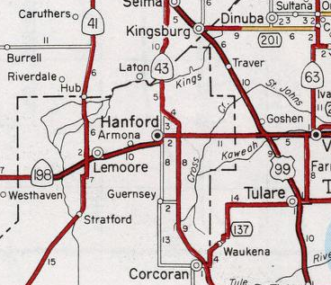
The Map of Kings County shows that CA 198 had a massively different surface highway than the modern freeway/expressway.

Westbound the original surface alignment of CA 198 in Kings County used the following route:
1. East Lacey Blvd from the Tulare County Line.
2. 7th Street through downtown Hanford.
3. Originally Irwin Street in Hanford to West Lacey Boulevard. CA 198 was later realigned to Garner Ave to West Lacey Boulevard
4. West Lacey Blvd west out of Hanford.
5. 14th Ave south to Armona
6. Front Street in Armona
7. Hanford-Armona Road through Lemoore.
8. 19th and 1/2 Avenue south out of Lemoore (which would have also been CA 41 at the time).
9. Jackson Ave over the Kings River to NAS Lemoore
10. Jackson Avenue west from NAS Lemoore over the Fresno County Line
The Map of Tulare County shows the original alignment of CA 198 through Visalia on Main Street, Court Street and Mineral King Avenue. CA 198 east of Lemon Cove was straightened at some point onto Long Drive through the present site of the Terminus Dam.

By 1936 the route of CA 198 between modern CA 245 and modern CA 216 was eased to the modern alignment used today which can be seen on the 1936-37 State Highway Map.

According to a June 1942 Department of Public Works Guide the route of CA 198 was moved onto a connecting alignment from Main Street and Coyner Street to reach Mineral King Avenue which bypassed downtown Visalia.
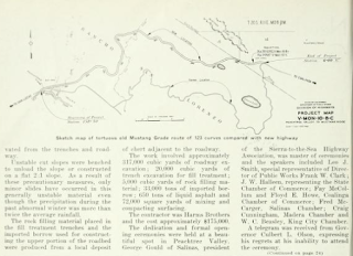
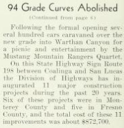
The October 1941 California Highways and Public Works Guide details the new Mustang Ridge alignment of CA 198/LRN 10 west from Priest Valley west o Peach Tree Valley. The realignment of CA 198/LRN 10 over Mustang Ridge eliminated an ungraded segment and 94 curves. The new alignment of CA 198 on Mustang Ridge is often considered to be one of the best driver's roads in California. The new Mustang Grade of CA 198/LRN 10 opened to traffic on September 15th, 1941.


At some point in 1957 a divided expressway alignment of CA 198 was completed from US 99 in Goshen east past downtown Visalia. This 1957 expressway first appears on the 1958 State Highway Map and was gradually upgraded to the modern freeway used by CA 198 today.

East of Lemon Cove CA 198 was realigned uphill at some point in 1961/1962 due to the construction of the Terminus Dam and opening of the Lake Kaweah Reservoir. The realignment of CA 198 is not covered in any California Highways & Public Works as it seems to have been overshadowed by projects like the San Luis Reservoir and Lake Oroville. The Terminus Dam was dedicated on May 18th, 1962 along with the Success Dam on CA 190. The new highway alignment of CA 198 south of the Terminus Dam site can be seen on the 1962 State Highway Map.


The 1966 State Highway Map shows the CA 198 expressway completed eastward to 10th Avenue in Hanford.

The 1967 State Highway Map shows CA 198 moved to a new expressway east of Hanford to CA 43.

Recently a 10 mile expressway upgrade of CA 198 between CA 43 east to CA 99 was approved by the California Transportation Commission in 2001. Construction of what is known as the Hanford Expressway began in November 2009 and was completed in December 2012. Interestingly the original alignment of LRN 10 on East Lacey Boulevard was incorporated into the Hanford Expressway as the westbound lanes of CA 198. More details about the Hanford Expressway project can be found on CAhighways.org.
With the massive back story and history of CA 198 out of the way the route begins in San Lucas at US 101 just east of the 1915 Salinas River Truss Bridge.


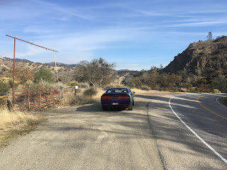
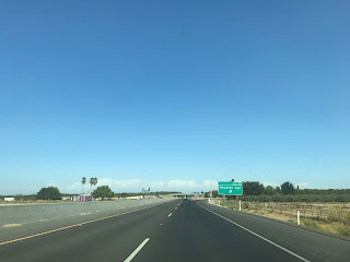
CA 198 east intersects Main Street in San Lucas at Post Mile MON R0.746. CA 198 east traffic enters the Gablian Range and is advised there are No Services for 53 miles.


CA 198 east continues to ascend through far flung canyon ranches before ascending over the crest of the Gabilan Range. CA 198 east descends a 5% downhill grade into Peach Tree Valley which is where the San Andreas Fault divides the Gabilan Range on the Pacific Plate from the Diablo Range on the North American Plate. CA 198 east crosses San Lorenzo Creek and meets the south terminus of CA 25 at Post Mile MON 13.99.


At Post Mile MON 14.079 CA 198 east meets Peach Tree Valley Road which continues south on the San Andreas Fault towards Paso Robles.

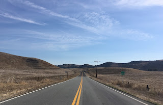
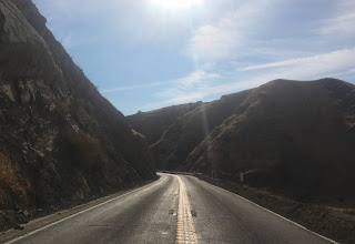
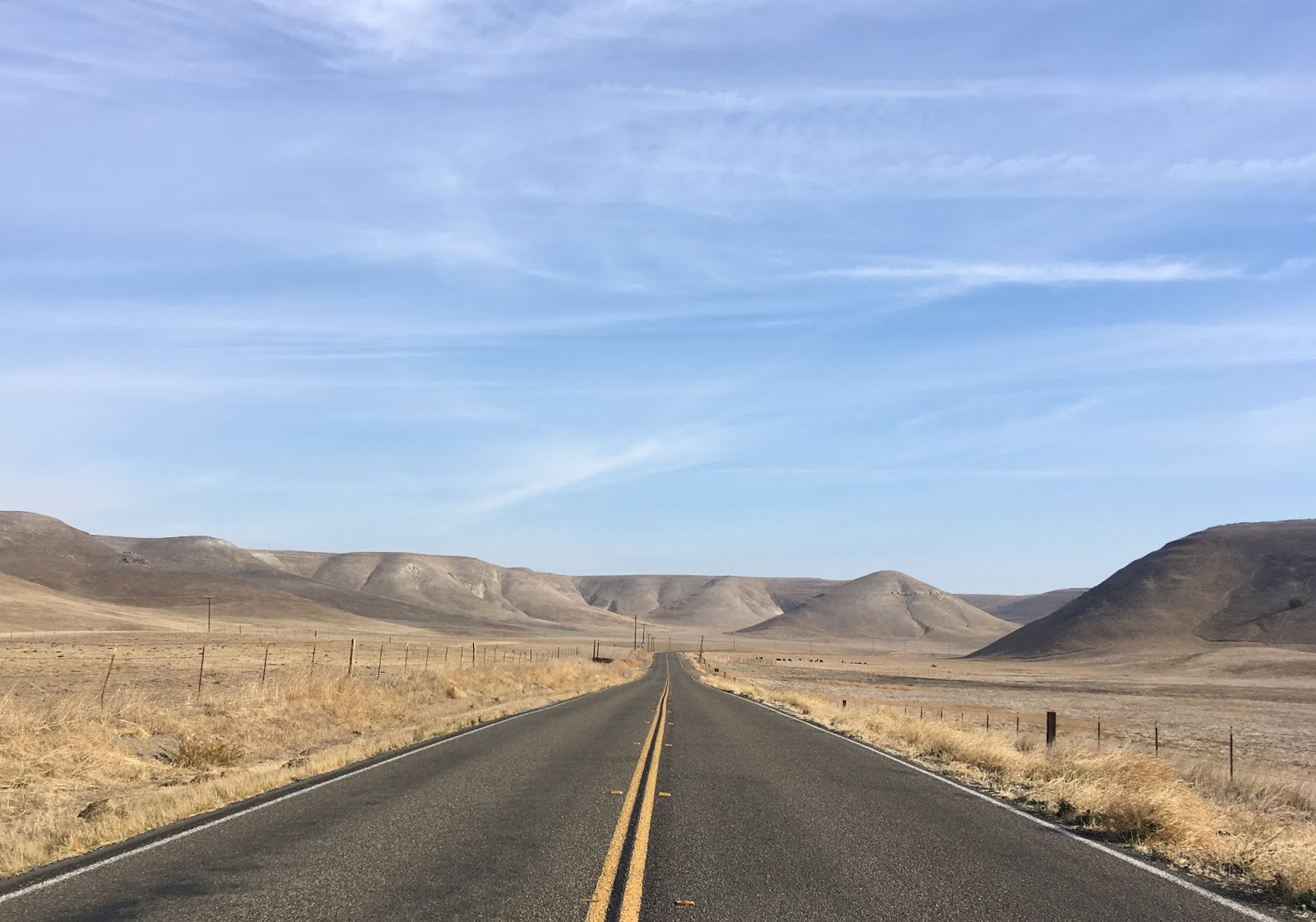
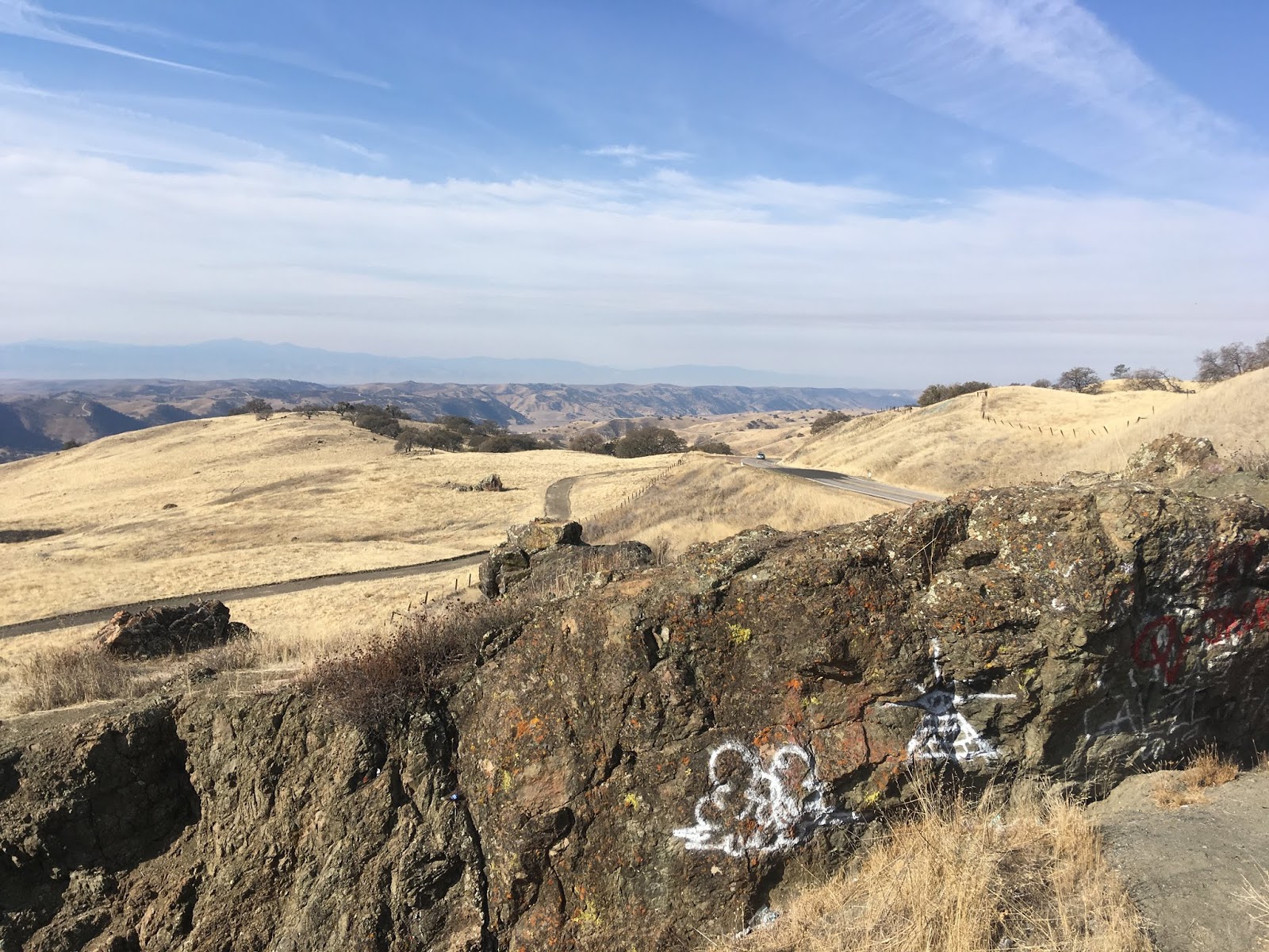
CA 198 east begins to ascend rapidly through the Diablo Range onto Mustang Ridge. At approximately Post Mile MON 17.377 there is a volcanic rock off to the side of CA 198 which serves as a unmarked vista of the San Andreas Fault in Peach Tree Valley.


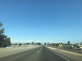
CA 198 east ascends above 2,700 feet above sea level atop canyons overlooking Lewis Creek. CA 198 intersects the old southern terminus of CA 25 at Post Mile MON 20.512. Before 1956 CA 25 utilized Lewis Creek Road to meet CA 25 near Priest Valley. This particular section of CA 198 east of CA 25 has been used in car magazines such as Motortrend for road testing. The route of CA 198 east from CA 25 towards Coalinga is one of the most fun in the State Highway System due to the relatively curvy alignment coupled with sparse traffic.


CA 198 east enters Priest Valley which is the only community on the highway from San Lucas east to Coalinga.
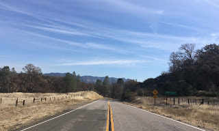


At Post Mile MON 25.785 CA 198 east enters Fresno County.


CA 198 east upon entering Fresno County follows the north bank of Warthan Creek. At Post Mile FRE 9.742 CA 198 east intersects Coalinga Mineral Springs Road.


East of Coalinga Mineral Springs Road CA 198 begins to lose elevation rapidly approaching the Parkfield Grade. CA 198 east intersects the Parkfield Grade at Post Mile FRE 12.335.


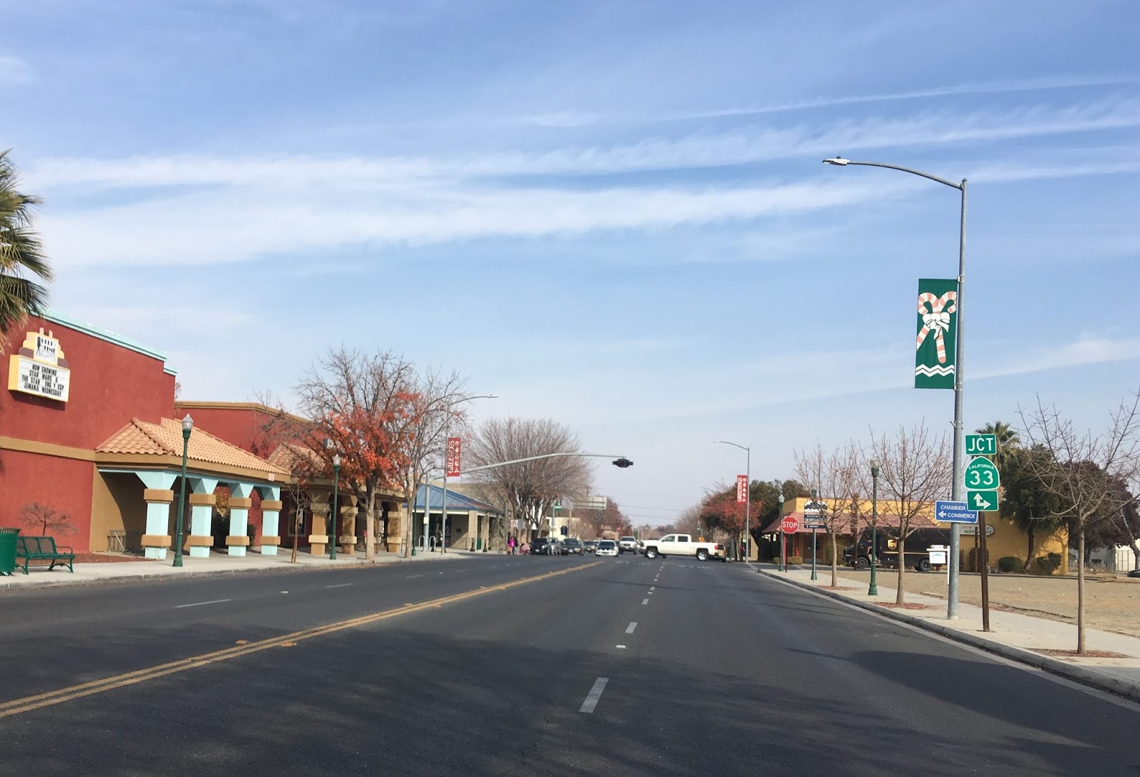
CA 198 east descends through a series of canyons following the general course of Warthan Creek. At approximately Post Mile FRE 21.093 CA 198 enters the City of Coalinga as Elm Avenue. CA 33 intersects CA 198 in Coalinga and multiplexes it north out of the city. Coalinga was established as a Southern Pacific Railroad siding in 1888 when it was called Coaling Station A. Apparently "Coalinga" comes from combing the "Coaling" and "A" from the previous status a railroad siding.


At the corner of CA 198/Elm Avenue and 6th Street is the Richfield Automotive Museum.

The Richfield Automotive Museum includes a restored 1934 Richfield Station. The 1934 Richfield Station was originally located on CA 33 at the corner of 5th Street and Glenn Street. The 1934 Richfield Station was restored in 2003 and moved to the present location in 2004.


At Post Mile FRE 22.649 CA 198 east meets CA 33 at 5th Street and begins a multiplex.


Lemoore is signed as 40 miles away from the City Limits of Coalinga on CA 198 east. CA 198 east/CA 33 north crosses Los Gatos Creek upon leaving Coalinga on Fresno-Coalinga Road.

At Route 33 Post Mile FRE R18.581 access to Los Gatos Creek is signed via Gale Avenue. Gale Avenue continues west to Los Gatos Creek Road which is another crossing of the Diablo Range.

CA 198 east/CA 33 north on Fresno-Coalinga Road multiplex into the Kettleman Hills where both routes split at Post Mile 22.666. At the split of CA 198 and CA 33 there is a historical monument pertaining Arroyo de Cantua which was the headquarters of bandit Joaquin Murieta.


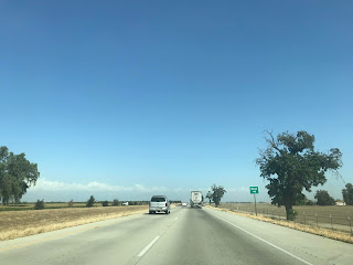
CA 198 east of CA 33 is signed on Doris Avenue to the Kings County Line. CA 198 east of CA 33 descends out of the Kettleman Hills into San Joaquin Valley and meets I-5 at Post Mile FRE 26.794 near Harris Ranch.


CA 198 east meets El Dorado Avenue at Post Mile FRE 28.638.
In times of heavy rain CA 269 is often routed onto a detour alignment which utilizes El Dorado Avenue. This photo below was taken during the winter of 2017 when the detour of CA 269 was signed.

At Post Mile FRE 34.657 CA 198 meets CA 269 at Lassen Avenue.

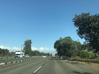
At Post Mile FRE 35.422 CA 198 crosses the California Aqueduct. At Post Mile FRE 42.379 CA 198 crosses the Union Pacific Line which terminates to the west of Huron.

At approximately Post Mile FRE 42.727 CA 198 enters Kings County.

At Post Mile KIN 3.012 CA 198 east at 25th Avenue expands to a four-lane expressway.


CA 198 east passes by a traffic light at the main gate for NAS Lemoore and becomes a freeway at Post Mile KIN 3.511.


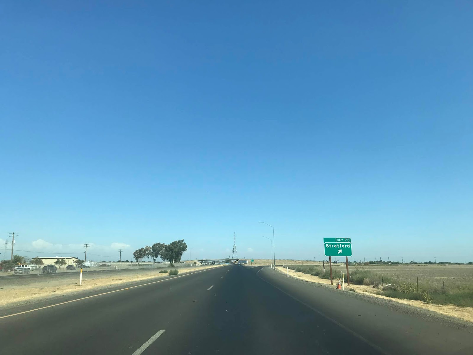
At Exit 73 CA 198 east has a junction with Avenal Cut-Off Road.


CA 198 east crosses the Kings River and meets CA 41 at Exit 77 in the City of Lemoore.


CA 198 east meets 19th Avenue at Exit 78.


At Exit 79 CA 198 east intersects Lemoore Avenue.


East of Lemoore CA 198 is signed as 8 miles from Hanford, 25 miles from Visalia and 78 from Sequoia National Park.

CA 198 east Exit 81 accesses Houston Avenue.

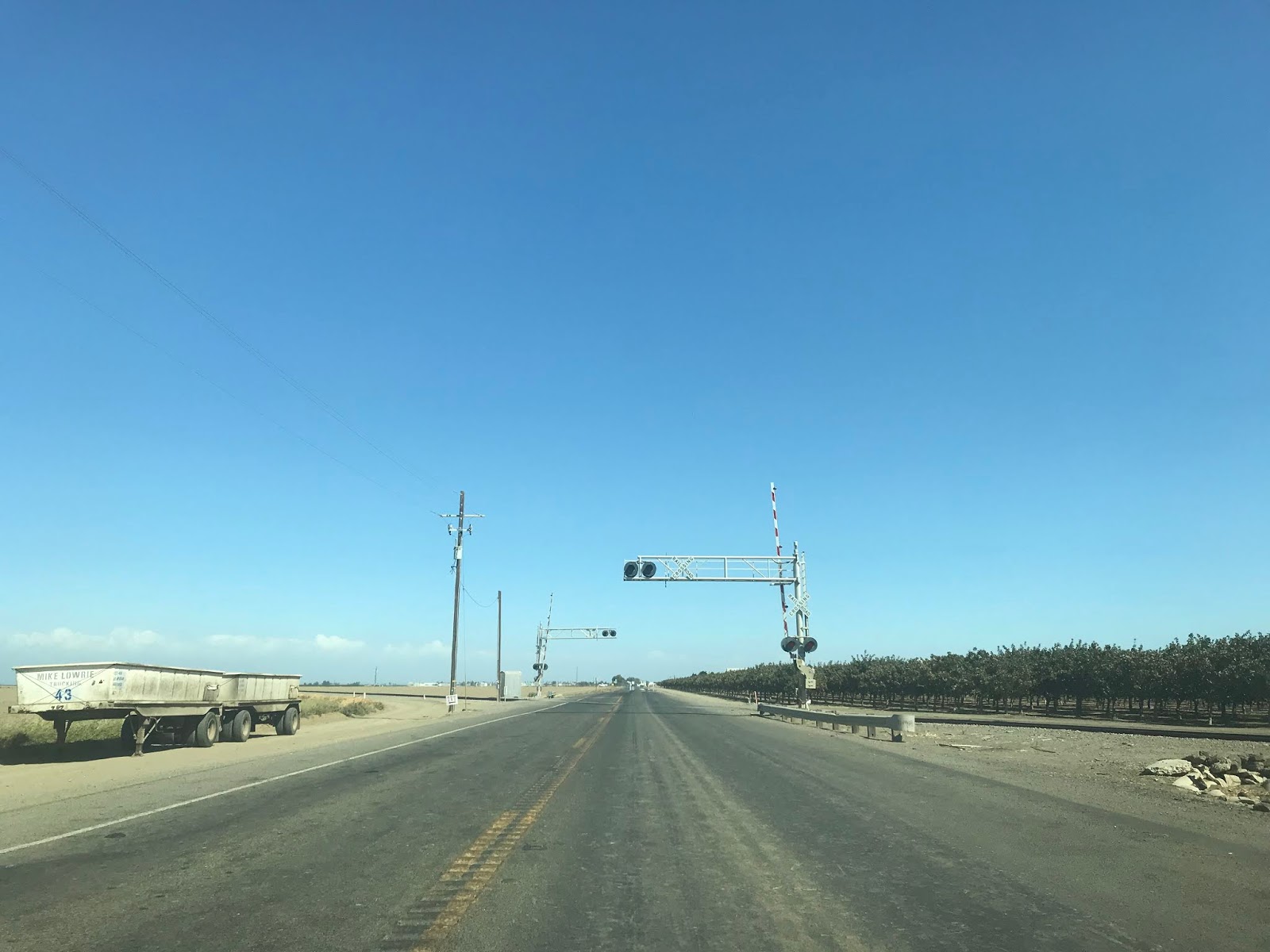
CA 198 east has one at-grade intersection located at Post Mile KIN R12.699 for 16th Avenue south approaching Armona.

CA 198 east intersects 14th Avenue at Exit 83 in Armona.


At Exit 84 CA 198 east intersects Hanford-Armona Road.


CA 198 east enters the City of Hanford and meets 12th Avenue at Exit 85.


CA 198 east Exit 86 accesses 11th Avenue.


CA 198 east accesses downtown Hanford via Douty Street at Exit 87.


CA 198 east of downtown Hanford as an at-grade intersection with 9th Avenue.


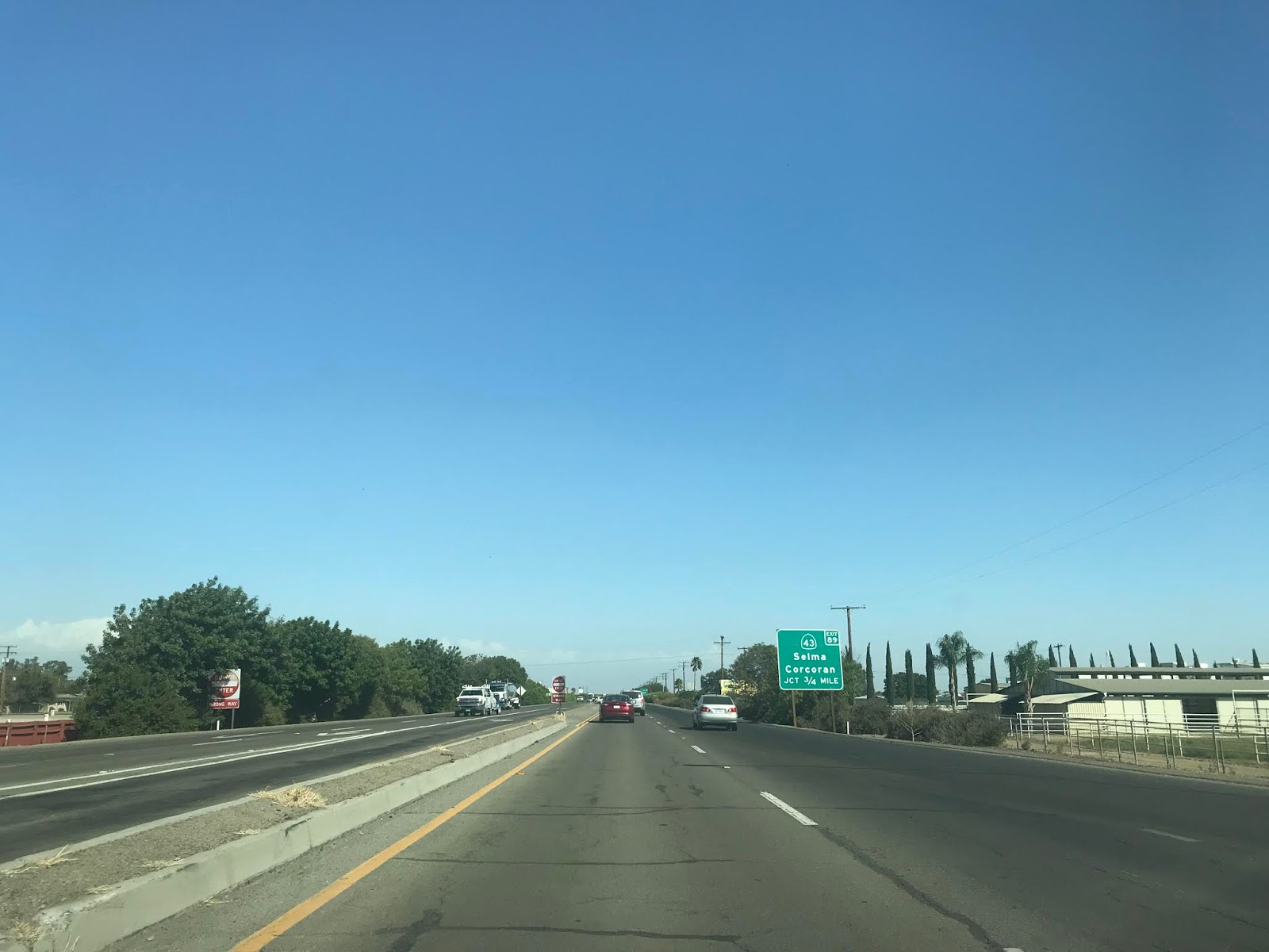
CA 198 east meets CA 43 at Exit 89.


CA 198 east passes under CA 43 and is signed 11 miles from CA 99. The route of CA 198 east to CA 99 follows the recently completed Hanford Expressway.


CA 198 east on the Hanford Expressway has an intersection with 7th Avenue at Post Mile KIN 22.315.

At Post Mile KIN 23.322 CA 198 east on the Hanford Expressway intersects 6th Avenue.


The Hanford Expressway has numerous intersections that only serve farms.


At Post Mile KIN 27.339 CA 198 east on the Hanford Expressway has an intersection with 2nd Avenue.

At Post Mile KIN 27.83 CA 198 east on the Hanford Expressway has an intersection with 1st 1/2 Avenue.

At Post Mile KIN 28.325 CA 198 east on the Hanford Expressway enters Tulare County and intersects Road 44/1st Avenue.

At Post Mile TUL 0.501 CA 198 on the Hanford Expressway intersects Road 48.
At Post Mile TUL 1.002 CA 198 on the Hanford Expressway intersects Road 52.

At Post Mile TUL 1.503 CA 198 on the Hanford Expressway intersects Road 56.

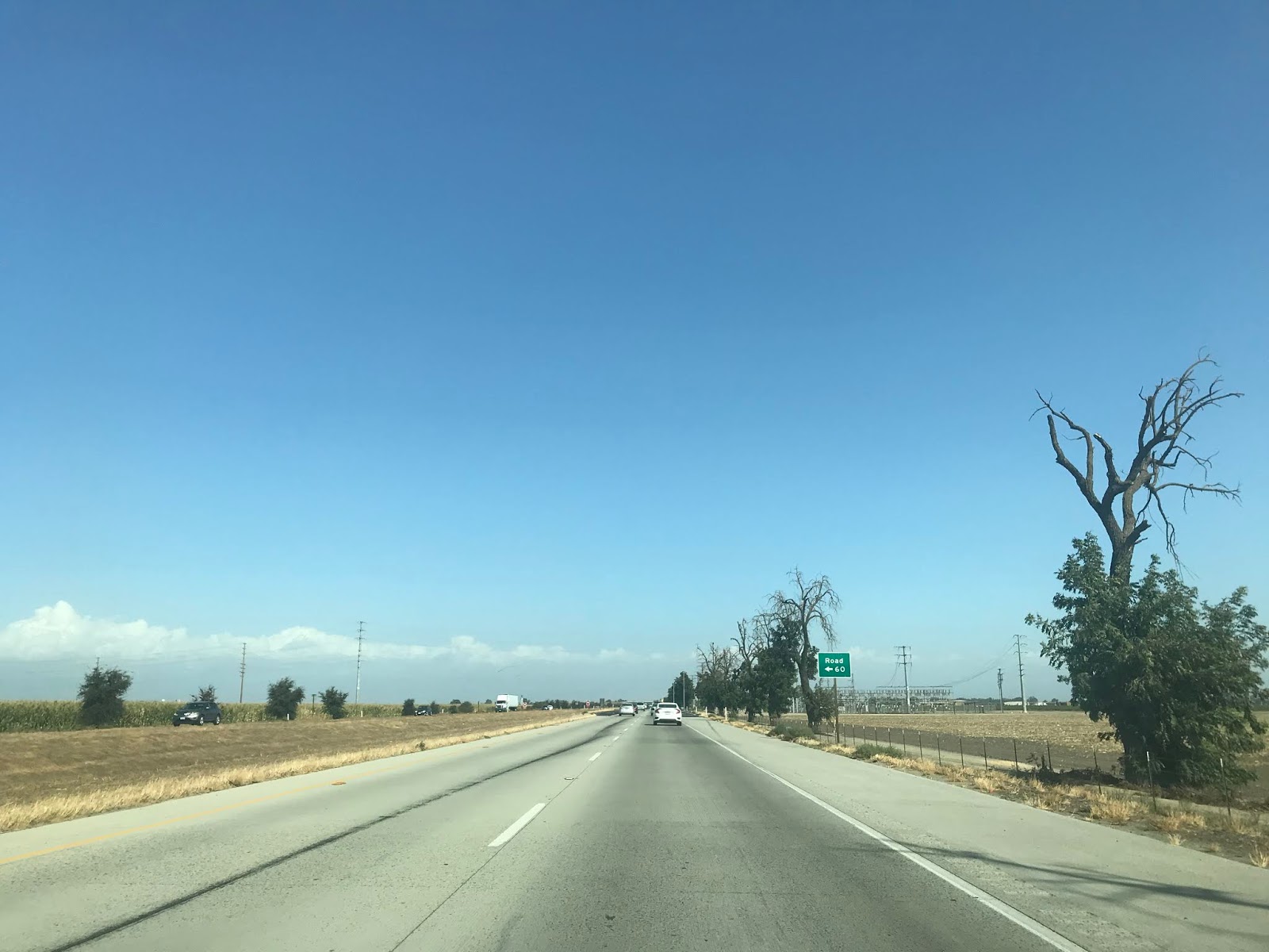
At Post Mile TUL 2.009 CA 198 on the Hanford Expressway intersects Road 60.

At Post Mile TUL 2.511 CA 198 on the Hanford Expressway intersects Road 64.

At Post Mile TUL 3.009 CA 198 on the Hanford Expressway crosses under Road 68. Road 68 southward is still technically part of Signed County Route J25 which essentially now has a hanging end since it no longer accesses CA 198 at it's north terminus. Tulare County largely has pulled all County Route signage aside from J37.

CA 198 east becomes a freeway again approaching the junction with CA 99 at Exit 101. CA 198 east passes under CA 99 and enters the City of Visalia.


At Exit 102 CA 198 east accesses CR J19 on Road 80.


At Exit 103 CA 198 east accesses Shirk Road.


At CA 198 east Exit 104 the freeway accesses Akers Street.


CA 198 east Exit 105A accesses Demaree Street.


CA 198 east junctions CA 63 at Exit 105B for Mooney Boulevard.


CA 63 north multiplexes CA 198 east to Exit 107A. CA 63 north splits away at Exit 107A towards downtown Visalia.


CA 198 east Exit 107B accesses Ben Maddox Way.


At Exit 108 CA 198 east meets Lovers Lane which carries CA 216 to the north and CR J15 on both sides of the freeway.


At Exit 110 CA 198 east intersects Road 156.


Exit 111 on CA 198 intersects CR J23 on Farmersville Road.


CA 198 east drops to an expressway with an at-grade intersection at Road 180 located at Post Mile TUL R16.764.


At Post Mile TUL R17.009 CA 198 east meets Road 182.

At Post Mile TUL R18.761 CA 198 enters Exeter and meets CR J27/CA 65 at Exeter Boulevard.


CA 198 east of J27/CA 65 rises on an overpass which overlooks the Great Western Divide of Sequoia National Park in the Sierra Nevada Mountains.

At Post Mile TUL R19.761 CA 198 east intersects CA 245 at Road 204.


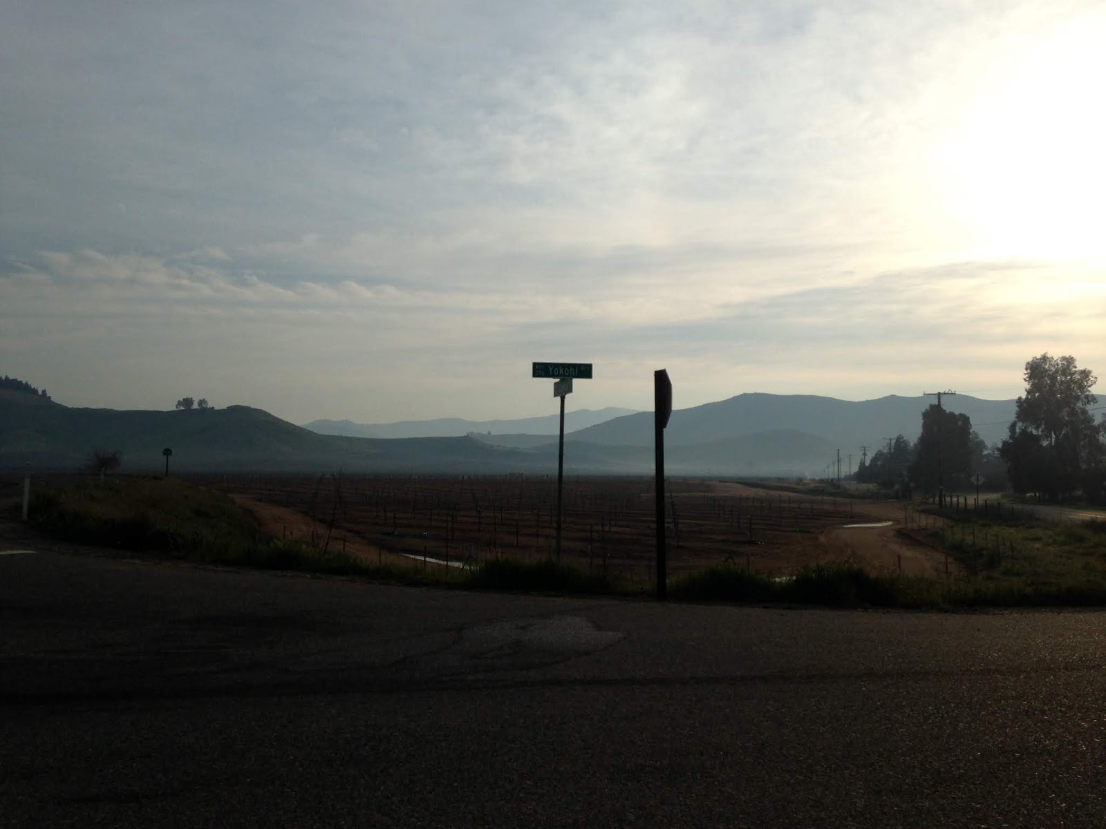
CA 198 east of CA 245 drops to a conventional two-lane highway known as Sierra Drive. At Post Mile TUL 21.861 CA 198 east intersects Yokohl Drive. Yokohl Drive was once intended to be a spur of the Lone Pine-Porterville High Sierra Road which was intended to cross Mulky Pass but was only built east to Balch Camp.


At Post Mile TUL 26.257 CA 198 east enters Lemon Cove. Lemon Cove interestingly has an intact Richfield Station off to the side of CA 198 which really illustrates how old the highway really is.


At Post Mile TUL 27.958 CA 198 east meets the east terminus of CA 216.

CA 198 east of CA 216 rises above the waters of Lake Kaweah south of the Terminus Dam. At Post Mile TUL 29.5 CA 198 has to access the Lemon Hill Recreation Area which overlooks the Terminus Dam. In years of low water the old alignment of CA 198 appears next to the Terminus Dam. The Terminus Dam was completed in 1962 and impounds the Kaweah River.


CA 198 east traverses Lake Kaweah in a counter clockwise manner. At Post Mile TUL 33.55 CA 198 east crosses Horse Creek.


At Post Mile 38.49 CA 198 east meets North Fork Road in Three Rivers. As noted above North Fork Road was originally known as the Colony Mill Road and was the original highway into Sequoia National Park. The first 18 miles of the Colony Mill Road were built in 1886 to facilitate a wagon train to the Giant Forest where Redwood lumber was milled from the Kaweah Colony. In 1890 Sequoia National Park was created and annexed all the lands that were being milled by the Kaweah Colony. The U.S. Army added another 8 miles to the Colony Mill Road in 1903 to utilize it as the main access point to the Giant Forest of Sequoia National Park.

At Post Mile TUL 41.23 CA 198 east crosses over the Salt Creek Bridge. I don't have an exact build date on the Salt Creek Bridge but it was likely either 1921 or 1922 since it is a similar arch concrete design to the nearby Pumpkin Hollow Bridge and Kaweah River Bridge. The Salt Creek Bridge is marked with a "End Truck Route" placard.

East of the Salt Creek Bridge there is a warning against trucks and trailers over 30 feet in length.

At Post Mile TUL 42.356 CA 198 east intersects Mineral King Road which intended to be CA 276. Mineral King Road is a 24.8 mile road which follows the East Fork Kaweah River to Mineral King Valley in Sequoia National Park.


A large silver claim at the White Chief Mine was struck in Mineral King Valley in 1872. Previous trails to Mineral King Valley were fleshed out which lead to the creation of Silver City six miles west of Mineral King Valley later in the year. The first Mineral King Road via proxy of Silver City was built by the Visalia and Inyo Wagon Company in 1873 on the south side of the East Fork Kaweah River. Construction second on a second Mineral King Road began in 1879 on the north side of the East Fork Kaweah River in 1879, this alignment largely is the same as the current roadway. The second Mineral King Road was managed by the Mineral King and Toll Road Company until it was deeded to Tulare County in 1884. There were some major realignments on Mineral King Road in 1915 but it essentially was under Tulare County maintenance completely until the National Park Service absorbed the Mineral King Valley in Sequoia National Park. Mineral King Road today is maintained by the National Park Service east of Lookout Point and as Tulare Mountain Road 375 west of it.
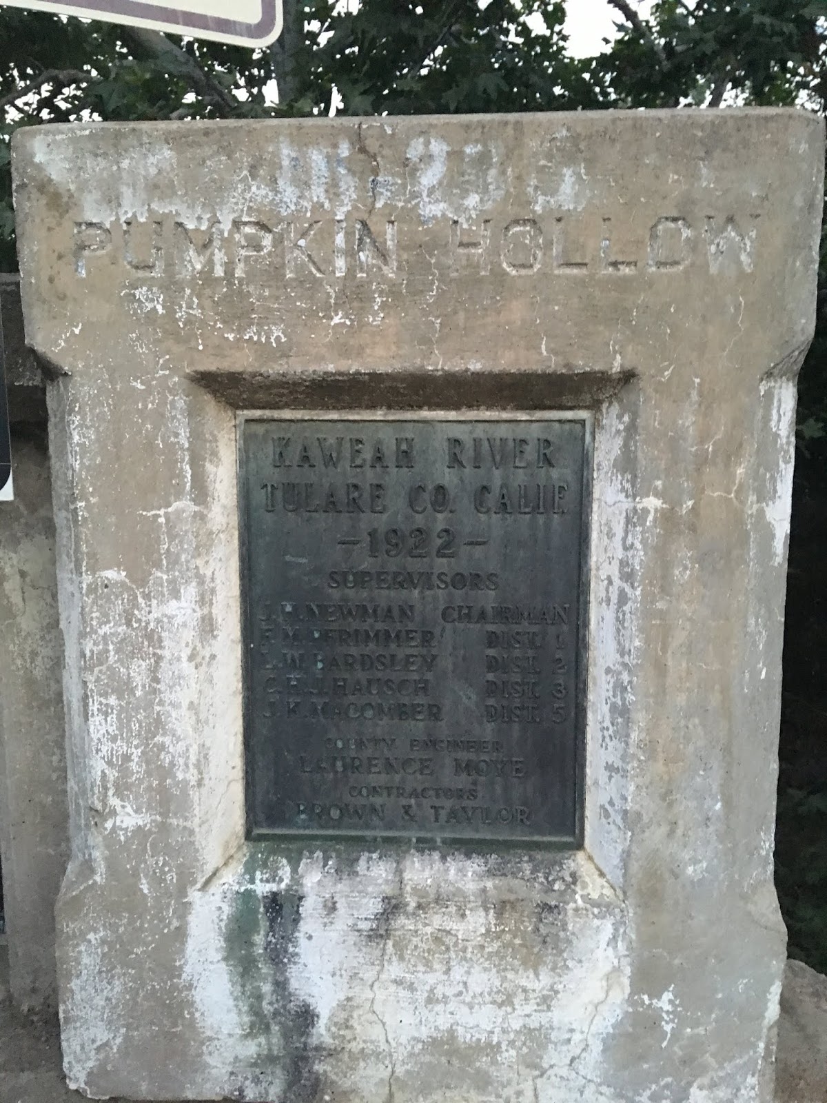
At Post Mile TUL 43.981 CA 198 east crosses the 1922 Pumpkin Hollow Bridge located at the confluence of the Middle Fork Kaweah River and East Fork Kaweah River.

The Pumpkin Hollow Bridge is an arch concrete design which is 205.1 feet in length. The 1922 Pumpkin Hollow Bridge was a key piece to improving traffic flow in Sequoia National Park. Beginning in 1921 traffic headed to the Giant Forest would head uphill via the Colony Mill Road and descend one-way via the Middle Fork Road. The 1919 Third State Highway Bond Act extension of LRN 10 east of Visalia seems to have largely been added with the almost sole purpose of facilitating better roads to/from Sequoia National Park.
A sketch of the 1922 Pumpkin Hollow Bridge along with the 1923 Kaweah River Bridge can be seen below. Note; the 1924 completion date of the Pumpkin Hollow Bridge on the sketch below isn't correct.
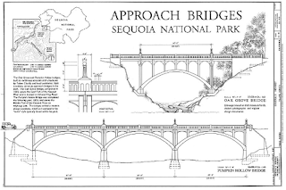
In my personal opinion the design of the Pumpkin Hollow Bridge is criminally underrated and is a perfect end to a highway like CA 198.


CA 198 east terminates at the boundary of Sequoia National Park at Post Mile 44.163. The road ahead continues as the Generals Highway which was built over the Middle Fork Road and opened to General Grant National Park (Kings Canyon National Park post-1940) in 1935.


CA 198 in present configuration is a 141 mile east/west State Highway from US Route 101 in San Lucas of Monterey County east to the Generals Highway or Sequoia National Park in Tulare County.

CA 198 was one of the original Signed State Highways which was announced in a 1934 Department of Public Works Guide on Page 32. CA 198 was aligned entirely over Legislative Route 10. Originally CA 198 was the highest number assigned to any Signed State Highway.

CA 198 has come up several times on Gribblenation mostly in regards to former alignments. While the history of the entire route of CA 198 will be discussed here much of the photographic details on particular areas can be found on the blogs below:
Old CA 198 in Kings County
Old CA 198 in Tulare County
Chisholm Ferry/Bridge Location and early Legislative Route 10
CA 198 between US 101 east to CA 33 is in my opinion one of the top driving segments of State Highway in California. That being the case said segment of CA 198 was covered in the context of a driving experience in the following blog:
Challenger Adventures in the Coast Range Part 4; CA 198 from US 101 east to I-5
As noted above CA 198 was signed entirely over LRN 10 in 1934. The earliest segment of LRN 10 was between Goshen west to Hanford was part of the 1909 First State Highway Bond Act. CA 198 was legislatively extended west to San Lucas in 1915. The 1918 State Highway Map shows LRN 10 completed between Goshen west to Hanford but only a proposed highway west to San Lucas.

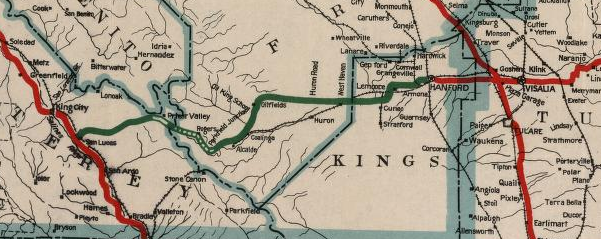
Since LRN 10 west of Hanford was unconstructed the implied route of the highway west to San Lucas had to traverse the marsh lands of Tulare Lake. The 1917 California State Automobile Association map indicates that implied route west of Lemoore to Coalinga:
- From Hanford-Armona Road south on Lemoore Avenue/18th Avenue.
- From 18th Avenue west on Jackson Avenue.
- Jackson Avenue west to 21st 1/2 Avenue.
- 21st 1/2 Avenue over the Kings River via the Chisholm's Ferry Bridge (constructed some time between 1885 and 1892) to Murphy's Ranch Road.
- From Murphy's Ranch Road southwesterly jog on roadways that appear to no longer exist to Huron.
- From Huron the right of way took an unclear path southwest to Jayne Avenue.
- From Jayne Avenue west to Polk Street in Coalinga.
The above alignment can be seen on this snip from the 1917 CSAA map. The red line denotes segments of State Highway. What appears to be certain is that the right-of-way between Lemoore and Coalinga essentially existed on whatever roads were present at the time. In the era of the early State Highway system the Department of Public Works would often build new road alignments that incorporated little if any of the previous right-of-way.

The 1920 State Highway Map shows the planned alignment of LRN 10 between Lemoore and Coalinga as only partially constructed. The route of LRN 10 west from Lemoore was planned to be aligned completely west of Lemoore on Jackson Avenue into the Diablo Range where it would have turned south from the Oilfields to Coalinga. The 1920 State Highway Map shows only the segment of LRN 10 south from the Oilfields to Coalinga as complete.

Of note; during the 1919 Third State Highway Bond Act LRN 10 was extended east from Visalia to the Colony Mill Road of Sequoia National Park. The original route of LRN 10 in Tulare County split from LRN 4 at Main Street and Mooney Boulevard in Visalia. It appears that LRN 10 east of downtown Visalia traversed southeast to Visalia Road through Farmersville and Exeter before swinging back north on Kaweah Avenue (current CA 65) to the current surface alignment of CA 198 east of CA 245. This early alignment of LRN 10 can be seen on the 1920 State Highway Map. The southeast jog of LRN 10 from downtown Visalia to Visalia Road doesn't align to any current existing roadways and likely was on rail frontage facilities.

East of current CA 245 the alignment of LRN 10 to the site of the Terminus Dam was very different than modern CA 198. LRN 10 turned north off the modern CA 198 alignment in Yokohl on Road 220 north, Avenue 312 east, Road 228 north, 7th Avenue/Moffet Drive/Road 236 northeast, and Avenue 324 back to the modern alignment in Lemon Cove. LRN 10 appears to have zig-zagged through Lemon Cove on Road 244, Pogue Avenue, modern CA 198, Lemon Road, Avenue 330, and modern CA 198 to make it through the town.
East of Lemon Cove LRN 10 would have passed modern CA 216 and used Road 248 north, Avenue 338 east, Road 249 north, and Avenue 340 east to reach the site of the modern Terminus Dam. At some point LRN 10 was moved onto what is now Long Drive (which was probably when the 1922 Pumpkin Hollow Bridge was built) approaching the Terminus Dam site.
The 1922 State Highway Map shows LRN 10 completed between Coalinga and Lemoore. Part of LRN 10 east of LRN 2 (future US 101) in San Lucas is shown being graded along with a segment east of Three Rivers east to Sequoia National Park. As noted above the Pumpkin Hollow Bridge was completed in 1922 which linked it with the highway out of Sequoia National Park. Traffic on the Colony Mill Road would ascend one-way into the Giant Forest of Sequoia National Park and descend on the Middle Fork Road. The Middle Fork Road was completed to the Giant Forest in 1919 and eventually became part of the Generals Highway in 1935.

The 1924 State Highway Map shows the only unbuilt segment of LRN 10 as Peach Tree Valley (future CA 25) east to Coalinga.

The 1926 State Highway Map shows LRN 10 east of downtown Visalia straightened on what is now Mineral King Avenue. LRN 10 likely used Court Street to bridge the highway from Main Street in downtown Visalia to Mineral King Avenue.

Interestingly it appears that LRN 10 may have been briefly signed as part of US 99 along Main Street. The 1927 Rand McNally State Highway Map of California shows US 99 splitting east from LRN 4 in Goshen into downtown Visalia via Main Street. From Main Street US 99 is shown splitting south onto future CA 63 via Mooney Boulevard.

The 1928 State Highway Map shows some of the gap in LRN 10 between Peach Tree Valley and Coalinga as functionally completed with some grading near Priest Valley.

The 1932 State Highway Map shows LRN 10 across the Diablo Range as almost fully graded aside from a segment west of Priest Valley.
The 1934 State Highway Map shows LRN 10 fully graded between San Lucas and Sequoia National Park. LRN 10 would be assigned as part of CA 198 later in 1934 as described above.

The 1935 Goshua Highway Map shows CA 198 as originally configured.

The 1935 Division of Highways Maps show where State Maintenance was located when CA 198 was first signed over LRN 10. The Map of Monterey County shows no difference in the alignment of CA 198 compared to the modern highway.

The Map of Fresno County shows some minor differences in the initial alignment of CA 198 east from the Monterey County Line east to Parkfield Junction. Much of CA 198 was originally aligned south of Warthan Creek east to Parkfield Junction whereas the modern highway is located to the north. The change between the original alignment and modern is so minor that I haven't determined when it actually occurred. The remainder of CA 198 in Fresno County east to Kings County is largely on it's original alignment.

The Map of Kings County shows that CA 198 had a massively different surface highway than the modern freeway/expressway.

Westbound the original surface alignment of CA 198 in Kings County used the following route:
1. East Lacey Blvd from the Tulare County Line.
2. 7th Street through downtown Hanford.
3. Originally Irwin Street in Hanford to West Lacey Boulevard. CA 198 was later realigned to Garner Ave to West Lacey Boulevard
4. West Lacey Blvd west out of Hanford.
5. 14th Ave south to Armona
6. Front Street in Armona
7. Hanford-Armona Road through Lemoore.
8. 19th and 1/2 Avenue south out of Lemoore (which would have also been CA 41 at the time).
9. Jackson Ave over the Kings River to NAS Lemoore
10. Jackson Avenue west from NAS Lemoore over the Fresno County Line
The Map of Tulare County shows the original alignment of CA 198 through Visalia on Main Street, Court Street and Mineral King Avenue. CA 198 east of Lemon Cove was straightened at some point onto Long Drive through the present site of the Terminus Dam.

By 1936 the route of CA 198 between modern CA 245 and modern CA 216 was eased to the modern alignment used today which can be seen on the 1936-37 State Highway Map.

According to a June 1942 Department of Public Works Guide the route of CA 198 was moved onto a connecting alignment from Main Street and Coyner Street to reach Mineral King Avenue which bypassed downtown Visalia.

The October 1941 California Highways and Public Works Guide details the new Mustang Ridge alignment of CA 198/LRN 10 west from Priest Valley west o Peach Tree Valley. The realignment of CA 198/LRN 10 over Mustang Ridge eliminated an ungraded segment and 94 curves. The new alignment of CA 198 on Mustang Ridge is often considered to be one of the best driver's roads in California. The new Mustang Grade of CA 198/LRN 10 opened to traffic on September 15th, 1941.


At some point in 1957 a divided expressway alignment of CA 198 was completed from US 99 in Goshen east past downtown Visalia. This 1957 expressway first appears on the 1958 State Highway Map and was gradually upgraded to the modern freeway used by CA 198 today.

East of Lemon Cove CA 198 was realigned uphill at some point in 1961/1962 due to the construction of the Terminus Dam and opening of the Lake Kaweah Reservoir. The realignment of CA 198 is not covered in any California Highways & Public Works as it seems to have been overshadowed by projects like the San Luis Reservoir and Lake Oroville. The Terminus Dam was dedicated on May 18th, 1962 along with the Success Dam on CA 190. The new highway alignment of CA 198 south of the Terminus Dam site can be seen on the 1962 State Highway Map.
More regarding former California State Route 198 at the bottom of Lake Kaweah can be found here:
Former California State Route 198 at the bottom of Lake Kaweah
The current freeway alignment of CA 198 in Kings County was built as an expressway after NAS Lemoore opened in 1961. The 1964 State Highway Renumbering is illustrated on the 1964 State
Highway Map with LRN 10 disappearing from CA 198. CA 198 was realigned
onto a new expressway segment west from CA 41 to NAS Lemoore by 1964.
The 1966 State Highway Map shows the CA 198 expressway completed eastward to 10th Avenue in Hanford.
The 1967 State Highway Map shows CA 198 moved to a new expressway east of Hanford to CA 43.

Recently a 10 mile expressway upgrade of CA 198 between CA 43 east to CA 99 was approved by the California Transportation Commission in 2001. Construction of what is known as the Hanford Expressway began in November 2009 and was completed in December 2012. Interestingly the original alignment of LRN 10 on East Lacey Boulevard was incorporated into the Hanford Expressway as the westbound lanes of CA 198. More details about the Hanford Expressway project can be found on CAhighways.org.
With the massive back story and history of CA 198 out of the way the route begins in San Lucas at US 101 just east of the 1915 Salinas River Truss Bridge.


CA 198 east intersects Main Street in San Lucas at Post Mile MON R0.746. CA 198 east traffic enters the Gablian Range and is advised there are No Services for 53 miles.


CA 198 east continues to ascend through far flung canyon ranches before ascending over the crest of the Gabilan Range. CA 198 east descends a 5% downhill grade into Peach Tree Valley which is where the San Andreas Fault divides the Gabilan Range on the Pacific Plate from the Diablo Range on the North American Plate. CA 198 east crosses San Lorenzo Creek and meets the south terminus of CA 25 at Post Mile MON 13.99.


At Post Mile MON 14.079 CA 198 east meets Peach Tree Valley Road which continues south on the San Andreas Fault towards Paso Robles.

CA 198 east begins to ascend rapidly through the Diablo Range onto Mustang Ridge. At approximately Post Mile MON 17.377 there is a volcanic rock off to the side of CA 198 which serves as a unmarked vista of the San Andreas Fault in Peach Tree Valley.


CA 198 east ascends above 2,700 feet above sea level atop canyons overlooking Lewis Creek. CA 198 intersects the old southern terminus of CA 25 at Post Mile MON 20.512. Before 1956 CA 25 utilized Lewis Creek Road to meet CA 25 near Priest Valley. This particular section of CA 198 east of CA 25 has been used in car magazines such as Motortrend for road testing. The route of CA 198 east from CA 25 towards Coalinga is one of the most fun in the State Highway System due to the relatively curvy alignment coupled with sparse traffic.


CA 198 east enters Priest Valley which is the only community on the highway from San Lucas east to Coalinga.


At Post Mile MON 25.785 CA 198 east enters Fresno County.


CA 198 east upon entering Fresno County follows the north bank of Warthan Creek. At Post Mile FRE 9.742 CA 198 east intersects Coalinga Mineral Springs Road.


East of Coalinga Mineral Springs Road CA 198 begins to lose elevation rapidly approaching the Parkfield Grade. CA 198 east intersects the Parkfield Grade at Post Mile FRE 12.335.


CA 198 east descends through a series of canyons following the general course of Warthan Creek. At approximately Post Mile FRE 21.093 CA 198 enters the City of Coalinga as Elm Avenue. CA 33 intersects CA 198 in Coalinga and multiplexes it north out of the city. Coalinga was established as a Southern Pacific Railroad siding in 1888 when it was called Coaling Station A. Apparently "Coalinga" comes from combing the "Coaling" and "A" from the previous status a railroad siding.


At the corner of CA 198/Elm Avenue and 6th Street is the Richfield Automotive Museum.

The Richfield Automotive Museum includes a restored 1934 Richfield Station. The 1934 Richfield Station was originally located on CA 33 at the corner of 5th Street and Glenn Street. The 1934 Richfield Station was restored in 2003 and moved to the present location in 2004.


At Post Mile FRE 22.649 CA 198 east meets CA 33 at 5th Street and begins a multiplex.

Lemoore is signed as 40 miles away from the City Limits of Coalinga on CA 198 east. CA 198 east/CA 33 north crosses Los Gatos Creek upon leaving Coalinga on Fresno-Coalinga Road.

At Route 33 Post Mile FRE R18.581 access to Los Gatos Creek is signed via Gale Avenue. Gale Avenue continues west to Los Gatos Creek Road which is another crossing of the Diablo Range.

CA 198 east/CA 33 north on Fresno-Coalinga Road multiplex into the Kettleman Hills where both routes split at Post Mile 22.666. At the split of CA 198 and CA 33 there is a historical monument pertaining Arroyo de Cantua which was the headquarters of bandit Joaquin Murieta.


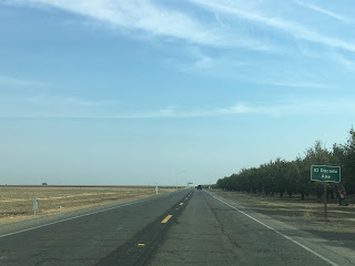
CA 198 east of CA 33 is signed on Doris Avenue to the Kings County Line. CA 198 east of CA 33 descends out of the Kettleman Hills into San Joaquin Valley and meets I-5 at Post Mile FRE 26.794 near Harris Ranch.


CA 198 east meets El Dorado Avenue at Post Mile FRE 28.638.

In times of heavy rain CA 269 is often routed onto a detour alignment which utilizes El Dorado Avenue. This photo below was taken during the winter of 2017 when the detour of CA 269 was signed.

At Post Mile FRE 34.657 CA 198 meets CA 269 at Lassen Avenue.

At Post Mile FRE 35.422 CA 198 crosses the California Aqueduct. At Post Mile FRE 42.379 CA 198 crosses the Union Pacific Line which terminates to the west of Huron.
At approximately Post Mile FRE 42.727 CA 198 enters Kings County.

At Post Mile KIN 3.012 CA 198 east at 25th Avenue expands to a four-lane expressway.


CA 198 east passes by a traffic light at the main gate for NAS Lemoore and becomes a freeway at Post Mile KIN 3.511.


At Exit 73 CA 198 east has a junction with Avenal Cut-Off Road.

CA 198 east crosses the Kings River and meets CA 41 at Exit 77 in the City of Lemoore.


CA 198 east meets 19th Avenue at Exit 78.


At Exit 79 CA 198 east intersects Lemoore Avenue.


East of Lemoore CA 198 is signed as 8 miles from Hanford, 25 miles from Visalia and 78 from Sequoia National Park.

CA 198 east Exit 81 accesses Houston Avenue.


CA 198 east has one at-grade intersection located at Post Mile KIN R12.699 for 16th Avenue south approaching Armona.

CA 198 east intersects 14th Avenue at Exit 83 in Armona.


At Exit 84 CA 198 east intersects Hanford-Armona Road.


CA 198 east enters the City of Hanford and meets 12th Avenue at Exit 85.


CA 198 east Exit 86 accesses 11th Avenue.


CA 198 east accesses downtown Hanford via Douty Street at Exit 87.


CA 198 east of downtown Hanford as an at-grade intersection with 9th Avenue.


CA 198 east meets CA 43 at Exit 89.


CA 198 east passes under CA 43 and is signed 11 miles from CA 99. The route of CA 198 east to CA 99 follows the recently completed Hanford Expressway.


CA 198 east on the Hanford Expressway has an intersection with 7th Avenue at Post Mile KIN 22.315.

At Post Mile KIN 23.322 CA 198 east on the Hanford Expressway intersects 6th Avenue.


The Hanford Expressway has numerous intersections that only serve farms.


At Post Mile KIN 27.339 CA 198 east on the Hanford Expressway has an intersection with 2nd Avenue.

At Post Mile KIN 27.83 CA 198 east on the Hanford Expressway has an intersection with 1st 1/2 Avenue.

At Post Mile KIN 28.325 CA 198 east on the Hanford Expressway enters Tulare County and intersects Road 44/1st Avenue.

At Post Mile TUL 0.501 CA 198 on the Hanford Expressway intersects Road 48.

At Post Mile TUL 1.002 CA 198 on the Hanford Expressway intersects Road 52.

At Post Mile TUL 1.503 CA 198 on the Hanford Expressway intersects Road 56.

At Post Mile TUL 2.009 CA 198 on the Hanford Expressway intersects Road 60.
At Post Mile TUL 2.511 CA 198 on the Hanford Expressway intersects Road 64.

At Post Mile TUL 3.009 CA 198 on the Hanford Expressway crosses under Road 68. Road 68 southward is still technically part of Signed County Route J25 which essentially now has a hanging end since it no longer accesses CA 198 at it's north terminus. Tulare County largely has pulled all County Route signage aside from J37.

CA 198 east becomes a freeway again approaching the junction with CA 99 at Exit 101. CA 198 east passes under CA 99 and enters the City of Visalia.


At Exit 102 CA 198 east accesses CR J19 on Road 80.


At Exit 103 CA 198 east accesses Shirk Road.


At CA 198 east Exit 104 the freeway accesses Akers Street.


CA 198 east Exit 105A accesses Demaree Street.


CA 198 east junctions CA 63 at Exit 105B for Mooney Boulevard.


CA 63 north multiplexes CA 198 east to Exit 107A. CA 63 north splits away at Exit 107A towards downtown Visalia.


CA 198 east Exit 107B accesses Ben Maddox Way.


At Exit 108 CA 198 east meets Lovers Lane which carries CA 216 to the north and CR J15 on both sides of the freeway.


At Exit 110 CA 198 east intersects Road 156.


Exit 111 on CA 198 intersects CR J23 on Farmersville Road.


CA 198 east drops to an expressway with an at-grade intersection at Road 180 located at Post Mile TUL R16.764.


At Post Mile TUL R17.009 CA 198 east meets Road 182.

At Post Mile TUL R18.761 CA 198 enters Exeter and meets CR J27/CA 65 at Exeter Boulevard.


CA 198 east of J27/CA 65 rises on an overpass which overlooks the Great Western Divide of Sequoia National Park in the Sierra Nevada Mountains.

At Post Mile TUL R19.761 CA 198 east intersects CA 245 at Road 204.


CA 198 east of CA 245 drops to a conventional two-lane highway known as Sierra Drive. At Post Mile TUL 21.861 CA 198 east intersects Yokohl Drive. Yokohl Drive was once intended to be a spur of the Lone Pine-Porterville High Sierra Road which was intended to cross Mulky Pass but was only built east to Balch Camp.

At Post Mile TUL 26.257 CA 198 east enters Lemon Cove. Lemon Cove interestingly has an intact Richfield Station off to the side of CA 198 which really illustrates how old the highway really is.


At Post Mile TUL 27.958 CA 198 east meets the east terminus of CA 216.

CA 198 east of CA 216 rises above the waters of Lake Kaweah south of the Terminus Dam. At Post Mile TUL 29.5 CA 198 has to access the Lemon Hill Recreation Area which overlooks the Terminus Dam. In years of low water the old alignment of CA 198 appears next to the Terminus Dam. The Terminus Dam was completed in 1962 and impounds the Kaweah River.


CA 198 east traverses Lake Kaweah in a counter clockwise manner. At Post Mile TUL 33.55 CA 198 east crosses Horse Creek.


At Post Mile 38.49 CA 198 east meets North Fork Road in Three Rivers. As noted above North Fork Road was originally known as the Colony Mill Road and was the original highway into Sequoia National Park. The first 18 miles of the Colony Mill Road were built in 1886 to facilitate a wagon train to the Giant Forest where Redwood lumber was milled from the Kaweah Colony. In 1890 Sequoia National Park was created and annexed all the lands that were being milled by the Kaweah Colony. The U.S. Army added another 8 miles to the Colony Mill Road in 1903 to utilize it as the main access point to the Giant Forest of Sequoia National Park.

At Post Mile TUL 41.23 CA 198 east crosses over the Salt Creek Bridge. I don't have an exact build date on the Salt Creek Bridge but it was likely either 1921 or 1922 since it is a similar arch concrete design to the nearby Pumpkin Hollow Bridge and Kaweah River Bridge. The Salt Creek Bridge is marked with a "End Truck Route" placard.

East of the Salt Creek Bridge there is a warning against trucks and trailers over 30 feet in length.

At Post Mile TUL 42.356 CA 198 east intersects Mineral King Road which intended to be CA 276. Mineral King Road is a 24.8 mile road which follows the East Fork Kaweah River to Mineral King Valley in Sequoia National Park.


A large silver claim at the White Chief Mine was struck in Mineral King Valley in 1872. Previous trails to Mineral King Valley were fleshed out which lead to the creation of Silver City six miles west of Mineral King Valley later in the year. The first Mineral King Road via proxy of Silver City was built by the Visalia and Inyo Wagon Company in 1873 on the south side of the East Fork Kaweah River. Construction second on a second Mineral King Road began in 1879 on the north side of the East Fork Kaweah River in 1879, this alignment largely is the same as the current roadway. The second Mineral King Road was managed by the Mineral King and Toll Road Company until it was deeded to Tulare County in 1884. There were some major realignments on Mineral King Road in 1915 but it essentially was under Tulare County maintenance completely until the National Park Service absorbed the Mineral King Valley in Sequoia National Park. Mineral King Road today is maintained by the National Park Service east of Lookout Point and as Tulare Mountain Road 375 west of it.
At Post Mile TUL 43.981 CA 198 east crosses the 1922 Pumpkin Hollow Bridge located at the confluence of the Middle Fork Kaweah River and East Fork Kaweah River.

The Pumpkin Hollow Bridge is an arch concrete design which is 205.1 feet in length. The 1922 Pumpkin Hollow Bridge was a key piece to improving traffic flow in Sequoia National Park. Beginning in 1921 traffic headed to the Giant Forest would head uphill via the Colony Mill Road and descend one-way via the Middle Fork Road. The 1919 Third State Highway Bond Act extension of LRN 10 east of Visalia seems to have largely been added with the almost sole purpose of facilitating better roads to/from Sequoia National Park.
A sketch of the 1922 Pumpkin Hollow Bridge along with the 1923 Kaweah River Bridge can be seen below. Note; the 1924 completion date of the Pumpkin Hollow Bridge on the sketch below isn't correct.

In my personal opinion the design of the Pumpkin Hollow Bridge is criminally underrated and is a perfect end to a highway like CA 198.


CA 198 east terminates at the boundary of Sequoia National Park at Post Mile 44.163. The road ahead continues as the Generals Highway which was built over the Middle Fork Road and opened to General Grant National Park (Kings Canyon National Park post-1940) in 1935.

Comments