Italian Bar Road (Road 225) east through the Geographic Center of California to the 1925 Italian Bar Bridge
This past week I took a day trip out to remote Madera County, California on Italian Bar Road (signed as Road 225) to the 1925 Italian Bar Bridge. On the way to the 1925 Italian Bar Bridge I passed through the Geographic Center of California.

Italian Bar Road is an approximately 16-mile highway which begins at North Fork and travels east/southeast over the San Joaquin River into Fresno County via the 1925 Italian Bar Bridge to Jose Basin Road. Italian Bar Road is now signed as Road 225 and largely routed through Sierra National Forest.

Italian Bar Road likely was constructed to ease access to Big Creek Hydroelectric Powerhouse #3 and #8. Big Creek Powerhouse #8 was completed by 1921 followed Big Creek Powerhouse #3 in 1923. Given the road access to both Powerhouses would have been from the Fresno County side of the San Joaquin River having a crossing via what is now the 1925 Italian Bar Bridge would have been a far more direct route. During the 1920s there was still considerable logging interests on the Madera County side and especially around North Fork.
Italian Bar Road is a conventional two-lane roadway east out of North Fork to the start of the Sierra Vista Scenic Byway at Minarets Road/Forest Route 81. East of Forest Route 81 the alignment of Italian Bar Road drops to a single lane as it drops into the San Joaquin River Gorge. The photo below shows the perspective from Forest Route 81 as it meets Italian Bar Road. Traffic headed onto Italian Bar Road and the 1925 Italian Bar Bridge would need to make a left-hand turn.

Italian Bar Road east of Forest Route 81 drops to a somewhat wide single lane road which passes through some remote residential property. The road can be miserable if you're caught following a slow driver like I was.


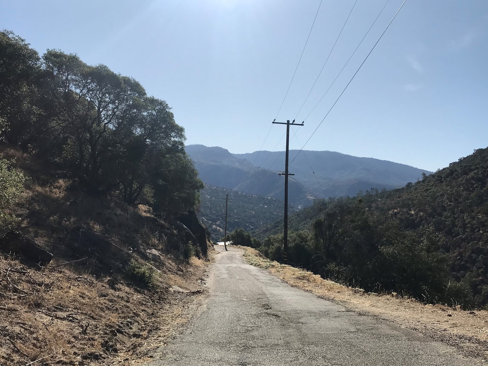
Italian Bar Road eastbound enters the Redinger Lake Recreation Area of Sierra National Forest.

After passing through a cattle guard Italian Bar Road passes through the Geographic Center of California. The Geographic Center of California marker was placed in 1998 by the North Fork History Group but there is an earlier marker placed by a Fresno State survey team in 1996.


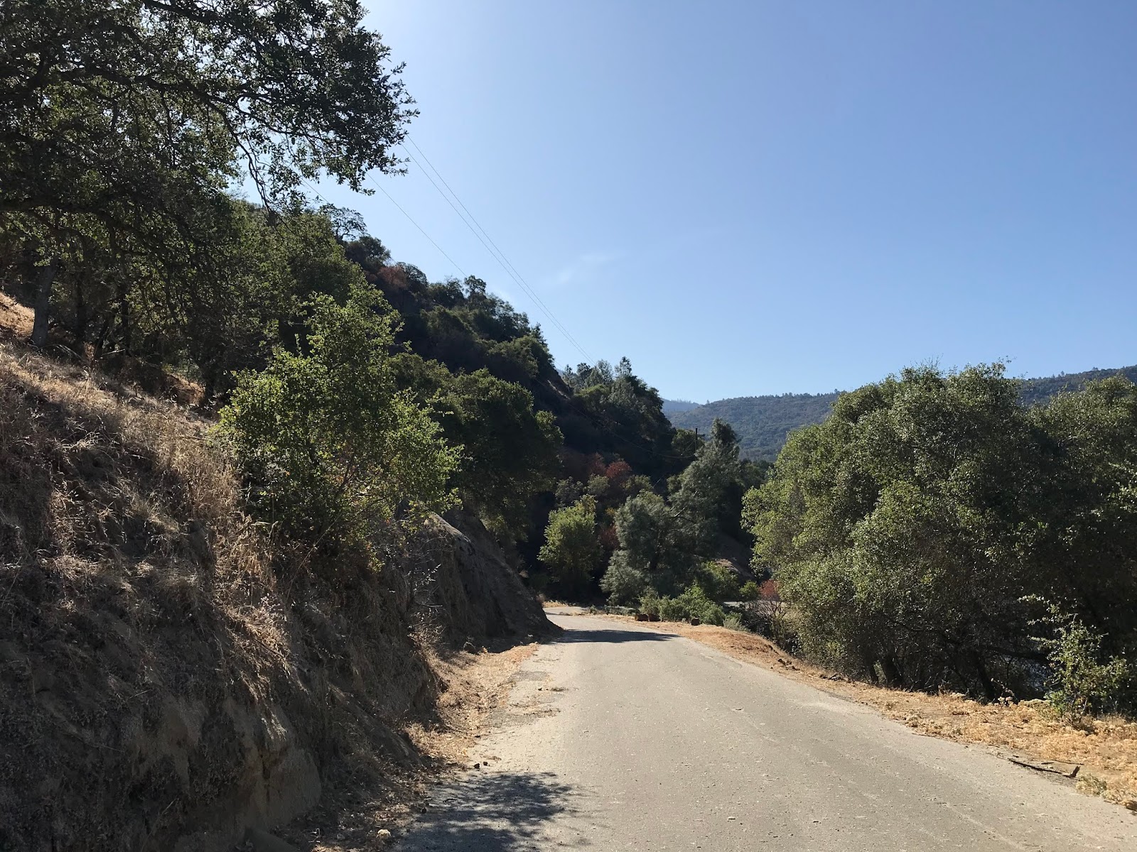
East of the Geographic Center of California traffic on Italian Bar Road is advised to camp in designated grounds. The terrain is incredibly remote past this point and it isn't uncommon to see people camping in tents along the road side.

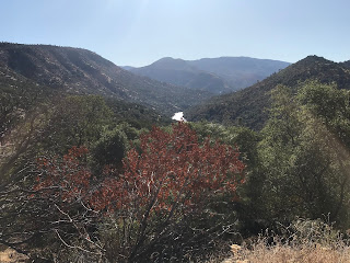
Italian Bar Road meets Redinger Lake Road (Road 235) as it enters the San Joaquin River Gorge. Italian Bar Road emerges onto a vista of the upstream catchment of Redinger Lake as it begins to resemble a river.

Traffic on Italian Bar Road is advised of the 5-ton weight limit of the 1925 Italian Bar Bridge at Redinger Lake Road.

Italian Bar Road crosses through another cattle gate and approaches with Saginaw Creek.


I'm sure people would actually expect to find Big Foot on the remote stretch of Italian Bar Road.

Italian Bar Road eastbound begins to descend in elevation rapidly and passes through another gate at Saginaw Creek. At Saginaw Creek the route of Italian Bar Road is aligned over a concrete ford which can be seen in the second to last photo below.


East of Saginaw Creek the route of Italian Bar Road emerges onto a bluff overlooking the 1925 Italian Bar Bridge.


Italian Bar Road makes the final descent to the Redinger Lake and the 1925 Italian Bar Bridge. Redinger Lake is part of the Big Creek Project and is formed by the 250-foot high Redinger Dam on the San Joaquin River. Redinger Dam is a concrete structure which was completed in 1951.


The 1925 Italian Bar Bridge is a Warren Pony Truss design which features a 242.1-foot length, a 11.2 wide wooden road deck and a hell of a cool view from the bottom of the San Joaquin River Gorge. The 1925 Italian Bar Road Bridge was renovated in 1951 (probably raised due to the Redinger Lake project) and is slated to be replaced by what sounds like a bland modernized 22-foot-wide modern span.
The approach to the 1925 Italian Bar Bridge includes a cattle guard. Traffic is advised of a recommended 15 MPH speed on the one-lane wooden deck 1925 Italian Bar Bridge. Traffic is intended to stay on top of the steel beams, and the 1925 Italian Bar Bridge has a singular weight capacity of 5 tons signed. Conjecture has it that the actual weight capacity of the 1925 Italian Bar Bridge is far higher, but I can't validate it myself.


For such a structure it is a shame that there appears to be zero intent at present moment to preserve the 1925 Italian Bar Bridge as a walking path. The 1925 Italian Bar Bridge isn't eligible to be on any list of historic structures.

On September 6th Sierra National Forest announced the following regarding the replacement of the Italian Bar Bridge on their Facebook page:
"Fresno & Madera Counties to begin the Italian Bar Bridge replacement project, on Italian Bar Road September 17, 2019
Clovis, Calif., September 06, 2019 – The Sierra National Forest would like to inform the forest communities and visitors to the forest, American Paving Co. (Contracted by Fresno & Madera Counties) will begin the Italian Bar Bridge replacement project in the very near future. Road closures will start on 9/17/19, with rock blasting starting around 9/30/19.
Signs will be posted along various roads, the San Joaquin River Trail where it intersects with Italian Bar Road, and at the Redinger Boat Launch.
The signs will inform visitors and residents of construction and road closures. The signs will state the following: “This Road (or Trail, or Boat Launch) will be Closed Intermittently Start Sept 2019 thru Feb 2021 Mon.-Sat. 7 am–5:30 pm.”
The existing bridge will remain in place until the new bridge has been completed, then it will be removed. The new bridge will be located just west, or downstream, of the existing one."
It seems that those wishing to enjoy the 1925 Italian Bar Bridge will have until early 2021 to do so. Given that blasting will take place it would seem that only a couple weeks remain to see the 1925 Italian Bar Bridge relatively unabated by construction. On a 2015 report posted by Sierra National Forest they cited Caltrans (an agency with has zero stake in this structure) listed the 1925 Italian Bar Bridge as structurally and functionally deficient. Considering how remote the terrain of the San Joaquin River Gorge really is I find the concept of a two-lane modern bridge on a largely one-lane road to be overkill.
While (rare opinion on this series) I understand the need to have a modernized structure to hold the weight of Big Creek Project vehicles it does seem reckless that nobody involved in replacing the 1925 Italian Bar Bridge thought it had any value to remain for people to enjoy. I would point to the countless examples of preserved historic bridges across the country that draw the interest of travelers and give real world examples of how road based transportation used to be like. Considering how long the 1925 Italian Bar Bridge has been in place above Redinger Lake I don't agree with the assessment (my disagreement is with blanket engineering logic with no regards historic value) that the current clearance is insufficient. While I would like to see the 1925 Italian Bar Bridge preserved the best advice I can give in the interim is to visit it yourself if it or the San Joaquin River Gorge captures your interest in any way.

Italian Bar Road is an approximately 16-mile highway which begins at North Fork and travels east/southeast over the San Joaquin River into Fresno County via the 1925 Italian Bar Bridge to Jose Basin Road. Italian Bar Road is now signed as Road 225 and largely routed through Sierra National Forest.

Italian Bar Road likely was constructed to ease access to Big Creek Hydroelectric Powerhouse #3 and #8. Big Creek Powerhouse #8 was completed by 1921 followed Big Creek Powerhouse #3 in 1923. Given the road access to both Powerhouses would have been from the Fresno County side of the San Joaquin River having a crossing via what is now the 1925 Italian Bar Bridge would have been a far more direct route. During the 1920s there was still considerable logging interests on the Madera County side and especially around North Fork.
Italian Bar Road is a conventional two-lane roadway east out of North Fork to the start of the Sierra Vista Scenic Byway at Minarets Road/Forest Route 81. East of Forest Route 81 the alignment of Italian Bar Road drops to a single lane as it drops into the San Joaquin River Gorge. The photo below shows the perspective from Forest Route 81 as it meets Italian Bar Road. Traffic headed onto Italian Bar Road and the 1925 Italian Bar Bridge would need to make a left-hand turn.

Italian Bar Road east of Forest Route 81 drops to a somewhat wide single lane road which passes through some remote residential property. The road can be miserable if you're caught following a slow driver like I was.


Italian Bar Road eastbound enters the Redinger Lake Recreation Area of Sierra National Forest.

After passing through a cattle guard Italian Bar Road passes through the Geographic Center of California. The Geographic Center of California marker was placed in 1998 by the North Fork History Group but there is an earlier marker placed by a Fresno State survey team in 1996.


East of the Geographic Center of California traffic on Italian Bar Road is advised to camp in designated grounds. The terrain is incredibly remote past this point and it isn't uncommon to see people camping in tents along the road side.

Italian Bar Road meets Redinger Lake Road (Road 235) as it enters the San Joaquin River Gorge. Italian Bar Road emerges onto a vista of the upstream catchment of Redinger Lake as it begins to resemble a river.
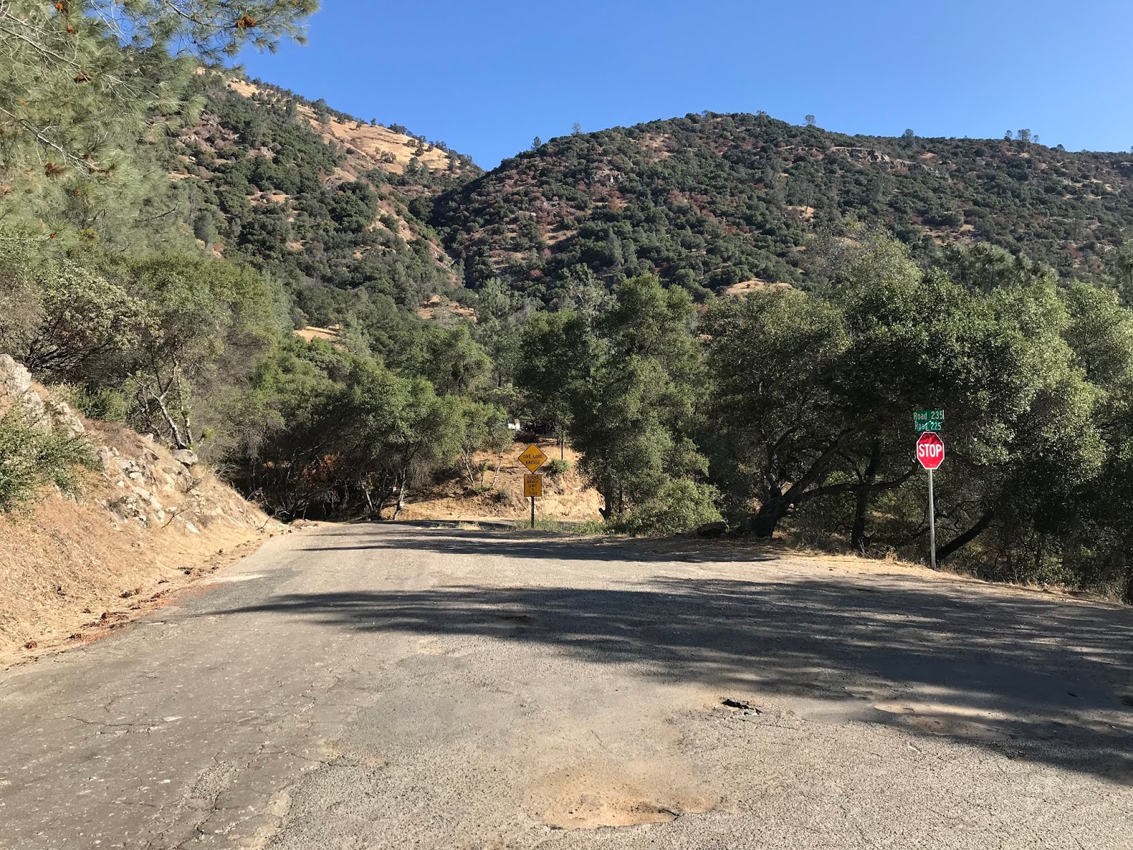

Traffic on Italian Bar Road is advised of the 5-ton weight limit of the 1925 Italian Bar Bridge at Redinger Lake Road.

Italian Bar Road crosses through another cattle gate and approaches with Saginaw Creek.


I'm sure people would actually expect to find Big Foot on the remote stretch of Italian Bar Road.

Italian Bar Road eastbound begins to descend in elevation rapidly and passes through another gate at Saginaw Creek. At Saginaw Creek the route of Italian Bar Road is aligned over a concrete ford which can be seen in the second to last photo below.


East of Saginaw Creek the route of Italian Bar Road emerges onto a bluff overlooking the 1925 Italian Bar Bridge.


Italian Bar Road makes the final descent to the Redinger Lake and the 1925 Italian Bar Bridge. Redinger Lake is part of the Big Creek Project and is formed by the 250-foot high Redinger Dam on the San Joaquin River. Redinger Dam is a concrete structure which was completed in 1951.


The 1925 Italian Bar Bridge is a Warren Pony Truss design which features a 242.1-foot length, a 11.2 wide wooden road deck and a hell of a cool view from the bottom of the San Joaquin River Gorge. The 1925 Italian Bar Road Bridge was renovated in 1951 (probably raised due to the Redinger Lake project) and is slated to be replaced by what sounds like a bland modernized 22-foot-wide modern span.
The approach to the 1925 Italian Bar Bridge includes a cattle guard. Traffic is advised of a recommended 15 MPH speed on the one-lane wooden deck 1925 Italian Bar Bridge. Traffic is intended to stay on top of the steel beams, and the 1925 Italian Bar Bridge has a singular weight capacity of 5 tons signed. Conjecture has it that the actual weight capacity of the 1925 Italian Bar Bridge is far higher, but I can't validate it myself.


For such a structure it is a shame that there appears to be zero intent at present moment to preserve the 1925 Italian Bar Bridge as a walking path. The 1925 Italian Bar Bridge isn't eligible to be on any list of historic structures.

On September 6th Sierra National Forest announced the following regarding the replacement of the Italian Bar Bridge on their Facebook page:
"Fresno & Madera Counties to begin the Italian Bar Bridge replacement project, on Italian Bar Road September 17, 2019
Clovis, Calif., September 06, 2019 – The Sierra National Forest would like to inform the forest communities and visitors to the forest, American Paving Co. (Contracted by Fresno & Madera Counties) will begin the Italian Bar Bridge replacement project in the very near future. Road closures will start on 9/17/19, with rock blasting starting around 9/30/19.
Signs will be posted along various roads, the San Joaquin River Trail where it intersects with Italian Bar Road, and at the Redinger Boat Launch.
The signs will inform visitors and residents of construction and road closures. The signs will state the following: “This Road (or Trail, or Boat Launch) will be Closed Intermittently Start Sept 2019 thru Feb 2021 Mon.-Sat. 7 am–5:30 pm.”
The existing bridge will remain in place until the new bridge has been completed, then it will be removed. The new bridge will be located just west, or downstream, of the existing one."
It seems that those wishing to enjoy the 1925 Italian Bar Bridge will have until early 2021 to do so. Given that blasting will take place it would seem that only a couple weeks remain to see the 1925 Italian Bar Bridge relatively unabated by construction. On a 2015 report posted by Sierra National Forest they cited Caltrans (an agency with has zero stake in this structure) listed the 1925 Italian Bar Bridge as structurally and functionally deficient. Considering how remote the terrain of the San Joaquin River Gorge really is I find the concept of a two-lane modern bridge on a largely one-lane road to be overkill.
While (rare opinion on this series) I understand the need to have a modernized structure to hold the weight of Big Creek Project vehicles it does seem reckless that nobody involved in replacing the 1925 Italian Bar Bridge thought it had any value to remain for people to enjoy. I would point to the countless examples of preserved historic bridges across the country that draw the interest of travelers and give real world examples of how road based transportation used to be like. Considering how long the 1925 Italian Bar Bridge has been in place above Redinger Lake I don't agree with the assessment (my disagreement is with blanket engineering logic with no regards historic value) that the current clearance is insufficient. While I would like to see the 1925 Italian Bar Bridge preserved the best advice I can give in the interim is to visit it yourself if it or the San Joaquin River Gorge captures your interest in any way.
Comments