
Portland is the 25th largest City in the United States by population at approximately 653,000 residents. Portland is by far the largest City in Oregon and the Multnomah County Seat. Portland was settled upon land in Willamette Valley in the early 1840s by settlers arriving to Oregon via the Oregon Trail. Portland was initially known as "The Clearing" and "Stumptown" due to the large number of felled trees that dotted the area. Portland was renamed after the namesake City in Maine after coin toss in 1845. By 1851 Portland had incorporated as a City and rapidly in size approaching the start of the 20th Century.
The focus of this blog will be slightly different than my typical fare. Unlike most cities I visit there was a lot of smaller roadways and sites that I explored, really there wasn't a typical plan to any of what I saw. That being the case I figured it would be better to do this blog in sections.
This blog is part of the larger Gribblenation US Route 99 Page. For more information pertaining to the other various segments of US Route 99 and it's three-digit child routes check out the link the below.

Part 1; Interstate 5 on the Marquam Bridge over the Willamette River
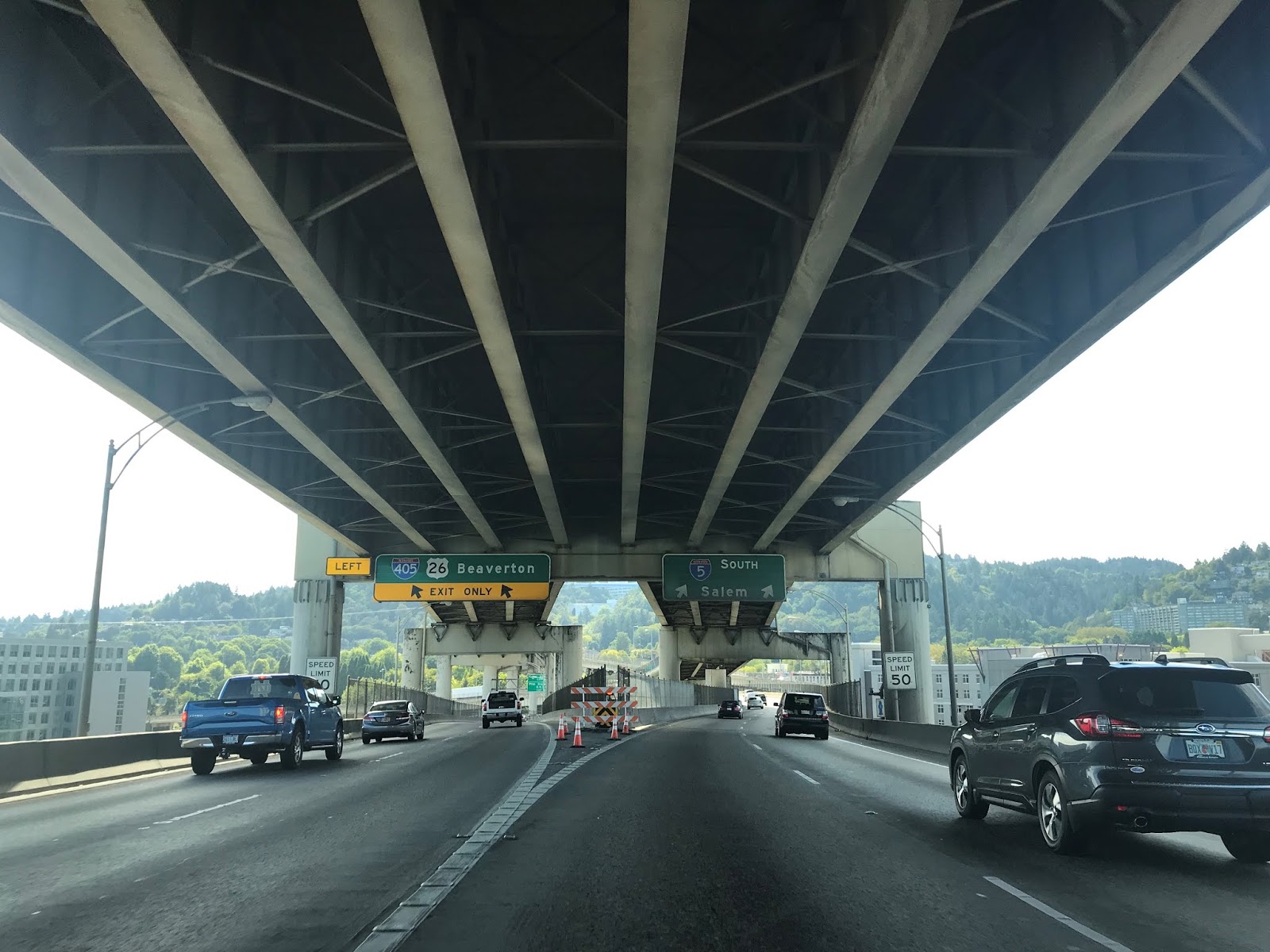
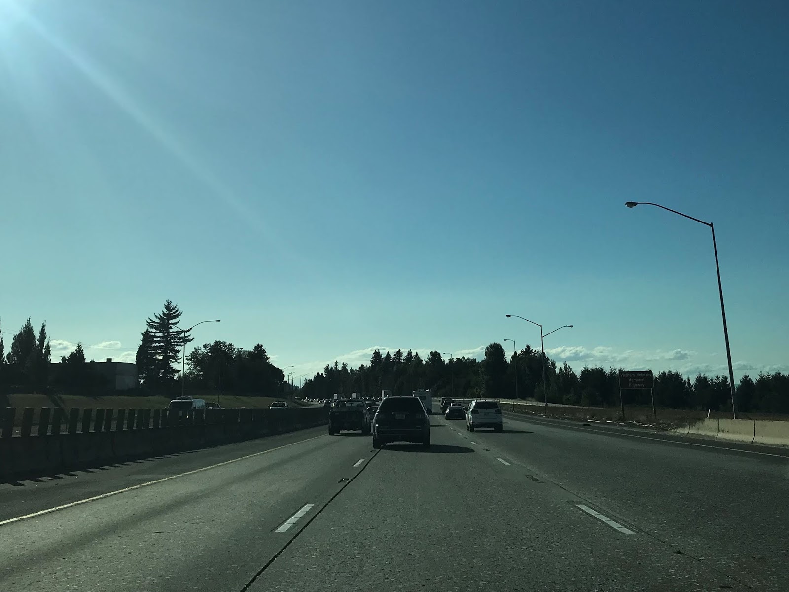
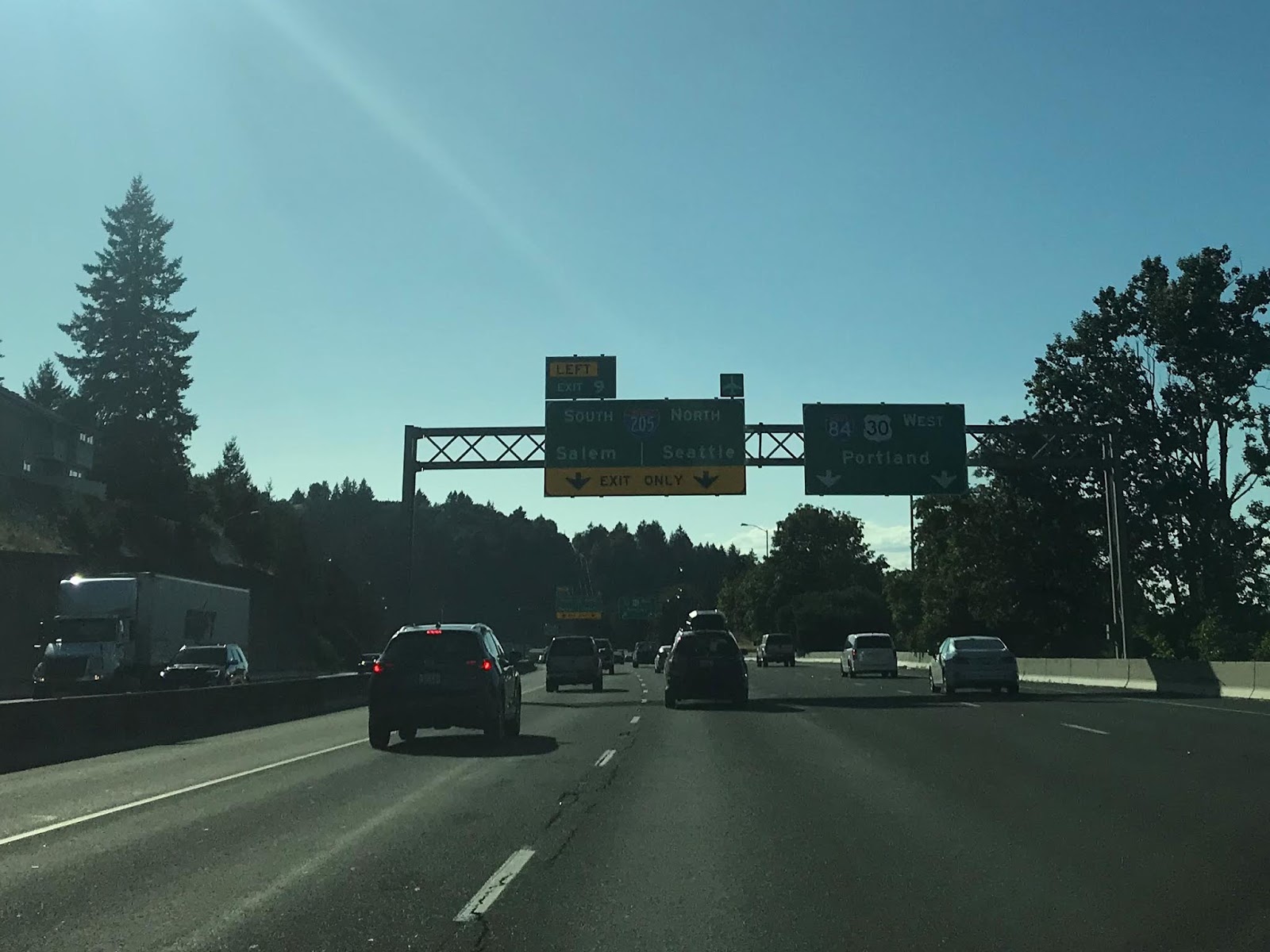
Upon my arrival to Portland I immediately headed towards downtown from PDX (Portland International Airport) via I-205 south and I-84 west. The terminus of I-84 west is located at I-5 as it approaching the Marquam Bridge on the eastern flank of the Willamette River. I turned on I-5 southbound approaching downtown Portland the Marquam Bridge.

The Marquam Bridge is a Cantilevered Warren Deck Truss structure which was completed in 1966. The Marquam Bridge is a double deck structure with the southbound lanes of I-5 riding the lower level whereas the northbound lanes ride the top. The Marquam Bridge is 1,044 feet in length with the largest span being 440 feet in length. The Marquam Bridge has a 130 foot vertical foot vertical clearance which allows ships to pass underneath.
Turning south on I-5 I drove over the Marquam Bridge towards downtown Portland. I made a detour towards my hotel which was south of OR 43.


Part 2; Oregon State Route 217
OR 217 is a 7.52 Mile freeway from I-5 north in Tigard of Washington County north to US 26/Sunset Highway in Beaverton. OR 217 is known as the Beaverton-Tigard Highway and was built up to freeway standards through the 1960s and complete by 1972. I didn't drive the entirety of OR 217 but rather picked up northbound from Exit 6 via OR 99W (former US 99W) in Tigard on Barbur Boulevard.
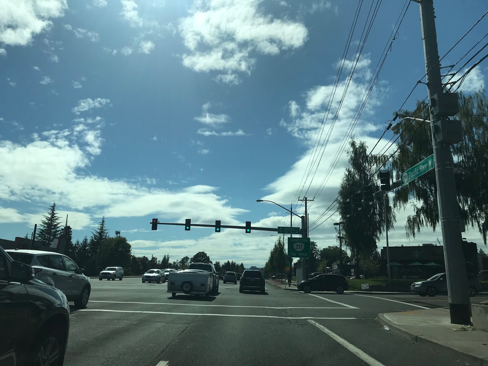


Something immediately apparent on Oregon Freeways which found useful is VMS signs which show the travel times to major junctions. The VMS above doesn't pick up very well in photos but shows a 6 minute travel time on OR 217 north to US 26.

OR 217 north accesses Greenburg Road via Exit 5. OR 217 north has a major junction with OR 210 at Scholls Ferry Road at Exit 4B.


OR 217 north Exit 3 accesses Denney Road.

OR 217 north Exit 2B accesses Allen Boulevard. OR 217 north Exit accesses both OR 10 and OR 8.


OR 217 north Exit 1 accesses Walker Road.

OR 217 north terminates at US 26.


The previous surface route of OR 217 is presently the unsigned OR 141. The original surface route of OR 217 can be partially seen on the below 1956 Shell Highway Map of Portland.

Part 3; US Route 26 through the Vista Ridge Tunnel
My second drive into downtown Portland included traveling eastbound through the Vista Ridge Tunnels on US 26 eastbound on the Sunset Highway. When US 26 was extended westward to Astoria in 1952 it was initially aligned on Canyon Road through Tanner Creek Canyon which was the routing of OR 6 north of Vista Ridge. The eastbound Vista Ridge Tunnel was completed first in 1969 and is the longer of the two at 1,001 feet in length. The westbound Vista Ridge Tunnel was completed in 1970 and is 949 feet in length. Both Vista Ridge Tunnels have a 6.5% grade with a 35 degree turn radius at western portals.
As noted above my approach on US 26 to the Vista Tunnels was eastbound between Exit 73 for Jefferson Street to Exit 74 at Market Street.


Part 4; the fate of US Route 99W in downtown Portland
The initial alignment of US 99W through downtown Portland was Barbur Boulevard, a dual one-way couplet on 4th Avenue/6th Avenue and the Broadway Bridge. By November 1942 the new boulevard known as Harbor Drive was formally dedicated along the Willamette River. The construction of Harbor Drive was highly contentious due to the removal of numerous historic structures along Front Avenue along with pedestrian access to the Willamette River being cut off. By 1950 Harbor Drive was converted to a primitive limited access roadway and US 99W was realigned onto it. Upon moving to Harbor Drive US 99W crossed the Willamette River via the Steel Bridge. The alignment of US 99W as it was on Harbor Drive can be seen on the below 1956 Shell Highway Map of Portland.

By 1961 the Baldock Freeway reached downtown Portland and I-5 was temporarily co-signed with US 99W along Harbor Drive. As noted above the Marquam Bridge was completed in 1966 which is the present alignment of I-5. In 1967 US 99 had been completely removed through California and by 1969 it was decommissioned as a US Route in 1969. Following the decomissioning of US 99 the route of Harbor Drive became OR 99W. In 1973 the Fremont Bridge was completed over the Willamette River which in turn linked I-405 through downtown. Subsequently Harbor Drive north of Market Street was closed in 1974 and began being converted to a City Park. In 1978 Tom McCall Waterfront Park opened upon what had been US 99W on Harbor Drive.
My approach to former US 99W on Harbor Drive was east on Market Street. Ahead in the photo below traffic on eastbound Market Street can take what is left of Harbor Drive southbound.

I turned left to head northbound along the western flank of Tom McCall Waterfront Park on Naito Parkway. Naito Parkway was originally Front Avenue but it was widened into a parkway during the build of Tom McCall Waterfront Park. The northbound lanes of Naito Parkway were partially built upon the southbound lanes of US 99W on Harbor Drive. I followed Naito Parkway north towards the Steel Bridge.


The Steel Bridge opened in 1912 over the Willamette River and is a double deck vertical lift structure. The 1912 Steel Bridge is incredibly versatile as it carries road traffic and light rail on the top deck. On the bottom deck the 1912 Steel Bridge carries Union Pacific Freight traffic, Amtrak rail service and has a pedestrian walkway. The longest span of the 1912 Steel Bridge is 211 and it has a clearance of 163 when the lift span is raised. The 1912 Steel Bridge is presently owned by the Union Pacific and replaced the earlier 1888 span which was also known as the "Steel Bridge."

At present moment only the two outer lanes of the top deck of the Steel Bridge carry automotive traffic whereas the center lanes have been converted to light rail. I followed the route of what was US 99W to the I-5 underpass at the Oregon Convention Center. US 99W traffic would turned northward along Interstate Avenue and converged with US 99E near Oregon Slough.


Part 5; the White Stag sign
One of the most known landmarks in downtown Portland is the White Stag neon sign located above the Burnside Bridge. The White Stag sign was first illuminated in October of 1940 and read "White Satin Sugar" with the shape of the State of Oregon as the background. In 1957 the sign was changed to read "White Stag Sportswear" and the iconic neon white stag was added to the background. The White Stag Sportwear signage remained beyond 1986 when the namesake company moved from Oregon until was converted to "Made in Oregon Old Town" in 1997. In late 2010 the City of Portland purchased the White Stag sign and was changed to read "Portland Oregon Old Town."
The White Stag sign even daylight hours still stands out amid the high rise buildings in downtown Portland.


But is pretty unforgettable lit up in neon colors at night.


Part 6; former US 30 on the Burnside Bridge
Prior to the completion of the Fremont Bridge in 1973 the mainline route of US 30 in downtown Portland crossed the Willamette River via the 1926 Burnside Bridge. The current Burnside Bridge was built at the same location as the original 1894 swing span. Three years prior to the 1894 Burnside Bridge opening B Street had been renamed as Burnside Street in honor of a local businessman. The 1926 Burnside Bridge was part of a $4,500,000 City Bond which also funded the construction of the Ross Island Bridge and Sellwood Bridge. The 1926 Burnside Bridge is a rather ornate Double Leaf Strauss Bascule structure with a central draw span. The 1926 Burnside Bridge is 1,382 feet in length and had streetcar service until 1950.
The photos below were taken from Tom McCall Waterfront Park.


The substructure of the Burnside Bridge has become part of the venue for the Portland Saturday Market. The Portland Saturday Market was established in 1974 (along with the conversion of US 99W/Harbor Drive to Tom McCall Waterfront Park) and bleeds into nearby Ankeny Plaza. Ankeny Plaza was dedicated in 1888 and is the site of the 1878 Skidmore Fountain.


Part 7; a shit load of Doughnuts
Portland is known for having several notable doughnut shops. I'm no stranger to partaking in doughnuts so I stopped at three shops; Voodoo Doughnuts, Blue Star Donuts and Pip's Original Doughnuts. The most well known donut shop is Voodoo Doughnuts which is located at the corner of 3rd Avenue and Ankeny Street. Voodoo Doughnuts has been in operation since 2003 and contains an odd assortment of flavors. In particular I preferred the "dirt" doughnut which essentially is just cookies and cream.

The neon sign at Voodoo Doughnuts is actually a pretty nice touch to the aesthetic being so close to the White Stag sign.

The pink Voodoo Doughnut boxes I found were a common sight throughout the City and PDX on the way home.

Blue Star Donuts has several locations in Portland, I stopped at the shop at the corner of Morrison Street and 12th Avenue. Blue Star Donuts is relatively new only having been in business since 2012 but is supposedly the most "artsy fartsy" of all the doughnut shops in Portland. While there wasn't quite the diverse assortment of flavors as Voodoo Doughnuts the best doughnut on the trip was the Old Fashioned Buttermilk from Blue Star Donuts.


Pip's Original Doughnuts and Chai is located at the corner of Northeast Fremont Street and Northeast 48th Street. Pip's opened in 2013 and is somewhat off the beaten path east of the Willamette River. Pip's offers mostly doughnut bites along with Chai Tea. A lot of Pip's doughnuts have Nutella in them which I'm allergic to. My wife liked Pip's the best out of the doughnut shops we visited in Portland (I suspect it had a lot to do with the free dozen they offer for birthdays). I thought the honey glaze doughnut was probably their best offering that I could actually eat.
Part 8; Morrison Bridge
The current Morrison Bridge was completed in 1958 and is a Double Leaf Chicago Style Bascule structure located on the Willamette River. The Morrison Bridge is 760 feet in length, contains a central draw span and is open to vehicle traffic in addition to pedestrian traffic. The present Morrison Bridge replaced the 1905 structure which in turn replaced the 1888 structure. Both the 1888 and 1905 Morrison Bridges carried electric street cars whereas the 1958 Morrison Bridge has no present rail use.

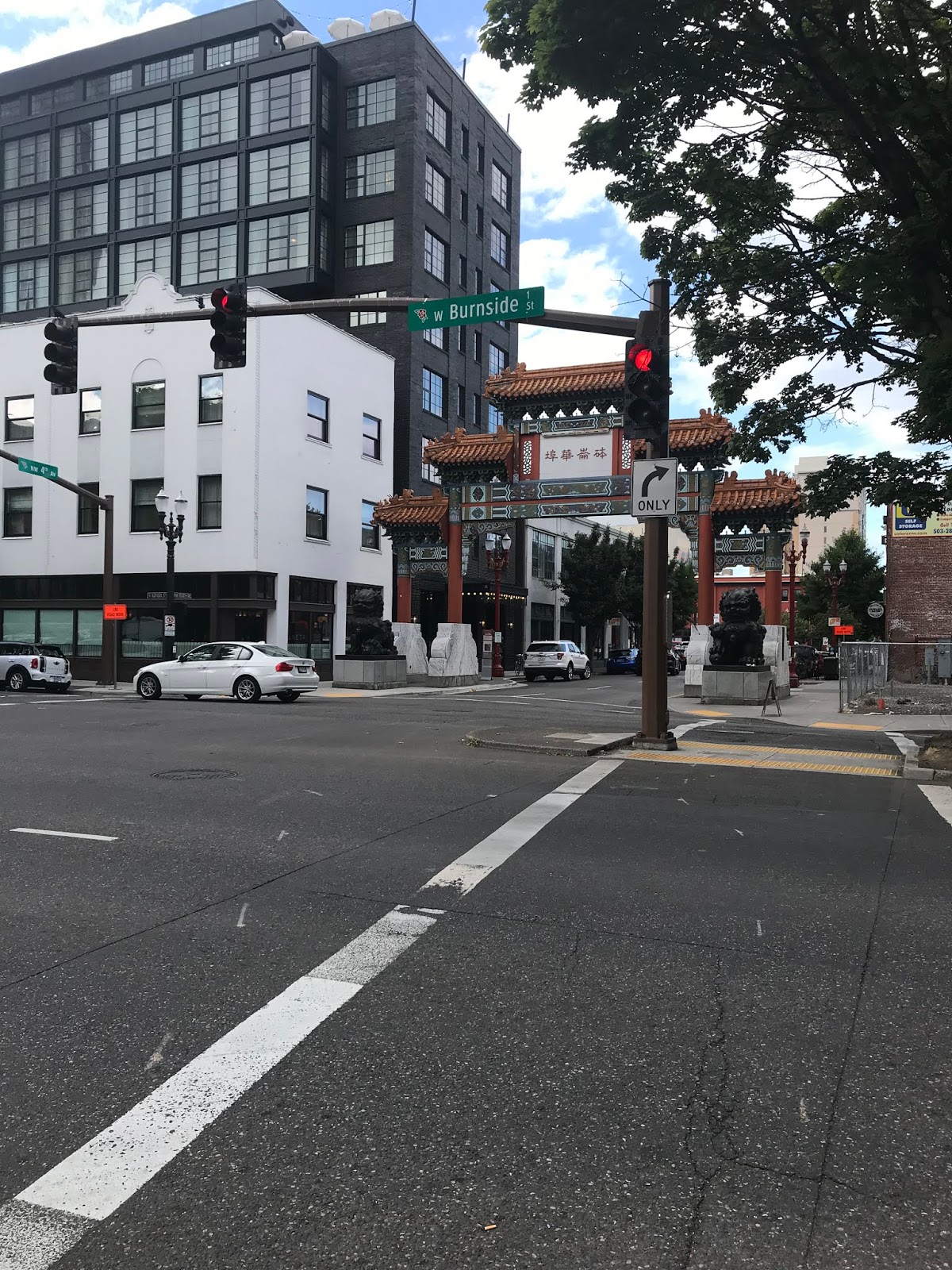
Part 9; Chinatown Gateway
The Chinatown Gateway is located on 4th Avenue in downtown Portland at Burnside Street and marks the boundary to the Old Town Chinatown neighborhood. The Chinatown Gateway was completed in November of 1986 and technically is a structure known as a Paifang. The Chinatown Gateway is 38 feet tall and was constructed from; bronze, marble, marble, wood, tile and steel.

Speaking of Chinatown...

Part 10; 1st Avenue MAX Light Rail
1st Avenue between Southwest Yamhill Street north to the Steel Bridge presently carries the red and blue MAX (Metropolitan Area Express) Light Rail Service. MAX light rail service in Metro Portland is laid out over five lines which include 59.7 miles of tracks and 97 stations. The current MAX system of light rail is the latest iteration of interurban rail service in the Portland area which began to reemerge following the freeway revolts of the 1970s. Portland MAX service began September 1986 when the first line opened between 11th Avenue 15.3 miles east to Gresham.
The photo below is 1st Avenue looking south towards the Burnside Bridge.

This photo is of northbound 1st Avenue looking towards the Burnside Bridge.

The photo below is of 1st Avenue looking south towards the Morrison Bridge.

Part 11; the Hawthorne Bridge
The Hawthorne Bridge opened in December of 1910 over the Willamette River and replaced the earlier wooden 1900 Madison Street Bridge. The Hawthorne Bridge is a Steel Truss structure which is 1,382 feet in length which includes a 244 foot long vertical lift span. The Hawthorne Bridge was originally a wooden deck structure which switched to steel grating in 1945. Streetcars once ran atop the Hawthorne Bridge but the structure is presently open only to vehicles and pedestrians.

Part 12; early US 26 on Canyon Road and the Vista Avenue Bridge
As noted in Part 3 the route of US 26 when it was extended to Astoria in 1952 climbed out of downtown Portland via Canyon Road through Tanner Creek Canyon. Tanner Creek Canyon is located immediately north of Vista Ridge and was originally signed as OR 6. Canyon Road is one of the most historic roadways in Oregon with origins dating back to the era when it was still a territory.
By the early 1850s a primitive dirt road between Portland and Tualatin Valley was in common usage in Tanner Creek Canyon. In January of 1851 the Portland & Valley Plank Road company was charted by the territorial government of Oregon. Construction on what came be known as the "Great Plank Road" began in Tanner Creek Canyon of September of 1851. Initial construction of the Great Plank Road was slow with only 3 miles being completed during the first year. In 1856 the Oregon Territorial Government hired the Portland & Taulatin Plank Road Company which completed the plank road by year end.
Since the era of the Great Plank Road the route of highways through Tanner Creek Canyon were infilled, widened and raised to modernize transportation. This modernization ultimately resulted in Canyon Road being bypassed by the Vista Ridge Tunnels in 1969/1970. Canyon Road and Old US 26 can still be accessed from the modern Sunset Highway eastbound via Exit 73 towards Jefferson Street.


Old US 26 on Canyon Road travels through Tanner Creek Canyon and becomes Southwest Jefferson Street as it passes under the Vista Avenue Viaduct. The Vista Avenue Viaduct opened in 1926 and is an arch concrete structure 248 feet in length. The Vista Avenue Viaduct replaced the 1903 Ford Street Bridge which was used as a streetcar line. The Vista Avenue Viaduct unfortunately has come to be known for suicides due to the 120 feet height above Tanner Creek Canyon.


Old US 26 on Southwest Jefferson Street eastbound emerged from Tanner Creek Canyon and split onto one-way alignments through downtown Portland. Eastbound Old US 26 traffic split onto Southwest Columbia Street at 18th Avenue whereas westbound Old US 26 was aligned on Southwest Jefferson Street.


Old US 26 continued onward towards Portland where it converged with US 99W on Harbor Drive. This alignment is clear on the 1956 Shell Highway Map of Portland.

Part 13; Washington Park (International Rose Test Garden and Portland Japanese Garden)
During my visit to Portland I stopped in Washington Park to see the International Rose Test Garden and Japanese Garden. Both the International Rose Test Garden and Japanese Garden are located north of Tanner Creek Canyon on Southwest Kingston Avenue. Washington Park lies within in land that was purchased by the City of Portland in 1871. The initial park was called "City Park" and it's grounds were brush filled and contained animals that made it somewhat threatening to visit. In 1903 changes to the City Park were recommended to make it more visitor friendly which gradually led up to to being reorganized as Washington Park in 1909.


The International Rose Test Garden ("Rose Garden") opened in 1917 which was initially meant to serve as a "safe haven" for hybrid roses grown in Europe during World War I. The Rose Garden quickly began to accumulate other roses from throughout the United States and a large segment of Europe which justified it becoming it's own annex of Washington Park. The Rose Garden was formally dedicated in June of 1924 and presently attractions approximately 700,000 visitors a year.


The Portland Japanese Garden is located uphill from the Rose Garden on a 12 acre site which has been leased from the City since 1967. The Portland Japanese Garden consists of 8 different garden spaces which have plants and Japanese cultural displays.


The Portland Japanese Gardens has an overlook of the 11,249 Mount hood off to the east. The location of the Portland Japanese Garden was deliberately chosen due to it's resembling Mount Fuji.


Part 14; Battleship Oregon
Located within Tom McCall Waterfront Park just south of the Burnside Bridge is the mast of Battleship Oregon. USS Oregon was built at the Union Iron Works of San Francisco and launched in October of 1893. The USS Oregon was renown for making a record pace on a 14,000 mile trip from San Francisco to Key West during the course of 68 days. The USS Oregon sunk the Spanish ships Viscaya and Colon during the 1898 Battle of Santiago de Cuba of the Spanish-American War. During World War I USS Oregon was used as a training ship and coastal defense. USS Oregon was briefly recommissioned in World War II only to be dismantled for war scrap.


Part 15; Rocky Butte Road and Park
Before departing Portland I headed towards the junction of I-205 and I-84 which is close to a small mountain known as Rocky Butte. Rocky Butte is a vista point of the City of Portland and somewhat of a rarity given it has 360 degree views of the area. My approach to Rocky Butte was via Northeast Fremont Street which becomes Northeast Rocky Butte Road.


Northeast Rocky Butte Road snakes around the northern extent of Rocky Butte and travels about 270 degrees to reach Rocky Butte park.


Rocky Butte is a 613 foot above sea level extinct volcanic cinder cone. The initial park atop Rocky Butte was completed in 1933 and was known Joseph Wood Hill Park. The initial park took it's name from Hill Military Academy which operated on the northern flank of Rocky Butte between 1931 to 1959. Work on the Rocky Butte Historic Drive began in 1934 and was completed in 1941 when the Rocky Butte Tunnel opened.


Directly to the east Mount Hood can easily be seen on clear days from Rocky Butte.


To the northeast I-84 and the Columbia River Gorge can be seen from Rocky Butte.


To the north of Rocky Butte both Mount Adams and Mount St. Helens can be seen in Washington State. I-205 crossing over the Columbia River and Government Island on the Glenn J. Jackson Memorial Bridge can also be seen. The Glenn J. Jackson Memorial Bridge was completed in December of 1982.


To the west of Rocky Butte downtown Portland can be seen.


From the peak of Rocky Butte the alignment of Northeast Rocky Butte Road snakes generally through a southwest to Northeast 92nd Avenue. Northeast Rocky Butte Road takes a 270 loop through the Rocky Butte Tunnel while descending to Northeast 92nd Avenue.


Part 16; St. Johns Bridge
While driving back from Astoria on US 30 eastbound I crossed under the St. Johns Bridge which is signed as US 30 Bypass. The St. Johns Bridge crosses the Willamette River on a suspension span which is 400 in height and opened to traffic in 1931. The St. Johns Bridge 2,067 feet in length and was the first non-movable bridge over the Willamette River.


Part 17; Burlington Northern Railroad Bridge 5.1
From US 30 eastbound on Northwest St. Helens Road near Doane Point the Burlington Northern Railroad Bridge 5.1 ("5.1 Bridge"). The 5.1 Bridge is owned by the BNSF Railway and opened over the Willamette River in 1908 as part of the Spokane, Portland & Seattle Railway. Interestingly the 5.1 Bridge was a swing-span design from 1908 to 1989 when it was converted to a vertical lift structure. The 5.1 Bridge spans 1,756 feet above the Willamette River.

Part 18; Fremont Bridge
As noted in Part 4 when the Fremont Bridge opened in November of 1973 it was the instigator of dramatic changes to the landscape of highways in downtown Portland. Upon opening the Fremont Bridge connected I-405 tover the Willamette River and became the new mainline route of US 30 over the previous route on the Burnside Bridge. The Fremont Bridge is a Tied-Arch design which has a total length of 2,154 feet. The upper deck of the Fremont Bridge carries US 30 west/I-405 south and the lower deck carries US 30 east/I-405 north. While I didn't cross the Fremont Bridge I did use part of the approach to transition from US 30 east onto I-405 south.


The Fremont Bridge can be seen even as far of Rocky Butte. The distinct Tied-Arch design obvious even from a distance.

Part 19; Interstate 84 from the Columbia River Gorge to the Willamette River
In the latter part of my trip I drove east out of Portland on Old US 30 on the Historic Columbia River Highway. Upon hiking Bridal Veil Falls I turned back west towards Portland on Interstate 84 via Exit 28 in the Columbia River Gorge. I-84 is co-signed with US 30 from the Columbia River Gorge west to I-5 in Portland.


I-84 in the western United States was meant to be designated as I-82 during the drafting phases of the Federal Aid Highway Act of 1956. Ultimately the suffixed designation of I-80N was chosen in 1958 in what I can assume was attempt not to duplicate I-84 on the east coast. By 1977 the AASHTO approved changing I-80N to I-84 which took until 1980 to actually occur completely. I-80N from Portland east through the Columbia River Gorge largely was complete by 1963 and required that a large segment of Historic Columbia River Highway be destroyed. I-80N in the Columbia River Gorge was fully brought up to Interstate Standards in 1968.
From Exit 28 I-84 west is signed as being 26 miles from Portland.


Rooster Rock State Park is accessible from I-84 west Exit 25. The Vista House atop the Historic Columbia River Highway can be seen from I-84 approaching Exit 25.


I-84 west has a vista point of the Columbia River Gorge west of Exit 25.


The Columbia River Gorge vista includes a historical station regarding British exploration in 1790s. The Columbia River Gorge is most famous for being part of the Oregon Trail. Emigrants from the eastern United States would literally float their wagons from The Dalles west to Willamette Valley. While not everyone was dying of dysentery a lot of those stories told in the old versions of Oregon Trail had tremendous basis actual history.

While the views of the Columbia River Gorge are nice they can't compare to what can be had from the Vista House on the Historic Columbia River Highway.


Exit 22 on I-84 west accesses Corbett and the Vista House on the Historic Columbia River Highway.


Lewis & Clark State Park and Sandy River Delta Park are accessible via the Historic Columbia River Highway at I-84 west Exit 18. At Exit 18 I-84 west leaves the Columbia River Gorge.


I-84 west crosses the Big Sandy River into Troutdale which can be accessed from Exit 17 via 257th Avenue.


West Exit 16 I-84 enters Fairview.


West of Exit 14 I-84 enters Gresham.


At Northeast 162nd Avenue I-84 west enters the City of Portland.


At Exit 9 in Portland I-84 west meets I-205.


West of I-205 the route of I-84 is aligned next to the MAX line I mentioned in Part 10.

I-84 west winds through the Cityscape of Portland and terminates at I-5 at the Willamette River. US 30 westbound splits off of I-84 onto I-5 to approach the Fremont Bridge.


Comments