Back in February/March of 2017 and August of 2016 I spent some time tracking down the old surface alignment of California State Route 198 in Kings County.

CA 198 in present configuration is a 141 mile east/west State Highway from US Route 101 in San Lucas of Monterey County east to the Generals Highway or Sequoia National Park in Tulare County.

CA 198 was one of the original Signed State Highways which was announced in a 1934 Department of Public Works Guide on Page 32. CA 198 was aligned entirely over Legislative Route 10. Originally CA 198 was the highest number assigned to any Signed State Highway.

Legislative Route 10 ("LRN 10") was first added to the State Highway System in 1909 during the First State Highway Bond act as a route between Goshen and Hanford. LRN 10 was extended west to San Lucas by the State Legislature in 1915 and east to Sequoia National Park during the 1919 Third State Highway Bond Act. More details can be found on CAhighway.org on the LRN 10 Page.
Through review of old State Highway Maps the original route of CA 198 within Kings County was easy to determine. In brief the reasoning behind moving CA 198 to an expressway alignment can be attributed to NAS Lemoore opening in 1961. By 1967 the CA 198 expressway was fully open between NAS Lemoore and CA 43 in eastern Hanford. Westbound the pre-1967 surface of alignment used the following:
1. East Lacey Blvd.
2. 7th Street through downtown Hanford.
3. Originally Irwin Street in Hanford to West Lacey Boulevard. CA 198 was later realigned to Garner Ave to West Lacey Boulevard
4. West Lacey Blvd west out of Hanford.
5. 14th Ave south to Armona
6. Front Street in Armona
7. Hanford-Armona Road through Lemoore.
8. 19th and 1/2 Avenue south out of Lemoore (which would have also been CA 41 at the time).
9. Jackson Ave over the Kings River to NAS Lemoore
Below is a list of Map Citation used to determine the surface alignment of CA 198 in Kings County:
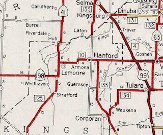
1935 California Division of Highways Map of Kings County
- Below the alignment of early CA 198 can be seen between Hanford and Lemoore on the 1935 Division of Highways Map:

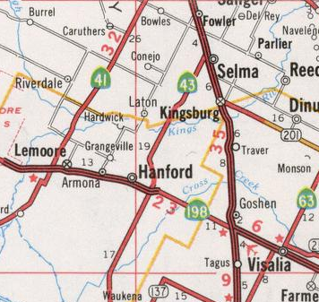
1960 State Highway Map
- Below the alignment of CA 198 can be seen fully on a surface alignment in Kings County on the 1960 State Highway Map.
1961 State Highway Map
- The 1961 State Highway Map shows no change to the routing of CA 198 in Kings County. As noted above 1961 was the year that NAS Lemoore opened.

1964 State Highway Map
- The 1964 State Highway Renumbering is illustrated on the 1964 State Highway Map with LRN 10 disappearing from CA 198. CA 198 was realigned onto a new expressway segment west from CA 41 to NAS Lemoore by 1964.

1966 State Highway Map
- The 1966 State Highway Map shows the CA 198 expressway completed eastward to 10th Avenue in Hanford.

1967 State Highway Map
- The 1967 State Highway Map shows CA 198 moved to a new expressway east of Hanford to CA 43.

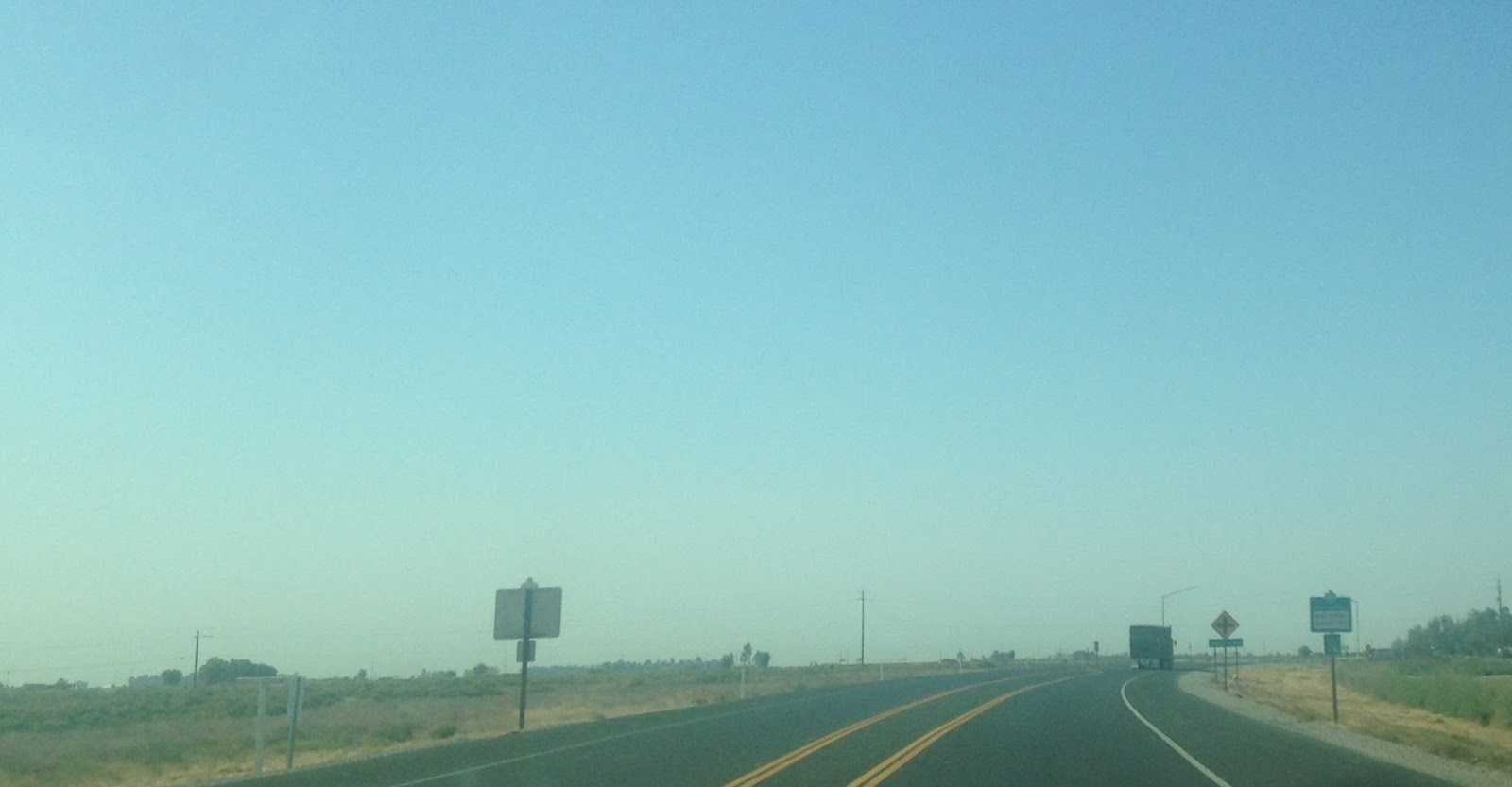
Back in 2016 I took the entire surface routing of 198 through Hanford, Armona, and Lemoore. As noted above CA 198 was on East Lacey Boulevard entering Hanford west from Tulare County. This picture is on East Lacey Boulevard from when the new CA 43 roundabout was being constructed.

LRN 135 would have begun southbound on 10th Avenue on the left in Hanford. LRN 135 was a precursor route to what would become CA 43.

On the 1935 California Division of Highways Map it is clear that CA 198 used 7th Street and Irwin Street to reach west Lacey Boulevard.
Downtown Hanford itself has some interesting structures on the old CA 198 alignment at the city square located at the intersection of West Lacey Boulevard and Irwin Street. The Fox Theater building dates back from 1929 and has much of the original insignia still intact. The Kings County Courthouse was opened in 1896 and was used for said purpose until the 1970s. The Bastille served as a county jail from 1898 to 1964 before being replaced by larger facilities. The Hanford Civic Auditorium was opened in 1924 and was the only such facility from San Francisco to Los Angeles.
Looking north on Irwin Street towards the Fox Theater, CA 198 originally turned on West Lacey Boulevar

Below are the; Kings County Court House, Hanford Civic Auditorium, Fox Theater, and Bastille.


At some point CA 198 west realigned off of Irwin Street and used 7th Street and Garner Avenue to reach West Lacey Boulevard.


CA 198 used West Lacey Boulevard west out of Hanford and turned south into Armona here on 14th Avenue.

CA 198 turned west on Front Street in Armona and merged into Hanford-Armona Road.


CA 198 bypassed downtown Lemoore and turned south on CA 41 which was on 19th 1/2 Avenue.

CA 198 would have multiplexed CA 41 southward on 19th 1/2 Avenue to Jackson Avenue. At Jackson Avenue CA 198 turned west off of CA 41 towards the Kings River and Tulare Lake Bed.

CA 198 crossed over the Kings River on two bridges. The first photo is from 2016 when the Kings River was dry and the next two are from February 2017 after the winter floods. Early LRN 10 would have used the Chisholm's Ferry Bridge which was located about a half mile to the south.


The former alignment of CA 198 on Jackson Avenue can clearly be seen heading directly west towards the power lines and the modern freeway.


CA 198 in present configuration is a 141 mile east/west State Highway from US Route 101 in San Lucas of Monterey County east to the Generals Highway or Sequoia National Park in Tulare County.

CA 198 was one of the original Signed State Highways which was announced in a 1934 Department of Public Works Guide on Page 32. CA 198 was aligned entirely over Legislative Route 10. Originally CA 198 was the highest number assigned to any Signed State Highway.

Legislative Route 10 ("LRN 10") was first added to the State Highway System in 1909 during the First State Highway Bond act as a route between Goshen and Hanford. LRN 10 was extended west to San Lucas by the State Legislature in 1915 and east to Sequoia National Park during the 1919 Third State Highway Bond Act. More details can be found on CAhighway.org on the LRN 10 Page.
Through review of old State Highway Maps the original route of CA 198 within Kings County was easy to determine. In brief the reasoning behind moving CA 198 to an expressway alignment can be attributed to NAS Lemoore opening in 1961. By 1967 the CA 198 expressway was fully open between NAS Lemoore and CA 43 in eastern Hanford. Westbound the pre-1967 surface of alignment used the following:
1. East Lacey Blvd.
2. 7th Street through downtown Hanford.
3. Originally Irwin Street in Hanford to West Lacey Boulevard. CA 198 was later realigned to Garner Ave to West Lacey Boulevard
4. West Lacey Blvd west out of Hanford.
5. 14th Ave south to Armona
6. Front Street in Armona
7. Hanford-Armona Road through Lemoore.
8. 19th and 1/2 Avenue south out of Lemoore (which would have also been CA 41 at the time).
9. Jackson Ave over the Kings River to NAS Lemoore
Below is a list of Map Citation used to determine the surface alignment of CA 198 in Kings County:
1935 California Division of Highways Map of Kings County
- Below the alignment of early CA 198 can be seen between Hanford and Lemoore on the 1935 Division of Highways Map:

1960 State Highway Map
- Below the alignment of CA 198 can be seen fully on a surface alignment in Kings County on the 1960 State Highway Map.

1961 State Highway Map
- The 1961 State Highway Map shows no change to the routing of CA 198 in Kings County. As noted above 1961 was the year that NAS Lemoore opened.

1964 State Highway Map
- The 1964 State Highway Renumbering is illustrated on the 1964 State Highway Map with LRN 10 disappearing from CA 198. CA 198 was realigned onto a new expressway segment west from CA 41 to NAS Lemoore by 1964.

1966 State Highway Map
- The 1966 State Highway Map shows the CA 198 expressway completed eastward to 10th Avenue in Hanford.

1967 State Highway Map
- The 1967 State Highway Map shows CA 198 moved to a new expressway east of Hanford to CA 43.
Back in 2016 I took the entire surface routing of 198 through Hanford, Armona, and Lemoore. As noted above CA 198 was on East Lacey Boulevard entering Hanford west from Tulare County. This picture is on East Lacey Boulevard from when the new CA 43 roundabout was being constructed.

LRN 135 would have begun southbound on 10th Avenue on the left in Hanford. LRN 135 was a precursor route to what would become CA 43.

On the 1935 California Division of Highways Map it is clear that CA 198 used 7th Street and Irwin Street to reach west Lacey Boulevard.
Downtown Hanford itself has some interesting structures on the old CA 198 alignment at the city square located at the intersection of West Lacey Boulevard and Irwin Street. The Fox Theater building dates back from 1929 and has much of the original insignia still intact. The Kings County Courthouse was opened in 1896 and was used for said purpose until the 1970s. The Bastille served as a county jail from 1898 to 1964 before being replaced by larger facilities. The Hanford Civic Auditorium was opened in 1924 and was the only such facility from San Francisco to Los Angeles.
Looking north on Irwin Street towards the Fox Theater, CA 198 originally turned on West Lacey Boulevar

Below are the; Kings County Court House, Hanford Civic Auditorium, Fox Theater, and Bastille.
 .
.


At some point CA 198 west realigned off of Irwin Street and used 7th Street and Garner Avenue to reach West Lacey Boulevard.


CA 198 used West Lacey Boulevard west out of Hanford and turned south into Armona here on 14th Avenue.

CA 198 turned west on Front Street in Armona and merged into Hanford-Armona Road.


CA 198 bypassed downtown Lemoore and turned south on CA 41 which was on 19th 1/2 Avenue.

CA 198 would have multiplexed CA 41 southward on 19th 1/2 Avenue to Jackson Avenue. At Jackson Avenue CA 198 turned west off of CA 41 towards the Kings River and Tulare Lake Bed.
CA 198 crossed over the Kings River on two bridges. The first photo is from 2016 when the Kings River was dry and the next two are from February 2017 after the winter floods. Early LRN 10 would have used the Chisholm's Ferry Bridge which was located about a half mile to the south.


The former alignment of CA 198 on Jackson Avenue can clearly be seen heading directly west towards the power lines and the modern freeway.

Comments