After leaving the eastern district Pinnacles National Park I headed to Signed County Route G13 to get in a minor route clinch.

CR G13 begins in San Benito County at the community of Bitterwater on Bitterwater Road. CR G13 is 15.7 miles long and terminates at US 101 in King City.


Bitterwater Road climbs to an approximately 1,300 foot pass of the Gabilan Range. There is a vista of Salinas Valley and the Santa Lucia Range to the west which can be seen from the pass.


Oddly the westbound lanes of travel on CR G13 have no reassurance shields that I observed on the entire route. The drop out of the Gabilans to the Monterey County line is fairly fast and moderately steep.


Despite what the pictures show the drop into King City wasn't all that foggy. CR G13 has a junction with the CR G15 at Metz Road.


For whatever reason I didn't take any pictures of the rest of G13 within King City or I lost them somehow. CR G13 uses 1st Street and Broadway Street in King City to reach US 101 near the Salinas River. Interestingly US 101 used to run on Broadway Street and 1st Street within King City until it was realigned onto the current freeway. This can be seen on the 1935 California Division of Highways Map of Monterey County along with county maintenance of Bitterwater Road.
1935 Monterey County Highway Map
Bitterwater Road was also a county maintained road in San Benito County in 1935.
1935 San Benito County Highway Map
According to CAhighways.org CR G13 was created in 1965.
CAhighways.org on CR G13
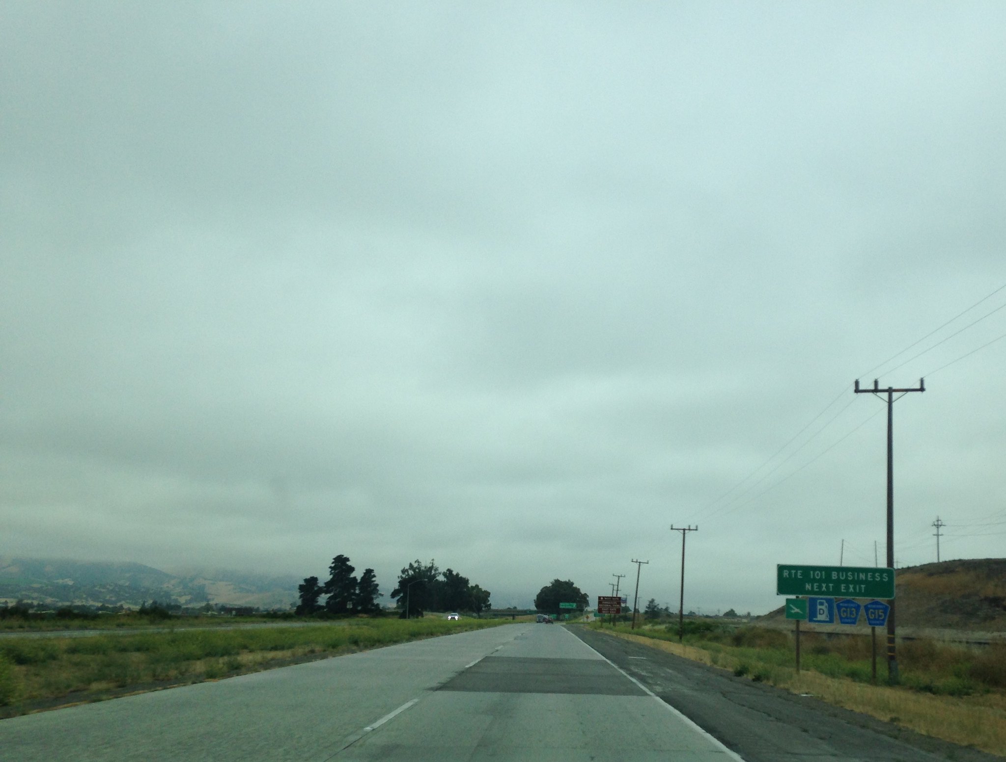
From US 101 there is a G13 reassurance shields for eastbound traffic. A photo I took of a G13 shield can be found here.
CR G13/CR G15 Shields

CR G13 begins in San Benito County at the community of Bitterwater on Bitterwater Road. CR G13 is 15.7 miles long and terminates at US 101 in King City.


Bitterwater Road climbs to an approximately 1,300 foot pass of the Gabilan Range. There is a vista of Salinas Valley and the Santa Lucia Range to the west which can be seen from the pass.


Oddly the westbound lanes of travel on CR G13 have no reassurance shields that I observed on the entire route. The drop out of the Gabilans to the Monterey County line is fairly fast and moderately steep.


Despite what the pictures show the drop into King City wasn't all that foggy. CR G13 has a junction with the CR G15 at Metz Road.


For whatever reason I didn't take any pictures of the rest of G13 within King City or I lost them somehow. CR G13 uses 1st Street and Broadway Street in King City to reach US 101 near the Salinas River. Interestingly US 101 used to run on Broadway Street and 1st Street within King City until it was realigned onto the current freeway. This can be seen on the 1935 California Division of Highways Map of Monterey County along with county maintenance of Bitterwater Road.
1935 Monterey County Highway Map
Bitterwater Road was also a county maintained road in San Benito County in 1935.
1935 San Benito County Highway Map
According to CAhighways.org CR G13 was created in 1965.
CAhighways.org on CR G13
From US 101 there is a G13 reassurance shields for eastbound traffic. A photo I took of a G13 shield can be found here.
CR G13/CR G15 Shields
Comments