
While researching the earliest routings of US Route 99 in California recently I found a very old alignment through Herndon of Fresno County, California north over the San Joaquin River.
This blog is part of the larger Gribblenation US Route 99 Page. For more information pertaining to the other various segments of US Route 99 and it's three-digit child routes check out the link the below.
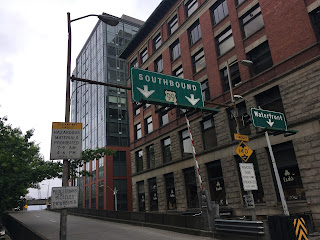
Former US Route 99 through Herndon
Herndon dates back to the 1860s when it was founded as a ferry landing on the San Joaquin River. Said ferry landing was used to supply the first Fresno County seat of Millerton which was located upstream near the present location of Friant Dam. In 1872 the Central Pacific Railroad organized a community known as "Sycamore" and built a roadway bridge east of the railroad tracks along what is now Weber Avenue. The modern name of Herndon apparently dates back to a Post Office name change in 1887. The original 1872 Herndon Bridge would be replaced by truss span in 1903 at the same location.
The earliest alignments of Legislative Route 4 were incorporated into the State Highway network by 1910 when the 1909 First State Highway Bond Act was approved by voters. By proxy the original "Herndon Bridge" along Weber Avenue was incorporated as the highway crossing for LRN 4 over the San Joaquin River. Said route of LRN 4 over the Herndon Bridge can be seen on the 1914 Fresno County Map below.
1914 Fresno County Map
In late 1926 the US Route system was finalized and US 99 was selected to run over the alignment of LRN 4 in San Joaquin Valley. As a result the Herndon Bridge was incorporated into the earliest alignment of US 99. This alignment didn't last long as a replacement span was built west of the Southern Pacific Railroad tracks and Herndon at the San Joaquin River which was completed by June 1929. The 1929 bridge is still in use as part of modern CA 99 but has been heavily modified to serve modern traffic. Various photos showing the older truss structure of the 1929 bridge can be found on Bridgehunter.com.
Bridgehunter.com; 1928 San Joaquin River Bridge
Update 4/17/19: I was provided a link by AAroads forum user Kniwt regarding the Herndon Bridge crossings from a 1927 California Highway and Public Works publication. Said volume details the history of the 1903 Herndon Bridge on page 555 and an overview of the 1928 replacement span project on page 552.
California Highway and Public Works 1927 Volume
The 1903 Herndon Bridge still appears on the 1935 California Division of Highways Map of Fresno County. I'm uncertain when the Herndon Bridge was demolished.
1935 California Division of Highways Map of Fresno County
This custom map below shows the differences between the original alignment of US 99 through Herndon compared to the 1929 (shown in error as 1928) alignment.

From Belmont Avenue near downtown Fresno the route of US 99 would have originally followed what is now Golden State Boulevard to Herndon Avenue. US 99 would have crossed the Southern Pacific Railroad tracks on Herndon Avenue before swinging north on Weber Avenue into Herndon.


Weber Avenue through Herndon north to Cattern Avenue doesn't resemble an early US Route in the slightest.


North of Cattern Avenue traffic on Weber Avenue is advised there is no outlet to the north. After a quick turn Weber Avenue changes drastically dropping down to a single lane of concrete top layered in dirt.


Weber Avenue continues north to the location of the Herndon Bridge at the San Joaquin River. The San Joaquin River Viaduct which is part of the current High Speed Rail construction can be seen in the background.


The San Joaquin River can no longer be accessed via Weber Avenue but the location of the Herndon Bridge can be seen at the end of the concrete in the photo below.

Doubling back to Golden State Boulevard north of Herndon Avenue the 1929 alignment of US 99 over the San Joaquin River Bridge is much straighter and far more direct. To the east of the 1929 alignment of US 99 the Union Pacific tracks (formerly Central Pacific and Southern Pacific) can be seen along with the not fully completed High Speed Rail San Joaquin River Viaduct.

The 1928 alignment of US 99 merges onto the CA 99 freeway and crosses the San Joaquin River as the northbound lanes. It is virtually impossible to tell from the CA 99 freeway that the northbound lanes are traveling on a bridge from 1929. Mid-way through the 1929 San Joaquin River Bridge US 99 would have entered Madera County.


From the Exit 144 sign for Avenue 7 the older alignment of US 99 can be seen near the UP tracks. The original alignment of US 99 would have come in from the left and crossed the rails.

From the Avenue 7 overpass a remaining portion of Road 33 can be seen looking southward towards the San Joaquin River Viaduct. The derelict curve is where the original alignment of US 99 met the 1929 alignment.


From the Avenue 7 overpass the original alignment of US 99 west of the Union Pacific tracks is partially intact as a rail frontage road.


Further Reading
Continuing north on US Route 99 to the Midway Palm and Pine?
Continuing south on US Route 99 to Fresno, Calwa, Malaga, Fowler, Selma and Kingsburg?
Comments