Upon returning to Colorado via US Route 40 I continued eastward through Moffat County towards Dinosaur National Monument. Access to the Colorado section of Dinosaur National Monument from US 40 is east of the town of Dinosaur via Harper's Corner Drive.

This blog serves as Part 18 of the 2016 Summer Mountain Trip, Part 17 can be found here:
2016 Summer Mountain Trip Part 17; US Route Route 191 over Flaming Gorge Dam
Harper's Corner Drive is a multi-state 32 mile long scenic Park Service roadway through Dinosaur National Monument connecting US 40 in Colorado to the Harper's Corner Trail above the Green River and Whirlpool Canyon. Harper's Corner Drive begins at US 40 near Dinosaur in Moffat County at an approximate elevation of 6,000 feet above sea level. I'm uncertain of the vintage of Harper's Corner Drive but it appears to have been built in the last quarter of the 20th Century.
Dinosaur National Monument is a National Park located in Uinta Mountains of Northwest Colorado and Northeast Utah. A large swath of Dinosaur National Monument protects the canyon lands around the Green River and Yampa River confluence. Dinosaur National Monument is mostly known for it's over 800 paleontological sites which includes notable dinosaurs fossils such as the Allosaurus. Dinosaur National Monument was declared as 80 acre National Park in 1915 but was expanded to much of the current boundary by 1938.
Harper's Corner Drive begins with a quick northward ascent to approximately 7,000 feet above sea level to an overlook of Plug Hat Butte.

Harper's Corner Drive swings westward at approximately 7,800 feet above sea level. At the beginning of the westward swing there is an overlook of Sand Canyon and the confluence of the Green River and Yampa River.

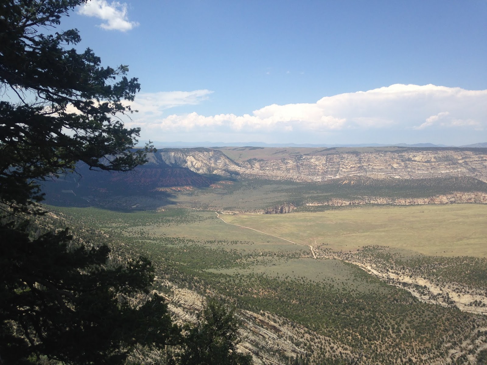
West of the Canyon Overlook the route of Harper's Canyon Drive enters Uintah County, Utah. As Harper's Canyon Drive takes a northward turn the roadway has an overlook the Yampa Plateu.
As Harper's Corner Drive begins an eastward swing back towards the Colorado State Line it has an overlook of Whirlpool Canyon and the Green River at approximately 7,560 feet above sea level.

Nearing the Colorado State Line Harper's Corner Drive has an view point called the Iron Springs Bench Overlook. The Iron Springs Bench Overlook views an plateau area just south of the Yampa River.

Upon entering Colorado the eastward route of Harper's Corner Road overlooks Echo Park which is located at the confluence of the Green River and Yampa River.

Harper's Corner Drive dead-ends at the namesake bend in the Green River which is about 7,510 feet above sea level.

From the end of Harper's Corner Road I turned around and headed back towards US 40. My overnight stay was over the Book Cliffs via CO 139 in Grand Junction.
Part 19 of the 2016 Summer Mountain Trip Series can be found here:
2016 Summer Mountain Trip Series Part 19; CO 139 over Douglas Pass and the Book Cliffs

2016 Summer Mountain Trip Part 17; US Route Route 191 over Flaming Gorge Dam
Harper's Corner Drive is a multi-state 32 mile long scenic Park Service roadway through Dinosaur National Monument connecting US 40 in Colorado to the Harper's Corner Trail above the Green River and Whirlpool Canyon. Harper's Corner Drive begins at US 40 near Dinosaur in Moffat County at an approximate elevation of 6,000 feet above sea level. I'm uncertain of the vintage of Harper's Corner Drive but it appears to have been built in the last quarter of the 20th Century.
Dinosaur National Monument is a National Park located in Uinta Mountains of Northwest Colorado and Northeast Utah. A large swath of Dinosaur National Monument protects the canyon lands around the Green River and Yampa River confluence. Dinosaur National Monument is mostly known for it's over 800 paleontological sites which includes notable dinosaurs fossils such as the Allosaurus. Dinosaur National Monument was declared as 80 acre National Park in 1915 but was expanded to much of the current boundary by 1938.
Harper's Corner Drive begins with a quick northward ascent to approximately 7,000 feet above sea level to an overlook of Plug Hat Butte.
Harper's Corner Drive swings westward at approximately 7,800 feet above sea level. At the beginning of the westward swing there is an overlook of Sand Canyon and the confluence of the Green River and Yampa River.
West of the Canyon Overlook the route of Harper's Canyon Drive enters Uintah County, Utah. As Harper's Canyon Drive takes a northward turn the roadway has an overlook the Yampa Plateu.
As Harper's Corner Drive begins an eastward swing back towards the Colorado State Line it has an overlook of Whirlpool Canyon and the Green River at approximately 7,560 feet above sea level.
Nearing the Colorado State Line Harper's Corner Drive has an view point called the Iron Springs Bench Overlook. The Iron Springs Bench Overlook views an plateau area just south of the Yampa River.

Upon entering Colorado the eastward route of Harper's Corner Road overlooks Echo Park which is located at the confluence of the Green River and Yampa River.
From the end of Harper's Corner Road I turned around and headed back towards US 40. My overnight stay was over the Book Cliffs via CO 139 in Grand Junction.
Part 19 of the 2016 Summer Mountain Trip Series can be found here:
2016 Summer Mountain Trip Series Part 19; CO 139 over Douglas Pass and the Book Cliffs
Comments