
Bob Malme, who has the uncanny knack of breaking transportation news, finding the key piece to a transportation puzzle, or being at the right place at the right time, was out and about this morning and happened upon the switch from I-540 to NC 540. All of Bob's photos are from the NC 55 Interchange.
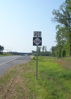 What once said JCT FUTURE I-540 on NC 55 East is now JCT NC 540. Below, a photo I took a little over a month ago, before the designation change.
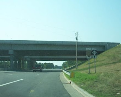
 They are still covering up the 540 shield in this shot from Bob. But the change to NC has been made.
 Finally, as mentioned in Brian's entry from yesterday, the exit numbers for 540 are in the process of being corrected also.
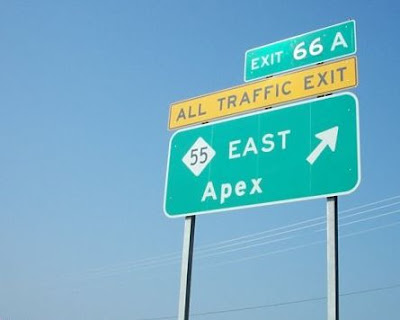 Although the angle doesn't show it well, the '66' has been pasted over the former '47'.
Stay tuned next week as NC 540, formerly I-540, may actually open.
For More:
I-540 getting a new name
An I-540 Preview
 What once said JCT FUTURE I-540 on NC 55 East is now JCT NC 540. Below, a photo I took a little over a month ago, before the designation change.
 They are still covering up the 540 shield in this shot from Bob. But the change to NC has been made.
 Finally, as mentioned in Brian's entry from yesterday, the exit numbers for 540 are in the process of being corrected also.
 Although the angle doesn't show it well, the '66' has been pasted over the former '47'.
Stay tuned next week as NC 540, formerly I-540, may actually open.
For More:
I-540 getting a new name
An I-540 Preview
Comments