
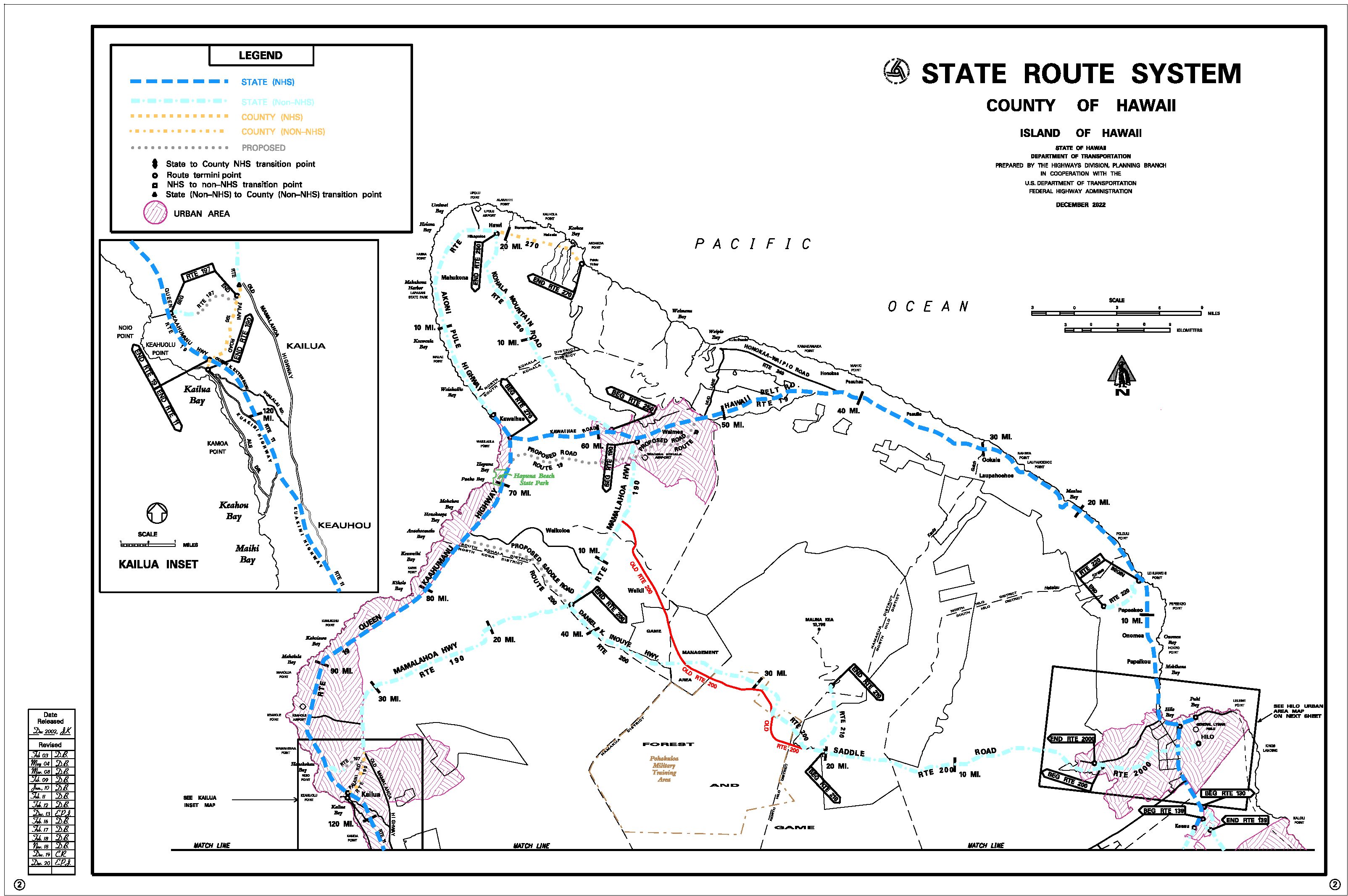
Hawaii Route 270 is a 27-mile highway located on northwest corner of the Big Island. The corridor largely follows Akoni Pule Highway from Hawaii Route 19 near Kawaihae to Pololu Valley Lookout via the town of Hawi. Originally numbered Hawaii Route 27 in 1955 the corridor was extended between Mahukona and Kawaihae in 1973. Upon being extended Hawaii Route 27 was renumbered as Hawaii Route 270.

This page is part of the Gribblenation Hawaii Roads series. A compellation of all Hawaii-related media from both Gribblenation and RoadwayWiz can be found by clicking here.

Part 1; the history of Hawaii Route 270
Much of Hawaii Route 270 lies on the windward side of Kohala Mount along the northern coast of the Big Island. Kohala Mountain is an extinct shield volcano which makes up the northwest portion of the Big Island. The mountain is thought to have breached the Pacific Ocean approximately 500,000 years ago and was last active approximately 120,000 years ago. Much of the northeast portion of the mountain collapsed via a massive landslide approximately 250,000-300,000 years ago. Currently Kohala Mountain rises to 5,480 feet above sea level.
The 1913 United States Geological Survey Map of Kohala displays Hawi and Waimea connected by the "Waimea-Kona Road." This road essentially is an overlay for the modern corridor of Kohala Mountain Road. Another roadway is shown along the northern coast of Kohala Mountain spanning east from Makeohule Point east to the Pololu Valley trail. This coastal road would form the basis for modern Hawaii Route 270.

The above map also displays the Hawaiian Railway spanning from Mahukona to Niulii. The line originally opened as the Hawaii Railroad in 1882 and was reorganized/renamed in 1897. The line was acquired by the Kohala Sugar Company in 1937 and was rebranded as Mahukona Terminals. Kohala Sugar began to truncate the line beginning in 1939 and abandoned it in 1946.
The 1930 Hilo Chamber of Commerce map of the Big Island displays the coastal road along the northern shore of Kohala Mountain.

n 1955 the Hawaii Route System was expanded to the Big Island. The existing highway between Makeohule Point east to Makapala was assigned as Hawaii Route 27. The road east of Makapala to the Pololu Valley trail is shown to be secondary road. Hawaii Route 27 appears on the 1959 Gousha Highway map of Hawaii.

The 1957 United States Geological Survey map of Honokane shows Hawaii Route 27 ending along the secondary roadway at the Pololu Valley trail.

According to Oscar Voss's hawaiihighways.com a proposed State Highway from Kawaihae to Makukona appears planned as an extension of Hawaii Route 11 on a 1961 Hawaii Department of Transportation document. The Kawaihae-Makukona road would be reassigned as planned Hawaii Route 270 by 1967 and would be completed by July 1973.
Upon completion of the Kawaihae-Makukona corridor the entirety of Hawaii Route 27 was renumbered to Hawaii Route 270. The highway was extended to over what was Hawaii Route 26 along Kawaihae Road to the future junction with Hawaii Route 19 and Queen Kaahumanu Highway. Hawaii Route 270 was named as "Akoni Pule Highway." Pule was the Hawaiian State Senator who had been the primary driver behind the completion of the Kawaihae-Makukona Road.
Hawaii Route 270 can be seen on the 1975 United States Geological Survey map of the Big Island.

According to 2022 Hawaii Department of Transportation logs Hawaii Route 270 east of Hawi is now maintained by Hawaii County.


Part 2; a drive on Hawaii Route 270 east of Hawi
Northbound Hawaii Route 250 descends Hawi Road and terminates at Hawaii Route 270 in Hawi. The Hawi townsite is located near the birthplace of Kamehameha I along the windward side of Kohala Mountain. The modern community was founded as a company town of the Kohala Sugar Company. Kohala Sugar began operations on the Big Island in 1863 and was active in Hawi until 1973.
Traffic turning east on Hawaii Route 270 in Hawi is notified that Pololu Valley is 9 miles away. Traffic heading west on the highway is notified that Kawaihae is 19 miles away.

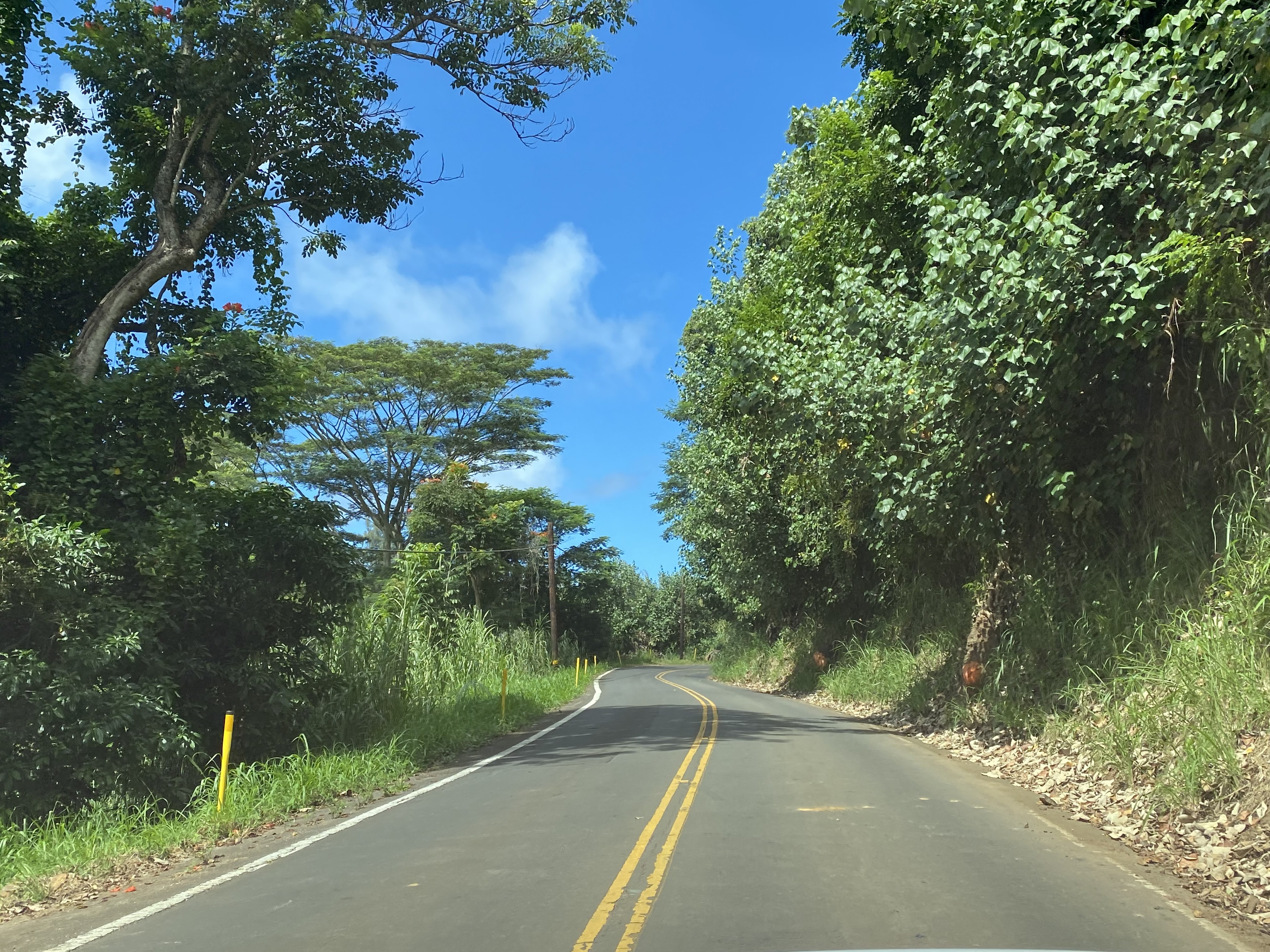
Eastbound Hawaii Route 270 passes through the community of Kapaau.


Hawaii Route 270 passes through the community of Halaula and crosses a one-lane bridge at Mile Marker 26. This concrete tee beam bridge spans Walaohia Gulch and was constructed in 1919.


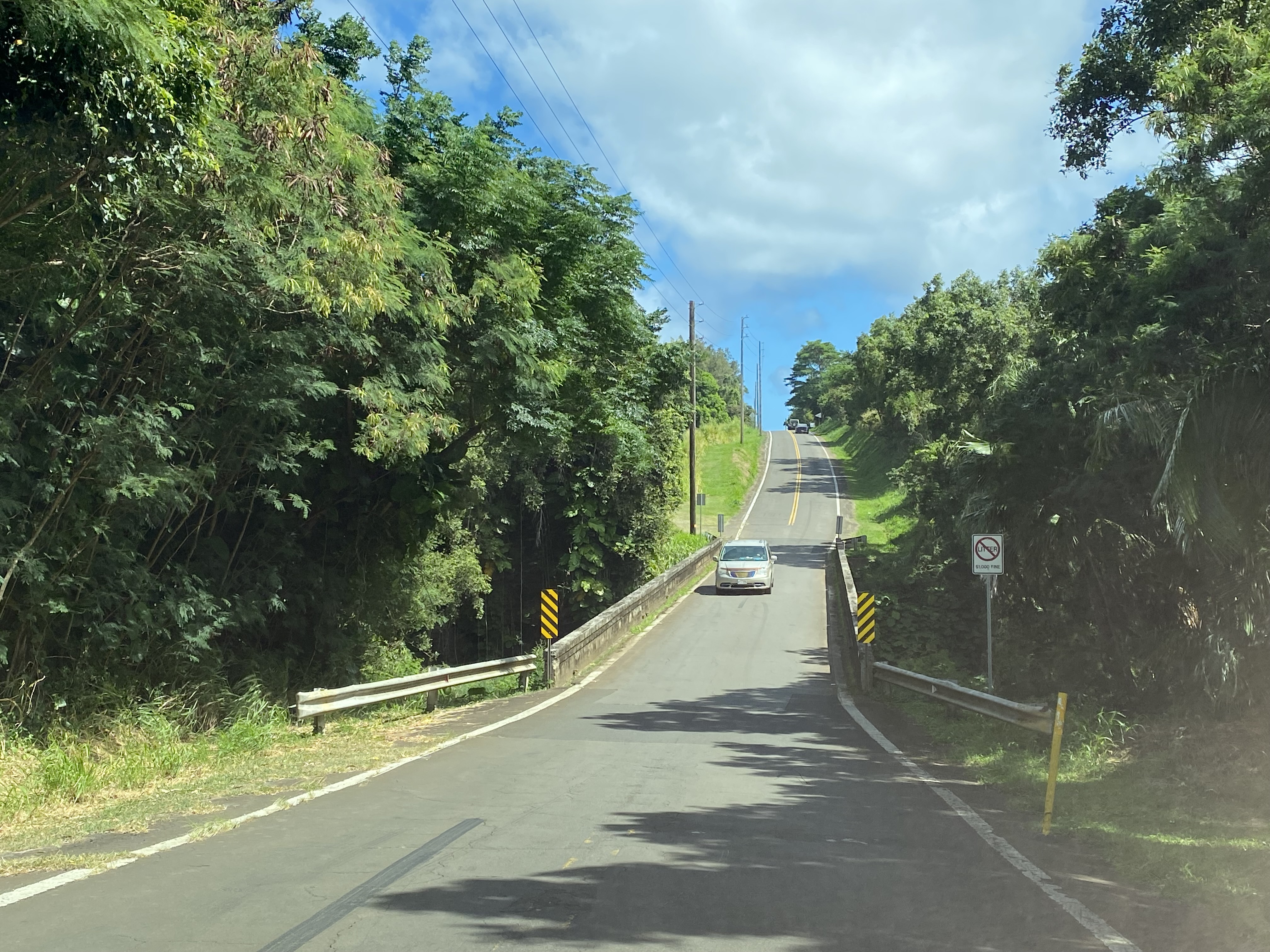
Hawaii Route 270 next crosses the single lane Aamakoa Gulch Bridge. This span is another concrete tee beam design which was constructed in 1918.


Hawaii Route 270 crosses the Waikani Gulch and Niulii Stream bridges in rapid succession. Both structures are concrete tee beam spans constructed in 1919. The highway intersects Keokea Beach Road and is signed as 2 miles from Polohu Valley.


Hawaii Route 270 terminates at the Polohu Valley Lookout parking lot.


Polohu Valley was the locale of a farming village during the early era of the Kingdom of Hawaii. The trail down to the valley was constructed during the mid-1800s amid the sugar boom on the Big Island. The last residents of Polohu Valley relocated in 1940 several years in advance of a devastating tsunami on April 1, 1946.


Part 3; Hawaii Route 270 west of Hawi
Hawaii Route 270 west of Hawaii intersects former Hawaii Route 271 at Upolu Point Road.


Hawaii Route 270 west of Hawi follows the northwest coast of the Big Island. The highway transitions from Akoni Pule Highway to Kawaihae Road in the namesake community of Kawaihae.


Hawaii Route 270 terminates at Hawaii Route 19 along Kawaihae Road.


Comments