
Pine Valley Road (Monterey County)


Pine Valley Road is a rural single-lane highway located in the Gabilan Range of southern Monterey County.  The roadway originates at the former alignment of US Route 101 along Cattleman Road and extends nine miles north to California State Route 198 in Long Valley.  Pine Valley Road appears to have been plotted after the Southern Pacific Railroad was extended through San Ardo during the late 1880s.  


Part 1; the history of Pine Valley Road

Pine Valley Road is located in southern Monterey County and is named after a valley of same name.  Pine Valley Road originates at the former alignment of US Route 101 on Cattleman Road near the former site of Docas siding.  Docas was located between the larger Southern Pacific Railroad sidings of San Lucas and San Ardo.  

Both San Lucas and San Ardo were plotted by the Southern Pacific Railroad (now Union Pacific Railroad) in 1886 as siding facilities.  San Ardo was originally known as San Bernardo, but the name was changed upon receiving Post Office Service in 1887.  Conversely the name of San Lucas was derived from Rancho San Lucas.  Both San Lucas and San Ardo can be seen on the 1890 George F. Cram Railroad Map of California.  

The 1915 United States Geological Survey map of Priest Valley depicts a primitive road through Pine Valley and Gabilan Range from near Docas between Cattleman Road northeast to the Warthan Canyon Road (future California State Route 198) in Long Valley.  Pine Valley Road is shown to pass the site of the Sherman School near the mouth of Brown Canyon. 


Part 2; a drive on Pine Valley Road

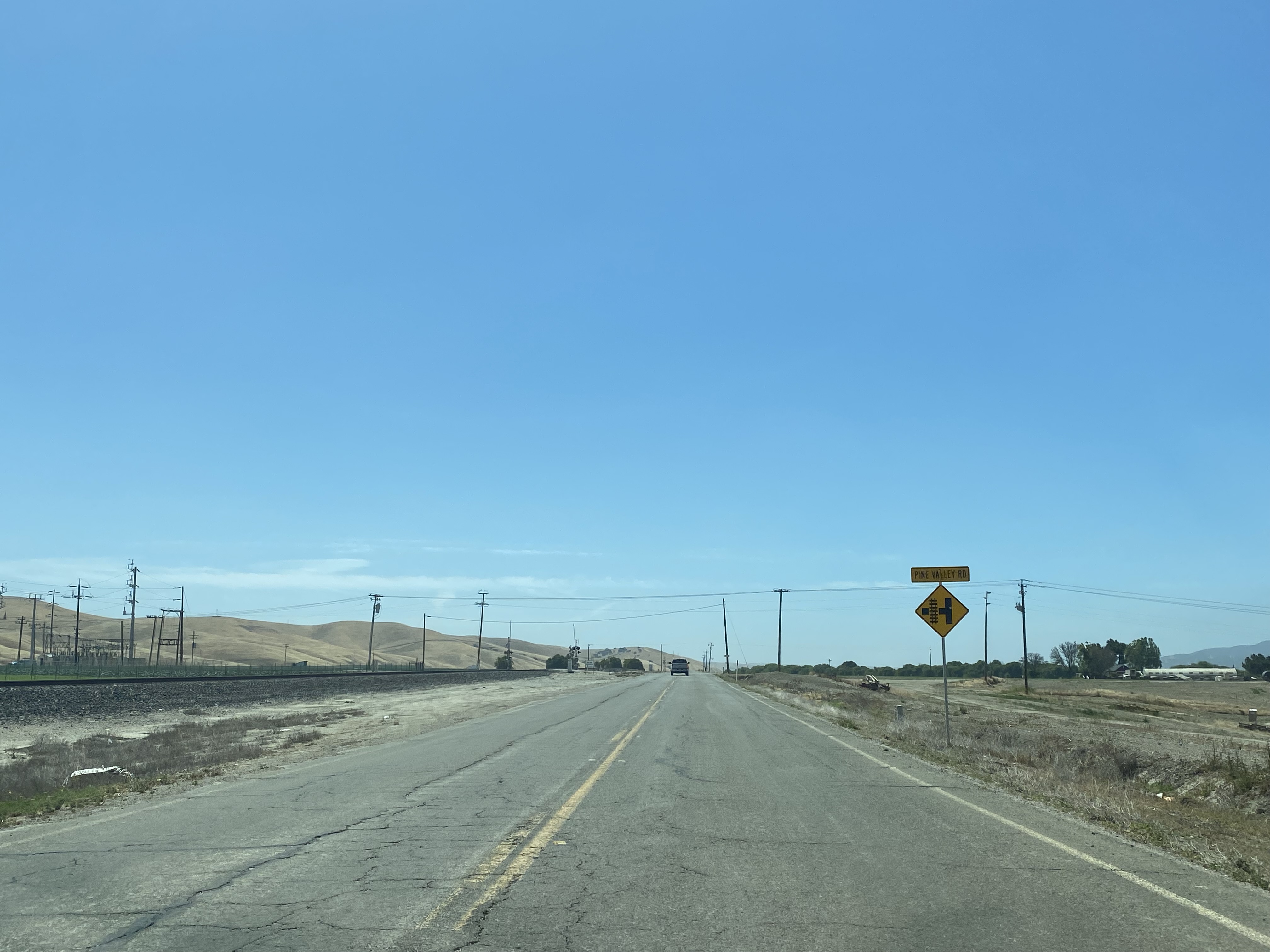
Northbound Pine Valley Road begins near the site of Docas siding from Cattleman Road.  


Pine Valley Road crosses the Union Pacific Railroad in front of a power transformer station. 


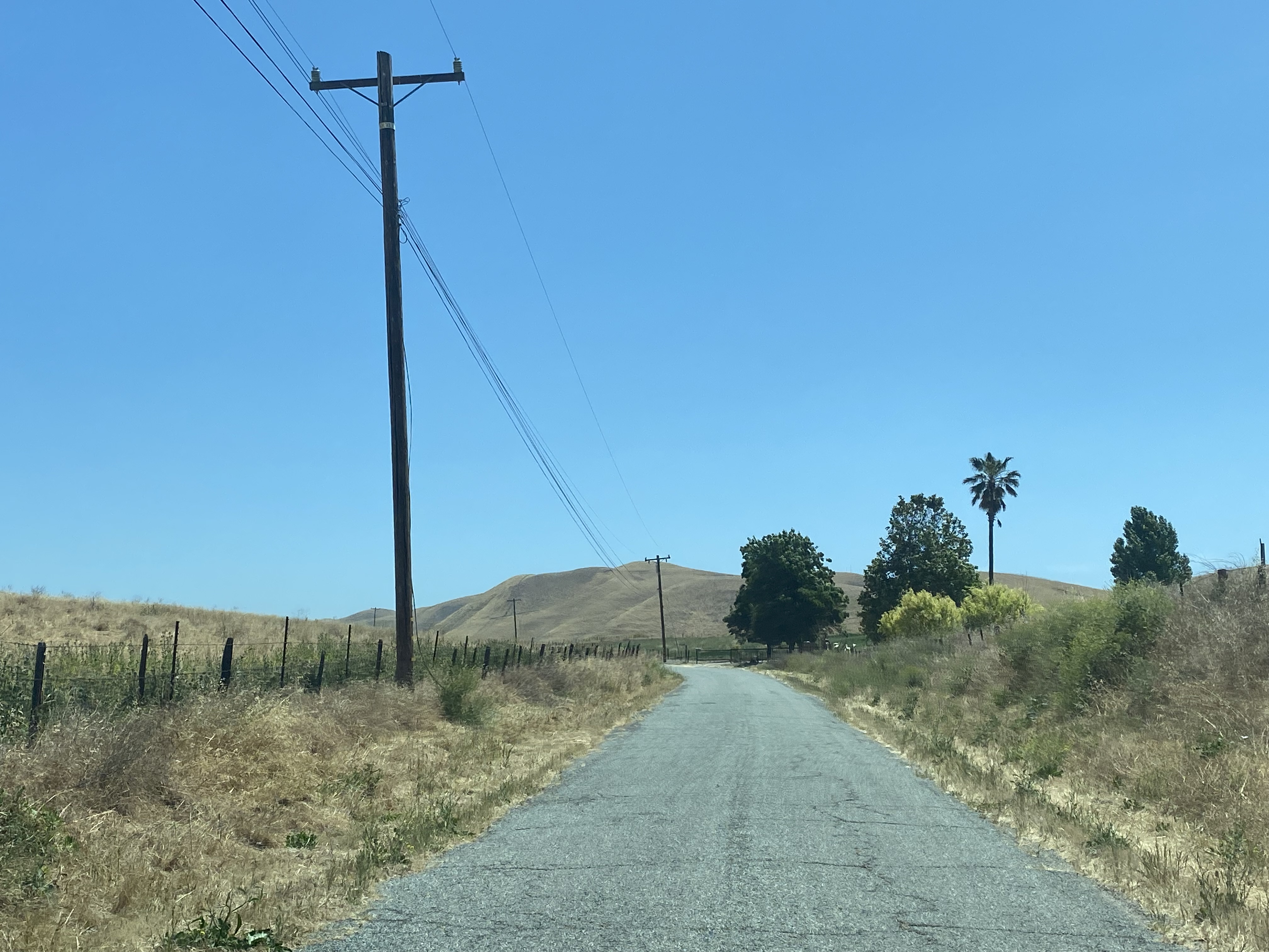
The entirety of Pine Valley Road is a narrow single lane.  The initial couple miles are mostly straight but begins to curve considerably as road rises into the Gabilan Range.


Pine Valley Road continues north through numerous ranching properties to a crest above Long Valley located at approximately 1,281 feet above sea level.


Pine Valley Road descends into Long Valley and terminates at California State Route 198. 


Comments

Popular posts from this blog

Abandoned Fowler Avenue in Clovis, California

Originally Fowler Avenue in the city of Clovis had a brief discontinuation approaching Herndon Avenue.  Fowler Avenue traffic heading northbound was required to detour briefly onto westbound Herndon Avenue.  During 2001 this discontinuation was removed when Fowler Avenue was reconfigured to access the Sierra Freeway (California State Route 168) via an interchange.  This led to a segment of the original alignment of Fowler Avenue just south of Herndon Avenue to be abandoned.  Despite a shopping center opening over part of the original Fowler Avenue alignment in 2016 much of the abandoned roadway remains.   The history of the abandoned original alignment of Fowler Avenue in Clovis The original alignment of California State Route 168 departed downtown Clovis eastbound along Tollhouse Road.  This original alignment did not interact with Fowler Avenue at the Herndon Avenue intersection.  Fowler Avenue north of Tollhouse Road ran north to Herndon Avenue...

May 2023 Ontario Trip (Part 3 of 3)

  Over the years, I have made plenty of trips to Ontario, crisscrossing the southern, central and eastern parts of the province. Living in Upstate New York, it's pretty easy to visit our neighbor to the north, or is that our neighbor to the west? Ottawa is one of my favorite cities to visit anywhere in the world, plus I've discovered the charm of Kingston, the waterfalls of Hamilton (which is on the same Niagara Escarpment that brings us Niagara Falls), the sheer beauty of the Bruce Peninsula, and more. But I hadn't explored much of Cottage Country. So I decided to change that, and what better time to go than over Memorial Day weekend, when the daylight is long and I have an extra day to explore. On the third and final day of my trip, I started in Huntsville and made my way through Muskoka District and Haliburton County, passing by many lakes along the way. I stopped in towns such as Dorset, Haliburton and Bancroft before making a beeline down to Belleville and then over th...

What's In a Name?: When the Roads Really Do Tell a Story

  Our tagline on the Gribblenation blog is "because every road tells a story". Some roads tell different stories than others. Along our travels, we may see historic markers that tell us a little story about the roads we travel or the places we pass by. Some historic markers are more general, as to telling us who lived where or what old trail traversed between two towns. During my travels across New York State and other states or provinces, I pass by many historic markers, some with interesting or amusing references to roads. I wanted to highlight a few of the markers I've seen along my travels around the Empire State and help tell their stories. Those stories may be as specific as explaining the tales of a tree that was used to help measure a distance of eight miles from Bath to Avoca in Steuben County, as referenced on the Eight Mile Tree historical marker above. They may also help point the way along historical roads first used centuries ago, or may help tell a local l...