
The present routing of US Route 85 within Texas comprises only 21 miles of the overall 1,479 miles of the highway. Of those 21 miles in Texas only approximately 5.6 miles of US Route 85 are signed as a standalone highway. US Route 85 was extended from Las Cruces, New Mexico to downtown El Paso during 1946 where it multiplexed US Route 80 to a terminus located at the intersection of Mesa Street and Texas Street. US Route 85 was shifted to a new terminus located at the Mexican border via the one-way couplets on Stanton Street and El Paso Street during 1974. Since 1990 US Route 85 has had a signage gap from the Texas/New Mexico state line 560 miles north to Fountain, Colorado. This signage gap exists due to the state of New Mexico removing what they determined to be superfluous US Route signage without approval from the American Association of State Highway Transportation Officials.

Part 1; the history of US Route 85 in Texas
The original terminus of US Route 85 was located in Las Cruces, New Mexico upon the commissioning of the US Route System by the American Association of State Highway Officials (AASHO) on November 11, 1926. US Route 85 entered the city of Las Cruces via Valley Drive and ended US Route 80 which was carried originally by Picacho Avenue.
During 1946 the New Mexico State Highway Department submitted an application to AASHO to extend US Route 85 concurrent with US Route 80 to the Texas state line. AASHO initially rejected the request and noted the Executive Committee would prefer US Route 85 be multiplexed to downtown El Paso along US Route 80. The AASHO Executive Committee requested the New Mexico State Highway Department alter their application to include the Texas Highway Department to extend US Route 85 to El Paso. Ultimately the request was altered, and US Route 85 was extended to downtown El Paso.

US Route 85 can be seen concurrent with US Route 80 along Mesa Street to Texas Street in downtown El Paso on the 1949 Texas Highway Department map (courtesy usends.com).

During June 1969, US Route 80 in the El Paso area was relocated along Interstate 10. The older surface routing was repurposed as part of the newly designated Texas State Highway 20. The commissioning of Texas State Highway 20 did not initially alter the routing of US Route 85 in Texas.

During 1974 the routings of US Route 85, US Route 62 and US Route 54 in Texas were altered. US Route 85 from the New Mexico state line was moved onto a multiplex of Interstate 10 and US Route 80 to CanAm Highway (former US Route 80A). The new routing of US Route 85 followed CanAm Highway and Paisano Drive to Stanton Street (formerly US Route 54). Southbound US Route 85 followed Stanton Street to the Mexican border crossing whereas the northbound highway entered the United States via El Paso Street. US Route 85 multiplexed US Route 62 to/from the Mexican border on Stanton Street and El Paso Street. The crossing into the United States had been previously located on Santa Fe Street until 1967 when the Paso del Norte Bridge relocated traffic to El Paso Street.


During 1990 New Mexico elected to remove all US Route 85 signage due to the highway being multiplexed entirely along Interstate 10 and Interstate 25 in the state. This measure was done without a formal request to AASHTO to truncate/remove US Route 85 within New Mexico. This led to the unusual circumstance where US Route 85 is no longer signed between the Texas/New Mexico state line north to Interstate 25 Exit 128 in Fountain, Colorado.
Part 2; scenes along US Route 85 in Texas
The original terminus of US Route 85 in downtown El Paso can be found along Texas State Highway 20 on Mesa Street approaches Texas Street. The corner of Mesa Street/Texas Street has also served as the terminus of US Route 366, US Route 70, US Route 54, US Route 62 and US Route 180 at various points through the history of the US Route System.

US Route 85 and US Route 62 are no longer signed along Stanton Street approaching the Mexican border. As traffic enters the United States along El Paso Street there is no route signage at the roundabout located at 6th Avenue. Despite the lack of signage, the AASHTO log descriptions for US Route 85 and US Route 62 include the one-way couplets on Stanton Street/El Paso Street.


The first reassurance shields for US Route 85 northbound and US Route 62 eastbound can be found as El Paso Street approaches 3rd Avenue. The US Route 85/US Route 62 signage assembly is presently a uni-sign design.


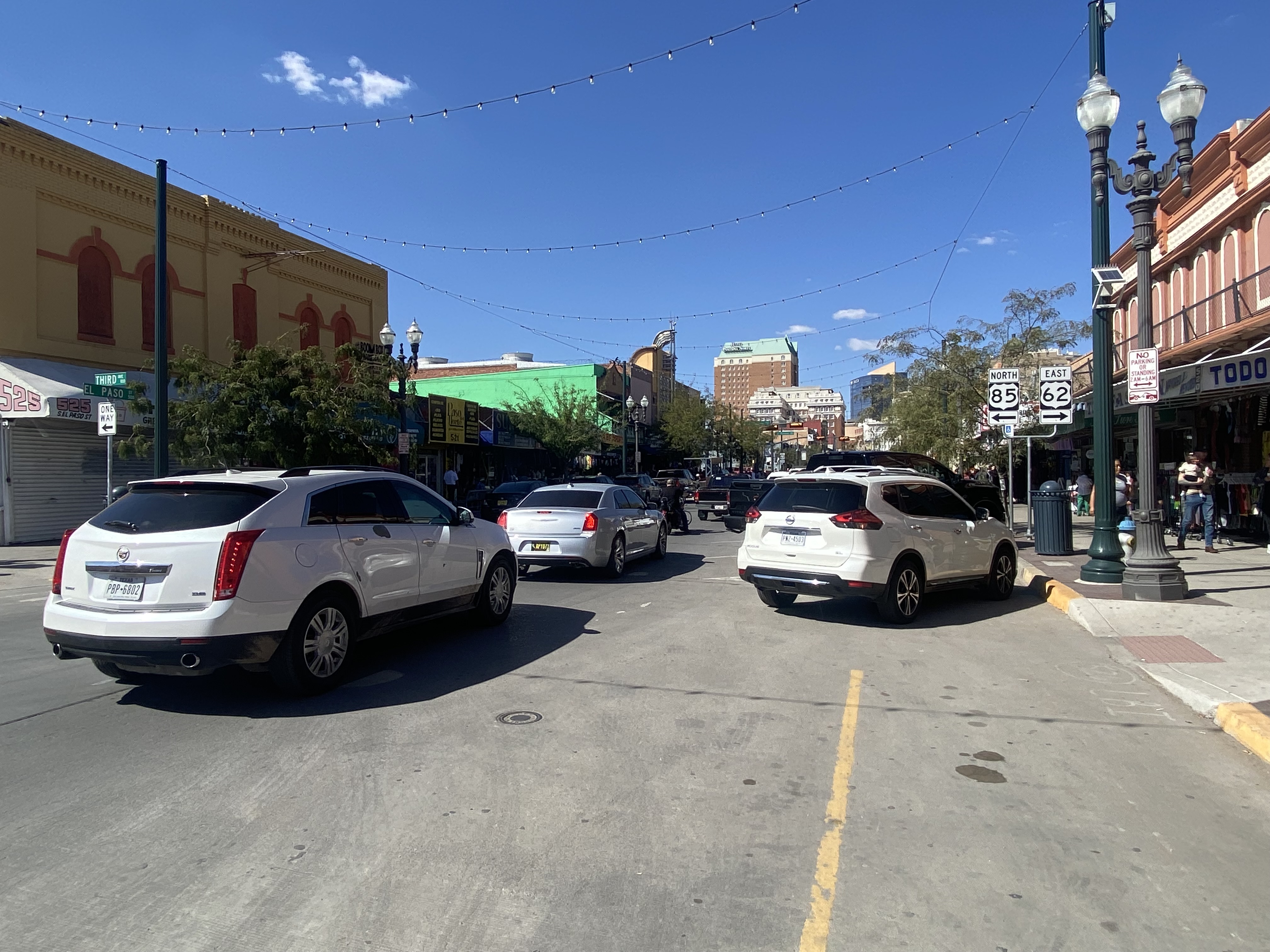

Signage on the intersection of El Paso Street and Paisano Drive directs northbound US Route 85 traffic to turn left. US Route 62 eastbound traffic is advised to turn right.

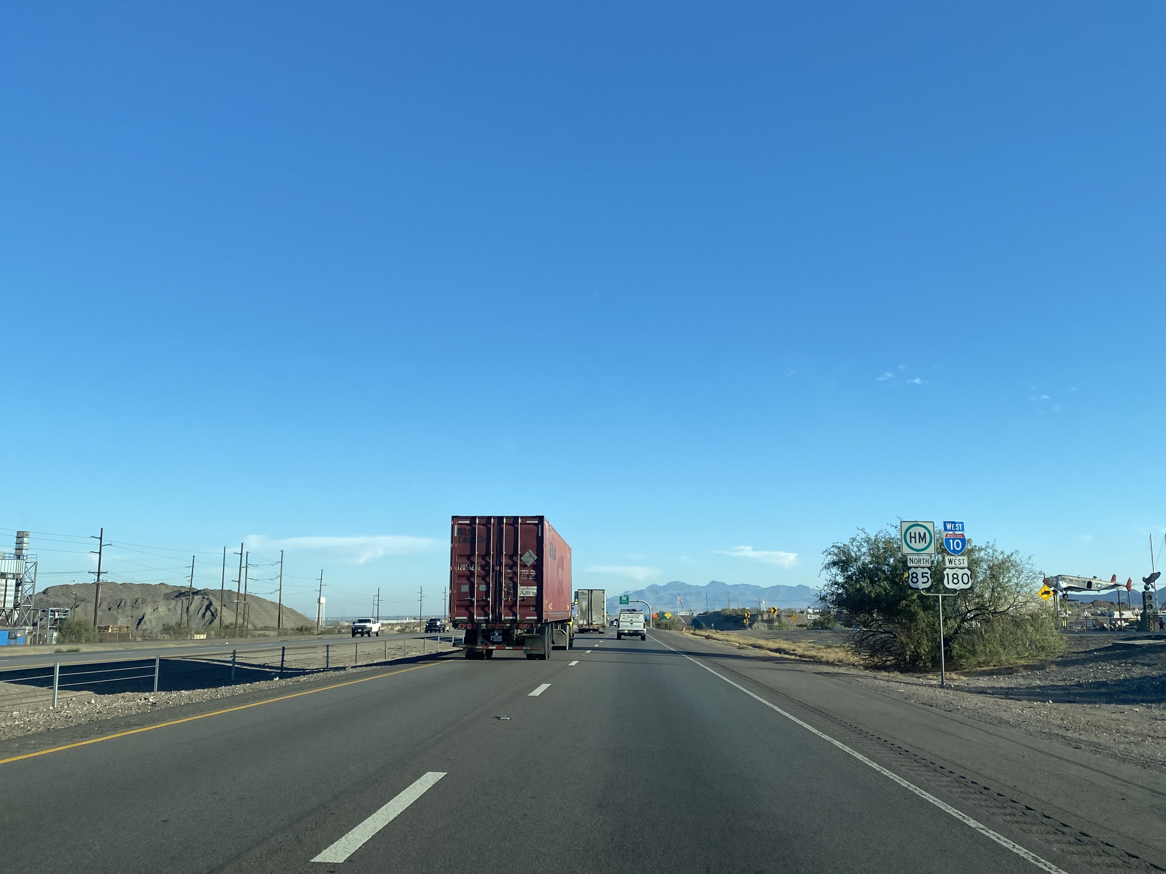
Pictured is the multiplex of Interstate 10, US Route 85 and US Route 180 in Anthony approaching the New Mexico state line. This is the last on-route US Route 85 reassurance shield for the next 560 miles to Interstate 25 Exit 128 in Fountain of El Paso County, Colorado.
Comments