
Dillon Road is a 34.2-mile highway located in northern Coachella Valley of Riverside County, California. Dillon Road begins at Avenue 48 on the outskirts of Indio and ends to the west at California State Route 62 near San Gorgonio Pass. Dillon Road was developed the 1930s as a construction road for the Colorado River Aqueduct. Dillon Road serves as a northern bypass to much of the development of Coachella Valley. Dillon Road is known for it's frequent dips and spectacular views of San Gorgonio Pass.

Part 1; the history of Dillon Road
Dillon Road was constructed as a haul road for the Colorado River Aqueduct through Coachella Valley. The Colorado River Aqueduct spans 242 miles from Parker Dam on the Colorado River west to Lake Mathews near Corona. Construction of the Colorado River Aqueduct began during January 1933 near Thousand Palms and was made functional on January 7, 1939. West of Berdoo Canyon Road the alignment of Dillon Road is largely concurrent with the Colorado River Aqueduct.
Dillon Road can be seen in a photo dated to 1934 at the intersection with Thousand Palms Canyon Road (courtesy Carl Schulz).

Modern Dillon Road between Grapefruit Boulevard and Interstate 10 was once part of the Indio-Cutoff alignment of US Route 60 and US Route 70. The September 1934 California Highways & Public Works announced construction on the Indio-Cutoff Spur of Legislative Route Number 64 (LRN 64) had begun. The Indio-Cutoff was to serve as a new alignment of US Route 60/US Route 70 which would enter Coachella Valley via Dillon Road and would provide a bypass to the hazards of Box Canyon.

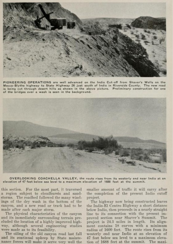

The July 1935 California Highways & Public Works featured the opening of the Indio-Cutoff and realignment of US Route 60/US Route 70 onto the new spur of LRN 64. The Indio-Cutoff is stated to have opened during June 1935 five months ahead of schedule. The Indio-Cutoff is stated to be 9 miles shorter than the original alignment of US Route 60/US Route 70 through Box Canyon. Despite Box Canyon no longer being part of US Route 60/US Route 70, it would remain under State maintenance and become part of the second California State Route 195. The eastern end of the Indio-Cutoff near Indio incorporated Dillon Road into it's alignment.


The November/December 1958 California Highways & Public Works noted US Route 60/US Route 70/LRN 64 from Indio-Cactus City was under study to expand to freeway standards. US Route 60/US Route 70/LRN 64 from Cactus City east to the Arizona State Line is stated to have had a freeway alignment adopted by the California Highway Commission.


US Route 70 was approved to be truncated from Los Angeles to US Route 95 in Blythe by the American Association of State Highway Officials on August 26, 1963. The truncation of US Route 70 left only US Route 60 and temporary Interstate 10 as the only signed routes using the Indio stub of Dillon Road along the Indio-Cutoff. LRN 26 would be dropped along with all the Legislative Route Numbers as part of the 1964 State Highway Renumbering.


The November/December 1964 California Highways & Public Works noted a 10-mile segment of US 60/Interstate 10 east of Indio was completed to freeway standards during the previous season.

The American Association of State Highway Officials Executive Committee approved US Route 60 to be truncated from downtown Los Angeles to US Route 95 in Blythe on October 2nd, 1965. The truncation of US Route 60 to Blythe left only temporary Interstate 10 on the Indio stub of Dillon Road.


The California Highways & Public Works publication ended in 1967 prior to Interstate 10 through Indio being completed. Interstate 10 appears on the 1967 Division of Highways Map with a determined freeway routing which would bypass Indio and would connect with a planned freeway to Thermal. Interstate 10 is shown following an interim alignment through Indio from the Indio Rail Overhead along Indio Boulevard and Dillon Road to the Indio-Cutoff.

During the early 1970s Interstate 10 was completed through Indio and the segment of Dillon Road in the State Highway System was relinquished. The completion of Interstate 10 in Coachella Valley and Indio appears on the 1975 Caltrans Map.

Part 2; a drive on Dillon Road
From westbound Interstate 10, Dillon Road can be accessed from Exit 146. Traffic is notified Dillon Road can be used to reach California State Route 86.


From modern California State Route 86 northbound traffic is advised the Exit to Dillon Road can be used to reach Interstate 10.

Dillon Road can also be accessed from the northern terminus of Thousand Palms Canyon Road. Westbound Dillon Road traffic has Desert Hot Springs, Sky Valley and Desert Edge as control locations.

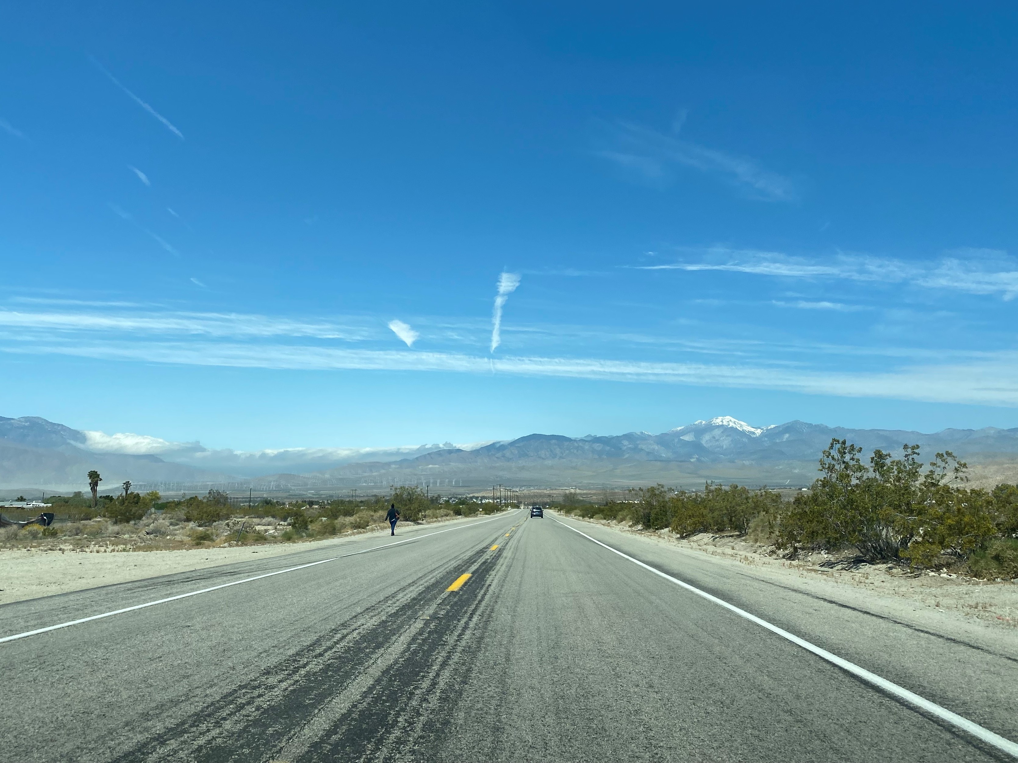
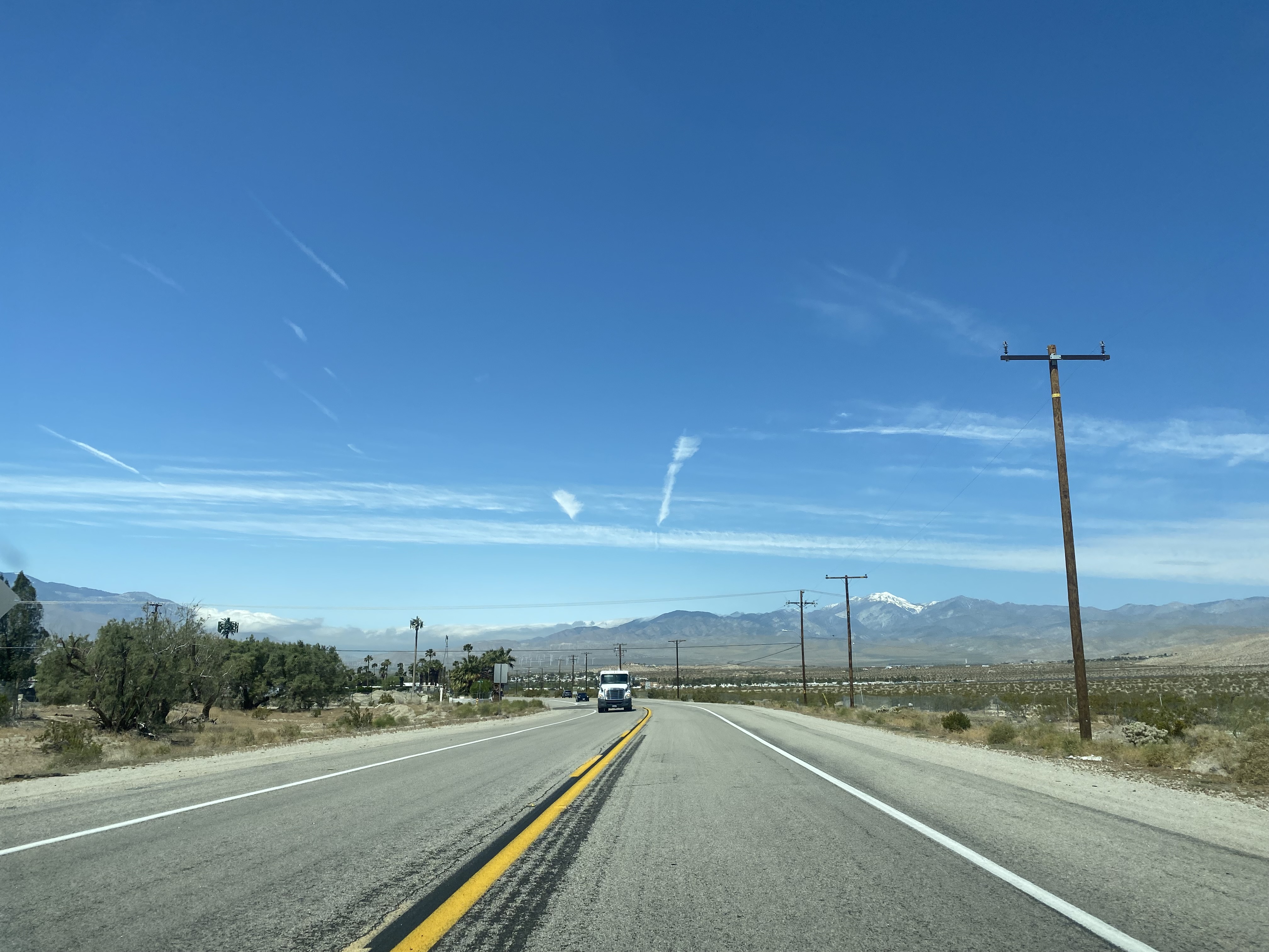
Dillon Road westbound emerges onto a view of San Gorgonio Mountain and San Gorgonio Pass before entering Sky Valley. The prominent dips of Dillon Road largely render it signed as a no passing zone.


Dillon Road westbound in Sky Valley is signed with a California Scenic Route placard.

Dillon Road westbound skirts the hills above Coachella Valley and passes through Desert Edge approaching Corkill Road.


Westbound Dillon Road enters the city of Desert Hot Springs approaching Palm Drive.


Dillon Road westbound enters the community of North Palm Springs approaching Indian Canyon Drive.


West of Indian Canyon Drive, Dillon Road passes through the city limits of Palm Springs and the San Gorgonio Pass Wind Farm. Dillon Road terminates at California State Route 62 just beyond the northwest city limit of Palm Springs near San Gorgonio Pass.


Comments