This week we examine the history of California State Route 53.


Part 1; the history of California State Route 53
The Legislative Routes that eventually became CA 53 were added to the State Highway System during the 1910s according to CAhighways.org. Legislative Route Number 50 ("LRN 50") was added to the State Highway System in 1915 as a new route between Rumsey following the meanderings of Cache Creek to Lower Lake. Legislative Route Number 49 ("LRN 49") was added as a new State Highway as part of the 1919 Third State Highway Bond Act from Calistoga north to Lower Lake (modern Clearlake). Legislative Route 50 was added as a State Highway
LRN 50 between Rumsey and Lower Lake appears to not have had a early clear routing as it does not appear on the 1918 Division of Highways State Map.

Both LRN 50 and LRN 49 appear on the 1920 Division of Highways State Map as a continuous State Highway west from Rumsey to Lower Lake then southward to Calistoga. The route of LRN 50 does not appear to correspond to an actual roadway as it is shown following the main flow of Cache Creek northeast from Lower Lake to the confluence of Cache Creek and North Fork Cache Creek. Even the road east of the confluence of North Fork Cache Creek/Cache Creek does not correspond to a roadway that was ever constructed.

The 1922 Division of Highways Map shows the planned route of LRN 50 between Lower Lake and Rumsey taking a more southern angle way from the confluence of Cache Creek/North Fork Cache Creek.

The 1926 Division of Highways State Map shows LRN 50 was realigned north of Lower Lake to LRN 15. LRN 50 followed LRN 15 east to Wilbur Spring where it split southeast towards Rumsey.
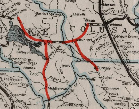
The corridor of future CA 53 was not among the original Sign State Routes announced in the August 1934 California Highways & Public Works Guide ("CHWP"). The muddied definition of LRN 49 and LRN 50 as a continuous route may have played a factor on why the corridor was not part of the original run of Sign State Routes.

During 1933 the definition of LRN 49 was extended south to Napa, LRN 50 was also extended eastward to Woodland. Both LRN 49 and LRN 50 were given updated definitions during 1935 according to CAhighways.org:
- LRN 49; LRN 8 near Napa to LRN 15 via Calistoga and Lower Lake.
- LRN 50; LRN 15 to Sacramento via Woodland and Rumsey.
Subsequent to the changes above CA 53 first appears on the 1938 Division of Highways State Map as a highway between CA 20/LRN 15 south to CA 29/LRN 49 in Middletown. CA 53 was entirely aligned on LRN 49 for it's entire length.

Between CA 20/LRN 15 south to Lower Lake the original alignment of CA 53 was substantially different than what it is in modern times. The original alignment of CA 53 south of CA 20/LRN 15 to Lower Lake used the following alignment:
- Modern CA 53 to Junction Plaza.
- Junction Plaza to Ogulin Canyon Road.
- Ogulin Canyon Road to modern CA 53.
- Modern CA 53 to Old Highway 53.
- Old Highway 53 to Olympic Drive.
- Olympic Drive to Old Highway 53.
- Old Highway 53 to Dam Way.
- Dam Way to Lake Street.
- Lake Street to Main Street in Lower Lake.
The above alignment can be seen in the former of LRN 49 on the 1935 Division of Highways Map of Lake County.

The modern alignment of CA 53 from CA 20/LRN 15 south to Lower Lake appears on the 1959 Division of Highways State Map. Given the modern alignment of CA 53 appears on the 1959 Division of Highways State Map this would insinuate that it was completed during 1958.

The July/August 1958 CHPW discusses the route improvements to CA 53. CA 53 between Lower Lake and Cache Creek was cited to have been realigned during 1953.


During the 1964 State Highway Renumbering CA 53 was truncated from Middletown to Lower Lake. CA 29 was realigned off it's original corridor onto what was CA 53 between Lower Lake and Middle Town, the original corridor of CA 29 became part of CA 175. For all intents and purposes the modern iteration of CA 53 took form as a result of the 1964 State Highway Renumbering. All these changes can be seen on the 1964 Division of Highways State Map.

Part 2; a virtual drive on California State Route 53 southbound
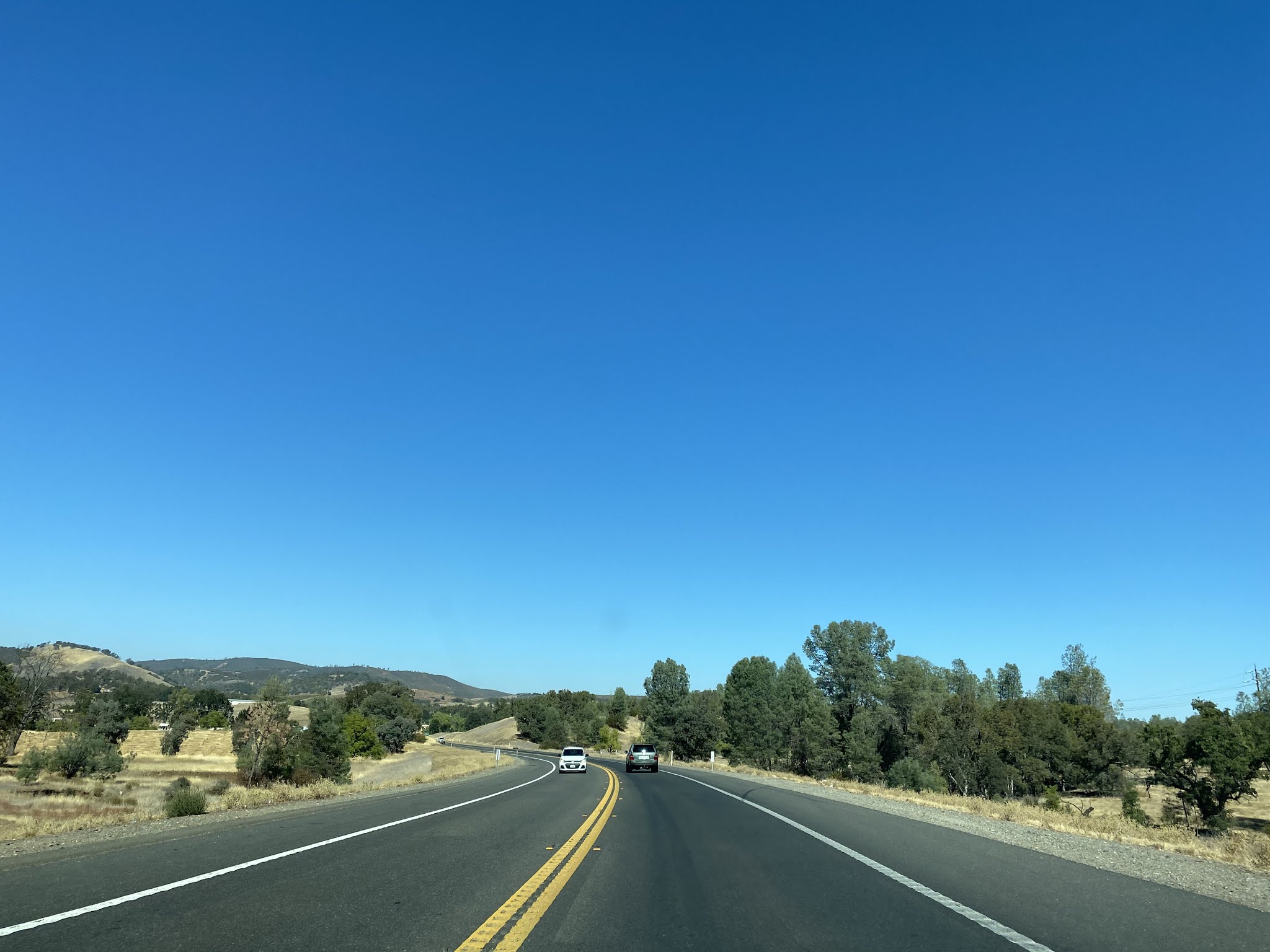
Our virtual drive on CA 53 southbound begins from CA 20 westbound. Note; all images below are ripped from Google Street View.
CA 53 is signed as 7 miles from Lower Lake immediately south of CA 20.

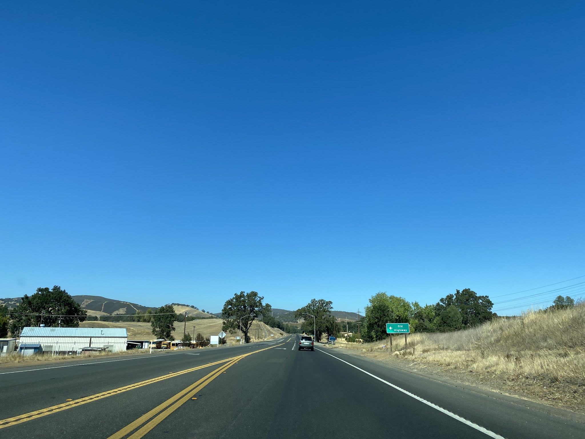
At Postmile LAK 7.23 CA 53 south meets it's former alignment at Junction Plaza.

CA 53 south is signed as the Lake County Veterans Memorial Highway.

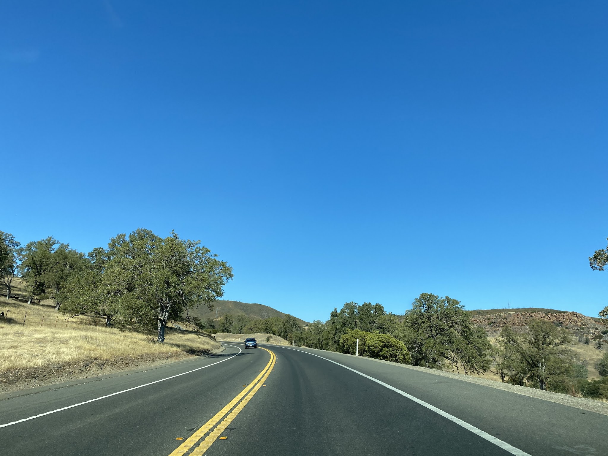
At Postmile LAK 5.054 CA 53 south intersects it's former alignment at Ogulin Canyon Road.

At Postmile LAK 4.880 CA 53 south intersects Old Highway 53.

CA 53 south passes through the outskirts of Clearlake. At Postmile LAK 2.961 CA 53 south passes by Lakeshore Drive which is signed as access to Clearlake.

CA 53 south expands to four lanes and is signed as 3 miles from Lower Lake.

CA 53 south intersects it's former alignments of Old Highway 53 and Dam Road at Postmile LAK 1.473.

At Postmile LAK 1.090 CA 53 south crosses Cache Creek.

At Postmile LAK 0.724 CA 53 south passes by Anderson Marsh State Historic Park which can be accessed via Anderson Ranch Parkway.


CA 53 south enters Lower Lake and terminates at CA 29.


Part 3; a drive on California State Route 53 northbound
CA 53 northbound begins at Lower Lake. This view is from CA 29 southbound approaching CA 53 in Lower Lake. The white California Spades are definitely a rare oddity in field signage.


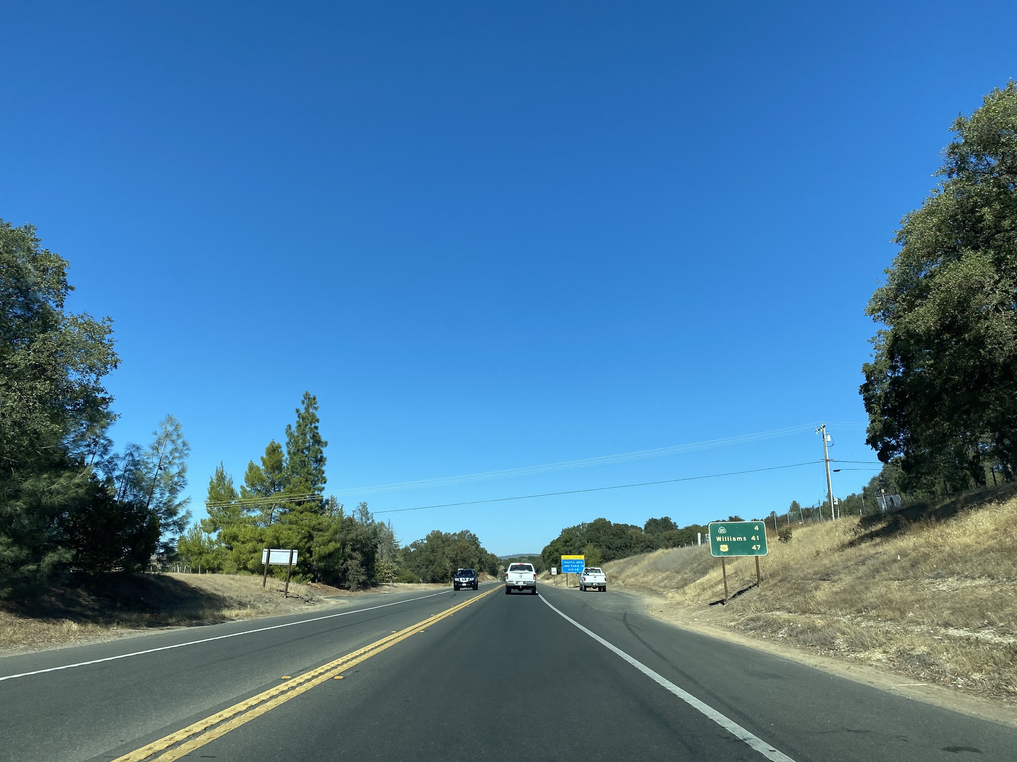
As CA 53 north begins traffic is advised via a simple guide sign that CA 20 is 7 miles ahead.

CA 53 north passes Anderson Marsh State Historical Park at Postmile LAK 0.72.


CA 53 north crosses Cache Creek at Postmile LAK 1.04.


CA 53 north enters Clearlake and intersects Old CA 53 at Postmile LAK 1.47.


At Postmile LAK 2.96 CA 53 north intersects Lakeshore Drive.


CA 53 is signed 4 miles from CA 20 north of Lakeshore Drive.
At Postmile LAK 3.92 CA 53 north intersects Olympic Drive.


At Postmile LAK 4.88 CA 53 north intersects Old CA 53.
At Postmile LAK 5.05 CA 53 north intersects Ogulin Canyon Road.

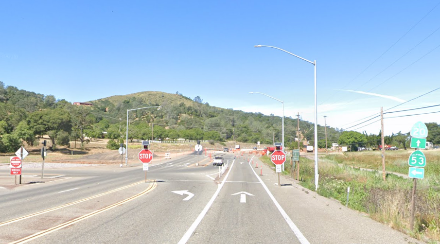
CA 53 continues north and terminates at CA 20. The CA 53/CA 20 junction has recently been reconfigured into a roundabout.


Comments