This past November I took California State Route 29 from the outskirts of Napa to Interstate 80 as part of my route home from Santa Rosa.

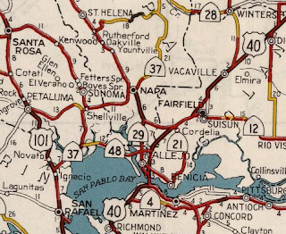
California State Route 29 ("CA 29") is a 106 mile north/south highway which begins at CA 20 near Upper Lake of Lake County. CA 29 is a mostly rural highway which terminates at Interstate 80 in the City of Vallejo of Solano County.


Part 1; the history of California State Route 29
CA 29 was one of the original California Sign State Routes announced in the August 1934 California Highway & Public Works ("CHPW"). CA 29's original definition had it aligned between Vallejo and Upper Lake.


The first map I can find that shows CA 29 in detail is the 1935 Goshua Highway Map of California. CA 29 is shown aligned through Cobb on what would be present day CA 175. Within Napa CA 29 was aligned through downtown and followed present day CA 221 towards Vallejo.

CA 29 as originally defined was aligned over the following Legislative Routes Numbers ("LRN"):
- LRN 74 from US 40/LRN 7 in Vallejo to LRN 8 near American Canyon. LRN 74 was added to the State Highway System during 1931 according to CAhighways.org.
- LRN 8 from near American Canyon through the City of Napa to LRN 49. LRN 8 was added to the State Highway System as part of the 1909 First State Highway Bond Act according to CAhighways.org.
- LRN 49 from LRN 8 to LRN 89 in Middletown. LRN 49 between Calistoga and Middletown was added to the State Highway System as part of the 1919 Third State Highway Bond Act according to CAhighways.org. LRN 49 between Calistoga and LRN 8 was added to the State Highway System during 1933.
- LRN 89 between Middletown and Upper Lake. LRN 89 was added to the State Highway System during 1933 according to CAhighways.org.
CA 29 prior to the 1964 State Highway Renumbering was little changed from it's original 1934 alignment which can be see on the 1963 Division of Highways State Map.


Within the City of Napa CA 29 southbound originally utilized; Trancas Street, Jefferson Street, 3rd Street, and Soscol Avenue. This early alignment of CA 29 can be seen on the 1935 Division of Highways Map of Napa County.

CA 29 was moved to a bypass of downtown Napa via the alignment of the modern freeway circa 1950. CA 29 appears on it's new alignment on the 1951 Division of Highways State Map. CA 29 south utilized Imola Avenue to connect to Soscol Avenue.
During the 1964 State Highway Renumbering CA 29 didn't have a change of terminus points. CA 29 did have a major realignment south of Clear Lake onto what had been LRN 243 and CA 53/LRN 49 between Lower Lake south to Middletown. What had been previously CA 29 through Cobb was assigned to CA 175. The changes to the alignment of CA 29 can be seen on the 1964 Division of Highways State Map.


My approach go CA 29/CA 12 began from CA 221 south out of Napa. I joined CA 29/CA 12 at the south terminus of CA 221 located at Post Mile NAP R6.201.

CA 29 multiplexes CA 12 south to Post Mile NAP 4.71 where the latter splits east on Lincoln Highway. CA 29 south of the split with CA 12 was part of the 1927 alignment of the Lincoln Highway to the Carquinez Bridge.


CA 29 south enters American Canyon as Broadway at Post Mile NAP 1.442.


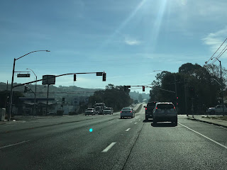
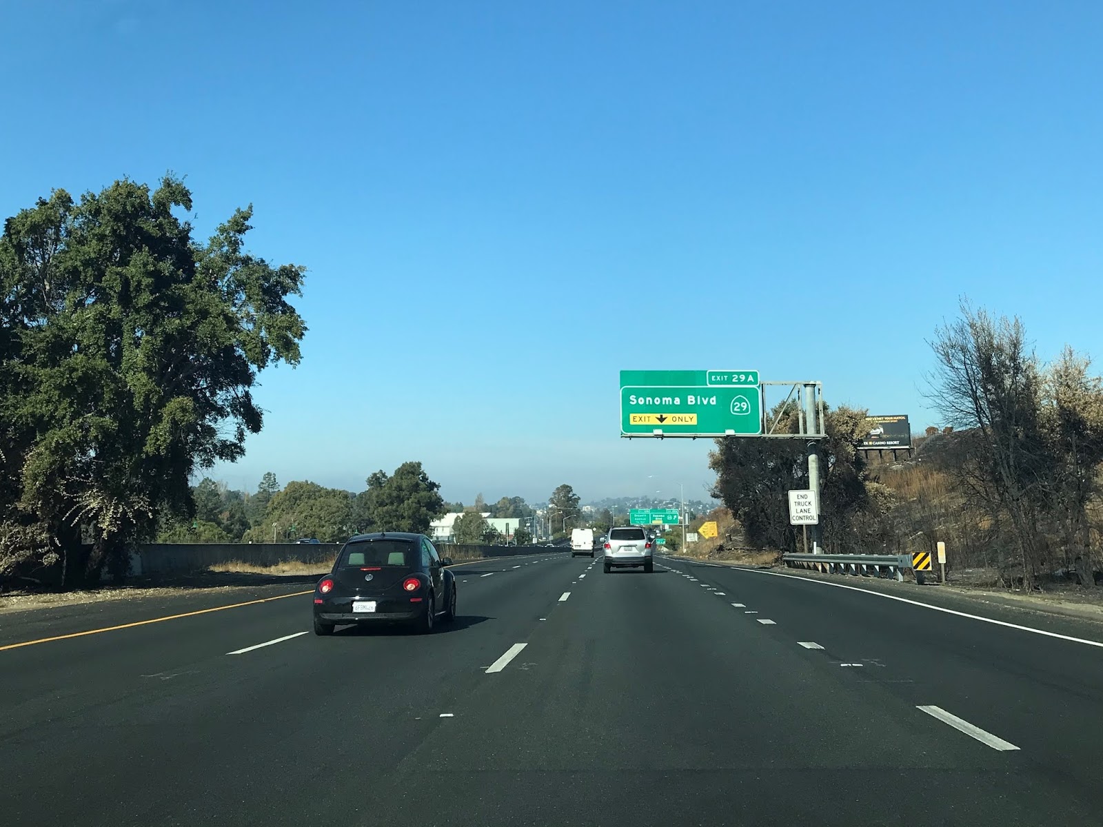
CA 29 south enters the City of Vallejo/Solano County as Sonoma Boulevard.


At approximately Post Mile 5.075 CA 29 south intersects CA 37.


CA 29 south on Sonoma Boulevard passes through downtown Vallejo and begins a southeast jog at Post Mile SOL 1.929 at Curtola Parkway. Notably just north of Curtola Parkway the route of CA 29 south intersects former CA 141 at Maine Street at Post Mile SOL 2.057. Curtola Parkway is the signed route connector from CA 29 to I-780.


CA 29 follows Sonoma Boulevard south to a terminus at I-80 approaching the Carquinez Bridge.


California State Route 29 ("CA 29") is a 106 mile north/south highway which begins at CA 20 near Upper Lake of Lake County. CA 29 is a mostly rural highway which terminates at Interstate 80 in the City of Vallejo of Solano County.


Part 1; the history of California State Route 29
CA 29 was one of the original California Sign State Routes announced in the August 1934 California Highway & Public Works ("CHPW"). CA 29's original definition had it aligned between Vallejo and Upper Lake.

The first map I can find that shows CA 29 in detail is the 1935 Goshua Highway Map of California. CA 29 is shown aligned through Cobb on what would be present day CA 175. Within Napa CA 29 was aligned through downtown and followed present day CA 221 towards Vallejo.

CA 29 as originally defined was aligned over the following Legislative Routes Numbers ("LRN"):
- LRN 74 from US 40/LRN 7 in Vallejo to LRN 8 near American Canyon. LRN 74 was added to the State Highway System during 1931 according to CAhighways.org.
- LRN 8 from near American Canyon through the City of Napa to LRN 49. LRN 8 was added to the State Highway System as part of the 1909 First State Highway Bond Act according to CAhighways.org.
- LRN 49 from LRN 8 to LRN 89 in Middletown. LRN 49 between Calistoga and Middletown was added to the State Highway System as part of the 1919 Third State Highway Bond Act according to CAhighways.org. LRN 49 between Calistoga and LRN 8 was added to the State Highway System during 1933.
- LRN 89 between Middletown and Upper Lake. LRN 89 was added to the State Highway System during 1933 according to CAhighways.org.
CA 29 prior to the 1964 State Highway Renumbering was little changed from it's original 1934 alignment which can be see on the 1963 Division of Highways State Map.


Within the City of Napa CA 29 southbound originally utilized; Trancas Street, Jefferson Street, 3rd Street, and Soscol Avenue. This early alignment of CA 29 can be seen on the 1935 Division of Highways Map of Napa County.

CA 29 was moved to a bypass of downtown Napa via the alignment of the modern freeway circa 1950. CA 29 appears on it's new alignment on the 1951 Division of Highways State Map. CA 29 south utilized Imola Avenue to connect to Soscol Avenue.

During the 1964 State Highway Renumbering CA 29 didn't have a change of terminus points. CA 29 did have a major realignment south of Clear Lake onto what had been LRN 243 and CA 53/LRN 49 between Lower Lake south to Middletown. What had been previously CA 29 through Cobb was assigned to CA 175. The changes to the alignment of CA 29 can be seen on the 1964 Division of Highways State Map.

The 1982 Caltrans State Highway Map
shows CA 12/29 moved to a new bypass route of Napa via the Napa River.
The original planned route of CA 221 appears to have been abandoned at this
point as it is shown shifted to the old alignment of CA 12/29.

According to CAhighways.org the
planned route of CA 221 was likely planned as an freeway or expressway
bypass of northern Napa. CA 221 was officially moved to the former
alignment of CA 12/29 legislatively in 1984. Apparently Caltrans and
the legislature wanted to relinquish the old alignment of CA 12/29 but
local interests spurred it be kept as a new CA 221.
Part 2; a drive on California State Route 29 from CA 221 south through Vallejo to Interstate 80

CA 29 multiplexes CA 12 south to Post Mile NAP 4.71 where the latter splits east on Lincoln Highway. CA 29 south of the split with CA 12 was part of the 1927 alignment of the Lincoln Highway to the Carquinez Bridge.


CA 29 south enters American Canyon as Broadway at Post Mile NAP 1.442.


CA 29 south enters the City of Vallejo/Solano County as Sonoma Boulevard.


At approximately Post Mile 5.075 CA 29 south intersects CA 37.


CA 29 south on Sonoma Boulevard passes through downtown Vallejo and begins a southeast jog at Post Mile SOL 1.929 at Curtola Parkway. Notably just north of Curtola Parkway the route of CA 29 south intersects former CA 141 at Maine Street at Post Mile SOL 2.057. Curtola Parkway is the signed route connector from CA 29 to I-780.


CA 29 follows Sonoma Boulevard south to a terminus at I-80 approaching the Carquinez Bridge.


Comments