This past December I drove the Glendale Freeway while visiting the Los Angeles Area. The Glendale Freeway carries California State Route 2 from Interstate 210 south towards Interstate 5.


CAhighways.org on LRN 61


The Glendale Freeway is a 10.2 mile segment of CA 2 which spans from I-210/Foothill Freeway in La Canada Flintridge south through Glendale. The Glendale Freeway intersects I-5/Golden State Freeway in the City of Los Angeles and empties onto Glendale Boulevard where CA 2 continues south towards US 101/Hollywood Freeway.

CA 2 has come up previously on the Gribblenation blog series. The present route of CA 2 on the Angeles Crest Highway can be found on the link below:
Much of CA 2 of what was (and still partially is CA 2) on Sunset Boulevard and Santa Monica Boulevard can be found on the link below:
Part 1; the history of the Glendale Freeway
What became the Glendale Freeway has origins in what was Legislative Route 61. The route LRN 61 was first defined by the State Legislature in 1915
loosely running from La Canada Flintridge north/northwest to Antelope
Valley. It wasn't until 1919 that funds were allocated to build the
route LRN 61 from La Canada Flintridge to the vicinity of Mount Wilson.
CAhighways.org on LRN 61
LRN 61 first appears as a 1919 Legislative roadway running slightly north of La Canada Flintridge on the 1920 Division of Highways Map.

Construction of LRN 61 reported didn't start until 1929. LRN 61 was
extended Legislatively in 1931 eastward to the route of LRN 62 (future
CA 39) in San Gabriel Canyon. LRN 61 and LRN 62 can be seen as a mostly
unimproved Secondary Road looping through Angeles National Forest on the
1932 Division of Highways State Map (both were far from complete in reality).

In 1933 the definition of LRN 61 was extended east to LRN 59 and west from LRN 9 (future CA 118) to LRN 4 (future rerouting of US 99). In 1933 the State Legislature made it clear the Division of Highways could maintain roadways within cites which led to a large swath of highway adoptions. The route of LRN 61 from LRN 9 south to LRN 4 followed; Verdugo Boulevard, Canada Boulevard, and Verdugo Road (at the time all three were Verdugo Road) through La Canada Flintridge and Glendale to Fletcher Drive in Los Angeles. LRN 61 utilized Fletcher Drive to reach LRN 4 on San Fernando Road. South of San Fernando Road Fletcher Road became LRN 162.
In an August 1934 California Highways and Public Works Guide CA 2 was announced as a Signed Highway routed between Santa Monica east to Lake Arrowhead. All of LRN 61 subsequently became the alignment of CA 2.


The Glendale Freeway is mentioned in the January/February 1956 California Highways and Public Works Guide. The first phase of the Glendale Freeway is cited as a 2.6 mile segment connecting from Avenue 36 (near Eagle Rock Boulevard) south over the Los Angeles River to Glendale Boulevard. The early Glendale Freeway is cited as being approved by the State Highway Commission on December 14th, 1955 and was to be planned for construction during the 1956-57 Fiscal Years.
The January/February 1958 California Highways and Public Works Guide states that the Glendale Freeway construction project was awarded via contract to Thompson Construction Company in February 1957. A District 7 report in the same CHPW issue states that a 1.0 mile section of the Glendale Freeway was under construction in January 1958.

The Glendale Freeway partially opened in 1958 as the January/February 1959 California Highways and Public Works Guide shows a 1.1 mile segment completed from Glendale Boulevard to Avenue 36.

The 1959 Division of Highways State Map City Insert shows CA 2 on a new freeway route over the Los Angeles River which replaced much of Fletcher Drive.

The future interchange of the Glendale Freeway and Golden State Freeway is displayed in the January/February 1961 California Highways and Public Works Guide.

The March/April 1962 California Highways and Public Works Guide displays the recently completed Glendale Freeway/Golden State Freeway interchange.

The September/October 1962 California Highways and Public Works Guide states the Glendale Freeway/Golden State Freeway Interchange opened in January of 1962.

The completion of the Glendale Freeway/Golden State Freeway interchange resulted in an alignment shift of CA 2/LRN 162 onto Glendale Boulevard and Alvarado Street to reach US 101/US 66 on the Hollywood Freeway. Previously CA 2/LRN 162 reached US 101/US 66 via Rowena Avenue, Hyperion Boulevard, and Santa Monica Boulevard. The new alignment of CA 2/LRN 162 along with the Glendale Freeway/Golden State Freeway Interchange can be seen on the 1963 Division of Highways State Map City Insert.

The September/October 1962 California Highways and Public Works Guide shows the newly adopted route of the Glendale Freeway from Avenue 36 north to Verdugo Boulevard.


The planned scope of the Glendale Freeway is discussed in the March/April 1964 California Highways and Public Works Guide which included a 9.1 mile segment in the design phase to the planned Foothill Freeway. Said issue states that the Glendale Freeway was planned to connect to the Hollywood Freeway north to the Foothill Freeway.

The planned route of the Glendale Freeway from Avenue 36 north the planned Foothill Freeway along with the planned route south to the Hollywood Freeway appears on the 1965 Division of Highways State Highway Map City Insert. Note; during the 1964 State Highway Renumbering all the Legislative Route designations were dropped.

A portion of the Glendale Freeway is shown completed south of La Canada Flintridge and the Foothill Freeway on the 1975 Caltrans State Highway Map City Insert.

The 1977 Caltrans State Highway Map City Insert shows the Glendale Freeway complete from I-5/Golden State Freeway north to CA 134/Ventura Freeway. The planned connector of the Glendale Freeway south to the Hollywood Freeway is not displayed and appears to have been cancelled at some point in the 1970s.

According to CAhighways the final segment of the Glendale Freeway connecting CA 134/Venture north to I-210/Foothill Freeway opened in 1978. The 1979 Caltrans State Highway Map City Insert shows the present configuration of CA 2 on the Glendale Freeway as it exists today.

Part 2; a drive on the Glendale Freeway
My approach to CA 2 south on the Glendale Freeway this past December was from I-210 eastbound on the Foothill Freeway. From the interchange with I-210 the route of CA 2 south on the Glendale Freeway almost immediately enters the City of Glendale.


The route of CA 2 south on the Glendale Freeway snakes south through the San Rafael Hills. Exit 18 accesses Mountain Street.


On a clear day downtown Los Angeles can be seen on the San Rafael Hills on CA 2 southbound on the Glendale Freeway. This photo was taken from southbound CA 2 back in 2016.
Exit 17A/B on southbound CA 2 access CA 134 on the Ventura Freeway.


I stayed my first night in the Los Angeles Area on Colorado Street (former CA 134 and briefly US 99) in Glendale. My hotel had a pretty decent view of the Glendale Freeway/Ventura Freeway Interchange.

Colorado Street still has signage which still displays CA 2/Glendale Freeway.

CA 2/Glendale Freeway southbound enters the City of Los Angeles. CA 2/Glendale Freeway south Exit 15B accesses York Boulevard whereas Exit 15A accesses Verdugo Road.


CA 2/Glendale Freeway south Exit 14 accesses former US 99 on San Fernando Road.


CA 2/Glendale Freeway south next has an unnumbered Exit at Fletcher Drive.


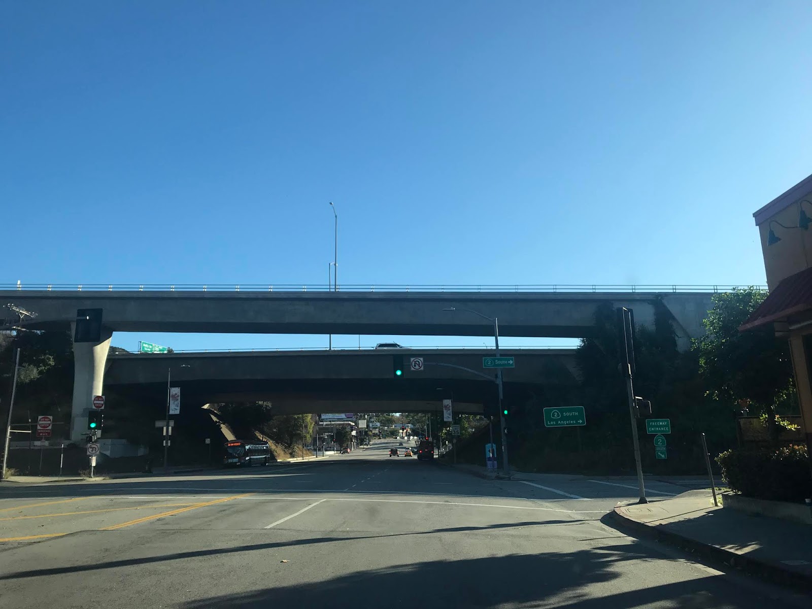
CA 2/Glendale Freeway southbound crosses the Los Angeles River and meets I-5 on the Golden State Freeway at Exit 13A/B. The Glendale Freeway continues south where CA 2 transitions onto Glendale Boulevard.

Comments