This past January I was traveling home from the King City area of Monterey County. Looking for something a little different I took Lonoak Road across the Gabilan Range to Lonoak of Peach Tree Valley.

Lonoak Road is an approximately 14 mile roadway which connects County Route G15 on 1st Street (former US Route 101) of King City to the ghost town of Lonoak at CA 25. Lonoak Road begins in Monterey County and dips into San Benito County before terminating in Monterey County near Lonoak. Much of Lonoak follows the course of San Lorenzo Creek. San Lorenzo Creek for reference is the Monterey/San Benito County Line until the confluence with Lewis Creek.

Part 1; the backstory of Lonoak Road
Peach Tree Valley lies on atop the San Andreas Fault at the confluence of San Lorenzo Creek and Lewis Creek. The fortunate confluence of San Lorenzo Creek and Lewis Creek made it an ideal locale for ranching. The prospects of profitable ranch lands led to the settlement of the small community known as Lonoak. Lonoak was important enough that it warranted Post Office Service by 1885. It was likely sometime around when Lonoak was settled that the namesake road to King City was constructed. King City had been settled in 1884 as a large ranching community and by 1886 it had a stop on the Southern Pacific Railroad. The outgrowth of the ranching of the King City Area no doubt played a contributing factor in the development of Lonoak and Lonoak Road. Lonoak and Lonoak Road both appear on the 1917 California State Automobile Association Map.

Part 2; a drive on Lonoak Road
My approach to Lonoak Road was from northbound 1st Street/G15 in King City. Lonoak Road begins with a right hand turn over the Union Pacific rails.


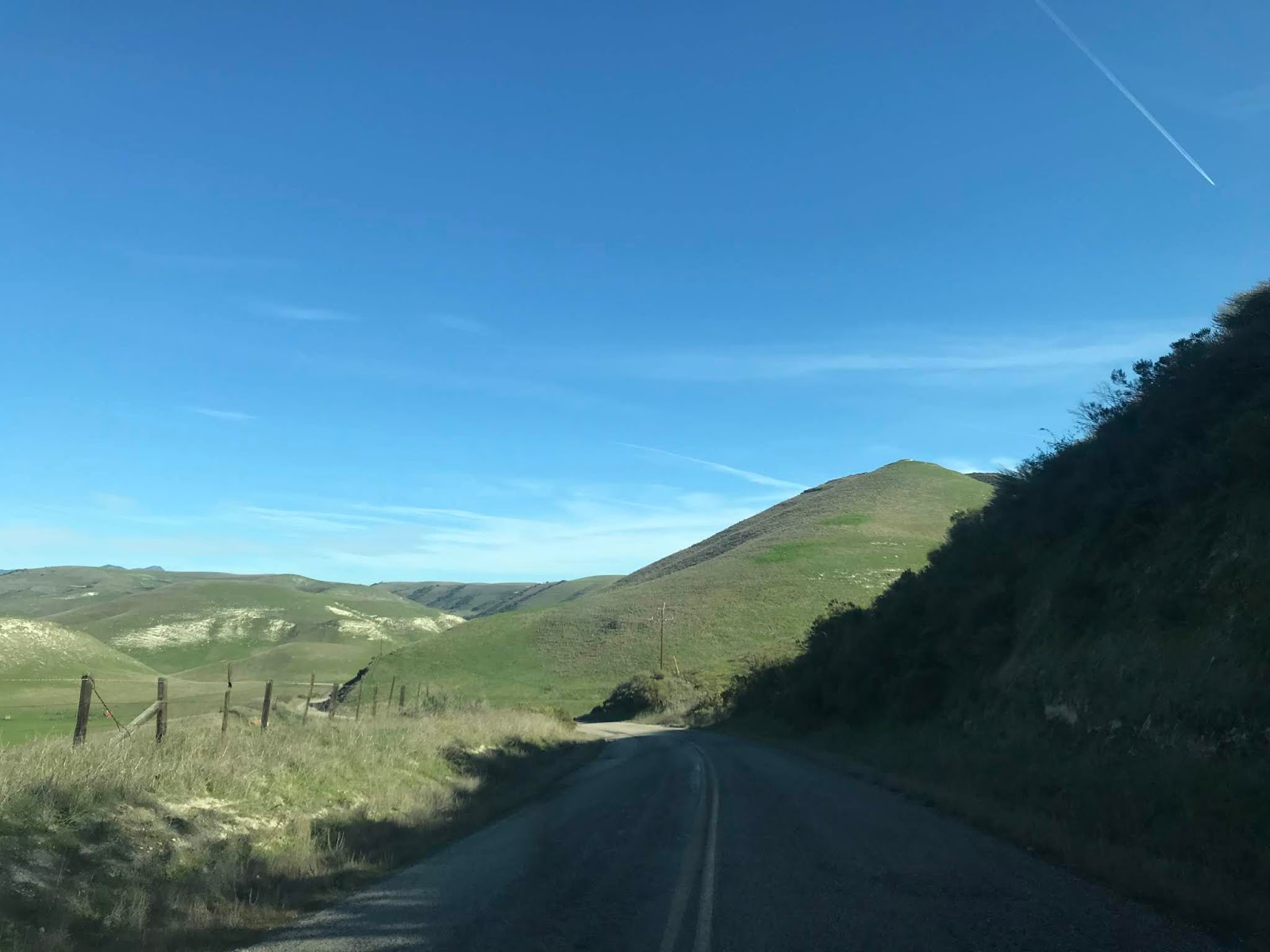
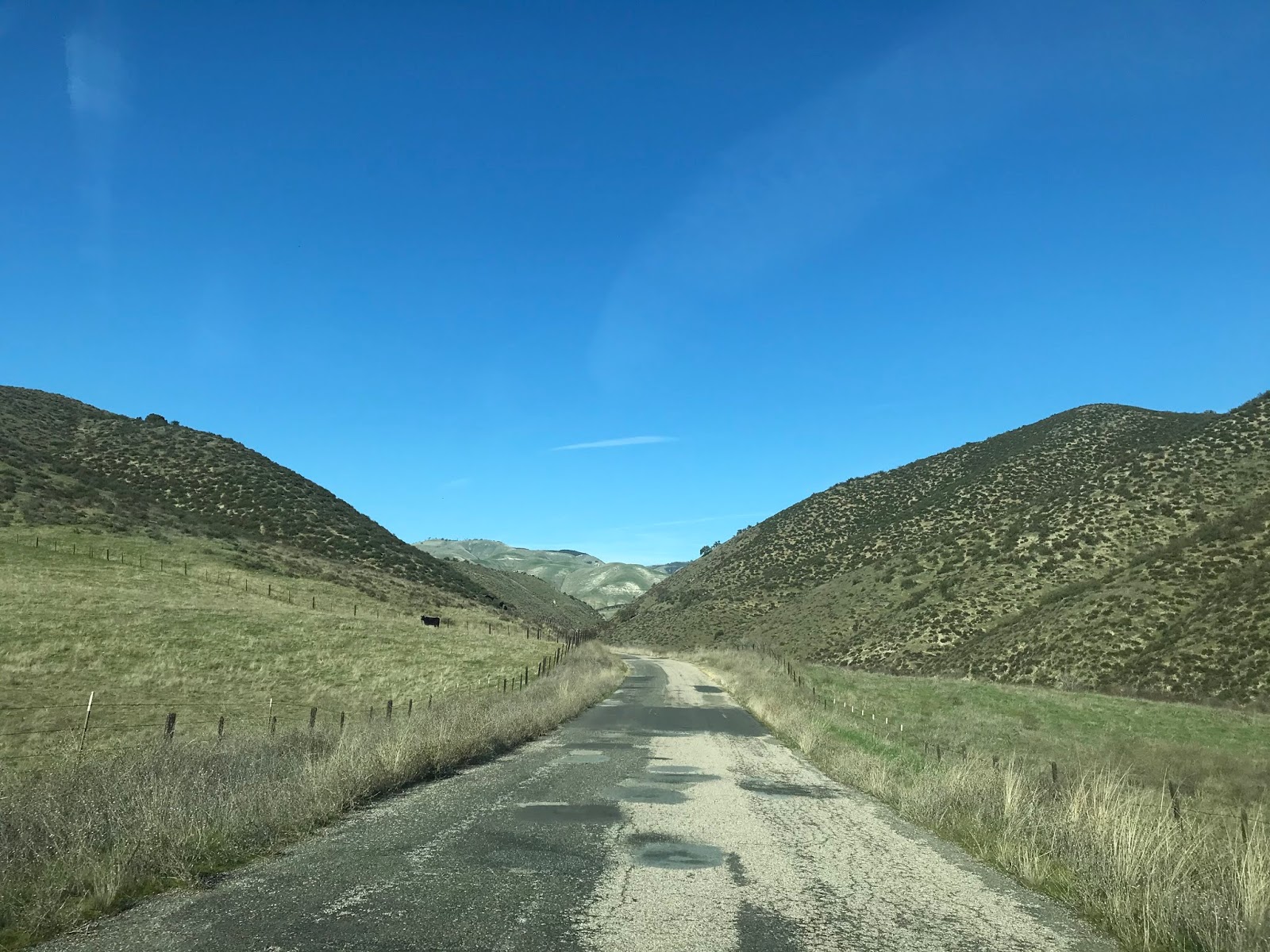
Lonoak Road begins as a conventional two-lane road within Monterey County. Lonoak Road eastbound from 1st Street begins to rapidly approach the foothills of the Gabilan Range. While mountain roads in Monterey County don't carry Post Miles like San Benito County they often have mileage markers (mile marker 3.0) like the one that can be seen in the last photo below.


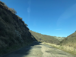
Lonoak Road winds through the Gablian Range for several miles before crossing San Lorenzo Creek into San Benito County.


Upon entering San Benito County Lonoak Road begins a single-lane roadway. Lonoak Road is maintained as San Benito County Road 152. Lonoak Road begins to traverse somewhat steep canyons alongside San Lorenzo Creek.


Lonoak Road eastbound follows San Lorenzo Creek for several miles before branching off towards Lewis Creek.


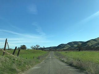


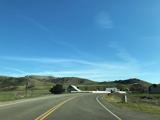
Lonoak Road eastbound approaches Lewis Creek, expands to two-lanes again, and reenters Monterey County. Upon reentering Monterey County the route of Lonoak Road ends in what is left of Lonoak at CA 25/Peach Tree Road. Of note; there is a pile of crashed antique cars in Lewis Creek which can be partially seen in the second photo below. Also of interest; CA 25 was moved to Peach Tree Road in 1955 and previously followed Lewis Creek Road. Interestingly Post Office Service in Lonoak ended in 1954 right before the community would end up on a State Highway.


Lonoak Road is an approximately 14 mile roadway which connects County Route G15 on 1st Street (former US Route 101) of King City to the ghost town of Lonoak at CA 25. Lonoak Road begins in Monterey County and dips into San Benito County before terminating in Monterey County near Lonoak. Much of Lonoak follows the course of San Lorenzo Creek. San Lorenzo Creek for reference is the Monterey/San Benito County Line until the confluence with Lewis Creek.

Part 1; the backstory of Lonoak Road
Peach Tree Valley lies on atop the San Andreas Fault at the confluence of San Lorenzo Creek and Lewis Creek. The fortunate confluence of San Lorenzo Creek and Lewis Creek made it an ideal locale for ranching. The prospects of profitable ranch lands led to the settlement of the small community known as Lonoak. Lonoak was important enough that it warranted Post Office Service by 1885. It was likely sometime around when Lonoak was settled that the namesake road to King City was constructed. King City had been settled in 1884 as a large ranching community and by 1886 it had a stop on the Southern Pacific Railroad. The outgrowth of the ranching of the King City Area no doubt played a contributing factor in the development of Lonoak and Lonoak Road. Lonoak and Lonoak Road both appear on the 1917 California State Automobile Association Map.

Part 2; a drive on Lonoak Road
My approach to Lonoak Road was from northbound 1st Street/G15 in King City. Lonoak Road begins with a right hand turn over the Union Pacific rails.


Lonoak Road begins as a conventional two-lane road within Monterey County. Lonoak Road eastbound from 1st Street begins to rapidly approach the foothills of the Gabilan Range. While mountain roads in Monterey County don't carry Post Miles like San Benito County they often have mileage markers (mile marker 3.0) like the one that can be seen in the last photo below.


Lonoak Road winds through the Gablian Range for several miles before crossing San Lorenzo Creek into San Benito County.


Upon entering San Benito County Lonoak Road begins a single-lane roadway. Lonoak Road is maintained as San Benito County Road 152. Lonoak Road begins to traverse somewhat steep canyons alongside San Lorenzo Creek.

Lonoak Road eastbound follows San Lorenzo Creek for several miles before branching off towards Lewis Creek.


Lonoak Road eastbound approaches Lewis Creek, expands to two-lanes again, and reenters Monterey County. Upon reentering Monterey County the route of Lonoak Road ends in what is left of Lonoak at CA 25/Peach Tree Road. Of note; there is a pile of crashed antique cars in Lewis Creek which can be partially seen in the second photo below. Also of interest; CA 25 was moved to Peach Tree Road in 1955 and previously followed Lewis Creek Road. Interestingly Post Office Service in Lonoak ended in 1954 right before the community would end up on a State Highway.


Comments