Recently while visiting the City of Chicago I drove the entirety of the Dan Ryan Expressway.

The Dan Ryan Expressway refers to a freeway section of Interstate 90 and Interstate 94 in Chicago. The Dan Ryan Expressway is 11.47 miles in length and begins at junction of I-290 with I-90/I-94 in downtown Chicago. The Dan Ryan Expressway is fully traversed southward by I-94 to a junction with I-57. I-90 is only partially aligned on the Dan Ryan Expressway as it splits away from I-94 on the the Chicago Skyway Tollway. The Dan Ryan Expressway is one of the busiest freeways in the country with daily traffic counts exceeding 300,000.
According to chicagoroads.com construction of the Dan Ryan Expressway began in 1958 when the first contract bids were accepted. The first 3 mile portion of the Dan Ryan Expressway opened in 1961 with the majority of remaining alignment opening in 1962. Interestingly I-90 was originally aligned on the entirety of the Dan Ryan Expressway whereas I-94 split onto the Chicago Skyway. I-90 and I-94 swapped alignments in 1963.
chicagoroads.com on the Dan Ryan Expressway
Although I did clinch the Dan Ryan Expressway on my trip I did not clinch a single direction of travel. My initial journey on the Dan Ryan Expressway was on I-90/I-94 east from the junction of I-290/Eisenhower Expressway at the end of the Kennedy Expressway (also I-90/I-94) in downtown Chicago.


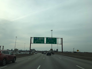
The first major highway junction on I-90/I-94 east on the Dan Ryan Expressway is at I-55 at Exit 53.


Past the junction with I-55 the route of I-90/I-94 east on the Dan Ryan Expressway splits into Express Lanes and local lanes. The Express Lane continues to Garfield Boulevard at Exit 57. I stuck to the local lanes of the Dan Ryan Expressway which passed by Comiskey Park which is home to the Chicago White Sox.

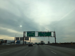


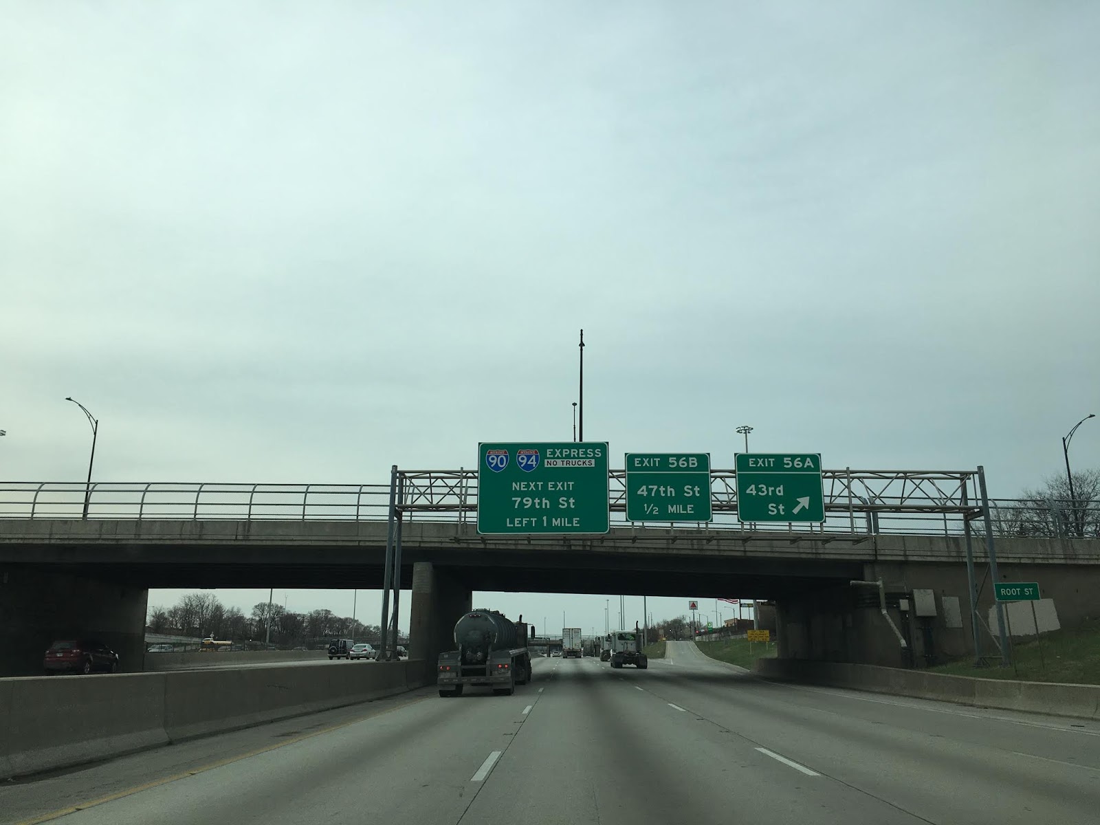
A new set of Express Lanes to 79th Street begin past Garfield Boulevard. I stuck to the local lanes of the Dan Ryan Expressway as the junction for I-90 east onto the Chicago Skyway isn't accessible from the Express Lanes.


On my departing trip from Chicago I took I-90 on the Chicago Skyway east towards the Indiana Toll Road. Back in 2017 I visited both the Chicago Skyway and Indiana Toll Road.
Great Lakes Road Trip Day 10 Part 1; downtown Chicago, the end of US Route 66 and Chicago Skyway
Great Lakes Road Trip Day 10 Part 2; Indiana Toll Road, dunes and Ohio Turnpike
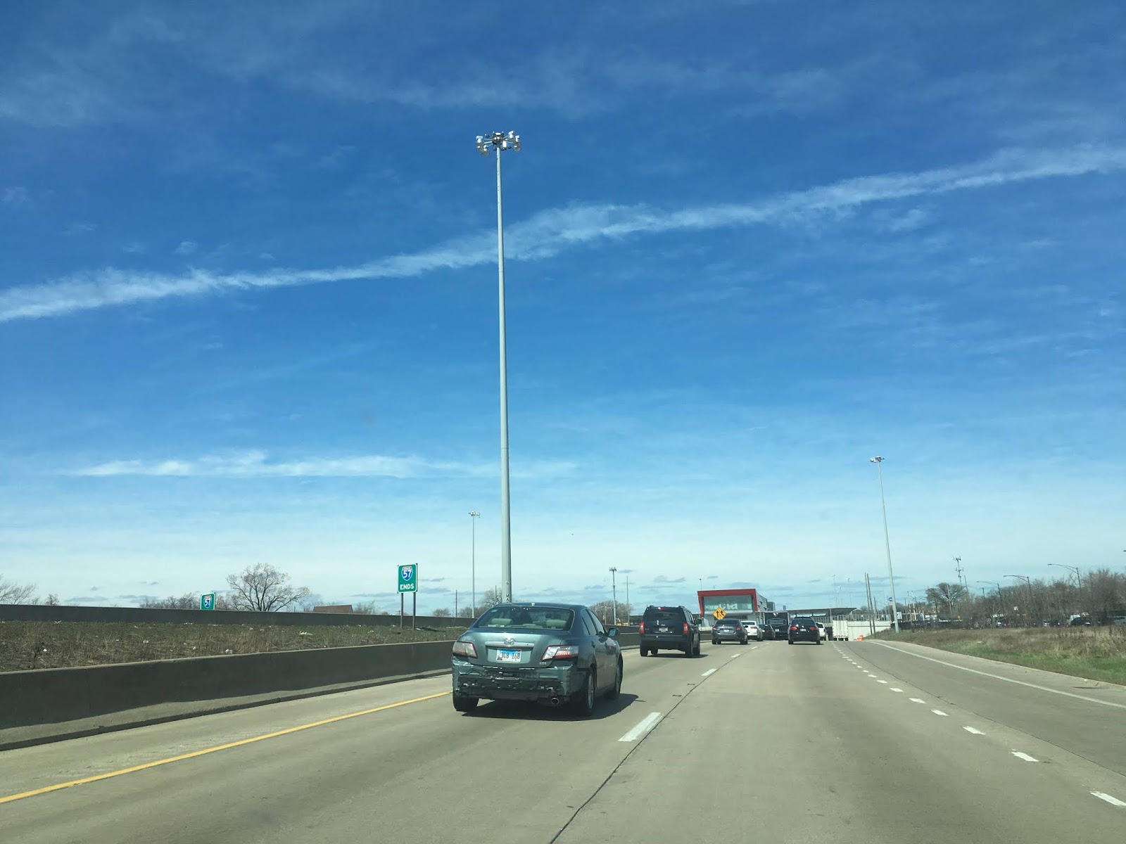
Upon my return to the Chicago Area I took I-94 west after I found out the Pullman neighborhood was recently declared a National Monument. After leaving the Pullman neighborhood I rejoined the Dan Ryan Expressway on I-94 west at the terminus of I-57.

The view of downtown Chicago from the Dan Ryan Expressway in the cover photo of this blog was obtained from I-90/I-94 west approaching I-55.


The Dan Ryan Expressway refers to a freeway section of Interstate 90 and Interstate 94 in Chicago. The Dan Ryan Expressway is 11.47 miles in length and begins at junction of I-290 with I-90/I-94 in downtown Chicago. The Dan Ryan Expressway is fully traversed southward by I-94 to a junction with I-57. I-90 is only partially aligned on the Dan Ryan Expressway as it splits away from I-94 on the the Chicago Skyway Tollway. The Dan Ryan Expressway is one of the busiest freeways in the country with daily traffic counts exceeding 300,000.
According to chicagoroads.com construction of the Dan Ryan Expressway began in 1958 when the first contract bids were accepted. The first 3 mile portion of the Dan Ryan Expressway opened in 1961 with the majority of remaining alignment opening in 1962. Interestingly I-90 was originally aligned on the entirety of the Dan Ryan Expressway whereas I-94 split onto the Chicago Skyway. I-90 and I-94 swapped alignments in 1963.
chicagoroads.com on the Dan Ryan Expressway
Although I did clinch the Dan Ryan Expressway on my trip I did not clinch a single direction of travel. My initial journey on the Dan Ryan Expressway was on I-90/I-94 east from the junction of I-290/Eisenhower Expressway at the end of the Kennedy Expressway (also I-90/I-94) in downtown Chicago.


The first major highway junction on I-90/I-94 east on the Dan Ryan Expressway is at I-55 at Exit 53.


Past the junction with I-55 the route of I-90/I-94 east on the Dan Ryan Expressway splits into Express Lanes and local lanes. The Express Lane continues to Garfield Boulevard at Exit 57. I stuck to the local lanes of the Dan Ryan Expressway which passed by Comiskey Park which is home to the Chicago White Sox.


A new set of Express Lanes to 79th Street begin past Garfield Boulevard. I stuck to the local lanes of the Dan Ryan Expressway as the junction for I-90 east onto the Chicago Skyway isn't accessible from the Express Lanes.


On my departing trip from Chicago I took I-90 on the Chicago Skyway east towards the Indiana Toll Road. Back in 2017 I visited both the Chicago Skyway and Indiana Toll Road.
Great Lakes Road Trip Day 10 Part 1; downtown Chicago, the end of US Route 66 and Chicago Skyway
Great Lakes Road Trip Day 10 Part 2; Indiana Toll Road, dunes and Ohio Turnpike
Upon my return to the Chicago Area I took I-94 west after I found out the Pullman neighborhood was recently declared a National Monument. After leaving the Pullman neighborhood I rejoined the Dan Ryan Expressway on I-94 west at the terminus of I-57.
The view of downtown Chicago from the Dan Ryan Expressway in the cover photo of this blog was obtained from I-90/I-94 west approaching I-55.


Comments