The final route I took this past Wednesday was California State Route 166.

CA 166 is a 96 mile east/west highway stretching from CA 1 in Guadalupe to CA 99 near Bakersfield. CA 166 is mostly a rural stretch of state highway which crosses the Coast Ranges largely following the course of the Cuyama River. CA 166 for the most part is a highly scenic highway, especially the portion following the Cuyama River. CA 166 is well graded enough for a fun drive as it traverses through Santa Barbara Couny, San Luis Obispo County, and Kern County.
I started my trip on CA 166 from CA 1 in Guadalupe heading east towards Santa Maria.

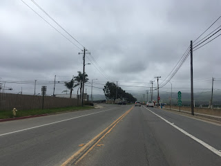
CA 166 crosses a series of railroad tracks as the route begins eastward on Main Street towards Santa Maria.

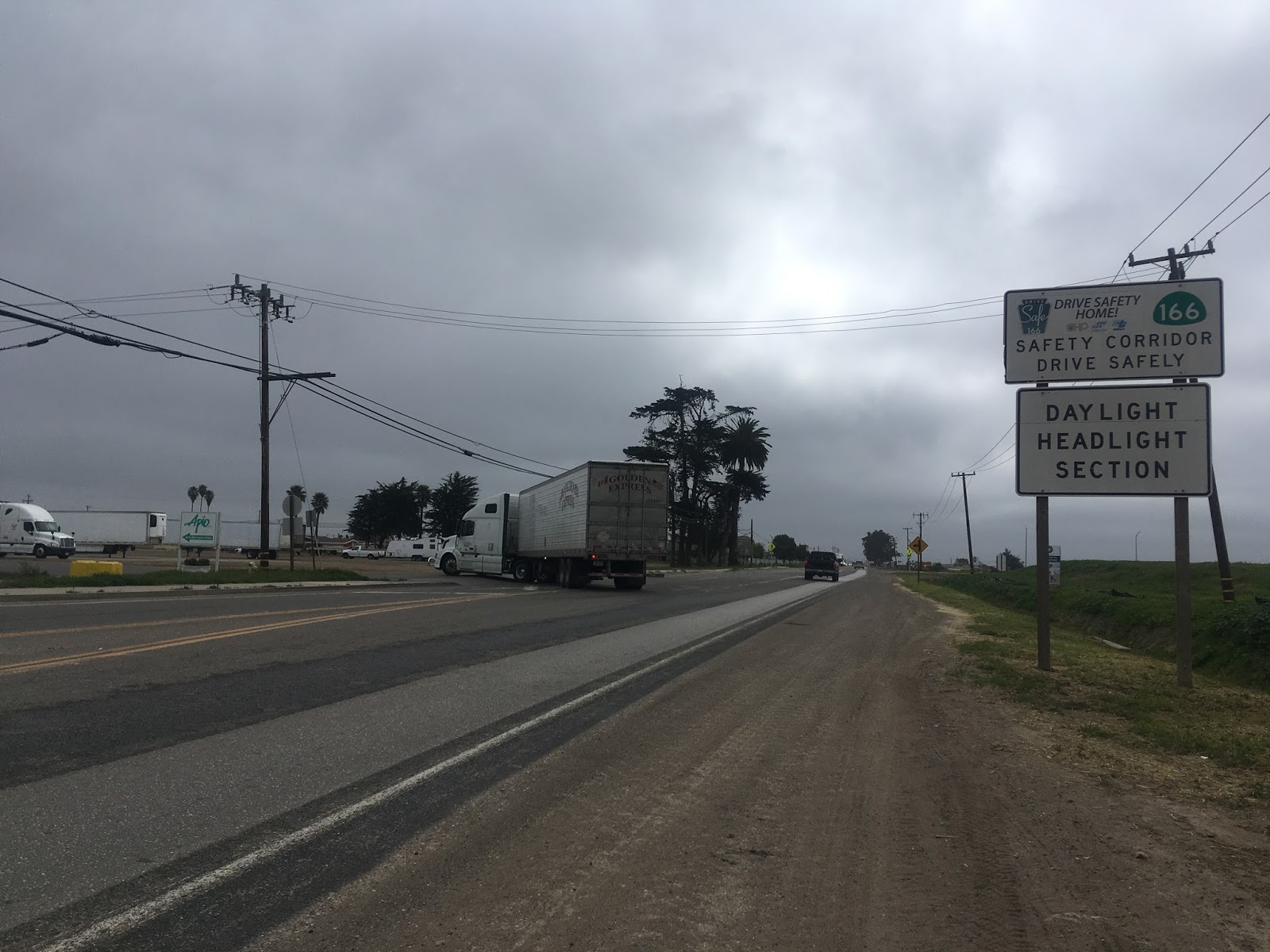
CA 166 between Guadalupe and Santa Maria is signed as a 6 mile long Safety Corridor. The road quality on Main Street is incredibly poor and choppy in this segment which is likely due to the heavy agriculture truck traffic. The Safety Corridor ends at the City Limits of Santa Maria.


Within Santa Maria CA 166 has a junction with CA 135 which runs on Broadway and is the original alignment of US 101.


CA 166 continues on Main Street through Santa Maria where it meets US 101 and begins a multiplex.


CA 166 is multiplexed on US 101 over the Santa Maria River north into San Luis Obispo County at exit 175. CA 166 has another junction with the terminus of CA 135 at the north end of Broadway.


When CA 166 was originally plotted in 1934 it ended at US 101 north of the Santa Maria River. The segment of CA 166 from CA 1 east to US 101 in Santa Maria was added from a segment of the unsigned Legislative Route 148. From US 101 eastward CA 166 is very rural and largely follows the course of the Cuyama River to CA 33. The next services are listed as being 52 miles to the east in New Cuyama.

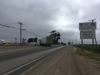
For whatever reason CA 166 is signed as a Safety Corridor 67 miles east to the Kern County Line. The roadway ahead is nowhere near as difficult as the Safety Corridor suggests. My assumption is that much of the passenger traffic drives way over the largely 55 MPH speed limit given the grade of CA 166 is very gentle.


CA 166 passes north of the Twitchell Reservoir which can be seen south of the roadway. The Twitchell Reservoir impounds the Cuyama River and was completed in 1958. The Twitchell Reservoir is largely used for flood control in the winter months along the Cuyama River and water is generally released as quickly as possible for irrigation purposes.


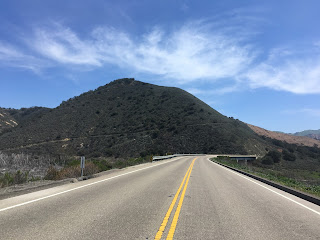
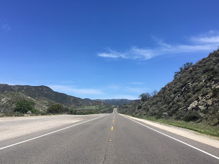
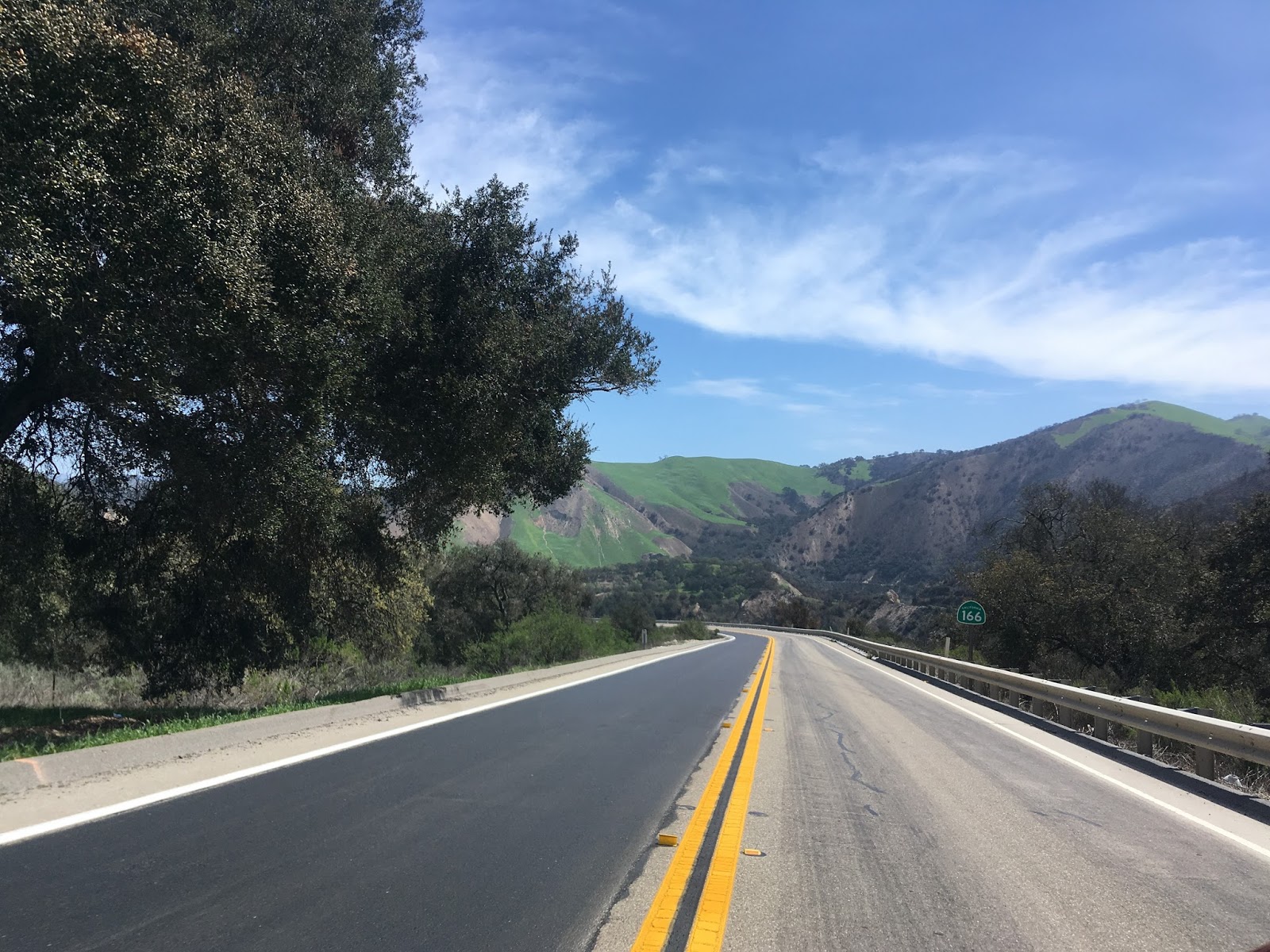
East of the Twitchell Dam CA 166 follows the course of the Cuyama River. The north bank of the Cuyama River is largely within San Luis Obispo County and the south bank is largely within Santa Barbara County. CA 166 snakes over the the Cuyama River on various bridges between the two counties. The roadway along the Cuyama River is sweeping, offers wide vistas of the terrain, and largely can be driven at the speed limit or higher. There are some apparent earlier alignments of CA 166 which can be seen on both sides of the highway but they all seem to follow the general course of the route.


There are numerous guide signs on CA 166 along the Cuyama River. It would seem Caltrans wants travelers to know for certain where the next services are located given the remote terrain.

CA 166 continues to jump banks of the Cuyama River heading east towards Cuyama Valley.


CA 166 begins to flatten out approaching Cuyama Valley.


New Cuyama is signed as 20 miles to the east when CA 166 enters Cuyama Valley. CA 166 continues to follow the course of the Cuyama River as the terrain of Cuyama Valley becomes more arid. Cuyama Valley lies between the Caliente Range to the north and the Sierra Madre Mountains to the south.


CA 166 enters New Cuyama in the center of Cuyama Valley.

New Cuyama is on the Santa Barbara County side of the Cuyama River. New Cuyama was established in 1951 when it was set up by ARCO to house workers in drilling in the South Cuyama Oilfield which had been discovered in 1949. There isn't much to New Cuyama but it does have a weird Jet Age feel given most of the structures date back to the 1950s and 1960s.


Maricopa is signed as 25 miles east on CA 166. CA 166 crosses through the community of Cuyama which is considerably older than New Cuyama but is essentially a ghost town today. Cuyama dates back to Mexican land grants in the early 1840s.


On the eastern end of Cuyama Valley CA 166 reaches a junction with CA 33. Originally CA 33 from Ventura to Taft was part of US 399 and was co-signed with CA 166 to Maricopa.


The CA 166 Safety Corridor ends at the Kern County Line.


CA 166 and CA 33 are co-signed to Maricopa. The signage is actually pretty solid but neither route has a directional placard. For some reason the street blades display CA 33 and I would speculate they previously displayed US 399 prior to the 1964 California Highway Renumbering. Incidentally Hudson Ranch Road becomes Frazier Mountain Park Road which ends at I-5 in Lebec to the southeast.


CA 166/CA 33 has a junction with Soda Lake Road east of Hudson Ranch Road. Soda Lake Road continues north largely as a dirt road along the San Andreas Fault to CA 58 through Carrizo Plain National Monument.

CA 166/CA 33 has an approximately 2,900 foot summit which descends on a five mile grade to Maricopa. San Joaquin Valley can be seen on the downhill descent on 4-7% grades. Both the uphill and downhill lanes actually have passing areas.


CA 166 crosses through Maricopa on Kilpstein Street while CA 33 takes a northward turn on California Street. CA 166 has signage directing traffic to I-5 off to the east.


From 1950 to the 1964 State Highway Renumbering CA 33 multiplexed CA 166 east of Maricopa to US 99. Said CA 33/CA 166 multiplex to US 99 can be seen on this 1950 State Highway Map.
1950 State Highway Map
CA 166 uses the Maricopa Highway the rest of the route east to I-5 and CA 99. Exiting Maricopa eastward Bear Mountain in the Tehachapi Range starts to come into view.

CA 166 has one more significant junction at Old River Road before reaching I-5. Old River Road is also near the Wind Wolves Preserve which has a section of the Old Camino Viejo open for hiking/biking in San Emidgio Canyon. The El Camino Viejo was the original inland route between Los Angeles and San Francisco Bay which dates back to the early 1800s. CA 166 also crosses the California Aqueduct immediately east of Old River Road.


Bear Mountain is very apparent from CA 166 to the northeast at the junction with I-5.


CA 166 ends about 1 mile east of I-5 at CA 99 in Mettler.

CA 166 from US 101 east to CA 99 was part of LRN 57 which was defined in 1919. CAhighways.org provides much more detail on the legislative history of LRN 57.
CAhighways on LRN 57
The extension of CA 166 west to CA 1 and change from US 399 to CA 33 can be seen comparing the 1963/1964 State Highway Maps. The CA 33/CA 166 multplex east of Maricopa to US 99 can be seen disappearing by the 1964 State Highway Map.
1963 State Highway Map
1964 State Highway Map
Interestingly LRN 57 is shown taking a northeast path along railroads on the south shore of Buena Vista from Maricopa to Bakersfield on the 1920 State Highway Map.
1920 State Highway Map
By 1926 LRN 57 is shown taking the Maricopa Highway east out of Maricopa close to the alignment of modern CA 166.
1926 State Highway Map
The alignment of CA 166 in 1935 can be viewed on the California Division of Highways Maps for Kern County and San Luis Obispo County from said year. The alignment appears very similar to modern CA 166 and it seems that the Santa Barbara County segment along the Cuyama River was considered to be part of a San Luis Obispo County maintenance segment.
1935 Kern County Highway Map
1935 San Luis Obispo County Highway Map

CA 166 is a 96 mile east/west highway stretching from CA 1 in Guadalupe to CA 99 near Bakersfield. CA 166 is mostly a rural stretch of state highway which crosses the Coast Ranges largely following the course of the Cuyama River. CA 166 for the most part is a highly scenic highway, especially the portion following the Cuyama River. CA 166 is well graded enough for a fun drive as it traverses through Santa Barbara Couny, San Luis Obispo County, and Kern County.
I started my trip on CA 166 from CA 1 in Guadalupe heading east towards Santa Maria.


CA 166 crosses a series of railroad tracks as the route begins eastward on Main Street towards Santa Maria.

CA 166 between Guadalupe and Santa Maria is signed as a 6 mile long Safety Corridor. The road quality on Main Street is incredibly poor and choppy in this segment which is likely due to the heavy agriculture truck traffic. The Safety Corridor ends at the City Limits of Santa Maria.


Within Santa Maria CA 166 has a junction with CA 135 which runs on Broadway and is the original alignment of US 101.


CA 166 continues on Main Street through Santa Maria where it meets US 101 and begins a multiplex.


CA 166 is multiplexed on US 101 over the Santa Maria River north into San Luis Obispo County at exit 175. CA 166 has another junction with the terminus of CA 135 at the north end of Broadway.


When CA 166 was originally plotted in 1934 it ended at US 101 north of the Santa Maria River. The segment of CA 166 from CA 1 east to US 101 in Santa Maria was added from a segment of the unsigned Legislative Route 148. From US 101 eastward CA 166 is very rural and largely follows the course of the Cuyama River to CA 33. The next services are listed as being 52 miles to the east in New Cuyama.

For whatever reason CA 166 is signed as a Safety Corridor 67 miles east to the Kern County Line. The roadway ahead is nowhere near as difficult as the Safety Corridor suggests. My assumption is that much of the passenger traffic drives way over the largely 55 MPH speed limit given the grade of CA 166 is very gentle.


CA 166 passes north of the Twitchell Reservoir which can be seen south of the roadway. The Twitchell Reservoir impounds the Cuyama River and was completed in 1958. The Twitchell Reservoir is largely used for flood control in the winter months along the Cuyama River and water is generally released as quickly as possible for irrigation purposes.


East of the Twitchell Dam CA 166 follows the course of the Cuyama River. The north bank of the Cuyama River is largely within San Luis Obispo County and the south bank is largely within Santa Barbara County. CA 166 snakes over the the Cuyama River on various bridges between the two counties. The roadway along the Cuyama River is sweeping, offers wide vistas of the terrain, and largely can be driven at the speed limit or higher. There are some apparent earlier alignments of CA 166 which can be seen on both sides of the highway but they all seem to follow the general course of the route.


There are numerous guide signs on CA 166 along the Cuyama River. It would seem Caltrans wants travelers to know for certain where the next services are located given the remote terrain.

CA 166 continues to jump banks of the Cuyama River heading east towards Cuyama Valley.


CA 166 begins to flatten out approaching Cuyama Valley.


New Cuyama is signed as 20 miles to the east when CA 166 enters Cuyama Valley. CA 166 continues to follow the course of the Cuyama River as the terrain of Cuyama Valley becomes more arid. Cuyama Valley lies between the Caliente Range to the north and the Sierra Madre Mountains to the south.


CA 166 enters New Cuyama in the center of Cuyama Valley.

New Cuyama is on the Santa Barbara County side of the Cuyama River. New Cuyama was established in 1951 when it was set up by ARCO to house workers in drilling in the South Cuyama Oilfield which had been discovered in 1949. There isn't much to New Cuyama but it does have a weird Jet Age feel given most of the structures date back to the 1950s and 1960s.


Maricopa is signed as 25 miles east on CA 166. CA 166 crosses through the community of Cuyama which is considerably older than New Cuyama but is essentially a ghost town today. Cuyama dates back to Mexican land grants in the early 1840s.


On the eastern end of Cuyama Valley CA 166 reaches a junction with CA 33. Originally CA 33 from Ventura to Taft was part of US 399 and was co-signed with CA 166 to Maricopa.


The CA 166 Safety Corridor ends at the Kern County Line.


CA 166 and CA 33 are co-signed to Maricopa. The signage is actually pretty solid but neither route has a directional placard. For some reason the street blades display CA 33 and I would speculate they previously displayed US 399 prior to the 1964 California Highway Renumbering. Incidentally Hudson Ranch Road becomes Frazier Mountain Park Road which ends at I-5 in Lebec to the southeast.


CA 166/CA 33 has a junction with Soda Lake Road east of Hudson Ranch Road. Soda Lake Road continues north largely as a dirt road along the San Andreas Fault to CA 58 through Carrizo Plain National Monument.

CA 166/CA 33 has an approximately 2,900 foot summit which descends on a five mile grade to Maricopa. San Joaquin Valley can be seen on the downhill descent on 4-7% grades. Both the uphill and downhill lanes actually have passing areas.


CA 166 crosses through Maricopa on Kilpstein Street while CA 33 takes a northward turn on California Street. CA 166 has signage directing traffic to I-5 off to the east.


From 1950 to the 1964 State Highway Renumbering CA 33 multiplexed CA 166 east of Maricopa to US 99. Said CA 33/CA 166 multiplex to US 99 can be seen on this 1950 State Highway Map.
1950 State Highway Map
CA 166 uses the Maricopa Highway the rest of the route east to I-5 and CA 99. Exiting Maricopa eastward Bear Mountain in the Tehachapi Range starts to come into view.

CA 166 has one more significant junction at Old River Road before reaching I-5. Old River Road is also near the Wind Wolves Preserve which has a section of the Old Camino Viejo open for hiking/biking in San Emidgio Canyon. The El Camino Viejo was the original inland route between Los Angeles and San Francisco Bay which dates back to the early 1800s. CA 166 also crosses the California Aqueduct immediately east of Old River Road.


Bear Mountain is very apparent from CA 166 to the northeast at the junction with I-5.


CA 166 ends about 1 mile east of I-5 at CA 99 in Mettler.

CA 166 from US 101 east to CA 99 was part of LRN 57 which was defined in 1919. CAhighways.org provides much more detail on the legislative history of LRN 57.
CAhighways on LRN 57
The extension of CA 166 west to CA 1 and change from US 399 to CA 33 can be seen comparing the 1963/1964 State Highway Maps. The CA 33/CA 166 multplex east of Maricopa to US 99 can be seen disappearing by the 1964 State Highway Map.
1963 State Highway Map
1964 State Highway Map
Interestingly LRN 57 is shown taking a northeast path along railroads on the south shore of Buena Vista from Maricopa to Bakersfield on the 1920 State Highway Map.
1920 State Highway Map
By 1926 LRN 57 is shown taking the Maricopa Highway east out of Maricopa close to the alignment of modern CA 166.
1926 State Highway Map
The alignment of CA 166 in 1935 can be viewed on the California Division of Highways Maps for Kern County and San Luis Obispo County from said year. The alignment appears very similar to modern CA 166 and it seems that the Santa Barbara County segment along the Cuyama River was considered to be part of a San Luis Obispo County maintenance segment.
1935 Kern County Highway Map
1935 San Luis Obispo County Highway Map
Comments