
Jalisco State Highway 112 is a 21.3 kilometers long route located on the northern shore of Lake Chapala. The highway begins from a disconnected segment of Federal Highway 23 at the intersection of Carretera Jocotepec-Chapala and Calle de Chante near the eastern town limit of Jocotepec. Jalisco State Highway 112 follows Carretera Jocotepec-Chapala through Ajijic where it intersects Jalisco State Highway 119 at the eastern town limit. Jalisco State Highway 112 from Ajijic follows Hildalgo through Riberas del Pilar to a terminus in downtown Chapala at Avenida Francisco Ignacio Madero.

Part 1; the history of Jalisco State Highway 112
Prior to the establishment of the current Jalisco State Highway numbering system Carretera Jocotepec-Chapala was part of Jalisco State Highway 35. Jalisco State Highway 35 can be seen extending from Federal Highway 15 in Jocotepec to Guadalajara via Chapala on the 1956 Shell Highway map of Mexico.

The current Jalisco State Highway numbering system was established in recent decades and is grouped into clusters. Jalisco State Highway 112 can be seen connecting Jocotepec and Chapala on the 2006 Mapa de carreteras y caminos en el estado de Jalisco. It isn't clear but it appears Jalisco State Highway 112 at the time was not continuous through Jocotepec west to Federal Highway 15. What is now Jalisco State Highway 155 along Vicente Guerrero Presidente may have once been part of Jalisco State Highway 112.
As presently configured Jalisco State Highway 112 is 23.1 kilometers long. The highway begins from a disconnected segment of Federal Highway 23 at the intersection of Carretera Jocotepec-Chapala and Calle de Chante near the eastern town limit of Jocotepec. Jalisco State Highway 112 follows Carretera Jocotepec-Chapala through Ajijic where it intersects Jalisco State Highway 119 at the eastern town limit. Jalisco State Highway 112 from Ajijic follows Hildalgo through Riberas del Pilar to a terminus in downtown Chapala at Avenida Francisco Ignacio Madero.

Google Maps erroneously show Federal Highway 23 as being continuous from Federal Highway 15 near Jocotepec to Guadalajara. Federal Highway 23 presently has a gap from Jocotepec northeast to Federal Highway 35 near Santa Rosa. It is likely in the near future the gap in Federal Highway 23 will be filled by way of annexation of portions of Jalisco State Highways 112, 119 and 148. Current highway maintenance sections can be viewed on the official Map of Jalisco.
Part 2; a drive on Jalisco State Highway 112
Below is the view of Malecón de Jocotepec at the western shore Lake Chapala. Jocotepec and the western shore of Lake Chapala is thought to have been inhabited first by tribes as early as 100 BC. The Nahua Tribe began permanent settlement of the western lakeshore beginning approximately 1361. Upon the arrival of the Spanish the land on the western lakeshore a was given as a grant in 1520. The town of Jocotepec was founded in 1529.

Lake Chapala is the largest freshwater lake in Mexico by surface area at approximately 420 square miles. Lake Chapala is shallow at a maximum depth of 34 feet which leads to seasonal variations of the lake level. Lake Chapala is located approximately 5,000 feet above sea level and is fed by; Rio Lerma, Rio Zula, Rio Huaracha, and Rio Duero. Lake Chapala is the headwaters of Rio Grande de Santiago.


Traffic wishing to reach Jalisco State Highway 112 and Chapala must follow Calle de Chante to a disconnected segment of Federal Highway 23 at Carretera Jocotepec-Chapala. Traffic can turn left onto Federal Highway 23 via the bypass downtown Jocotepec to reach Federal Highway 15 or continue straight onto eastbound Jalisco State Highway 112.

Jalisco State Highway 112 eastbound passes through Chantepec and enters the community of Jaltepec.


Jalisco State Highway 112 eastbound passes through Jaltepec and San Juan Cosalá where it departs the Municipality of Jocotepec.


Jalisco State Highway enters the community of Ajijic which was founded on the north shore of Lake Chapala in 1533.


Carretera Jocotepec-Chapala east of Ajijic transitions onto Jalisco State Highway 119 via a left-hand turn. Jalisco State Highway 112 eastbound transitions to Hildalgo through Riberas del Pilar towards downtown Chapala.

Jalisco State Highway 112 follows Hidalgo to a terminus in downtown Chapala at Avenida Francisco Ignacio Madero.


Malecón de los Pelicanos Chapala can be accessed via a right turn on Avenida Francisco Ignacio Madero and following into the shore of Lake Chapala.

The current site of the City of Chapala was home to Nahautl Tribes before Spanish contact. The Spanish first contacted the tribes in Chapala during 1524. Many of church facilities in Chapala were built in 1531 leading to the formation of the Town. Chapala was the locale of a battle during the Mexican Revolution in 1812 in which the occupying Spanish forces were defeated by revolutionaries. Tourism in Chapala began to develop during the 1880s in the form of mostly Americans and Canadians who were attracted by the temperate climate. Modern Chapala today has one of the largest American and Canadian populations within Central Mexico.

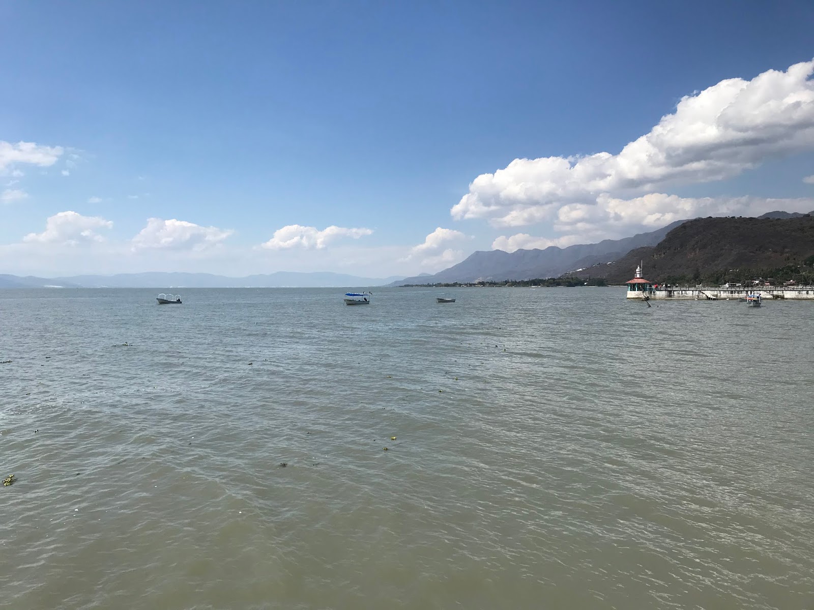
From the Chapala Malecon there is a fantastic view of Lake Chapala looking eastward and the Sierra de San Juan Cosalá.




A small mercado at Malecón de los Pelicanos Chapala seems to be popular amongst tourists.


Local tribal members conduct a rope swinging show several times a day in at the mercado.


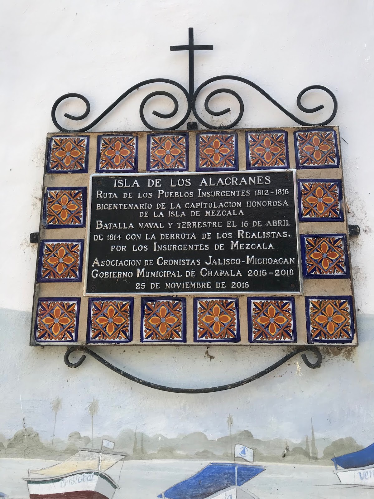
Isla de los Alacranes can be visited via a short ride from the shoreline in Chapala via motorboat.


Isla de los Alacranes was once a Spanish fort and prison. There are a couple of small chapels along with numerous ruins of the fortification.




Comments