
The Putah Creek Bridge of Monticello (former California State Route 28)

The Putah Creek Bridge was a masonry structure constructed during 1896 by Napa County to serve the community of Monticello.  The Putah Creek Bridge would be annexed into the State Highway System in 1933 when Legislative Route Number 6 was extended from Woodland Junction to Napa.  The Putah Creek Bridge was a component of the original California State Route 28 from 1934-1952.  The span briefly became part of California State Route 128 in 1953 until the highway was relocated as part of the Monticello Dam project in 1955.  Today the Putah Creek Bridge sits at the bottom of the Lake Berryessa reservoir and is accessible to divers.  Pictured as the blog cover is the Putah Creek Bridge as it was featured in the September 1950 California Highways & Public Works.  

California State Route 28 can be seen crossing the Putah Creek Bridge near Monticello on the 1943 United States Geological Survey map of Copay.  


The history of the Putah Creek Bridge

The site of Monticello lies under the waters of the Lake Berryessa reservoir in what was once known as Berryessa Valley.  The Berryessa Valley name is derived from the Berryessa family which was granted the lands of Rancho Las Putas by Mexican Governor Manual Micheltorena during 1843.  The Berryessa sold their stake in Rancho Las Putas to American investors during 1853.  

Rancho Las Putas was subdivided during 1866 and the farming community of Montecillo was plotted.  By 1870 a franchise wagon road from Napa was constructed via a new bridge over Putah Creek.  By 1875 Napa County purchased the road connecting Napa-Monticello and declared it a public highway.  The highway connecting Napa-Monticello can be seen on the 1882 Bancroft's Map of California.  

The history of the Putah Creek Bridge was featured in the September 1950 California Highways & Public Works Centennial Edition.  The Putah Creek Bridge was referenced in the issue as being a notable example of a masonry bridge in the State Highway System (then part of California State Route 28 and Legislative Route Number 6).  The Putah Creek Bridge was constructed during 1896 by Napa County. The structure was cut from native sourced sandstone and was 70 feet long. The article notes the Putah Creek Bridge was subject to being inundated if the construction of Monticello Dam proceeded.


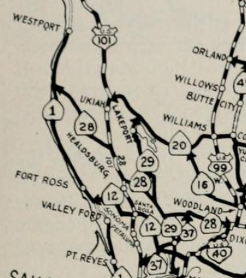
During 1933 Legislative Route Number 6 (LRN 6) was extended from Woodland Junction to Napa by way of Monticello. The extension of LRN 6 annexed the Putah Creek Bridge into the State Highway System.

The initial run of Sign State Routes was announced in the August 1934 California Highways & Public Works.   The Putah Creek Bridge was assigned as a component of the original California State Route 28 which utilized LRN 6 in the Monticello area.  


California State Route 28/LRN 6 can be seen crossing the Putah Creek Bridge near Monticello on the 1935 Division of Highways Map of Napa County.  

California State Route 28/LRN 6 can be seen crossing the Putah Creek Bridge near Monticello on the 1943 United States Geological Survey map of Copay.  


The May/June 1953 California Highways & Public Works announced that California State Route 28 was redesignated as California State Route 128.  The California State Route 28 designation was moved to the north shore of Lake Tahoe to be continuous with the long existing Nevada State Route 28.  


The March/April 1955 California Highways & Public Works depicts the progress of the realignment of California State Route 128/LRN 6 at the site of the 270-foot-high Monticello Dam.  The Monticello Dam project broke ground in 1953 along Putah Creek with the end goal of creating the Lake Berryessa Reservoir.  The construction of Monticello Dam required both California State Route 37 and California State Route 128 be realigned to the south of the planned Lake Berryessa.   California State Route 128/LRN 6 in particular was heavily impacted by the Monticello Dam project as it followed Putah Creek from the outskirts of the Town of Monticello east to the Yolo County Line.  Additionally, the Town of Monticello in Berryessa Valley was slated to be inundated by 100 feet of water.  In total 16.3 miles of new highway was slated to be constructed which was largely comprised of a realigned California State Route 128.  The realigned California State Route 128 would make a brief swing into Solano County near the site of Monticello Dam.   Monticello Dam was topped out during November of 1957, but Lake Berryessa wouldn't fill to capacity until April of 1963.


The newly realigned California State Route 128/LRN 6 south of the planned Lake Berryessa appears on the 1956 Division of Highways State Map.  


The former site of Monticello and location of Putah Creek can be seen on the 1959 United State Geological Survey map of Lake Berryessa.  The Putah Creek Bridge was not demolished during the Monticello Dam project and generally is located 100 feet beneath the waters of Lake Berryessa.  


The Putah Creek Bridge has become a well-known dive site at Lake Berryessa.  Underwater footage from the Putah Creek Bridge can be seen below as it was presented on YouTube in 2011.  

Comments

Popular posts from this blog

The 1915-era Teilman Bridge (the only known Concrete Pony Truss Bridge in California)

The Teilman Bridge is a semi-abandoned structure over Fresno Slough west of Burrell siding near the intersection of Elkhorn Avenue and Elkhorn Grade.  This structure is the only known Concrete Pony Truss Bridge constructed in California and was designed by Ingvart Teilman.  Teilman's Bridge would open in late 1915 when the Elkhorn Grade was the primary road between Fresno and Coalinga.  The structure would be replaced in 1991 but was left standing as it carries pipelines over Fresno Slough.  Part 1; the history of the Teilman Bridge In the early Twentieth Century the most direct highway between Fresno and Coalinga followed the Elkhorn Grade.  The Elkhorn Grade began at Fresno Slough a short distance west of Burrell siding.  From Fresno Slough the Elkhorn Grade followed a generally southwestern course through San Joaquin Valley into the Kettleman Hills towards Coalinga.   The Elkhorn Grade can be seen on the  1914 C.F. Weber map of Fresno Coun...

The Dummy Lights of New York

  A relic of the early days of motoring, dummy lights were traffic lights  that  were  placed  in the middle of a street intersection. In those early days, traffic shuffled through busy intersections with the help of a police officer who stood on top of a pedestal. As technology improved and electric traffic signals became commonplace, they were also  originally  positioned on a platform at the center of the intersection. Those traffic signals became known as  " dummy lights "  and were common until  traffic lights were moved  onto wires and poles that crossed above the intersection.  In New York State, only a handful of these dummy lights exist. The dummy lights  are found  in the Hudson Valley towns of Beacon and Croton-on-Hudson, plus there is an ongoing tug of war in Canajoharie in the Mohawk Valley, where their dummy light has been knocked down and replaced a few times. The dummy light in Canajoharie is currently...

Prunedale Road (Monterey County)

Prunedale Road is a short 2.6-mile-long frontage corridor of US Route 101 in the namesake Monterey County community of Prunedale.  Prior to 1932 US Route 101 bypassed Prunedale in favor of the San Juan Grade to the east.  Prunedale Road along with nearby Moro Road served as an alternative connecting highway between Salinas and San Juan Bautista.  Following the realignment of US Route 101 onto the Prunedale Cutoff the former through route along Prunedale Road would be rendered as a western frontage.   Part 1; the history of Prunedale Road Prunedale Road is located in and is named after the Monterey County community of Prunedale.  Said community was founded near the junction of San Migeul Canyon, Langley Canyon and Echo Valley.  Watsonville settler Charles Langley (namesake of Langley Canyon) was one of the prominent early community settlers.  The Prunedale Post Office would open for the first time in 1894 but would close by 1908.  Early agricu...