California State Route 72 is a State Highway located in the Los Angeles Metro Area and a component of early US Route 101. The Legislative definition of California State Route 72 presently begins at Interstate 605 in Whittier and follows Whittier Boulevard to California State Route 39 near La Habra. Prior to 1953 US Roue 101 followed Whittier Boulevard, Spadra Road (now Harbor Boulevard) and Los Angeles Street (now Anaheim Boulevard) from Los Angeles to Anaheim. The original surface corridor of US Route 101 was repurposed as California State Route 72 during the 1964 State Highway Renumbering. California State Route 72 as originally defined during the 1964 State Highway Renumbering spanned from Interstate 5 in Anaheim to the original California State Route 245 at Downey Road near Los Angeles. Below the current scale of California State Route 72 can be seen contrasted to it's original size seen on the 1965 Division of Highways Map.

The history of California State Route 72 and early US Route 101 between Los Angeles-Anaheim
The era of State Highway Maintenance through in the Los Angeles-Anaheim corridor would begin with the 1909 First State Highway Bond Act which was approved by voters in 1910. One of the highways approved through the 1909 First State Highway Bond Act was a 481.8-mile highway originating at the City Limits of San Francisco which terminated in San Diego. This highway would ultimately come to be known in time as Legislative Route Number 2 ("LRN 2").
The January 1915 California Highway Bulletin references LRN 2 from the Los Angeles/Orange County line to Anaheim as being completed between to State standards.
Prior to 1933 the State of California could not actively maintain highways in incorporated cities. LRN 2 can be seen following Whittier Boulevard, Spadra Road and Los Angeles Street from the Los Angeles city limit to Anaheim on the 1917 California State Automobile Association Map. LRN 2 can be seen passing through the communities of Montebello, Whittier, La Habra and Fullerton.
LRN 2 between Los Angeles and Anaheim is shown as part of the Old Spanish Trail on the 1924 Rand McNally Map of California.
The
November 1924 California Highways & Public Works features the widened Whittier Boulevard between Pasadena Avenue and Montebello. The 56-foot-wide segment of Whittier Boulevard/LRN 2 is cited to have been the mostly costly State Highway yet constructed at a rate of $150,000 per mile. The long-term goal for Whittier Boulevard is cited to have it act as a main street between Los Angeles, Whittier and Orange County.


The
May 1925 California Highways & Public Works noted a proposed expenditure budget for LRN 2/Whittier Boulevard from Montebello to Whittier. A bridge department article in same issue noted a Union Pacific Railroad subway along Whittier Boulevard was being considered by the State Bridge Department.
The
July 1925 California Highways & Public Works featured a sidewalk installed on the side of the Rio Hondo Bridge along LRN 2/Whittier Boulevard. The 24-foot road deck of the Rio Hondo Bridge is noted to have been rapidly becoming insufficient to handle traffic loads on LRN 2.
The
October 1925 California Highways & Public Works noted construction of the Union Pacific Railroad subway on LRN 2/Whittier Boulevard was underway.

The
March 1926 California Highways & Public Works noted the Union Pacific Railroad subway on LRN 2/Whittier Boulevard was completed.
The
October 1926 California Highways & Public Works featured the relocation of the Rio Hondo Bridge along LRN 2/Whittier Boulevard. The Rio Hondo Bridge was moved 15 feet upstream to a new alignment which would allow the structure to be twinned.
The
October 1926 California Highways & Public Works referenced the expansion of LRN 2/Whittier Boulevard from Michigan Avenue in Whittier to the Orange County line as being underway.

During November 1926 the US Route System was created by the American Association of State Highway Officials. US Route 101 was applied to the existing corridor of LRN 2 between Los Angeles and Anaheim. US Route 101 can be seen following LRN 2 between the Los Angeles city limit to Anaheim on the
1927 Rand McNally Map of California.
The
May 1927 California Highways & Public Works referenced the twinning of the Rio Hondo Bridge along US Route 101 on Whittier Boulevard as being completed. The original Rio Hondo Bridge is noted to have been completed during 1921.
The
November 1929 California Highways & Public Works featured a photo of the Union Pacific Railroad subway along US Route 101/Whittier Boulevard.

The
January 1932 California Highways & Public Works referenced a planned widening of US Route 101/LRN 2 from Fullerton to the Los Angeles County line as being underway. A secondary contract to repave US Route 101/LRN 2 in Fullerton from the Electric Railway Arch to the north city limits is noted to be soon breaking ground as a cooperative project with Orange County.
US Route 101/LRN 2 between the Los Angeles city limit to Anaheim can be seen on the 1935 Division of Highways Maps of
Los Angeles,
Los Angeles County and
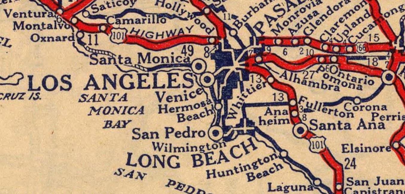
Orange County. US Route 101/LRN 2 can be seen approaching Whitter Boulevard via Boyle Avenue in Los Angeles. From Los Angeles, US Route 101/LRN 2 is shown following Whittier Boulevard to La Habra in Orange County via Montebello and Whittier. US Route 101/LRN 2 is seen departing La Habra via Spadra Road towards Anaheim via Fullerton. US Route 101/LRN 2 is shown passing through Anaheim via Los Angeles Street south towards Santa Ana.


The
1942 Division of Highways Map depicts California State Route 26 with a gap originating at the eastern terminus of LRN 173 at Indiana Street in Los Angeles. Much of what had been California State Route 26 on Anaheim-Telegraph Road (LRN 166) was designated as US Route 101 Bypass. From Anaheim-Telegraph Road, US Route 101 Bypass is shown following Lakewood Boulevard (LRN 168), Firestone Boulevard (LRN 174) and Manchester Boulevard (LRN 174) to Anaheim. Mainline US Route 101 is still shown following Whittier Boulevard, Spadra Road and Los Angeles Street between Los Angeles-Anaheim.
The
January/February 1952 California Highways & Public Works announced the Santa Ana Freeway (US Route 101 Bypass) was expected to be complete between Rosemead Boulevard and the Los Angeles Civic Center by late year 1952 or early 1953. The article notes US Route 101 Bypass traffic would still need to utilize Lakewood Boulevard and Firestone Boulevard due the Santa Ana Freeway east of Rosemead Boulevard to Norwalk not likely opening for several more years.
The
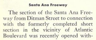
March/April 1953 California Highways & Public Works noted US Route 101 Bypass on the Santa Ana Freeway was expected to open to Slauson Avenue by April 1953. The extension of the Santa Ana Freeway to Santa Ana is stated to be planned for completion sometime during 1954.
The
1954 Division of Highways Map shows the Santa Ana Freeway completed to Pioneer Boulevard near Norwalk. Mainline US Route 101 is shown realigned onto the Santa Ana Freeway (LRN 166), an interim routing on Pioneer Boulevard and Firestone Boulevard/Manchester Boulevard (LRN 174) between Los Angeles-Anaheim. The former mainline of US Route 101 on LRN 2 is shown to no longer be part of the highway.
As part of the 1964 State Highway Renumbering the Legislative Route Numbers were deleted in favor of Sign Route designations. Former US Route 101/LRN 2 in the Los Angeles-Anaheim corridor were reassigned as California State Route 72. California State Route 72 was defined as beginning at Interstate 5 in Anaheim and ending at California State Route 245 near Los Angeles. California State Route 72 can be seen for the first time on the
1964 Division of Highways Map.
1965 Legislative Chapter 1372 changed the northern terminus of California State Route 72 to Downey Road which reflected the deletion of the original California State Route 245. The same Legislation added numerous stipulations to California State Route 72:
(A) The portion of Route 72 from Route 5 in or near Anaheim to Route 39 shall cease to be a state highway when Route 57 freeway in the Cities of Fullerton and Brea and the County of Orange is completed and commission relinquishes present Route 57 in the Cities of Fullerton and Brea and the County of Orange.
(B) The portion of Route 72 from Route 39 to Downey Road shall cease to be a state highway when Route 90 freeway is completed from Route 5 to Route 39.
1981 Legislative Chapter 292 truncated California State Route 72 to "Route 39 to Downey Road near Los Angeles." California State Route 72 appears only on Whittier Boulevard on the
1982 Caltrans Map.
1985 Legislative Chapter 385 added new conditions to the definition of California State Route 72:
(A) Route 72 shall cease to be a state highway when Route 90 freeway is completed from Route 5 to Route 39.
(B) Notwithstanding subdivision (A), that portion of Route 72 from Atlantic Boulevard to Downey Road shall cease to be a state highway when the County of Los Angeles completes the reconstruction of Whittier Boulevard these two limits.
1988 Legislative Chapter 106 added an additional condition to the definition of California State Route 72:
(C) Notwithstanding subdivision (A), the portion of Route 72 from Route 605 to Atlantic Boulevard shall cease to be a state highway when the County of Los Angeles, the City of Montebello and the City of Pico Rivera complete the reconstruction of their respective portions of Whittier Boulevard between these two limits.
1992 Legislative Chapter 1243 truncated the definition of California State Route 72 to "Route 39 to Atlantic Boulevard near the City of Los Angeles."
2010 Legislative 421/Senate Bill 1318 truncated California State Route 72 to "Route 605 in Whittier to Route 39." Subsection (B) of California State Route 72 was also amended:
(B) Notwithstanding subdivision (A) any portion of Route 72 from Route 605 to Atlantic Boulevard ceases to be a state highway when the County of Los Angeles, the City of Montebello, and the City of Pico Rivera complete the reconstruction of their respective portion of Whittier Boulevard between these two limits.
2019 Assembly Bill 1810/Chapter 636 authorized the relinquishment of California State Route 72 in city of Whittier and County of Los Angeles. During June 2022 the California Transportation Commission amended a project into SHOPP (7-LA-72 0.0/6.767). This project provided financial contribution to the city of Whittier to relinquish California State Route 72 between Interstate 605 in Whittier to the Orange County line. To date as this blog is being published the Legislative Definition of California State Route 72 has not been altered but the highway effectively only exists between Postmiles ORA 0.00 to Valley Home Avenue ORA 11.914.


Comments