California State Route 55


California State Route 55 is an eighteen-mile State Highway located within Orange County.  California State Route 55 begins at California State Route 91 at Santa Ana Canyon and ends at the Newport Beach Channel Bridge immediately south of California State Route 1 at Newport Beach.  California State Route 55 south from California State Route 91 to 19th Street in Costa Mesa is carried by the Costa Mesa Freeway.  The remaining surface balance of California State Route 55 south to the Newport Beach Channel Bridge is aligned on Newport Boulevard.  


The history of California State Route 55

What was to become California State Route 55 was added to the State Highway System during 1931 as an extension of Legislative Route Number 43.  LRN 43 was extended from Waterman Canyon near San Bernardino to south to Newport Beach via Santa Ana Canyon.  The extended definition of LRN 43 to Newport Beach first appears on the 1932 Division of Highways Map.  

The future alignment of California State Route 55 can be seen in the form of LRN 43 following Newport Road and Tustin Avenue north from LRN 60 to Santa Ana Canyon near Olive on the 1934 Division of Highways Map.  

The August 1934 California Highways & Public Works announced the initial run of Sign State Routes.  California State Route 55 was announced as following LRN 43 from California State Route 3/LRN 60 in Newport Beach to California State Route 18 near Olive. 


California State Route 55/LRN 43 can be seen terminating at Balboa Boulevard in Newport Beach on the 1935 Division of Highways Map of Orange County.  

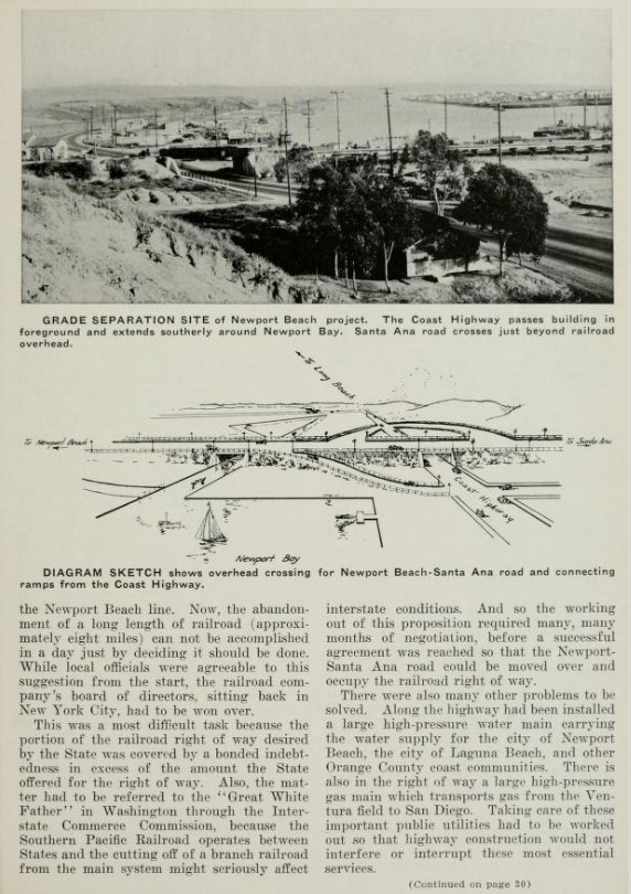
The February 1936 California Highways & Public Works featured the in-progress Newport Beach Grade Separation project which would serve as the new junction of California State Route 55/LRN 43 and US Route 101A/LRN 60 at Newport Beach.  The Newport Beach Grade Separation project is noted to have been first proposed as three-way cooperative between Orange County, the city of Newport Beach and Division of Highways.  The Newport Beach Grade Separation is noted to have an anticipated completion during September 1936.  


The September 1936 California Highways & Public Works featured the nearly completed Newport Beach Grade Separation.
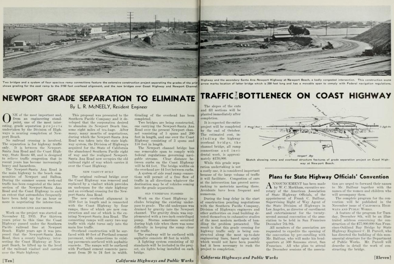
The opening of the Newport Beach Grade Separation is featured in the January 1937 California Highways & Public Works.  The Newport Beach Grade Separation was dedicated on November 28, 1936, by Governor Frank F. Merriam as the new junction of California State Route 55/LRN 43 and US Route 101A/LRN 60.  The article notes the Newport-Santa Ana Road was taken into the State Highway System on August 14, 1931.  


The 1938 Division of Highways Map features California State Route 55 applied to LRN 43 on Newport Avenue and Tustin Avenue.

The May 1941 California Highways & Public Works featured landscaping along California State Route 55/LRN 43 in Costa Mesa along Newport Boulevard.  The planted area along Newport Boulevard were repurposed from the abandoned grade of the Santa Ana & Newport Railway largely due to the efforts of W. Carl Spenser.  The history of community of Costa Mesa being renamed from Harper twenty-three years prior is referenced.  


The November/December 1951 California Highways & Public Works referenced allocations being made to install grade separation structures along California State Route 55/LRN 43 between Newport Beach and Costa Mesa during the 1952-53 Fiscal Year.  

The November/December 1953 California Highways & Public Works featured the freeway expansion of California State Route 55/LRN 43 in the newly incorporated Costa Mesa.  California State Route 55/LRN 43 is described as being expanded to six lanes from US Route 101A/LRN 60 north to 20th Street.  The existing grade of Newport Boulevard was repurposed into the grade of the northbound lanes of the expanded California State Route 55/LRN 43.  The completed freeway (expressway by modern standards) was accepted by the Division of Highways on October 2, 1953.  Costa Mesa incorporated as a city on June 29, 1953.  


The January/February 1954 California Highways & Public Works referenced the planned Santa Ana Canyon Freeway.  The Santa Ana Canyon Freeway is cited to be planned as originating at Newport Beach and ending at the Riverside County Line.  The article stub notes the two miles of completed expressway along California State Route 55/LRN 43 between Newport Beach-Costa Mesa as part of the greater Santa Ana Canyon Freeway.  

The January 1955 California Highways & Public Works referenced the entirety of California State Route 55 from Newport Beach north to US Route 91/California State Route 18 as being planned as part of the Santa Ana Canyon Freeway.  


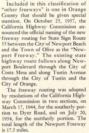
The November/December 1957 California Highways & Public Works announced the California State Route 55 Freeway had been renamed the Newport Freeway by the California Highway Commission.

The January/February 1958 California Highways & Public Works cites when the segments of the California State Route 55/Newport Freeway had been adopted by the California Highway Commission.  The segment of the Newport Freeway south of Dyer Road was adopted by the California Highway Commission on March 17, 1954 (shown in error as 1944) whereas the northern segment was adopted on July 20, 1954.  The Newport Freeway is cited to have a planned length of 17.5 miles. 

The November/December 1958 California Highways & Public Works announced construction funds for 2.6 miles of frontage roads for the future Newport Freeway in Costa Mesa were funded for the 1959-60 Fiscal Year budget.  The freeway frontage road in Costa Mesa was intended to function as an interim one-way couplet alignment of California State Route 55.  

The November/December 1959 California Highways & Public Works noted the first unit of the Newport Freeway between Santa Ana Freeway and Riverside Freeway had been budgeted for the 1960-61 Fiscal Year. 

The March/April 1961 California Highways & Public Works noted the California State Route 55/Newport Freeway frontage road in Costa Mesa had been completed on May 31, 1960.  Numerous segments of the Newport Freeway north of the Santa Ana Freeway are noted to be under construction with the segment to Chapman Avenue anticipated to be complete by February 1962.  The article stub notes contract plans for 5.4 miles of the Newport Freeway south of the Santa Ana Freeway to Palisades were being prepared.  


The March/April 1962 California Highways & Public Works noted the California State Route 55/Newport Freeway had opened from the Santa Ana Freeway northward three miles to Chapman Avenue.  The segment of the Newport Freeway north to the Riverside Freeway is noted to have an anticipated opening during the coming September.  


The September/October 1962 California Highways & Public Works announced the California State Route 55/Newport Freeway had opened north of Chapman Avenue in Tustin to the Riverside Freeway on September 4, 1962.  

California State Route 55/LRN 43 is shown to be realigned onto the Newport Freeway between Interstate 5/US Route 101 at the Santa Freeway north through Tustin to US Route 91 at the Riverside Freeway on the 1963 Division of Highways Map


The March/April 1963 California Highways & Public Works featured a photo of the completed Newport Freeway north of the Santa Ana Freeway. 


The Newport Freeway from Chapman Avenue in Tustin is featured in the July/August 1963 California Highways & Public Works


The November/December 1963 California Highways & Public Works noted the Newport Freeway was under construction south from the Santa Ana Freeway towards Warner Avenue.  


As part of the 1964 State Highway Renumbering the Legislative Route Numbers were dropped in favor of Sign State Route designations.  California State Route 55 was legislatively designated as "From Newport Beach to Route 91 in Santa Ana Canyon."  The new legislative designation of California State Route appears for the first time on the 1964 Division of Highways Map


The March/April 1964 California Highways & Public Works announced the Newport Freeway extension to Warner Avenue was anticipated to be complete before the end of the calendar year.  Construction of the Newport Freeway 3.9 miles south from Warner Avenue to Bristol Street/Palisades Road is cited to have an anticipated groundbreaking during 1965. 


The November/December 1964 California Highways & Public Works announced California State Route 55 had been rerouted to the Warner Avenue extension of the Newport Freeway during December 1964.  


The 1965 Division of Highways Map displays California State Route 55 shifted to the Warner Avenue extension of the Newport Freeway. 


The January/February 1967 California Highways & Public Works announced the Newport Freeway was completed upon the opening of segment south of Warner Avenue to Bristol Street/Palisades Road during December 1966.  The new segment of the Newport Freeway included an interchange with the incomplete San Diego Freeway (Interstate 405). 


The Newport Freeway appears extended to Bristol Street in Costa Mesa on the 1967 Division of Highways Map.  


The Newport Freeway designation was changed to the "Costa Mesa Freeway" by 1976 Assembly Concurrent Resolution Number 177, Chapter 86.  The change to "Costa Mesa Freeway" was effective over California State Route 55 Postmiles ORA 2.032-R17.61.

California State Route 55 was upgraded to freeway standards from Bristol Street south to 19th Street in Costa Mesa by 1990.  During 1999 the Newport Beach Grade Separation was replaced by a modern interchange structure.  During 2009 Assembly Bill 344, Chapter 238 authorized the relinquishment of California State Route 55 in the city of Newport Beach.  During May 2013 the California Transportation Commission relinquished California State Route 55 in Newport Beach from Finnley Avenue to the Newport Channel Bridge.  2014 Assembly Bill 2752, Chapter 345 amended the southern definition of California State Route 55 to end at the Newport Channel Bridge.  

Comments

Popular posts from this blog

Cajon Pass; Cajon Pass Toll Road, National Old Trails Road, US Route 66/91/395 and Interstate 15

This past weekend I spent some time in Cajon Pass traversing the many historic road alignments. Cajon Pass is located in San Bernardino County, California along the San Andreas Fault.  Cajon Pass  serves the boundary line between the Mojave Desert, the San Gabriel Mountains, San Bernardino Mountains and San Bernardino Valley.  Cajon Pass is historically one of the most traveled transportation corridors in American California and presently is served by four rail lines, Interstate 15 and California State Route 138. While Cajon Pass is known mostly for carrying US Route 66 it has carried numerous other signed highways that have had a significant impact on regional and national road travel.  While this is my best attempt to compile everything from the best sources I could find into one single transportation history blog regarding road travel in Cajon Pass I suspect as time goes on this article will be frequently updated.  If you have any information that you ...

Pardee Dam Road

Pardee Dam is a 358-foot-high concrete structure located near Campo Seco at the Calaveras County and Amador County Line.  Pardee Dam impounds the Mokelumne River which forms the namesake Pardee Reservoir.  Pardee Dam was completed during 1929 and is part of the East Bay Municipal Utility District.  Pardee Dam is accessed by the namesake Pardee Dam Road which crosses the structure via the one-lane road seen as the blog cover photo.   Part 1; the history of Pardee Dam Road The closest community to Pardee Dam is that of Campo Seco on the Calaveras County side of the Mokelumne River.  Campo Seco was founded in 1850 by Mexican Miners who worked placer claims in Oregon Gulch during the height of the California Gold Rush.  Campo Seco would reach a population of about three hundred by 1860 spurred by the numerous mining claims in the area.  Main Street of Campo Seco flowed directly into the Campo Seco Turnpike which had been authorized by the California L...

California State Route 82/Old US Route 101 on the El Camino Real from San Francisco to Interstate 380

After completing Interstate 380 I made my way northward into the City Limits of San Francisco to drive the northernmost portion of California State Route 82. CA 82 is 52 mile State Route between I-280 in San Francisco southward to Interstate 880 in San Jose.  CA 82 is significant due to it being part of the historical surface alignment of US Route 101 and the El Camino Real. The "El Camino Real" was a Spanish Highway in Las Californias and Alta California which connected the 21 Catholic Missions along the coast.  Essentially the route of the El Camino Real was plotted out in the late 1700s from two Spanish survey expeditions.  The Missions were plotted approximately 30 miles apart along the 600 mile route so that they would be a single day journey by horse.  The El Camino Real name fell into disuse after the Mexican Revolution of 1821 but was revived by American highway promoters in the 1890s and 1900s.  Today the El Camino Real is mostly associated...