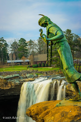
Legend says that a young Cherokee princess named Noccolula, on her wedding day, wishing not to marry the man her father arranged for her, leaped to her death at the site of a great waterfall.
The land surrounding the falls changed hands several times in the 19th century. A former Gadsden mayor, Rueben A. Mitchell, purchased the land surrounding the falls in 1909. He intended to sell the land to the city for a future park. The City of Gadsden purchased the land in 1950 and began efforts to convert it into a city park.
The statue of Noccolula that graces the falls was commissioned by the Gadsden Women's Club. Installed in 1969, the statue depicts Princess Noccolula as she is about to leap into the falls.
Noccolula Falls and the hiking trails that surround them are free of charge. Noccolula Falls Park is operated by the City of Gadsden Park. The park charges a small admission fee of $8/adults & $6 for children/seniors. Kids under three are free. The park has mini-golf, a petting zoo, two miniature trains, a botanical garden, and more.
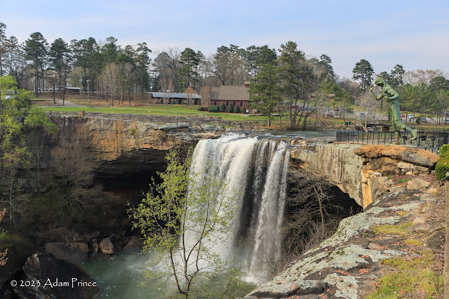
Noccolula Falls, a 90-foot cascade into the Black Creek Gorge near Gadsden, is one of Northeastern Alabama's most popular spots for hiking and camping. Located at the western end of Lookout Mountain, the falls are surrounded by a city park, campground, and a popular wedding chapel.
Noccolula translates to the "place where water thunders." The falls, whose water flow can vary by season, are an impressive sight with many great vantage points.
The land surrounding the falls changed hands several times in the 19th century. A former Gadsden mayor, Rueben A. Mitchell, purchased the land surrounding the falls in 1909. He intended to sell the land to the city for a future park. The City of Gadsden purchased the land in 1950 and began efforts to convert it into a city park.
The statue of Noccolula that graces the falls was commissioned by the Gadsden Women's Club. Installed in 1969, the statue depicts Princess Noccolula as she is about to leap into the falls.
Noccolula Falls and the hiking trails that surround them are free of charge. Noccolula Falls Park is operated by the City of Gadsden Park. The park charges a small admission fee of $8/adults & $6 for children/seniors. Kids under three are free. The park has mini-golf, a petting zoo, two miniature trains, a botanical garden, and more.
All photos were taken by post author - March 16, 2023.
Sources & Links:
- Noccolula Falls Park
- Noccolula Falls Park ---Encyclopedia of Alabama
- Noccolula Falls Park ---ExploreSouthernHistory.com
How To Get There:


Comments