Calimesa is a city located in Riverside County near the outskirts of San Gorgonio Pass. When the US Route System was created during November 1926 only US Route 99 was aligned through the community via what is now Calimesa Boulevard along with parts Copper Drive and Roberts Road. US Route 99 was joined through Calimesa by US Route 70 in 1935. US Route 99-70 would move to a new expressway alignment during 1951 onto a grade which would eventually become Interstate 10. Featured as the cover of this blog is former US Route 99-70 in Calimesa on Roberts Road. Below what was the original alignment of US Route 99-70 through Calimesa can be seen between Redlands of San Bernardino County and Beaumont on the 1935 Division of Highways Map of Riverside.
This blog is part of the larger Gribblenation US Route 99 Page. For more information pertaining to the other various segments of US Route 99 and it's three-digit child routes check out the link the below.
Part 1; the history of former US Route 99-70 in CalimesaThe origins of the current community of Calimesa are relatively modern. What is now Calimesa was traditionally tied to neighboring Yucaipa which is located to the north in San Bernardino County. During June 1929 approximately 100 local residents attended a meeting and decided to apply for their Post Office designation in Riverside County. A contest for naming was held through which the community's name of Calimesa was ultimately selected. The name Calimesa is amalgamation of "California" and the Spanish word table in the form of "mesa." Ultimately Calimesa would incorporate as a city on December 1st, 1990.
What would become US Route 99 (US 99) and US Route 70 (US 70) in Calimesa was added to the State Highway System as part of the 1916 Second State Highway Bond Act in the form of Legislative Route Number 26 (LRN 26). The initial definition of LRN 26 originated in San Bernardino and terminated in El Centro. LRN 26 appears a planned highway through the future site of Calimesa on the 1918 California Highway Commission map.
The
November 1924 California Highways & Public Works announced 7.1 miles of LRN 26 between Redlands and Beaumont would soon be paved.
The
August 1925 California Highways & Public Works featured the completed surfacing concrete on the Redlands-Beaumont corridor of LRN 26. The article stub notes the recently surfaced Redlands-Beaumont corridor of LRN 26 was originally constructed via grading during 1920.

The initial draft of the US Route System was approved by the Secretary of Agriculture during November of 1925. The US Route System within California was approved by California Highway Commission ("CHC") with no changes recommended which can be seen in January 1926 California Highways & Public Works. US 99 is shown departing San Bernardino via LRN 26 towards Imperial Valley via the corridor which would become Calimesa.


Thusly planned US 99 appears on the 1925 Rand McNally Map of California following LRN 26 between Redlands and Beaumont.
The US Route System was formally approved by the American Association of State Highway Engineers (AASHO) on November 11th, 1926. which formally brought US 99 into existence on LRN 26 in the Redlands-Beaumont corridor.
A September 1934 exchange of letters between the California State Highway Engineer and AASHO acknowledged US 70 had been extended into California with an endpoint following US 60 into downtown Los Angeles. The routing definition of US 70 indicated it would multiplex US 99/US 60 east from downtown Los Angeles to Pomona and onwards to US 60 east to Beaumont.


US 70 is shown in the 1936 US Route descriptions provided by the California Highway Commission (CHC) to have been realigned onto US 99/LRN 26 between Beaumont and Pomona. The realignment of US 70 onto US 99/LRN 26 between Beaumont and Pomona is stated to have been recommended by the CHC to the AASHO on March 1st, 1935. This new routing of US 70 brought onto a multiplex US 99/LRN 26 in Calimesa.

As noted in the intro what was the original alignment of US Route 99-70 through Calimesa can be seen between Redlands of San Bernardino County and Beaumont on the 1935 Division of Highways Map of Riverside.
The May/June 1950 California Highways & Public Works features the expansion of US 99/US 70/LRN 26 in Calimesa. The article stub notes Calimesa was the last section of US 99/US 70 between Los Angeles and Palm Springs to be two-lanes wide. The expansion of US 99/US 70/LRN 26 was a four-lane expressway over a 9.6-mile project zone. The new four-lane expressway grade of US 99/US 70/LRN 26 was largely a completely new alignment detached from than existing Calimesa Boulevard.
The
May/June 1951 California Highways & Public Works featured the newly completed divided expressway segment of US 99/US 70/LRN 26 in Calimesa. The Calimesa expressway segment of US 99/US 70/LRN 26 is stated to have opened to traffic on May 21st, 1951. Part of the new alignment of US 99/70/LRN 26 in Calimesa included a new junction with US 60 on the outskirts of Beaumont. The article stub notes that the bottle neck on US 99/US 70/LRN 26 through the Calimesa business district on Calimesa Boulevard was relieved by the new expressway.


On June 29th, 1956, the Federal Highway Aid Act of 1956 was signed into law on the Federal Level. The Federal Highway Aid Act of 1956 was the genesis point of the Interstate Highway System which would in the coming decade sew the demise via of US 99 and US 70 in Calimesa by way of being replaced by Interstate 10.
The
November/December 1961 California Highways & Public Works noted the freeway bypass alignment of US 99/US 70/Interstate 10/LRN 26 through Redlands was under way. Once complete US 99/US 70/Interstate 10 would have 125 continuous miles of freeway and expressway between Los Angeles and Indio.
The
January/February 1962 California Highways & Public Works announced the new US 99/US 70/US 60/Interstate 10/LRN 26 bypass of Beaumont and Banning were expected to open to traffic during the coming March. The bypass of Beaumont and Banning included a new interchange between US 60/LRN 19 and US 99/US 70/Interstate 10/LRN 26.


The
September/October 1962 California Highways & Public Works announced the opening of the US 99/US 70/Interstate 10/LRN 26 freeway bypass of Redlands. The new freeway alignment through Redlands is cited to have been opened on August 28th, 1962. Combined with the recently completed Beaumont-Banning bypass only approximately 12 miles of existing US 99/US 70/Interstate 10/LRN 26 through the Calimesa area were left in need of freeway conversion.


The truncation of US 99 from Calexico to the junction of the Golden State Freeway and San Bernardino Freeway in Los Angeles was approved by the AASHO Executive Committee on June 19th, 1963. The justification by the California Division of Highways to truncate US 99 was to avoid what the agency viewed as confusing multiplexes on the new Interstate corridors of Southern California. The truncation of US 99 to Los Angeles left US 70 and Interstate 10 as the multiplexed highway through Calimesa.
US 70 was approved to be truncated from Los Angeles to US 95 in Blythe by the AASHO on August 26th, 1963. The truncation of US 70 left only Interstate 10 as the only signed route through Calimesa. LRN 26 would be dropped along with all the Legislative Route Numbers as part of the 1964 State Highway Renumbering.

Part 2; exploring former US Route 99-70 in Calimesa
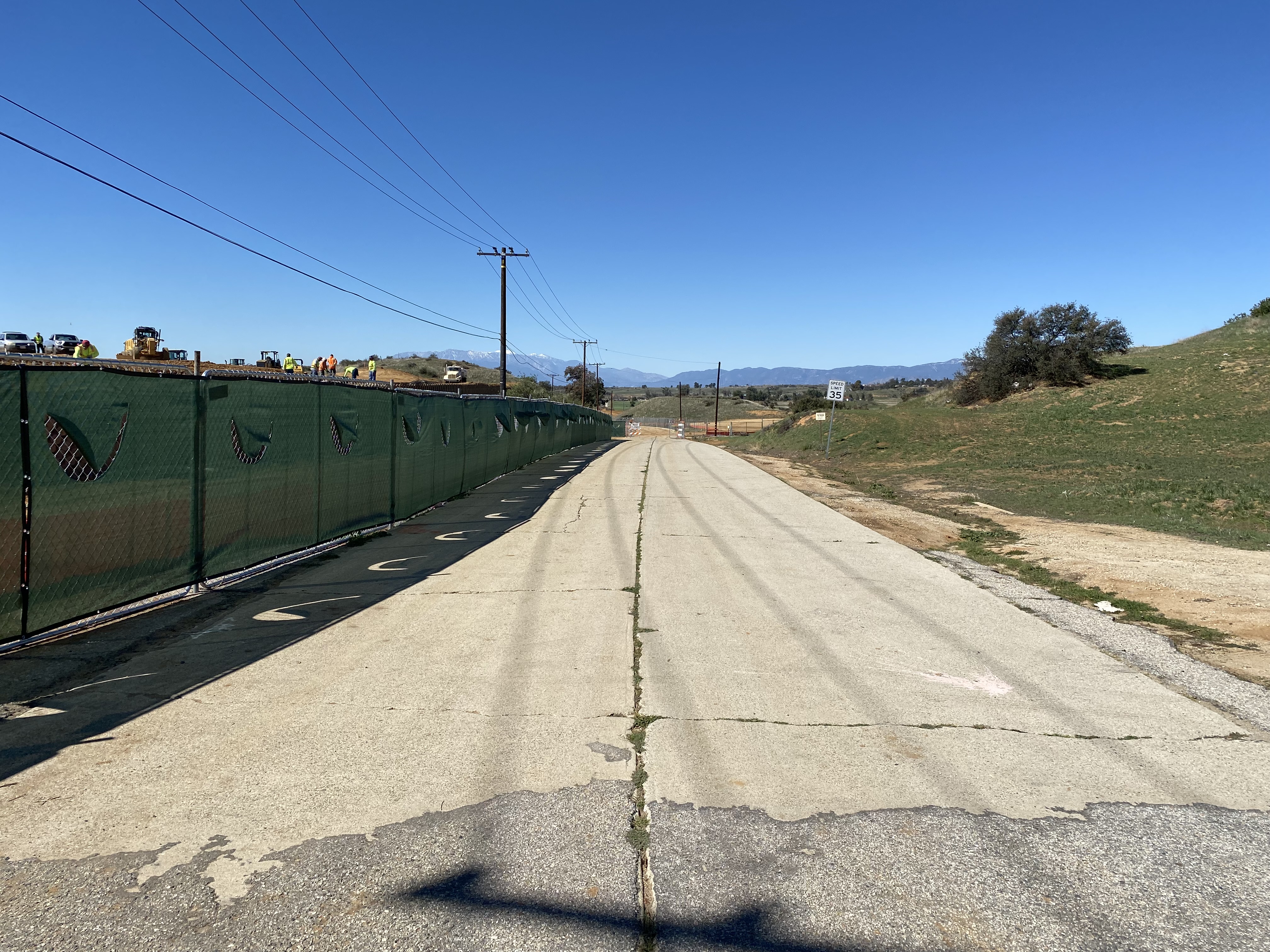
Upon being upgraded to expressway standards in 1951 an approximately one-mile segment of former US 99/US 70 was isolated and incorporated into what is now Copper Drive and Roberts Road. This particular segment one mile of former US 99/US 70 retained the same concrete poured during 1925 before the US Route System was finalized.
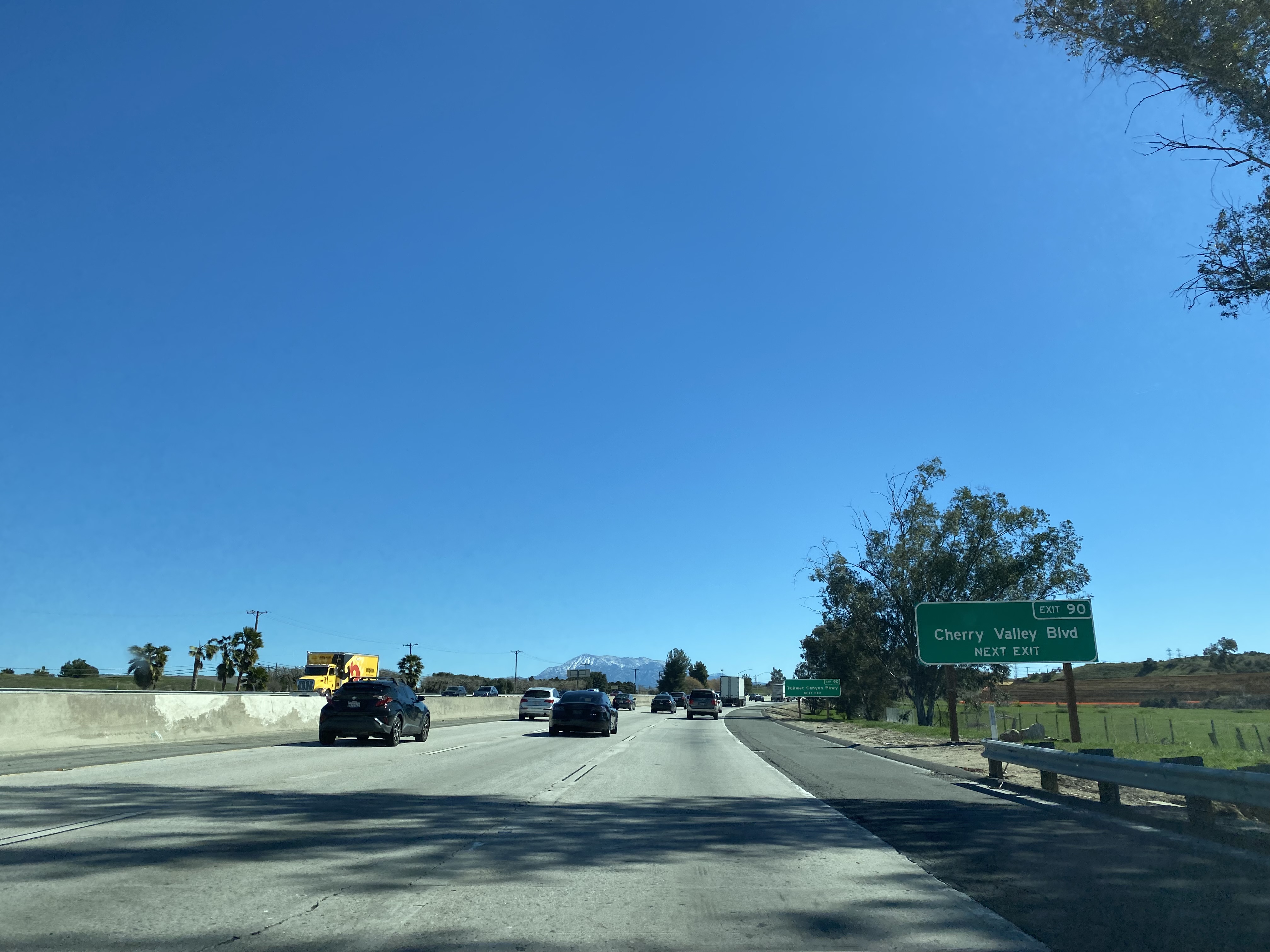
Former US 99/US 70 on Roberts Road in Calimesa can be accessed from modern Interstate 10 Exit 90 onto Cherry Valley Boulevard.
From Cherry Valley Boulevard former US 99/US 70 on Roberts Road can be accessed south of Interstate 10. The remaining concrete segment of US 99/US 70 on Roberts Road appears to be endangered by new housing construction as of February 2022.
The overall scale of the remaining concrete from US 99/US 70 can be seen spanning from Copper Drive eastward via Roberts Road to Cherry Valley Boulevard.
Further Reading
Continuing north on 1926-1934 alignment of US Route 99 to Redlands and Los Angeles?
Continuing north of the 1935-1963 alignment of US Route 99 to Redlands and Los Angeles?
Continuing south on US Route 99 to the communities of San Gorgonio Pass?







Comments