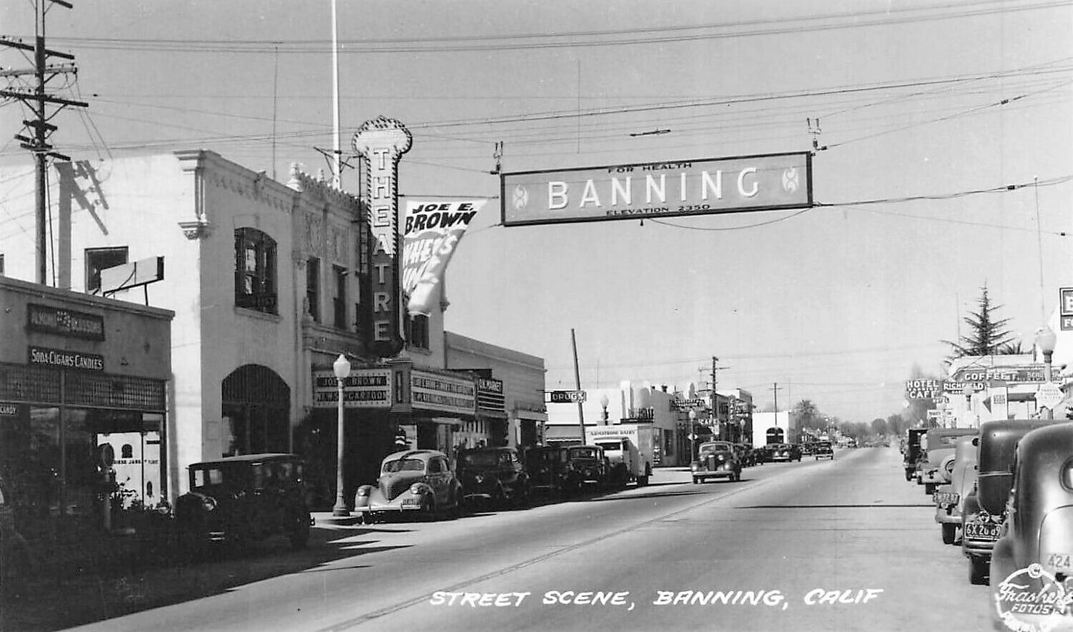
San Gorgonio Pass is located in Riverside County, California in the divide between the San Bernardino Mountains and San Jacinto Mountains. San Gorgonio Pass is home to several communities which were part of US Routes 99, 60 and 70. This blog will explore the alignment history of US Routes 99-60-70 within the communities of Beaumont, Banning and Cabazon. Pictured above as the blog cover is US Routes 99-60-70 facing west on Ramsey Street in downtown Banning during 1952.
This blog is part of the larger Gribblenation US Route 99 Page. For more information pertaining to the other various segments of US Route 99 and it's three-digit child routes check out the link the below.
Part 1; the history of US Routes 99-60-70 in San Gorgonio Pass
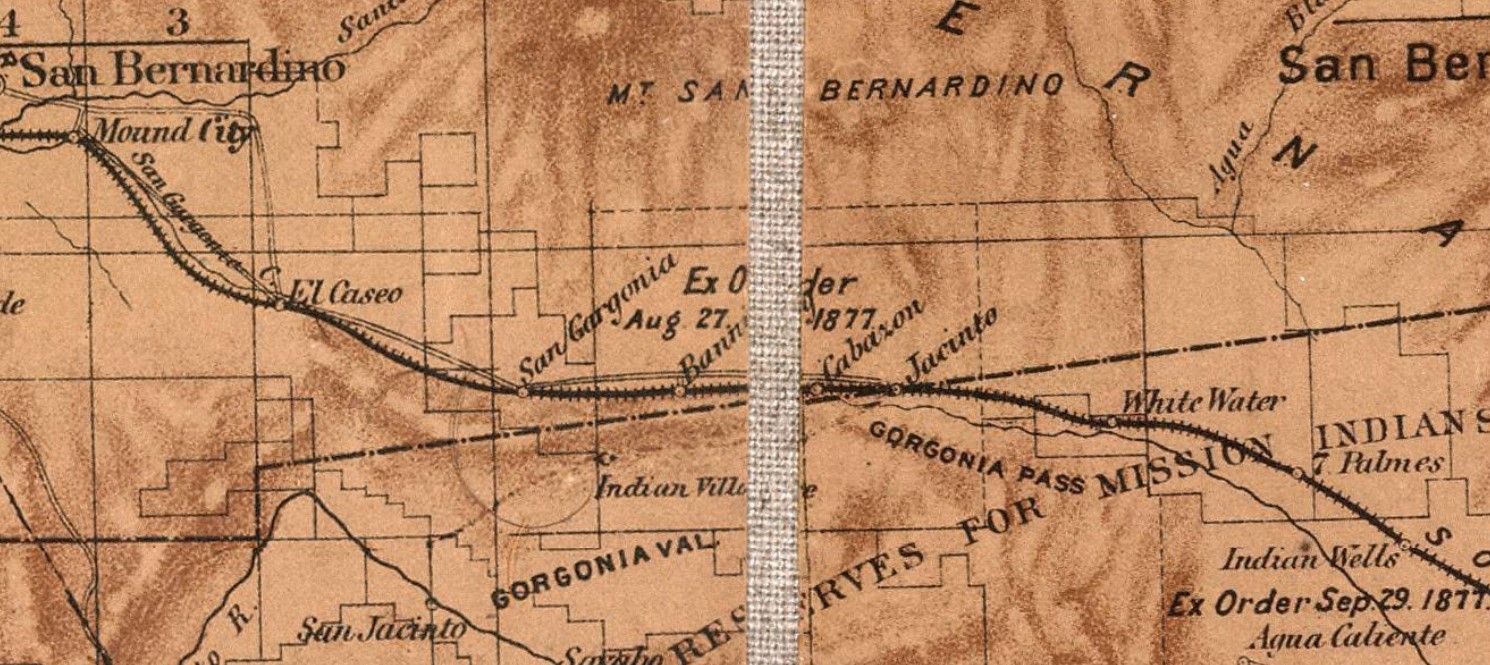
Modernized transportation San Gorgonio Pass dates back to the days of the Bradshaw Trail which was a stage route originating in San Bernardino which crossed through the Sonoran Desert east to the Colorado River. During the California Gold Rush the Bradshaw Trail was plotted through the Sonoran Desert by William D. Bradshaw. The Bradshaw Trail was plotted in 1862 through the San Gorgonio Pass and Sonoran Desert east over the Colorado River to a new mining strike found in La Paz, Arizona. Bradshaw consulted the Cahuilla Tribe who advised him of the best route east of the Salton Sink between the Orocopia Mountains and Chocolate Mountains. More information regarding the Bradshaw Trail and where to find it can be found on desertusa.com.
Below the Bradshaw Trail can be in San Gorgonio Pass on the 1873 Bancroft's Map of California, Nevada, Utah and Arizona.
During the 1870s the Southern Pacific Railroad would begin laying a line through San Gorgonio Pass and establishing siding facilities. During 1875 the Southern Pacific Railroad laid line through the future site of Beaumont and would plot Summit Station. During 1876 the Southern Pacific Railroad would build its line east from Summit Station to the vicinity of Gillman's Ranch at what is now Banning. Later in the 1870s the Southern Pacific Railroad would establish a station known as "Cabezone" near the Native American Rancheria of the same name.
In 1884 the town site of Cabazon was laid out by the Cabazon Land Company. Also, during 1884 a real estate development company would plot a town at San Gorgonio Station (originally Summit Station) which was originally called San Gorgonio. 1884 would also see a survey for town site of Banning. San Gorgonio Station, Banning and Cabazon can be seen on the Bradshaw Trail and Southern Pacific Railroad on the 1882 Bancroft's Map of California and Nevada.
During 1887 San Gorgonio Station was purchased by a second real estate developer and renamed as Beaumont. Beaumont would incorporate as a city on November 18th, 1912. Banning would soon after also incorporate as a city on February 6th, 1913.
What would become US Route 99 (US 99), US Route 60 (US 60) and US Route 70 (US 70) in San Gorgonio Pass was added to the State Highway System as part of the 1916 Second State Highway Bond Act in the form of Legislative Route Number 26 (LRN 26). The initial definition of LRN 26 originated in San Bernardino and terminated in El Centro. LRN 26 appears a planned highway through the communities of San Gorgonio Pass on the 1918 California Highway Commission map.
The
1924 Rand McNally Map of California reveals LRN 26 in San Gorgonio Pass to be part of the Southern National Highway and Atlantic & Pacific Highway. Through Beaumont LRN 26 was aligned on 6th Street, Ramsey Street within Banning and Main Street within Cabazon.
The November 1924 California Highways & Public Works announced 7.1-miles of LRN 26 between Redlands and Beaumont would soon be paved.
The
August 1925 California Highways & Public Works featured the completed concrete surfacing on the Redlands-Beaumont corridor of LRN 26 at the future site of Calimesa. The article stub notes the recently surfaced Redlands-Beaumont corridor of LRN 26 was originally constructed via grading during 1920.

The September 1925 California Highways & Public Works features photos of the San Gorgonio Wash Bridge on LRN 26.
The initial draft of the US Route System was approved by the Secretary of Agriculture during November of 1925. The US Route System within California was approved by California Highway Commission ("CHC") with no changes recommended which can be seen in January 1926 California Highways & Public Works. US 99 is shown departing San Bernardino via LRN 26 towards Imperial Valley via the communities of San Gorgonio Pass.


Thusly planned US 99 appears on the 1925 Rand McNally Map of California following LRN 26 through San Gorgonio Pass.
The US Route System was formally approved by the American Association of State Highway Engineers (AASHO) on November 11th, 1926. which formally brought US 99 into existence on LRN 26 in the San Gorgonio Pass corridor.
The
May/June 1928 California Highways & Public Works notes a weigh station had been installed on US 99/LRN 26 east of Banning. The Division of Motor Vehicles requested a weigh station be installed due to US 99/LRN 26 carrying heavy traffic from Indio to Riverside.

As originally envisioned in the early drafts of US Route System what became US 66 in California was intended to be US 60. The designation of the Chicago-Los Angeles corridor was intended to carry a X0 route number given it was to denote a major east/west US Route. Ultimately the State of Kentucky petitioned to have a X0 US Route and the Chicago-Los Angeles corridor became US 66 in the finalized US Route System created by the American Association of State Highway Officials (AASHO) during November 1926.
US 60 would rapidly be extended after the US Route System was created and would come into play in California during the early 1930s. A letter from the AASHO Executive Secretary to the California State Highway Engineer dated Marth 30th, 1931 noted that US 60 had been tentatively approved to be extended to California during the AASHO Executive Committee on May 26th, 1930. The approval of US 60 being extended to California carried the stipulation that the Colorado River Bridge in Blythe be purchased by the California Division of Highways and Arizona State Road Department. The letter noted California and Arizona had taken steps through their respective legislatures to purchase the Colorado River Bridge and the terminus of US 60 to be at an undisclosed location in Los Angeles.


A letter from the California State Highway Engineer to the AASHO Executive Secretary on April 13th, 1931, noted legislation to purchase the Colorado River Bridge had been passed in California. The purchase of the Colorado River Bridge effectively made the extension of US 60 into California active.
The California State Highway Engineer submitted a recommended routing of US 60 to the AASHO Executive Secretary on September 8th, 1931. The route description of US 60 show as ending in Los Angeles by way of Pomona at an undisclosed terminus. The routing of US 60 defined it as following US 99/LRN 26 through San Gorgonio Pass and departing onto Jack Rabbit Trail from Beaumont west through the Moreno Valley Badlands towards Riverside.
A September 1934 exchange of letters between the California State Highway Engineer and AASHO acknowledged US 70 had been extended into California with an endpoint following US 60 into downtown Los Angeles. The routing definition of US 70 indicated it would multiplex US 99/US 60 east from downtown Los Angeles to Pomona and onwards multiplexed with US 60 east to Beaumont and US 99/US 60 through San Gorgonio Pass.


The
January 1935 California Highways & Public Works notes US 99/US 60/US 70/LRN 26 between Beaumont and Cabazon was part of a 1935 Federal Aid Project which would even out the existing highway surface dips. A second project notes US 99/US 60/US 70/LRN 26 was to be widened between Banning east to Whitewater.
US 70 is shown in the 1936 US Route descriptions provided by the California Highway Commission (CHC) to have been realigned onto US 99/LRN 26 between Beaumont and Pomona. The realignment of US 70 onto US 99/LRN 26 between Beaumont and Pomona is stated to have been recommended by the CHC to the AASHO on March 1st, 1935. This new routing of US 70 brought onto a multiplex US 99/LRN 26 through Calimesa to US 60 in Beaumont.

The March 1936 California Highways & Public Works features truck traffic on US 99/US 60/US 70/LRN 26 near Banning.
Below US 99/US 60/US 70/LRN 26 on westbound Ramsey Street in Banning can be seen below during 1937.
The upcoming improvement of US 99/US 70/LRN 26 west of Beaumont to the San Bernardino County Line is detailed in the
March 1938 California Highways & Public Works. Much of the improvements over the previous recent years on US 99/US 60/US 70/LRN 26 in San Gorgonio Pass are detailed.
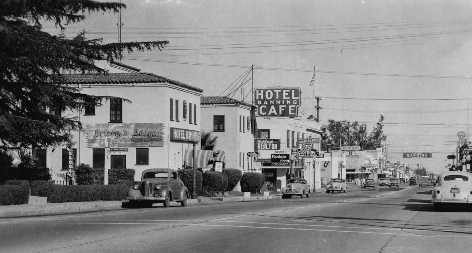
Below US 99/US 60/US 70/LRN 26 on eastbound Ramsey Street in Banning can be seen below during 1947.
US 99/US 60/US 70/LRN 26 on 6th Street can be seen facing westbound in the undated photo below.
US 99/US 60/US 70/LRN 26 can be seen on Main Street in Cabazon during 1947 in the below photo by Darin Kuna of the U.S. Highway 60 Facebook page (sourced from a Pomona Public Library Photo). A comparison image from Google during 2021 can be seen as a contrast.
The December 1948 California Highways & Public Works notes US 99/US 60/US 70/LRN 26 was expanded to four lanes between Banning-Whitewater during 1940. The original two travel lanes are described as having been widened.
The May/June 1950 California Highways & Public Works features the expansion of US 99/US 70/LRN 26 in Calimesa. The article stub notes Calimesa was the last section of US 99/US 70 between Los Angeles and Palm Springs to be two-lanes wide. The expansion of US 99/US 70/LRN 26 was a four-lane expressway over a 9.6-mile project zone. The new four-lane expressway grade of US 99/US 70/LRN 26 was largely a completely new alignment detached from than existing Calimesa Boulevard.
The
May/June 1951 California Highways & Public Works featured the newly completed divided expressway segment of US 99/US 70/LRN 26 in Calimesa. The Calimesa expressway segment of US 99/US 70/LRN 26 is stated to have opened to traffic on May 21st, 1951. Part of the new alignment of US 99/70/LRN 26 in Calimesa included a new junction with US 60 on the outskirts of Beaumont. The article stub notes that the bottle neck on US 99/US 70/LRN 26 through the Calimesa business district on Calimesa Boulevard was relieved by the new expressway.


As noted in the intro US 99/US 60/US 70/LRN 26 can be seen on Ramsey Street in the below photo dated to 1952.
On June 29th, 1956, the Federal Highway Aid Act of 1956 was signed into law on the Federal Level. The Federal Highway Aid Act of 1956 was the genesis point of the Interstate Highway System which would in the coming decade sew the demise via of US 99, US 60 and US 70 in San Gorgonio Pass by way of being replaced by Interstate 10.
The
January/February 1962 California Highways & Public Works announced the new US 99/US 60/US 70/Interstate 10/LRN 26 bypass of Beaumont and Banning were expected to open to traffic during the coming March. The bypass of Beaumont and Banning included a new interchange between US 60/LRN 19 and US 99/US 70/Interstate 10/LRN 26. Upon opening the freeway bypass of Beaumont replaced 6th Street as the through highway in the city.
The truncation of US 99 from Calexico to the junction of the Golden State Freeway and San Bernardino Freeway in Los Angeles was approved by the AASHO Executive Committee on June 19th, 1963. The justification by the California Division of Highways to truncate US 99 was to avoid what the agency viewed as confusing multiplexes on the new Interstate corridors of Southern California. The truncation of US 99 to Los Angeles left US 60, US 70 and Interstate 10 as the multiplexed highway through San Gorgonio Pass.


US 70 was approved to be truncated from Los Angeles to US 95 in Blythe by the AASHO on August 26th, 1963. The truncation of US 70 left only US 60 and Interstate 10 as the only signed routes through San Gorgonio Pass. LRN 26 would be dropped along with all the Legislative Route Numbers as part of the 1964 State Highway Renumbering.
The
November/December 1963 California Highways & Public Works notes the new Truck Scales east of Banning were being constructed alongside the new freeway to Cabazon.
The AASHO Executive Committee approved US 60 to be truncated from downtown Los Angeles to US 95 in Blythe on October 2nd, 1965. The truncation of US 60 to Blythe left only Interstate 10 as the sole highway through San Gorgonio Pass.
Part 2; exploring former US Routes 99-60-70 in San Gorgonio Pass
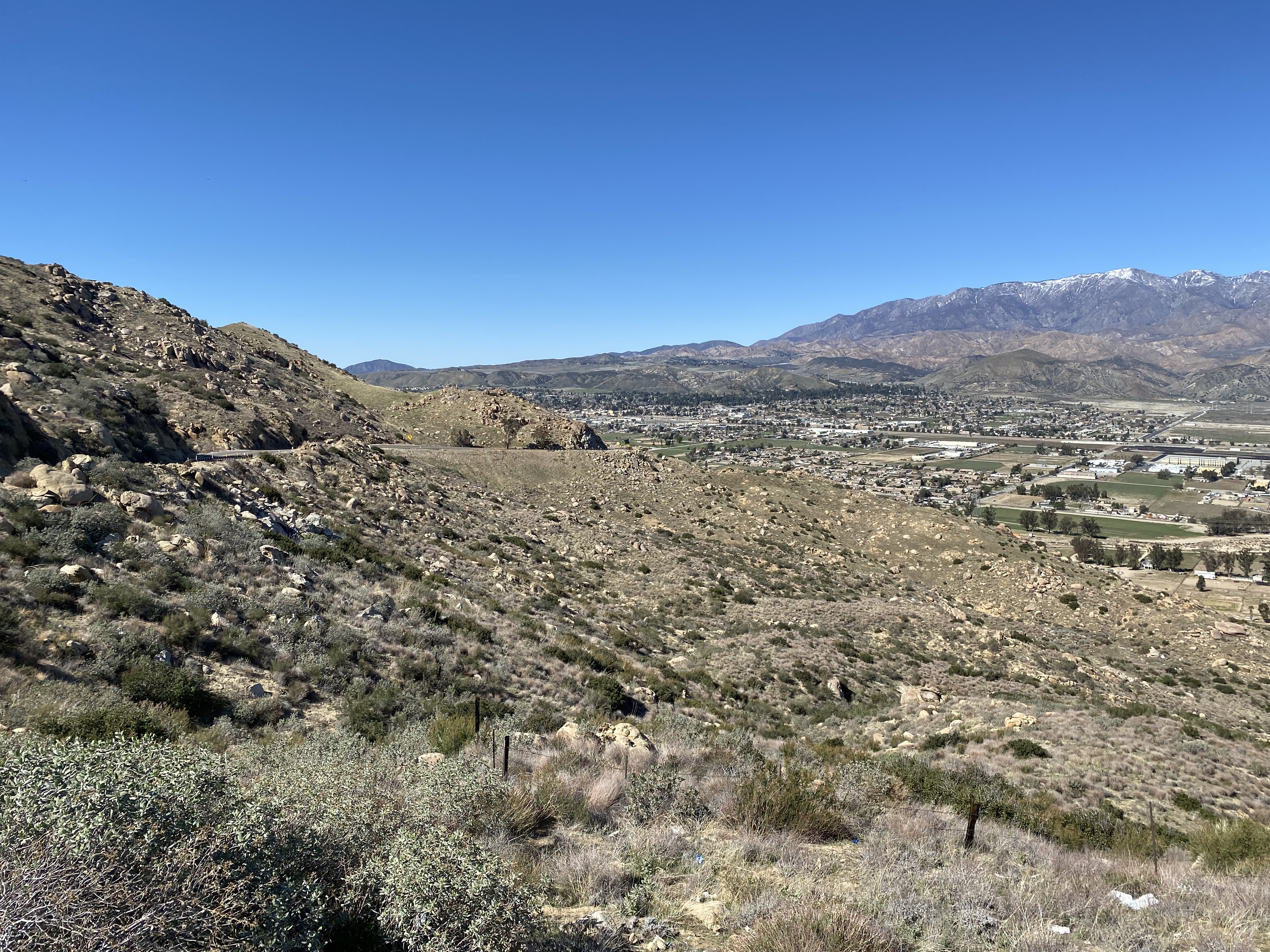
From California State Route 243 in the San Jacinto Mountains the much of former US 99/US 60/US 70 in San Gorgonio Pass can be seen. From left to right one can see Banning and Cabazon.
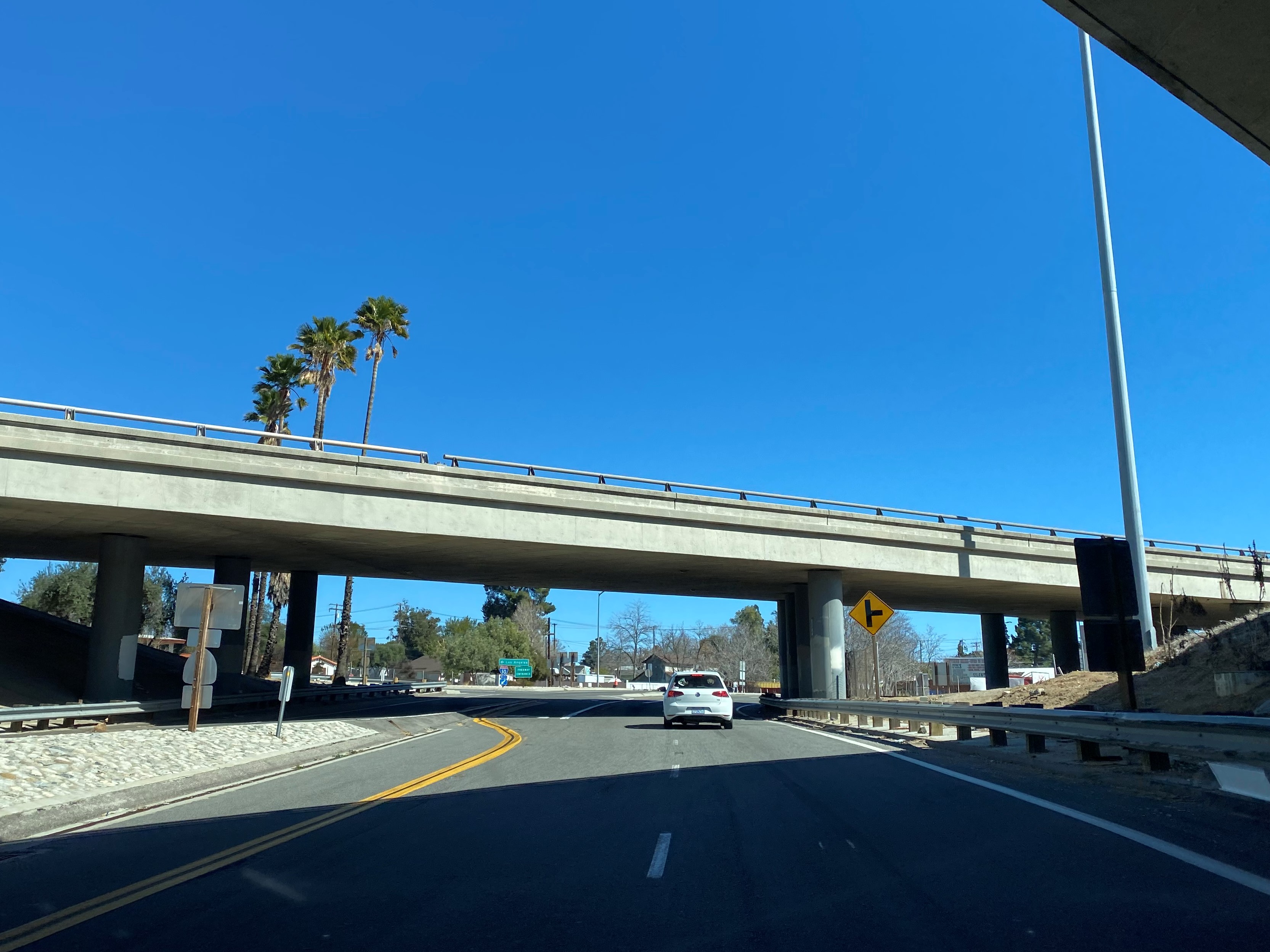
From modern Interstate 10 eastbound traffic can access California State Route 60 and former US 99/US 60/US 70 in Beaumont via Exit 93.
Former US 99/US 60/US 70 would have passed through Beaumont east on 6th Street. Approaching Beaumont Avenue traffic on 6th Street can access Interstate 10 and California State Route 79.
Former US 99/US 60/US 70 continues east on 6th Street to the Beaumont city limit at Highland Springs Avenue.
Former US 99/US 60/US 70 continues east into the city of Banning and transitions onto Ramsey Street. As Ramsey Street approaches 8th Street in Banning traffic can access Interstate 10 and California State Route 243.
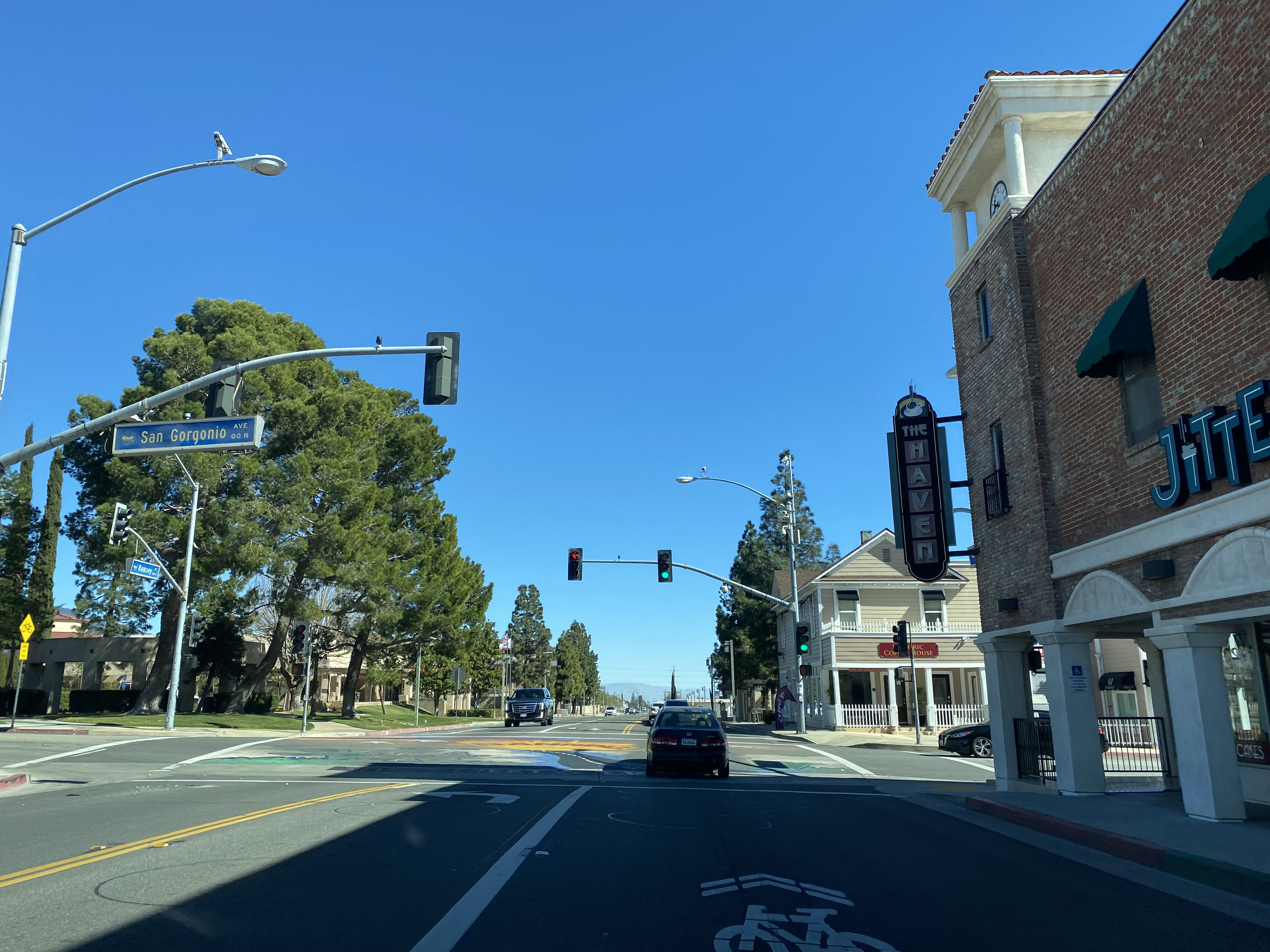
East from 8th Street the former alignment of US 99/US 60/US 70 on Ramsey Street enters downtown Banning. Approaching San Gorgonio Avenue on eastbound Ramsey Street one can observe the same Fox Theatre as the cover photo.
East of Hargrove Street the alignment of US 99/US 60/US 70 on Ramsey Street is broken up by Interstate 10.
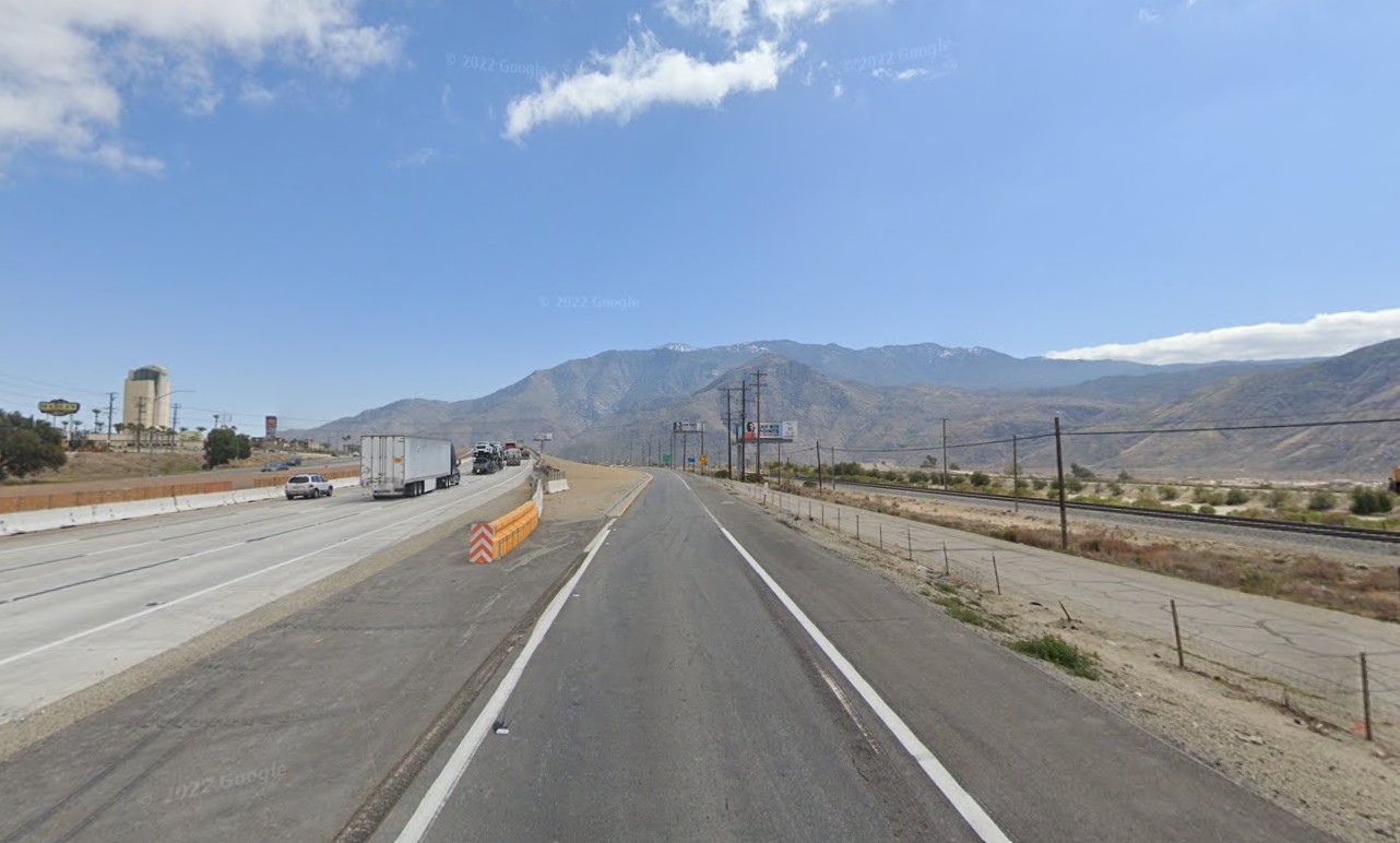
Some of the concrete slabs of US 99/US 60/US 70 between Banning and Main Street in Cabazon can be found south of Interstate 10 (as seen in the Google image below from Interstate 10 Exit 104). As noted in Part 1 the alignment of US 99/US 60/US 70 in Cabazon was on Main Street.
Further Reading
Continuing north on US Route 99 to Calimesa?
Continuing south on US Route 99 to Whitewater?


Comments