
This past Labor Day weekend I found myself in Shasta County on the way home from Lassen Volcanic National Park. That being the case I decided to take a detour on California State Route 273 through Redding and Anderson. California State Route 273 is aligned almost entirely on what was US Route 99 aside from a segment of Market Street in downtown Redding.
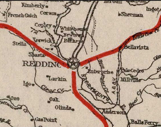
California State Route 273 ("CA 273") is a 16 mile north/south State Highway which serves as a loop of Interstate 5 ("I-5") through the communities of Redding and Anderson. As noted above CA 273 is largely aligned over the previous corridor of US Route 99 ("US 99") but diverges slightly from Market Street in downtown Redding.

This blog is part of the larger Gribblenation US Route 99 Page. For more information pertaining to the other various segments of US Route 99 and it's three-digit child routes check out the link the below.

Part 1; the history of US Route 99/California State Route 273 through Redding and Anderson
Redding and Anderson lie on or near the banks of the Sacramento River of Shasta County. Redding is presently the largest City in the Southern Cascade region as it boasts a population of approximately 92,000 residents. Redding is also the Shasta County Seat and is considered one of the main gateways to Lassen Volcanic National Park.
The first European settlement in modern day Redding was in 1844 when Pierson B. Redding received a Mexican land grant of Rancho Buena Ventura. During the American California Gold Rush mining claims were made near the ghost town of Shasta. These mining claims near Shasta led to the formation of a community known as Poverty Flats. In 1868 the Central Pacific Railroad purchased land in Poverty Flats which it intended to be the northern terminus of it's line to the gold claims of Northern California. By 1872 the Central Pacific Railroad reached Redding and the community began surpass nearby Shasta in importance. Redding was incorporated in 1887 and won the Shasta County Seat from Shasta in 1888.
By extension Anderson was organized as a community on the Central Pacific Railroad in 1872. Anderson derives it's name from Elias Anderson who was a significant land owner in the area who granted land to the Central Pacific Railroad. Anderson being closely located to Redding more or less developed into a suburb and incorporated in 1956. Redding and Anderson can be seen along the Central Pacific Railroad on the 1873 Oregon, California, & Nevada Railroad Map.

The Central Pacific Railroad laid out a road network which served as a frontage facility through the heart of the Southern Cascade and Sacramento Valley. As the 19th Century gave way to the 20th Century the age of the automobile began. The emergence of the automobile led to the 1909 First State Highway Bond Act which was approved by voters during 1910. The majority of the highways approved as part of the First State Highway Bond Act were largely well established routes of travel. In the case of Redding and Anderson it was along the path of what would become Legislative Route 3 ("LRN 3"). According to CAhighways.org the original definition of LRN 3 was "Sacramento to the Oregon Line."
Within Sacramento Valley much of LRN 3 incorporated what was the Central Pacific Railroad frontage roads. Within Redding the implied route of LRN 3 bypassed downtown as it crossed the Sacramento River from what is now Henderson Open Space Park via the 1908 Redding Free Bridge to Smile Place. From Smile Place LRN 3 continued west on Parkview Avenue and turned south on Market Street. At the time LRN 20 traversed downtown Redding north on Market Street and west on Eureka Way towards Weaverville. Within Anderson LRN 3 followed what is now CA 273, Barney Road, and Rhonda Road towards Cottonwood. Early LRN 3 through Redding and Anderson can be seen on the 1917 California State Automobile Association Map. Is likely that the Pacific Highway (which was formed in 1913) used this early route of LRN 3.

The 1918 Division of Highways Map shows LRN 3 crossing the Sacramento River over the 1915 Diestelhorst Bridge. The shift in LRN 3 put the 1908 Redding Free Bridge on LRN 28 State Highway and truncated LRN 20 out of downtown Redding. The new alignment over the Sacramento River departed Market Street north of downtown Redding and swung westward to a crossing via Riverside Drive.
The Pacific Highway can be seen multiplexed with the National Park-to-Park Highway on the 1920 Rand McNally Highway Map of California.


During November of 1926 the US Route System was approved by the AASHO. US Route 99 was aligned over the entirety of LRN 3 between the Oregon State Line south to Sacramento thus making it the signed highway through the roads described above in Redding and Anderson. US Route 99 can be seen aligned on LRN 3 through Redding and Anderson on the 1926 Rand McNally Highway Map of California.

A new bridge for US 99/LRN 3 over the Sacramento River north of downtown Redding is cited to be budgeted for the 1933-35 fiscal years in the January/February 1933 California Highways & Public Works.

The March 1938 California Highways & Public Works details the three phase project to improve US 99/US 299/LRN 3 north of downtown Redding and the Sacramento River. Phase 1 included the completion of the 795 foot long plate girder 1935 Sacramento River Bridge. The 1935 Sacramento River Bridge likely played a huge factor in why the original CA 44 was reassigned as US Route 299 during 1935. Phase 2 included a new direct alignment of US 99/US 299/LRN 3 on Market Street from the north bank of the Sacramento River to Sulpur Creek which was completed in December 1935. Phase 3 was completed during July 1937 between Sulpur Creek and Boulder Hill. The Phase 3 project included a new interchange where US 299/LRN 28 split towards Alturas.


The January 1936 California Highways & Public Works contains more detail of the opening of the 1935 Sacramento River Bridge and the former alignment of US 99/LRN 3 over the Diestelhorst Bridge. The new Sacramento River Bridge is cited have an opening ceremony on December 18th.


The below two maps depict what US 99/LRN 3 would have looked like in downtown Redding and Anderson in 1937.


The July/August 1950 California Highways & Public Works contains an article regarding the new four lane expressway alignment of US 99/LRN 3 between Cottonwood and Anderson. This new expressway alignment of US 99/LRN 3 replaced what is now Main Street, Rhonda Road, and Barney Road between Cottonwood north to Anderson with a grade that lines up with I-5 between Exits 665 north to Exit 667 and modern CA 273 north to Anderson Creek. The article also cities that US 99/LRN 3 was being upgraded from Anderson north to Clear Creek from two lanes to four.


The September/October 1951 California Highways & Public Works goes into great detail regarding improvements to US 99/LRN 3 between Red Bluff north to Redding that occurred from 1937 through 1950. The history of the original two lane 1937 South Redding Railroad Underpass on Market Street is expounded upon in great detail. The 1937 South Redding Railroad Underpass on Market Street is cited to have been renovated as part of a four lane expansion project between downtown Anderson north on US 99/LRN 3 on Market Street to Hill Street in Redding which had been completed by 1950. US 99/LRN 3 is cited to be four lanes from one mile south of Anderson north into Redding.


During the 1964 Highway Renumbering US 99/LRN 3 between Redding and Anderson was given a new designation of of Route 5. The Route 5 designation was implemented in anticipation of I-5 opening as a bypass of Redding and Anderson. This change can be seen on the 1964 Division of Highways State Map.

The November/December 1964 California Highways & Public Works cites that planned route of I-5 around Anderson and Redding north of the Sacramento River was budgeted for 1965-66.

The November/December 1965 California Highways & Public Works cites that the route of I-5 bypassing Anderson and Redding was slated to be complete by fall of 1966.

According to CAhighways.org 1967 Legislative Chapter 1584 moved former US 99 in Redding and Anderson from Route 5 to the new designation of Route 273 ("CA 273"). CA 273 can be seen for the first time on the 1969 Division of Highways State Map.

During February of 1972 the City of Redding closed Market Street between Tehama Street and Placer Street to traffic. This segment of Market Street was subsequently converted into a pedestrian mall which required CA 273 to be rerouted onto a pair of one-way alignments around downtown Redding. During the present year the City of Redding has been working to reopen Market Street between Tehama Street and Placer Street to traffic. It is unclear at this time if this will lead to CA 273 being realigned to Market Street or if it will maintain it's current dual one-way alignments.
Part 2; a drive on California State Route 273
Our approach to CA 273 is from I-5 southbound. I-5 south junctions CA 273 south at Exit 681B in Redding.


CA 273 southbound begins on Market Street in north Redding and is co-signed as Historic US 99. At Postmile SHA 18.616 CA 273 intersects CA 299 at Lake Boulevard. Eureka Way is also where westbound CA 44 terminates at CA 273 at Market Street. Lake Boulevard west of CA 273/CA 299 is Sign County Route A18.


CA 273 south multiplexes CA 299 west on Market Street over the 1935 Sacramento River Bridge to Eureka Way at Postmile SHA 16.836. CA 299 west departs CA 273 south via Eureka Way towards Shasta.


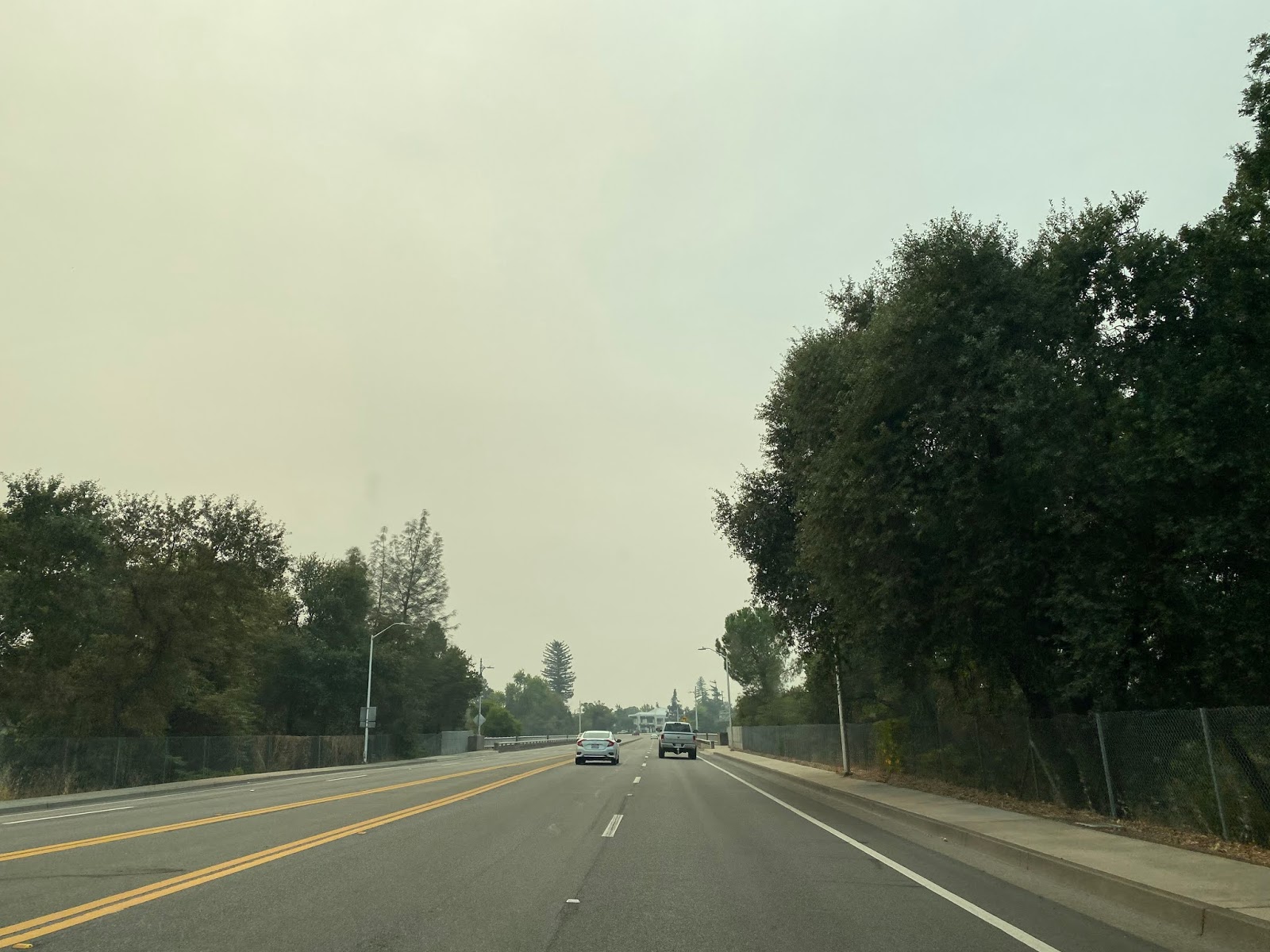


CA 273 south continues on Market Street to Tehama Street at Postmile SHA 16.801L in downtown Redding. CA 273 south makes a right hand turn onto Tehama Street whereas CA 44 eastbound begins with a left hand turn onto Tehama Street. The reconstruction project on Market Street between Tehama Street and Placer Street can be seen in the final photo below.


CA 273 south follows Tehama Street to a left hand turn onto California Street. CA 273 south intersects Sign County Route A16 at the intersection of California Street and Placer Street.


CA 273 south makes a left hand turn onto Gold Street and merges back into with a right hand turn Market Street at Postmile SHA 16.253L. CA 273 north departs Market Street at Pine Street and uses it along with Eureka Way (multiplexed with CA 44 westbound) to reach Market Street north of downtown Redding.


CA 273 south on Market Street passes under the South Redding Railroad underpass and emerges onto a four lane divided expressway.


CA 273 south follows a four lane expressway into the City Limits of Anderson.


CA 273 south passes through downtown Anderson and crosses by the former alignment of US 99 at approximately Postmile SHA 5.208 near South Street.


CA 273 south crosses Anderson Creek and terminates at I-5.


Further Reading
Continuing east or west on former US Route 299?
Continuing north on US Route 99 to Lake Shasta and the Sacramento River Canyon?
Continuing south on US Route 99 to Cottonwood?
Comments