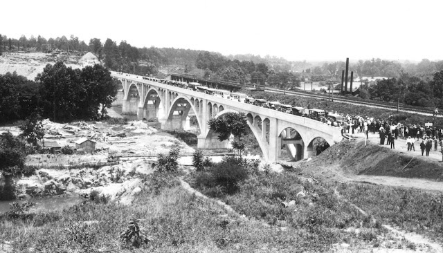
Earlier this month, I brought over the feature I did on the Wil-Cox Bridge
on the old website to the blog. The seven arch concrete open-spandrel
bridge opened in 1924 and was a key piece of the Central Highway.
Recently, Ben Thurkill sent along a handful of photos from the bridge's
1924 opening. The five photos below are part of the NCDOT archives.
Our tagline on the Gribblenation blog is "because every road tells a story". Some roads tell different stories than others. Along our travels, we may see historic markers that tell us a little story about the roads we travel or the places we pass by. Some historic markers are more general, as to telling us who lived where or what old trail traversed between two towns. During my travels across New York State and other states or provinces, I pass by many historic markers, some with interesting or amusing references to roads. I wanted to highlight a few of the markers I've seen along my travels around the Empire State and help tell their stories. Those stories may be as specific as explaining the tales of a tree that was used to help measure a distance of eight miles from Bath to Avoca in Steuben County, as referenced on the Eight Mile Tree historical marker above. They may also help point the way along historical roads first used centuries ago, or may help tell a local l...


Comments