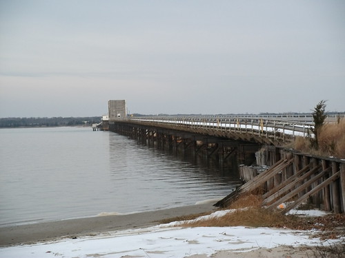
Thursday Jersday: Beesleys Point Bridge

Here's a feature that I plan on doing every Thursday for the next few months. I'll be posting a link to a New Jersey collection of photos I've taken and posted onto Flickr, for your enjoyment.

The first week's installment will take us to the controversial Beesleys Point Bridge, which crosses over the Great Egg Harbor in South Jersey. Enjoy!


Beesleys Point Bridge (December 2011 photos)

Beesleys Point Bridge (February 2005 photos, as a bonus)

Comments

Did not this blog link to "A Trip Within The Beltway"

I recall seeing it here previously...

Popular posts from this blog

The Tale of Tollhouse Road, western California State Route 168 and failed Piute Pass Highway

Western California State Route 168 is entirely located in Fresno County and is linked historically to the Tollhouse Road corridor.   Tollhouse Road is one of the oldest highways in the Sierra Nevada range of Fresno County. The corridor presently begins in at Clovis Avenue in downtown Clovis and extends northeast to Huntington Lake. In 1866 the Woods Brothers established mining claims on Pine Ridge. In 1867 Fresno County would grant the brothers a toll franchise to construct a roadway to the desirable logging areas atop Pine Ridge and near Dinkey Creek. The Woods would establish a tollhouse at the start of their franchise road and lumber mill. The lumber mill attracted settlers which led to the establishment of the mountain town of Tollhouse. Fresno County would purchase the Tollhouse Road in 1878 and make it a public highway. The county would remove the tolls and incorporate the corridor into the existing county road network. Prior to the establishment of Clovis in 1...

California State Route 73

California State Route 73 is 21 mile limited access highway aligned over the Corona del Mar Freeway and San Joaquin Hills Toll Road.  California State Route 73 connects Interstate 5 near San Juan Capistrano westward to Interstate 405 in Costa Mesa.  Prior to the construction of the Corona del Mar Freeway and San Joaquin Hills Tollway California State Route 73 was a surface highway located on largely MacArthur Boulevard. Part 1; the history of California State Route 73 What became California State Route 73 ("CA 73") entered the State Highway System in 1933 as Legislative Route Number 184 ("LRN 184").  LRN 184 was given the following route definition: "LRN 60 near Corona Del Mar to Santa Ana via Main Street" LRN 184 was announced in the April 1933 California Highways & Public Works .   LRN 184 appears for the first time on the  1934 Division of Highways Map .   LRN 184 appears under State Maintenance from US Route 101/LRN 2 in Santa Ana south ...

Mormon Emigrant Trail (Emergency US Route 50 Alternate)

Mormon Emigrant Trail is an approximately 24.5-mile portion of the original routing of the Carson Pass Highway in Eldorado National Forest.  Mormon Emigrant Trail begins at California State Route 88 near Alder Hill and extends westward to Eldorado County Route J16 at Sly Park Road.   Carson Pass was a known crossing of the Sierra Nevada by the Washoe and was surveyed in an 1844 expedition led by John C. Fremont.  The Carson Pass Highway was plotted as a wagon road by the Mormon Battalion in 1848 and was once the primary crossing of the Sierra Nevada.  By the 1880s the Carson Pass Highway had several spurs with the primary traffic corridor being rerouted to Jackson.  The original routing towards Placerville would come to be known as Morman Emigrant Trail and became part of Eldorado National Forest in 1910.  Morman Emigrant Trail is part of Forest Road 10N50 and Eldorado National Forest Route 5.  Despite being a seasonally maintained roadway corrido...