Damaged from Irene, Mohawk Trail Finally Reopens

Due to significant damage caused by Tropical Storm Irene in late August, a portion of MA Route 2 connecting the towns of North Adams, Florida, Savoy, and Charlemont in northern Berkshire and Franklin counties was closed. Because MA 2 (Mohawk Trail) is a major connecting route between the communities in the area, it was imperative to reconstruct the damaged portion of the roadway in a quick fashion. Construction had to be done from the base up. As a result, this section of MA 2 has finally reopened to traffic, effective December 15, 2011. This is one of the final stretches of roadway that has reopened to traffic after being damaged from the remnants of Hurricane Irene.


http://www.flickr.com/photos/massdot/sets/72157627932012320/

MA 2 construction photos from MassDOT on Flickr.


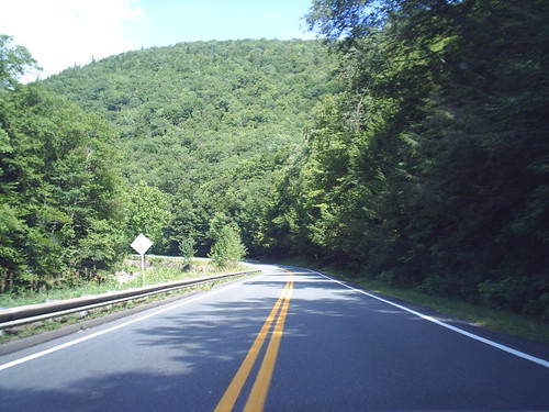
2005 Doug Kerr photo from the aforementioned stretch of roadway.

Comments

Popular posts from this blog

The Tale of Tollhouse Road, western California State Route 168 and failed Piute Pass Highway

Western California State Route 168 is entirely located in Fresno County and is linked historically to the Tollhouse Road corridor.   Tollhouse Road is one of the oldest highways in the Sierra Nevada range of Fresno County. The corridor presently begins in at Clovis Avenue in downtown Clovis and extends northeast to Huntington Lake. In 1866 the Woods Brothers established mining claims on Pine Ridge. In 1867 Fresno County would grant the brothers a toll franchise to construct a roadway to the desirable logging areas atop Pine Ridge and near Dinkey Creek. The Woods would establish a tollhouse at the start of their franchise road and lumber mill. The lumber mill attracted settlers which led to the establishment of the mountain town of Tollhouse. Fresno County would purchase the Tollhouse Road in 1878 and make it a public highway. The county would remove the tolls and incorporate the corridor into the existing county road network. Prior to the establishment of Clovis in 1...

Old Dunlap Road (former California State Route 180 in Yokuts Valley)

When California State Route 180 was commissioned in August 1934 the alignment in took in Sierra Nevada range was very different than from today.  The original highway alignment from Squaw Valley (now Yokuts Valley) to east Grant Grove (then part of General Grant National Park) originally followed what is now Ruth Hill Road, Dunlap Road, Pinehurst Road (modern California State Route 245), Dark Canyon Road (partially now Forest Road 14S45).  After funding fell through for the planned Kings Canyon Road the was corridor eventually picked up as a 30-mile-long cooperative project between the Division of Highways and Federal Government.  Much of current alignment of California State Route 180 bypassing Squaw Valley (now Yokuts Valley) and Dunlap was complete by 1941.  The post-1941 alignment of California State Route 180 in Squaw Valley was shifted onto what was once Dunlap Road in Squaw Valley.  This alignment itself was later bypassed by modern California State Route...

California State Route 73

California State Route 73 is 21 mile limited access highway aligned over the Corona del Mar Freeway and San Joaquin Hills Toll Road.  California State Route 73 connects Interstate 5 near San Juan Capistrano westward to Interstate 405 in Costa Mesa.  Prior to the construction of the Corona del Mar Freeway and San Joaquin Hills Tollway California State Route 73 was a surface highway located on largely MacArthur Boulevard. Part 1; the history of California State Route 73 What became California State Route 73 ("CA 73") entered the State Highway System in 1933 as Legislative Route Number 184 ("LRN 184").  LRN 184 was given the following route definition: "LRN 60 near Corona Del Mar to Santa Ana via Main Street" LRN 184 was announced in the April 1933 California Highways & Public Works .   LRN 184 appears for the first time on the  1934 Division of Highways Map .   LRN 184 appears under State Maintenance from US Route 101/LRN 2 in Santa Ana south ...