Prunedale Road is a short 2.6-mile-long frontage corridor of US Route 101 in the namesake Monterey County community of Prunedale. Prior to 1932 US Route 101 bypassed Prunedale in favor of the San Juan Grade to the east. Prunedale Road along with nearby Moro Road served as an alternative connecting highway between Salinas and San Juan Bautista. Following the realignment of US Route 101 onto the Prunedale Cutoff the former through route along Prunedale Road would be rendered as a western frontage.
Part 1; the history of Prunedale Road
Prunedale Road is located in and is named after the Monterey County community of Prunedale. Said community was founded near the junction of San Migeul Canyon, Langley Canyon and Echo Valley. Watsonville settler Charles Langley (namesake of Langley Canyon) was one of the prominent early community settlers. The Prunedale Post Office would open for the first time in 1894 but would close by 1908. Early agriculture in the area consisted of Plum Trees which failed due to a lack of irrigation.
Upon the passage of the 1909 First State Highway Bond Act Legislative Route Number 2 (LRN 2) was defined as a highway running from San Diego north to the San Francisco city limit. The corridor was planned to bypass Prunedale in favor of going over the Gabilan Range to San Juan Bautista following the general corridor now part of Old Stage Road.
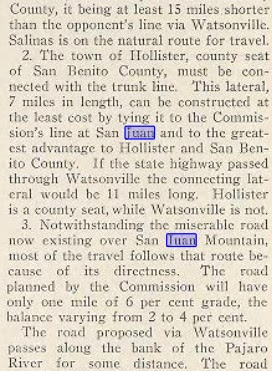
The rationale for selecting the routing of the San Juan Grade through the Gabilan Range (referenced as San Juan Mountain) is noted to be three-fold in the January 1913 California Highway Bulletin. The route through the Gabilan Range was the most direct and particle route between Salinas Valley-Santa Clara Valley, within seven miles of the San Benito County seat of Hollister and had an estimated gradient ranging from 2-6%. The existing route of American El Camino Real over Old Stage Road is noted to be direct, and it would be desirable for LRN 2 to follow nearby over a better grade.


The January 1915 California Highway Bulletin noted LRN 2 had been completed over the San Juan Grade from the Monterey County Line north to San Jaun Bautista. The San Juan Grade despite not yet being paved immediately saw service as a replacement for Old Stage Road. LRN 2 north of San Juan Bautista north to the Santa Clara County is cited to have gone through the process of a rejected contract and was now being constructed via prison labor.
The January 1915 California Highway Bulletin noted the San Juan Grade from Salinas to the San Benito County line had been completed as an unpaved highway.
Early LRN 2 over the San Juan Grade can be seen bypassing Prunedale to the east on the 1917 United States Geological Survey map of San Juan Bautista. Prunedale Road can be seen as part of the alternate through route to San Juan Bautista along with Moro Road through Langley Canyon. The Prunedale School can be seen on Prunedale Road just south of where the current California State Route 156 west of US Route 101 overpasses. Prunedale Road south of Prunedale is shown following modern Martines Road and Harrison Road into Salinas.
During November 1926 the US Route System would be approved by the American Association of State Highway Officials. The San Juan Grade and the entirety of LRN 2 were assigned as part of US Route 101.
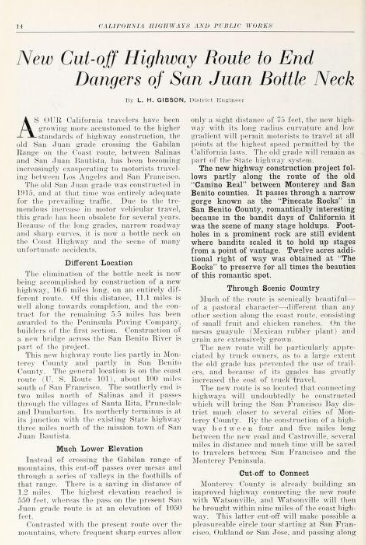
The
October 1931 California Highways & Public Works featured the construction of the Prunedale Cutoff which would replace the San Juan Grade as the new alignment of US Route 101/LRN 2. The Prunedale Cutoff alignment of US Route 101/LRN 2 is noted to bypass San Juan Bautista by way of the communities of Santa Rita, Prunedale and Dumbarton. The Prunedale Cutoff is noted to have a planned crossing of the Gabilan Range at 550 feet above sea level versus the 1,050-foot elevation used by the San Juan Grade. The article notes the Prunedale Cutoff was anticipated to be opened to traffic during the summer of 1932.
The
April 1932 California Highways & Public Works noted the new alignment of US Route 101/LRN 2 was scheduled to open to traffic on July 1. The article stub notes that the San Juan Grade would be retained as part of the State Highway System. The Prunedale Cutoff alignment of US Route 101/LRN 2 is noted to pass by the former bandit's lair known as the Pinecate Rocks.
The opening of the Prunedale Cutoff as the new alignment of US Route 101/LRN 2 was featured in the
August 1932 California Highways & Public Works. The Prunedale Cutoff was opened to traffic on July 20, 1932, upon the completion of a dedication ceremony. The Prunedale Cutoff is shown to have a terminal elevation of 473 feet in the Gabilan Range compared to the 1,016 feet on the San Juan Grade.


The Prunedale Cutoff would bypass Moro Road and Prunedale Road. Both corridors remained as frontages west of US Route 101 serving the Prunedale community. Prunedale Road can be seen spanning from US Route 101 west of the highway northward to San Miguel Canyon Road (then LRN 22) on the 1939 United States Geological Survey map of San Juan Bautista.
Part 2; a drive on Prunedale Road
As California State Route 156 westbound branches away from US Route 101 traffic can access both North and South Prunedale Road. The northern branch of Prunedale Road passes through the current business district of Prunedale towards San Miguel Canyon Road (Monterey County Route G12).
Southbound Prunedale Road crosses over California State Route 156 near the former site of the Prunedale School. The roadway has a major intersection at Blackie Road. Beyond Blackie Road the corridor of Prunedale Road crosses over US Route 101 and terminate at Reese Circle.






Comments