
M-85 is a 21.882-mile-long State Trunkline which overlaps Fort Street in metro Detroit. The Trunkline begins at Interstate 75 in Brownstown Township and ends at Griswold Street in downtown Detroit. Fort Street was completed to current scale during the 1930s as one of Detroit's major radial streets. The segment of Fort Street from Interstate 75 to Oakwood Boulevard was adopted as State Trunkline during 1956. The remaining segment from River Rouge to downtown Detroit is part of the historic alignments of M-10, M-17 and US Route 25. When US Route 25 was decommissioned in Michigan during 1967 the segment carried by Fort Street was transferred to M-85.

Part 1; the history of M-85
The Fort Street name is a reference to British fortification of Fort Shelby. Fort Shelby (originally Fort Lernoult) was built during 1779 at what is now the intersection of Fort Street and Shelby Road. The fortification was ceded to the United States in 1796 and renamed to Fort Detroit in 1805. The corridor currently extends from Woodward Avenue in downtown Detroit southwest to Interstate 75 near the community of Rockwood.
Fort Street was officially opened by the city of Detroit between Woodward Avenue west to Cass Avenue during September 1827. The corridor was extended west to Seventh Street (now Brooklyn Street) by December 1835 and the following year it would be extended another block to 8th Street. A legislative act during March 1837 would extend the corridor on paper west through the community of Belgrade (now the neighborhood of Delray) to the road to Dearborn (now Oakwood Boulevard) at River Rouge. Fort Street was not constructed west to River Rouge until late year 1845. By the time the corridor was extended it functionally served the then new army fortification of Fort Wayne.
(Source: Fort Street page on detroiturbanism.blogspot.com)
During the Auto Trail era the highway corridor between Rockwood and downtown Detroit was part of the Eastern Dixie Highway in Michigan. The Dixie Highway was a concept of Lincoln Highway founder Carl G. Fisher and was organized during December 1914 in Chattanooga, Tennessee. What was intended to be originally a singular route between Chicago, Illinois and Miami, Florida quickly became a highway with multiple branches. A full map of the numerous paths of the Dixie Highway can be seen below.

Fort Street east of River Rouge would become parts the Signed Trunklines of M-10 and M-17 during 1919. The Dixie Highway from Monroe utilized what is now signed as "Dixie Highway," U.S. Turnpike, Jefferson Avenue, Biddle Avenue and Jefferson Avenue to reach downtown Detroit. The 1924 Rand McNally Map displays the Monroe-Detroit routing of the Dixie Highway (25). The map also displays M-10 and M-17 entering Detroit via Oakwood Boulevard and River Rouge towards Fort Street.
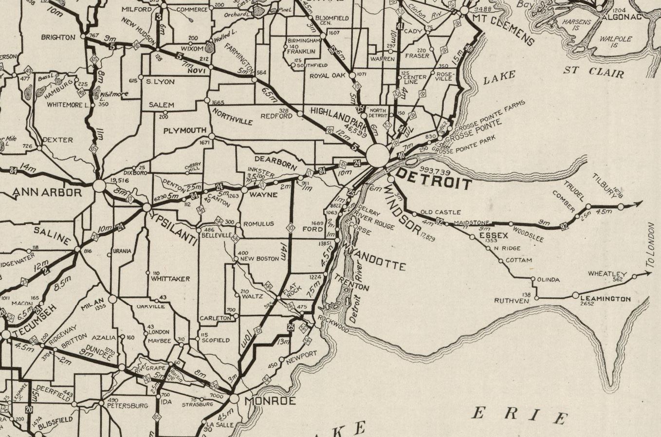

During 1924 the Detroit Rapid Transit Commision announced an extension of Fort Street west of River Rouge. The newly selected extension of Fort Street was touted to be planned as a "204-foot-wide superhighway."
(Source: Fort Street page on detroiturbanism.blogspot.com)
The US Route System was commissioned by the American Association of State Highway Officials (AASHO) on November 11, 1926. US Route 25 was one of the original interstate highways which was commissioned to run through Michigan. North of Monroe US Route 25 originally multiplexed US Route 24 via Telegraph Road to Ecorse Road (M-17). US Route 25 (via multiplex of M-17) followed Ecorse Road, Allen Road and Oakwood Boulevard to Fort Street at River Rouge. US Route 25 followed Fort Street east to into downtown Detroit where it met US Route 10 at Woodward Avenue.
(Source: michiganhighways.org)


During 1930 the Detroit-Toledo Highway was completed. The then new segment of highway split US Route 25 away from US Route 24 (Telegraph Road) in Brownstown Charter Township. US Route 25 followed Detroit-Toledo Highway to Dixie Highway (unrelated to the original routing) in Lincoln Park. The highway followed Dixie Highway to Oakwood Boulevard and turned east towards Fort Street at River Rouge.
(Source: michiganhighways.org)
The new alignment of US Route 25 on Detroit-Toledo Highway and Dixie Highway can be seen on the 1931 Clauson's Map of Michigan.

By the mid-1930s the extension of Fort Street to Rockwood was complete. Despite the completion of Fort Street, the corridor for the time being remained out of the State Trunkline System west of River Rouge.
(Source: Fort Street page on detroiturbanism.blogspot.com)
The southern end of Fort Street can be seen terminating at M-56 (Huron River Drive) at South Rockwood on the 1942 United States Geological Survey map of Flat Rock.

On April 5, 1956, Fort Street from US Route 25 (Oakwood Boulevard and Fort Street) was transferred as a then new State Trunkline carrying the second iteration of M-85. The corridor was designated as 14.6 miles and included a 1.6-mile segment which was temporarily signed as US Route 24 Alternate. The temporary signage was removed in 1958 when the Detroit-Toledo Expressway (now Interstate 75) was completed.
(Source: michiganhighways.org)
On October 15, 1966, the Michigan State Highway Department submitted an application to AASHO to delete US Route 25 in the state. The justification for deletion was the numerous multiplexes the highway took in southern Michigan in addition to superior through-route Interstate mileage being constructed. The AASHO Executive Committee approved the request on June 20, 1967. Following AASHO application the segment of Fort Street from Oakwood Boulevard to Woodward Avenue was transferred as an extension of M-85.


On March 15, 2001, Fort Street from Woodward Avenue to Griswold Street was transferred back to the city of Detroit.
(Source: michiganhighways.org)
Part 2; a drive on Fort Street in Detroit
From the neighborhood of Delray traffic on Jefferson Avenue is forced to use Clark Street and Fort Street (M-85) to head eastbound into downtown Detroit.
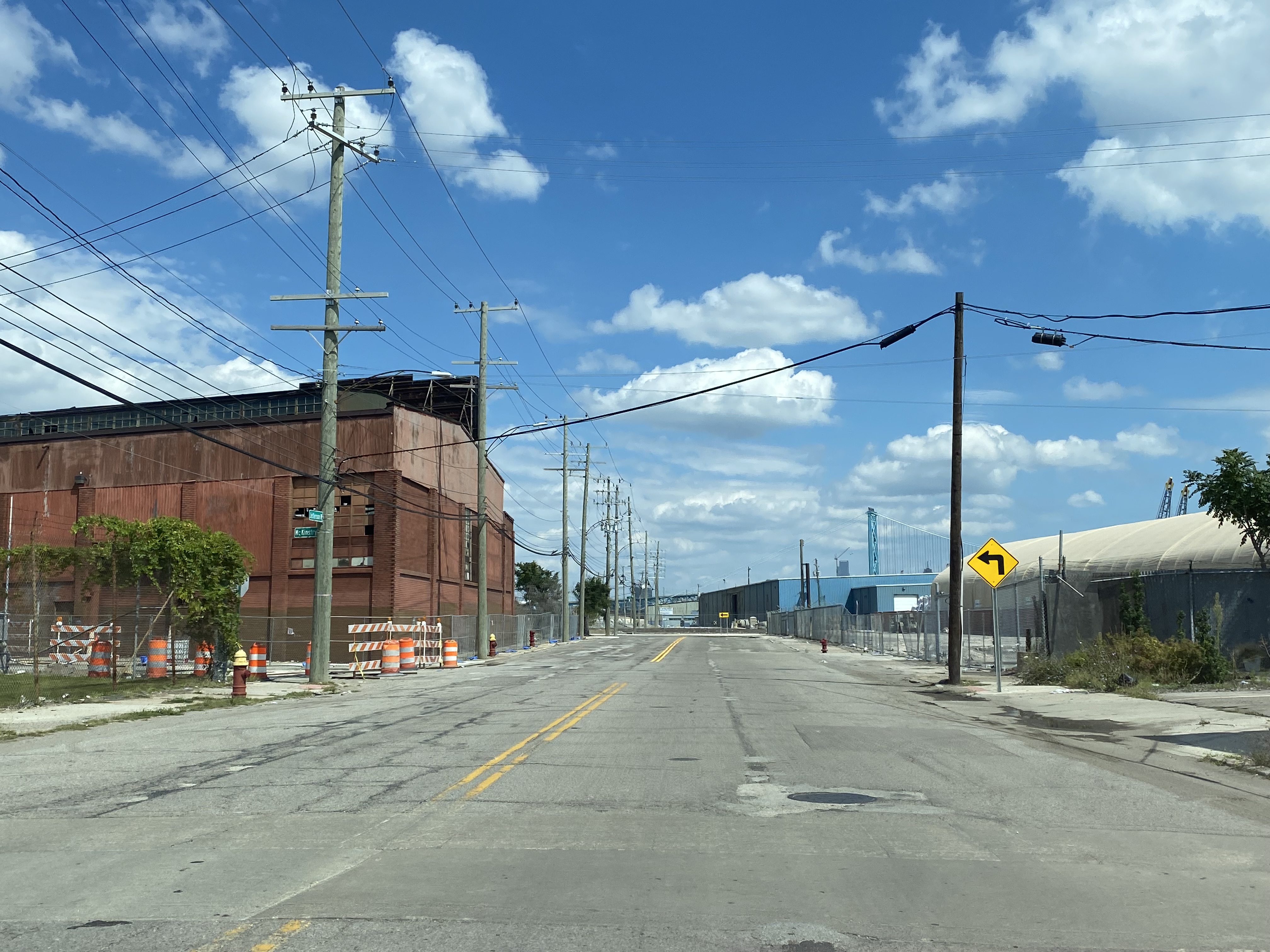


Fort Street east of Clark Street faces downtown Detroit and the approach to the Ambassador Bridge.

As Fort Street passes under the Ambassador Bridge the derelict second span can be seen. During 2007 the Moroun Family (owners of the Ambassador Bridge) was granted a permit by the Michigan Department of Environmental Quality to construct a second span. This permit expired in 2012, and the U.S. Coast Guard issued another in 2016. The Coast Guard permit was in conflict with one issued in 2017 by Transportation Canada which stipulated that the original Ambassador Bridge be retained. The Transportation Canada Bridge permit expired in 2022.


Fort Street continues east into downtown Detroit and M-85 terminates at Griswold Street.


Westbound M-85 is a rare example of a Michigan Trunkline which has a "BEGIN" placard.

US Route 25 would have continued on Fort Street to US Route 10 at Woodward Avenue. US Route 25 east of Woodward Avenue followed Cadillac Square and Randolph Street to Gratiot Avenue. During 2004 Campus Martius Park was reconstructed in the center of Woodward Avenue.

Part 3; RoadwayWiz on M-85
During 2021 Dan Murphy of the RoadwayWiz Youtube channel featured behind the wheel drives along M-85 and Fort Street. Below M-85 can be viewed from Griswold Street to Schaefer Road.
M-85 and Fort Street to can be viewed below from Schaefer Road to Griswold Street.
Comments