
Recently, I did an explore trip in Central North Carolina. There were a few items for my Carolina Crossroads project that I wanted to get photos of - but like many road trips, there were a few surprises!
This trip took me from our home northeast of Charlotte and out to Chatham County and back. It was a mix of churches and freeways, antiques and old bridges, backroads, and old country stores. You can find the entire photo set on flickr, here.
I didn't gain any new state highways as I've done them all before - and in some cases, I had passed a few times and finally took some photos or even returned to take some more.
 |
| Lower Grace Stone Church |
Have you ever driven past an old building that you know has been there a long time - it sticks out compared to the rest of the landscape - and wanted to stop? The Grace Lower Stone Church would be one. I've often driven past this historic church on our way to the North Carolina Zoo. (Sometimes, we take the backway vs. the typical I-85 US 64 route.)
The church dates to 1795 - and the congregation to the 1740s. The church has German roots, as it was founded by colonial Pennsylvanians who settled in the area in the mid-18th Century.

Located on about 16 acres in rural Rowan County, the church was constructed of local fieldstone. Weekly services still occur at the nearly 230-year-old chapel. The cemetery that surrounds it has gravestones that date well into the 1800s.
 |
| Downtown Ramseur, NC |
I recently wrote about the Town of Ramseur for the Crossroads project. My photos were dated (November 2010), and it was suggested that I return and take a fresh look at the community. It was a quiet Sunday afternoon - so the downtown was inactive. Yet, there were a handful of new businesses in formerly abandoned buildings. I also noticed that the Deep River State Trail goes through the town, bringing additional opportunities.
 |
| The Deep River State Trail is a hybrid trail that combines paddling, biking, and hiking. |

Often, it is easy to visit a town - or even travel down a highway - and never go back. I am trying, when I can, to go back to communities I have visited or photographed. It's easy to miss something when you first come through; a second look is always worthwhile.
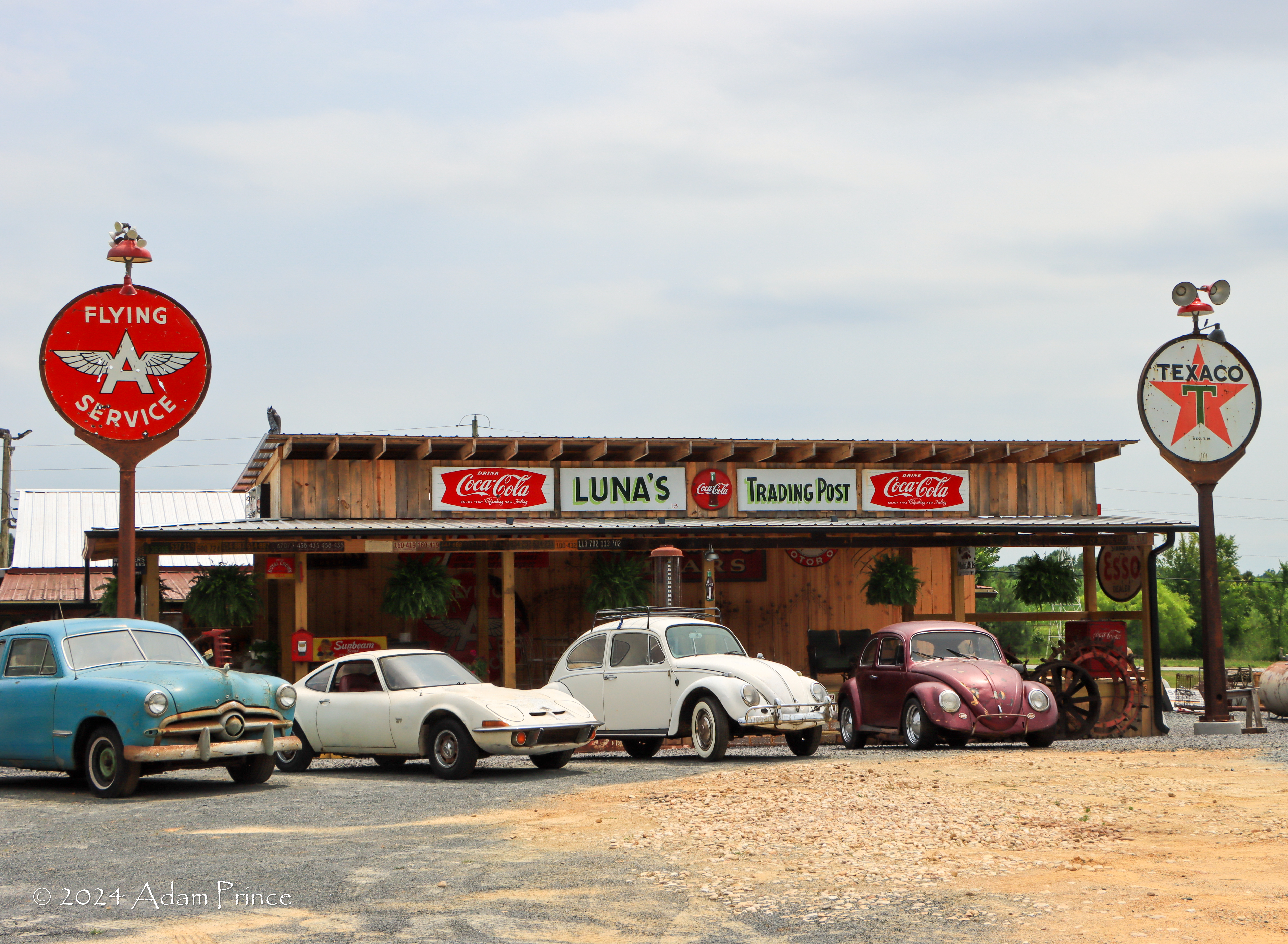
One of the surprises on the trip is on US 64 east of Ramseur. Luna's Trading Post is an absolute wonder for anyone who likes old gas station and highway memorabilia - or equipment. I believe it was closed when I stopped. Even though a TV was broadcasting on the front porch, the door to the inside was locked. Yet, there's enough on the outside to satisfy your curiosity - and wet it enough to return when the store is open.
 |
| Luna's Trading Post is a must-visit for anyone that loves old gas station, soda, and automobile memorbilia. |

There are easily one hundred old gas pumps, endless amounts of old gas station signs and license plates, old cars, soft drink signs, and more. I'm definitely going to come back.
 |
| Chatham Bridge 147 is a pin-connected Pratt Truss Bridge. |
The other planned stop for the trip was the recently closed Chatham Bridge 147 over the Rocky River. After a routine inspection about a month ago, state transportation officials closed the bridge indefinitely. The inspection found deficiencies in the steel structure.
 |
| Chatham Bridge 147 |
The one-lane bridge dates to the 1920s and is one of the last steel-truss bridges in the state. Over the years, several efforts by nearby residents kept the bridge from being replaced with a modern two-lane structure. Hopefully, the bridge will be preserved in some way.
 |
| G.C. Sharpe's (Reno's) Store dates to 1883. |
 |
| Behind the store is a stage where bluegrass music is played. |
At this point, I began the journey back to Charlotte - and not long after, I found a gem of an old country store. The Reno Sharpe Store on Pittsboro-Goldston Road sits off the road a bit and is surrounded by woods. Behind the store is a small stage. Reno Sharpe's reopens occasionally for Bluegrass music. A few outbuildings are also around. It seems that music has preserved these old country stores in some communities. Whether weekly, monthly, or occasionally, these decades, if not century-old, stores come alive with visitors from near and far to enjoy a pleasant night out.


 |
| The former Enterprise Manufacturing Company store stayed open after the mill closed in the 1950s. It operated into the 1970s. |
After miles of forests and farmland on secondary roads, I came to an old textile mill town in Randolph County. The community of Coleridge along the Deep River was home to the Enterprise Manufacturing Company. Here, at the junction of NC 22 and 42, are abandoned structures from the Piedmont's textile manufacturing past. An old company store, former cotton mill, bank, and mill offices are now part of the Coleridge Historic District.
The rest of the drive on a humid June afternoon was a mix of threatening skies and some rain. But I did see a few more things that I'll have to get back to.
All photos taken by post author - June 17, 2024
Comments