
California State Route 71 is a 16-mile state highway which exists in the Los Angeles Metropolitan area. California State Route 71 begins at California State Route 57 in Pomona. From California State Route 57 the routing of California State Route 71 is generally comprised the Chino Valley Freeway south to California State Route 91. California State Route 71 is one of the original Sign State Route designations from 1934. California State Route 71 once spanned from US Route 66 in Claremont south to US Route 80 in San Diego. Portions of California State Route 71 would in time become components of US Route 395, Interstate 15, California State Route 215, California State Route 79 and California State Route 371. Featured as the blog cover is California State Route 71 passing through Temescal Canyon during 1941.

Part 1; the history of California State Route 71
The initial segment of what was to become California State Route 71 was added to the State Highway System as part of the 1909 First State Highway Bond Act. The First State Highway Bond Act defined what would become Legislative Route Number 19 (LRN 19) as running from Claremont to Riverside. The segment of LRN 19 between Claremont and Pomona would in time become part of California State Route 71. LRN 19 can be seen on the 1918 California Highway Commission Map. The routing of LRN 19 between Claremont and Pomona followed Garey Avenue.

The bulk of what was to become California State Route 71 was brought into the State Highway System by way of 1931 Legislative Chapter 82 which defined Legislative Route Number 77 (LRN 77). LRN 77 was initially defined as running from San Diego to Pomona. LRN 77 can be seen for the first time on the 1932 Division of Highways Map classified as a secondary State Highway.


LRN 77 appears as the cover photo on the September 1932 California Highways & Public Works.

The January/February 1933 California Highways & Public Works referenced the name of LRN 77 as the "Inland Road."
California State Route 71 was announced as one of the original Sign State Routes in the August 1934 California Highways & Public Works. California State Route 71 originated at US Route 66 near Claremont and followed LRN 19 south towards Pomona. From Pomona, California State Route 71 followed the entirety of LRN 77 to US Route 80 near San Diego.

The California Highway Commission during 1934 submitted a request to the American Association of State Highway Officials (AASHO) to extend US Route 395 into the state with a terminus in San Diego. This request was subsequently approved by the AASHO Executive Commitee. On September 6, 1934, the California Highway Commission submitted their official routing of US Route 395 to AASHO. From Elsinore south to San Diego the alignment of US Route 395 absorbed what was California State Route 71 and LRN 77.


In 1935 the Division of Highways released County maps which depict routing of California State Route 71. Within Los Angeles County, California State Route 71 is shown following Garey Avenue along LRN 19 south from US Route 66/LRN 9 in Claremont to US Route 99/US Route 60/US Route 70/LRN 26 at Holt Avenue in Pomona. California State Route 71 briefly multiplexed US Route 60/LRN 19 on Garey Avenue south to 5th Street where the latter split east towards Riverside. California State Route 71 transitioned onto LRN 77 following Garey Avenue and Philadelphia Street to the San Bernardino County line.


Within San Bernardino County the entirety of California State Route 71 followed LRN 77. California State Route 71 entered San Bernardino County via Eli Street and quickly turned south towards Corona via Pipeline Avenue. California State Route 71 skirted the city limit of Corona via Chino Avenue and Ramona Avenue. South of Chino, California State Route 71 intersected LRN 177 at Merrill Avenue (now Chino Hills Parkway). From LRN 177, California State Route 71 followed Merill Avenue, Central Avenue, El Prado Road, Pine Avenue and Pioneer Avenue to Chino Road in Riverside County. Much of Pioneer Avenue has since been abandoned or razed within what is now El Prado Regional Park.

Within Riverside County the alignment of California State Route 71 was concurrent with LRN 77. California State Route 71 followed Chino Road to California State Route 18/LRN 43. California State Route 71 multiplexed California State Route 18 along Pomona-Rincon Road and 6th Street into downtown Corona. California State Route 71 split south from California State Route 18 in downtown Corona via Main Street. California State Route 71 south of Corona followed Ontario Avenue, Temescal Canyon Road, Lake Street and Lakeshore Drive to California State Route 74/LRN 64 at Riverside Drive near Elsinore. It is likely California State Route 71 originally multiplexed California State Route 74 in Elsinore to US Route 395/Main Street via Lakeshore Drive and Graham Avenue.


The 1936-1937 Division of Highways Map displays California State Route 71/LRN 77 south of Pomona bypassing Chino via an extension of Garey Avenue. The new bypass of Chino tied into Merrill Avenue south of the city of limit of Chino directly towards LRN 177.

California State Route 71 can be seen aligned between Claremont and Elsinore on the 1938 Division of Highways Map.

The March 1939 California Highways & Public Works featured the ongoing realignment of California State Route 71/California State Route 18 near the site of Prado Dam within the Santa Ana River Canyon. The existing alignment of both highways through Prado siding was to be flooded by the new reservoir. A contract to relocate California Stare Route 71/California State Route 18 near the site of Prado Dam was awarded on January 10, 1939. The new grade of California Stare Route 71/California State Route 18 is shown to be partially complete.


The October 1939 California Highways & Public Works details the upcoming Pomona Grade Separation which would serve as an extension of LRN 77 and the new split of US Route 60 from US Route 99/US Route 70/LRN 26. US Route 60 originally had split from US Route 99/US Route 70/LRN 26 multiplexed with California State Route 71 via Garey Avenue south to 5th Street in downtown Pomona. Once completed the Pomona Grade separation would have US Route 60 follow LRN 77 to 5th Street via two railroad overpass structures. Construction on the Pomona Grade Separation is noted to have already begun and was partially Federally funded.


The 1940 Division of Highways Map displays California State Route 71 extended to California State Route 79 at Sage Road east of Temecula. California State Route 71 is shown to have been extended via multiplex of US Route 395/LRN 77 from Elsinore to Temecula by way of Murrieta. From Temecula to east to Sage Road, California State Route 71 followed LRN 78. The extension of California State Route 71 seems to have been driven by California State Route 79 absorbing the original California State Route 83 along LRN 194. Originally California State Route 79 had ended in Temecula via LRN 78.

From Elsinore, California State Route 71/US Route 395 multiplexed on Lakeshore Drive, Mission Trail, Palomar Street and Washington Avenue into Murietta. From Murietta the multiplexed followed Ivy Street, Jefferson Avenue, and Front Street to Temecula. From Temecula, California State Route 71 split from US Route 395 via LRN 78 along what is now modern Temecula Parkway towards Sage Road.
The February 1940 California Highways & Public Works featured the completed relocation of California State Route 18 south of Prado Dam. The new alignment south of Prado Dam is noted to have been completed on December 8, 1939. The realignment project spanned from the Orange County line east to the city limit of Corona mostly as part of California State Route 18 and LRN 43. The new alignment included a new junction with California State Route 71/LRN 77. California State Route 71 and LRN 77 passed through the Prado Dam Flood Channel north of California State Route 18/LRN 43. Prado Dam would be completed by April 1941.


The May 1940 California Highways & Public Works detailed the newly opened Pomona Grade Separation which served as the new branch for US Route 60 from US Route 99/US Route 70/LRN 26 in Pomona. The Pomona Grade Separation is noted to have opened on March 19, 1940. The completion of the Pomona Grade Separation removed the multiplex of US Route 60 and California State Route 71 in Pomona.


The Pomona Grade Separation appears on the 1940 Division of Highways Map.

The October 1941 California Highways & Public Works featured the straightening of California State Route 77 in Temescal Canyon. The straightening of California State Route 71 in Temescal Canyon was instigated by heavy floods which occurred during March 1938. The straightened highway was located above the original alignment along less flood terrain in a 1.67-mile corridor.


On July 1, 1947, the AASHO Executive Secretary notified the California State Highway Engineer that California's request to extend US Route 91 from Barstow to Long Beach had been approved. The extension of US Route 91 to Long Beach brought it into the city via multiplex of California State Route 19/LRN 168 to Los Alamitos Traffic Circle and west on US Route 101A/LRN 60 on Pacific Coast Highway. US Route 91 would multiplex California State Route 71 and California State Route 18 from Main Street in Corona west to the Prado Dam turnoff.


The July/August 1951 California Highways & Public Works featured a study of Temecula after US Route 395 and California State Route 71 were moved to a bypass. The bypass of Front Street (now Old Town Front Street) in Temecula is noted to have opened during July 1949.


The May/June 1953 California Highways & Public Works noted that US Route 395 was rerouted north of Temecula onto a new cutoff towards Perris. The new alignment of US Route 395 was constructed as a segment of LRN 78 which bypassed Elsinore. This new alignment removed US Route 395 from a multiplex with California State Route 71 between Elsinore and Temecula.


The split from California State Route 71 and US Route 395 in Temecula appears on the 1954 Division of Highways Map.

The November/December 1954 California Highways & Public Works featured the relocation of US Route 99/US Route 70 onto the San Bernardino Freeway in Pomona on November 16, 1954. The new segment of the San Bernadino Freeway shifted the intersection between California State Route 71 and US Route 99/US Route 70 north on Garey Avenue.

The September/October 1957 California Highways & Public Works referenced the corridor of California State Route 18/US Route 91/California State Route 71 from the Orange County line to Corona was in the process of being converted to a freeway. The volume California Highway Commission notes the California Highway Commission had selected freeway corridor through Corona towards Riverside on June 30, 1956.

The January/February 1958 California Highways & Public Works announced a contract to construct the Temescal Freeway between 5th Street to 0.9 miles south of Riverside Drive in Pomona. The initial segment of the Temescal Freeway is noted to have an anticipated completion during April as an expressway. While not overly stated the Temescal Freeway was intended to be the new alignment of California State Route 71.


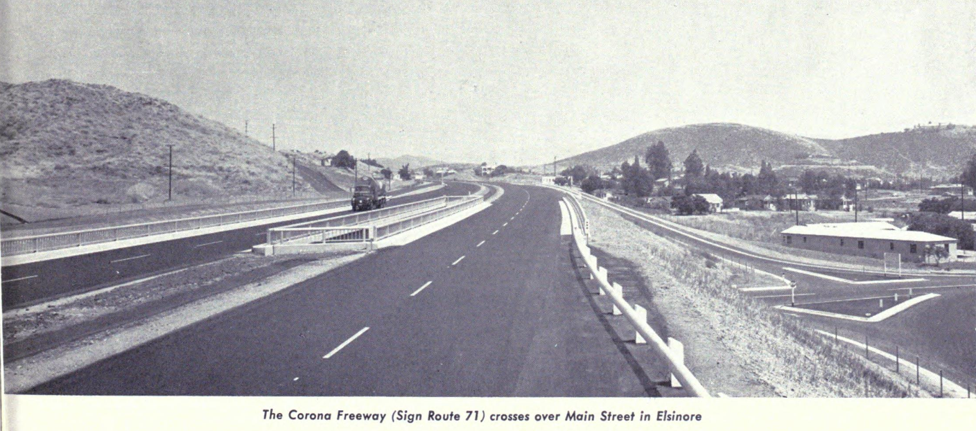
The Temescal Freeway name was short lived as the corridor was announced as having been named the "Corona Freeway" in the November/December 1958 California Highways & Public Works. The Corona Freeway name was selected by the California Highway Commission on July 23, 1958. The Corona Freeway corridor is noted to have been selected by the California Highway Commission during 1947 between the Los Angeles County line and the US Route 395 Escondido Freeway. California State Route 71 is noted have been shifted to a partially complete Corona Freeway between Temecula and Elsinore during 1956. The articles note a segment of the Corona Freeway between Elsinore north to Alberhill had been completed during May 1958. A photo features the Corona Freeway crossing over Main Store in Elsinore. California State Route 74 multiplexed California State Route 71 on the Corona Freeway initially between Central Avenue and Main Street in Elsinore.

The 1959 Division of Highways Map displays California State Route 71 in Pomona as a bisected highway. The northern segment of California State Route 71 is shown to follow LRN 19 between Claremont to the US Route 60 along Garey Avenue. The segment of Garey Avenue south to the Corona Freeway is shown to have been relinquished back to Pomona. The southern Segment of California State Route 71 is shown originating at US Route 60 and following the Corona Freeway south towards Chino. The multiplex of California State Route 71 and California State Route 74 on the Corona Freeway is also displayed. The entire Corona Freeway corridor had been added the Freeway & Expressway System during 1959.


The May/June 1959 California Highways & Public Works announced the Corona Freeway between Merrill Avenue (LRN 177) south to Euclid Avenue (LRN 192) was under construction as the new alignment of California State Route 71. The corridor is noted to have an opening during June under a temporary two-lane expressway configuration. The same volume featured a construction photo along the Corona Freeway corridor south of Chino. The stub notes the only general corridor of the Corona Freeway not to have yet been adopted was through the city of Corona.


The 1960 Division of Highways Map displays the adoption of Legislative Route Number (LRN 277) which would in the coming years become an extension of California State Route 71. LRN 277 was defined by 1959 Legislative Chapter 1062 as originating at LRN 78 (California State Route 79) east of Temecula east to LRN 64 (California State Route 74) near Anza. LRN 277 is displayed as not having a determined routing.

The 1960 Division of Highways Map also depicts California State Route 71 shifted onto the new Corona Freeway corridor as an expressway through Chino to Merrill Avenue. The completion of the segment to Merrill Avenue effectively made California State Route 71 from US Route 60 in Pomona south California State Route 18/US Route 91/LRN 43 near Prado Dam fully modernized.

The November/December 1960 California Highways & Public Works referenced the 7.7-mile-long Corona Bypass was under construction as part of the Riverside Freeway.

The March/April 1961 California Highways & Public Works noted construction of the Pomona Freeway/Corona Freeway interchange in Corona was under construction.


The July/August 1961 California Highways & Public Works featured the opening of the Corona Bypass. The Corona Bypass was a component of the Riverside Freeway which opened to traffic on April 6, 1961. The Corona Freeway brought the multiplex of California State Route 18/US Route 91/California State Route 71 through Corona via a limited access grade. California State Route 71 departed the Corona Bypass via Main Street south on LRN 77 towards Elsinore.


The November/December 1961 California Highways & Public Works announced Cahuilla Road had been adopted by the California Highway Commission as LRN 277. LRN 277 was included in the Freeway & Expressway System.

LRN 277 appears along Cahuilla Road on the 1962 Division of Highways Map.

The 1964 State Highway Renumbering heavily altered the corridor of California State Route 71. The Legislative Route Numbers were dropped as part of the 1964 State Highway Renumbering in favor of Sign Route designations. California State Route 71 was defined with several segments:
(A) Route 10 to near Pomona to Route 91 via Pomona.
(B) Route 91 to Route 395.
(C) Route 395 near Temecula to Route 74 east of Anza.
The 1964 Division of Highways Map displays the changes to California State Route 71. What had been California State Route 71 along Garey Avenue between US Route 66 in Claremont to US Route 60 in Pomona was designated as California State Route 215. The establishment of California State Route 215 removed the gap in California State Route 71. California State Route 71 was extended north of US Route 60/5th Street to the Interstate 10 and the San Bernardino Freeway.

California State Route 71 was extended over what had been LRN 277 to California State Route 74 east of Anza. The extension of California State Route 71 included a brief multiplex of California State Route 79 east of Sage Road.

The definition of California State Route 71 as it appeared on the 1964 Division of Highways Map.

The November/December 1964 California Highways & Public Works announced California State Route 71 and the Corona Freeway were to be constructed to four-lane freeway standards from Glen Ivy Road to Ontario Avenue in Corona. The corridor project south of Corona was listed as part of the 1965-66 Fiscal Year budget. The project zone would connect with the already existing realignment of California State Route 71 near Alberhill.

1965 Legislative Chapter 1372 deleted California State Route 215 along Garey Avenue between Claremont and Pomona. It is unclear if California State Route 215 ever had any signage or was signed as California State Route 71 prior to being deleted.
The adopted Corona Freeway corridor from Corona to Alberhill appears in the January/February 1965 California Highways & Public Works. The adopted alignment of California State Route 71 south of Corona is noted to have been altered during the September-December 1964 California Highway Commission meetings.


The November/December 1965 California Highways & Public Works announced California State Route 71 south of Corona would be moved to the Corona Freeway during summer 1966.

Former California State Route 71/California State Route 215 along Garey Avenue between Claremont and Pomona no longer appears on the 1966 Division of Highways Map.

During 1965 the definition of California State Route 79 was altered by Legislative Route Number 1372 due to the relinquishment of Sage Road. The new definition of California State Route 79 had it multiplex California State Route 71 from Sage Road west into Temecula. This change did not appear on the Division of Highways Maps until the 1967 edition.

The 1967 Division of Highways Map displays California State Route 71 shifted to the Corona Freeway south of Corona.

1968 Legislative Chapter 282 changed the northern terminus of California State Route 71 to "Route 210." The "Route 210" at the northern terminus of California State Route 71 reflects Interstate 210. 1969 Legislative Chapter changed the references to "Route 395" in the definition of California State Route 71 to "Route 15. The change from US Route 395 to Interstate 15 reflected the latter corridor being approved by the Federal Highway Administration during December 1968 for a chargeable extension from Interstate 10 in San Bernardino to Interstate 8 in San Diego.
California State Route 71 was reconstructed to freeway standards from the Kellogg Interchange to 5th Street in Pomona during 1971. The Kellogg Interchange connected California State Route 71, Interstate 10, California State Route 57 and Interstate 210.
During 1972 mainline Interstate 15 had been realigned onto the partially completed freeway corridors of California State Route 31 and California State Route 71 south of Corona. A letter from the California State Highway Engineer dated February 28, 1972, noted the request to shift the mainline corridor of Interstate 15 to California State Route 31 and California State Route 71 was submitted to the Federal Highway Administration during July 1971. The Federal Highway Administration approved the change of alignment for Interstate 15 on January 24, 1972. The new alignment of Interstate 15 was assigned as chargeable mileage.


1974 Legislative Chapter 537 rerouted Interstate 15 between Temecula and the San Bernardino area. Interstate 15 was realigned over what was the California State Route 31 along the planned freeway between San Bernardino and Corona. Interstate 15 south of Corona was realigned onto the partially constructed Corona Freeway corridor which had been built as California State Route 71. The original routing Interstate 15 between San Bernardino-Temecula was legislatively renumbered to California State Route 194 and signed as Interstate 15E.
1974 Legislative Chapter 537 deleted segments (B) and (C) from the definition of California State Route 71. What had been California State Route 71 from California State Route 79 near Aguanga to California State Route 74 east of Anza was designated as California State Route 371. Signage of California State Route 71 was withdrawn to Interstate 15/US Route 395 near Temecula. California State Route 71 remained signed south of Corona on the established Corona Freeway segments as a placeholder for Interstate 15.
All the above changes in the prior three paragraphs can be seen on the 1975 Caltrans Map.
The partially completed corridor the Corona Freeway south of Corona appears co-signed as California State Route 71 and Interstate 15 on the 1977 Caltrans Map. California State Route 31 appears co-designated as Temporary Interstate 15.


Signage of California State Route 71 is shown to be withdrawn to California State Route 91 on the 1981 Caltrans Map. The Corona Freeway south of Corona is displayed solely signed as Interstate 15.

California State Route 71 appears mostly as expressway on the 1990 Caltrans Map. The only true freeway grade along California State Route 71 is displayed as that north of 5th Street in Pomona to the Kellogg Interchange. A portion of California State Route 71 between California State Route 60 and California State Route 142 near Chino is displayed as conventional highway.

1993 Assembly Concurrent Resolution, Chapter 55 renamed the entire corridor California State Route 71 as the "Chino Valley Freeway." The Corona Freeway designation was withdrawn to solely existing on Interstate 15 south of Corona. 1994 Legislative Chapter 1220 clarified the southern terminus of California State Route 71 as "Route 91 via Pomona and Chino Hills."
California State Route 71 was completed to freeway standards between California State Route 60 and California State Route 91 during early 1998. The completed Chino Valley Freeway south of California State Route 60 to California State Route 91 appears on the 2005 Caltrans Map.
2010 Legislative Chapter 421 changed the northern terminus of California State Route 71 to "Route 57." Despite the northern terminus of California State Route 71 being changed at the Legislative level to California State Route 57 the highway still ends at what is Federal Highway Administration recognized Interstate 210.


Part 2; a drive on former California State Route 71 (current California State Route 79) from Temecula to Aguanga
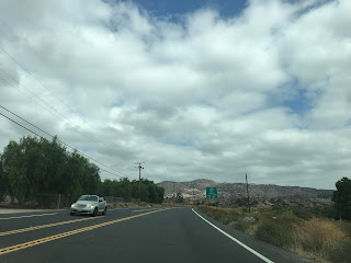
California State Route 79 southbound multiplexes Interstate 15 southbound into Temecula. At Intestate to Exit 58, California State Route 79 departs Interstate 15 onto the former routing of California State Route 71 on Temecula Parkway.


California State Route 79 in Temecula has been relinquished to the eastern city limit. At Post Mile RIV 15.74 State maintenance of California State Route 79 begins again on Temecula Parkway near Anza Road. State Maintained California State Route 79 on Temecula Parkway is easily distinguished when the highway becomes two-lanes.


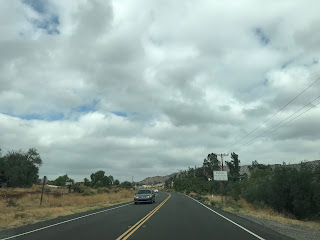
At the Anza Road intersection California State Route 79 southbound traffic is advised against using 30 foot or longer vehicles on the highway. California State Route 79 southbound is also signed with an "End Truck Route" sign assembly.


California State Route 79 beyond Anza Road is signed as a Safety Corridor.


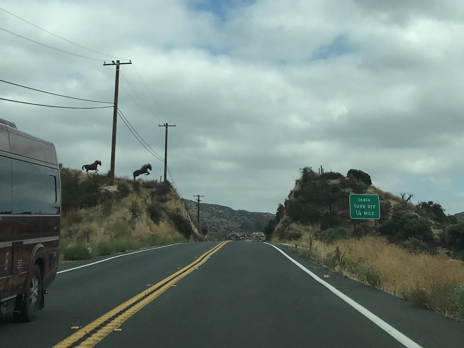
California State Route 79 southbound continues through mountainous terrain for several miles before intersecting Sage Road/County Route R3 (former California State Route 83/California State Route 79) at Post Mile RIV 5.804. The County Route R3/Sage Road turnoff from California State Route 79 is located in a small community known as Radec.


California State Route 79 southbound continues through rolling hills until the turnoff for California State Route 371 at Post Mile RIV 2.267 in Aguanga.


California State Route 79 in Temecula has been relinquished to the eastern city limit. At Post Mile RIV 15.74 State maintenance of California State Route 79 begins again on Temecula Parkway near Anza Road. State Maintained California State Route 79 on Temecula Parkway is easily distinguished when the highway becomes two-lanes.


At the Anza Road intersection California State Route 79 southbound traffic is advised against using 30 foot or longer vehicles on the highway. California State Route 79 southbound is also signed with an "End Truck Route" sign assembly.


California State Route 79 beyond Anza Road is signed as a Safety Corridor.


California State Route 79 southbound continues through mountainous terrain for several miles before intersecting Sage Road/County Route R3 (former California State Route 83/California State Route 79) at Post Mile RIV 5.804. The County Route R3/Sage Road turnoff from California State Route 79 is located in a small community known as Radec.


California State Route 79 southbound continues through rolling hills until the turnoff for California State Route 371 at Post Mile RIV 2.267 in Aguanga.


Part 3; a drive on former California State Route 71 (current California State Route 371) from Aguanga to California State Route 74
California State Route 371 eastbound begins from California State Route 79 in Aguanga.


Post Mileage on California State Route 371 begins at RIV 56.469. The Post Miles on California State Route 371 are inherited from California State Route 71. California State Route 371 eastbound is immediately signed as a Daytime Headlight Safety Corridor for the next 18 miles. Truck traffic on California State Route 371 is advised against 30 foot or longer loads. Traffic is further advised that California State Route 371 is susceptible to chain restrictions.


Anza is signed as 14 miles away on California State Route 371 eastbound. Palm Desert is signed as 43 miles away and Indio is signed at 53 miles.

California State Route 371 eastbound traverses the semi-arid terrain of the Santa Rosa Mountain foothills and enters the Cahuila Indian Reservation at Post Mile RIV 67.145.


California State Route 371 eastbound passes through the Cahuila Reservation and enters the community of Anza.


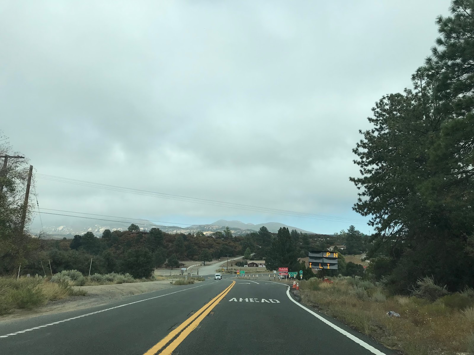
Anza lies at an elevation of 3,921 feet above sea level in Anza Valley. The community of Anza is named after Spanish explorer Juan Bautista de Anza which explored Anza Valley in 1774 and 1775. California State Route 371 passes through Anza on Cahuilla Road where it transitions onto Kenworthy-Bautista Road.


California State Route 371 east of Anza begins to ascend into the Santa Rosa Mountains, traffic is advised the Safety Corridor ceases.


California State Route 371 eastbound enters San Bernardino National Forest at Post Mile RIV 75.264. California State Route 371 ascends through the Santa Rosa Mountains to an eastern terminus at California State Route 74/Pines-to-Palms Highway at Post Mile RIV 77.143.


Post Mileage on California State Route 371 begins at RIV 56.469. The Post Miles on California State Route 371 are inherited from California State Route 71. California State Route 371 eastbound is immediately signed as a Daytime Headlight Safety Corridor for the next 18 miles. Truck traffic on California State Route 371 is advised against 30 foot or longer loads. Traffic is further advised that California State Route 371 is susceptible to chain restrictions.


Anza is signed as 14 miles away on California State Route 371 eastbound. Palm Desert is signed as 43 miles away and Indio is signed at 53 miles.

California State Route 371 eastbound traverses the semi-arid terrain of the Santa Rosa Mountain foothills and enters the Cahuila Indian Reservation at Post Mile RIV 67.145.


California State Route 371 eastbound passes through the Cahuila Reservation and enters the community of Anza.


Anza lies at an elevation of 3,921 feet above sea level in Anza Valley. The community of Anza is named after Spanish explorer Juan Bautista de Anza which explored Anza Valley in 1774 and 1775. California State Route 371 passes through Anza on Cahuilla Road where it transitions onto Kenworthy-Bautista Road.


California State Route 371 east of Anza begins to ascend into the Santa Rosa Mountains, traffic is advised the Safety Corridor ceases.


California State Route 371 eastbound enters San Bernardino National Forest at Post Mile RIV 75.264. California State Route 371 ascends through the Santa Rosa Mountains to an eastern terminus at California State Route 74/Pines-to-Palms Highway at Post Mile RIV 77.143.


Comments