California State Route 47 is a short 3.31-mile State Highway located in the Los Angeles Area. California State Route 47 begins at Interstate 110/Harbor Freeway and follows the Vincent Thomas Bridge east over Los Angeles Harbor to Terminal Island. California State Route 47 follows Seaside Avenue east into the city limits of Long Beach to the Terminal Island Freeway. California State Route 47 follows the Terminal Island Freeway north back into the city of Los Angeles where it terminates at the Henry Ford Avenue exit. From the Terminal Island Freeway California State Route 47 has an unbuilt segment to Interstate 10 in downtown Los Angeles.
Part 1; the history of California State Route 47What is now Terminal Island was originally known as Raza de Buena Gente and later Rattlesnake Island. The modern name of Terminal Island was assumed during 1891. Existing Terminal Island was absorbed into the Los Angeles during 1909 when the city annexed Wilmington. In the ensuing decades Terminal Island was greatly expanded via dredged landfill which gradually extended it into the city of Long Beach. In 1924 the Henry Ford Avenue Bridge was constructed over Cerritos Channel to Terminal Island. During 1927 civilian use Allen Field was constructed on Terminal Island via dredge from the Port of Los Angeles. A Naval Air Reserve Training Facility was built alongside Allen Field and utilized its runways. Allen Field closed to civilian use during 1935 and the facility was renamed Reeves Air Field San Pedro.
The site of Allen Field can be seen on Terminal Island on the 1938 Thomas Brothers Map of Los Angeles. Notably two ferry routes from San Pedro are shown traversing Los Angeles Harbor to Terminal Island. One ferry can be seen crossing from Los Angeles Harbor from 1st Street whereas the second departed from 5th Street. Both ferry routes are shown converging on Terminal Island via Terminal Way. The Henry Ford Avenue Bridge can be seen crossing Cerritos Channel onto Terminal Island where traffic could transition onto Dock Street or Badger Avenue.
Notably private ferry service from San Pedro to what became Terminal Island began in 1870 according to the Palos Verde Post. The Terminal Island Ferry became part of the Municipal Ferry Service beginning in 1941.
The Terminal Island Naval Dry Docks were authorized in June 1940 and construction began during the following August. In 1943 during World War II the regular Navy took over Reeves Air Field and renamed it to Naval Air Station Terminal Island. Naval Air Station Terminal Island continued as a training base until the conclusion of World War II. Following World War II Naval Air Station Terminal Island and the base was turned over to Bureau of Yards and Docks. The name of the Terminal Island Dry Docks was changed to the Terminal Island Naval Shipyard during November 1945 following the conclusion of World War II. After World War II adjoining Naval Air Station Long Beach was commissioned during November 1946. Terminal Island Naval Shipyard was renamed to Long Beach Naval Shipyard by March 1948.
The
May/June 1946 California Highways & Public Works announced numerous awarded contracts for the construction of the Terminal Island Freeway. The scale of Division of Highways contracts over construction of the Terminal Island Freeway is stated to be 2.1 miles between Henry Ford Avenue and Willow Street.


The
July/August 1946 California Highways & Public Works features details pertaining to the construction of the Terminal Island Freeway. Dubbed the "Terminal Island Access Road Project" the Terminal Island Freeway is stated to be a $14,000,000 project financed by the Navy. Construction of the Terminal Island Freeway by the Division of Highways was requested by Navy to aid in ease of access to their sizable installations on Terminal Island. Construction of the Terminal Island Freeway was funded by the Federal Government and was not a State Highway. The Terminal Island Freeway is stated to include a new lift bridge over Cerritos Channel as a replacement for the existing bascule bridge. The article features embankment stabilization for the Terminal Island Freeway grade and references a realignment of US Route 101A/Legislative Route Number 60 (LRN 60). Note: the bascule span referred to is the 1924 Henry Ford Bridge which still is in use by the Pacific Harbor Line.


The
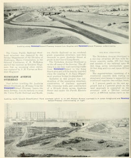
November/December 1947 California Highways & Public Works features the planned realignment of US Route 101A/LRN 60 as part of the Terminal Island Freeway project. The realignment of US Route 101A/LRN 60 (formerly State Street) is stated to be a freeway grade design and featured a full interchange with the Terminal Island Freeway.
The
November/December 1947 California Highways & Public Works features an overview of structures along the unfinished Terminal Island Freeway. The Terminal Island Freeway project is cited in the article being initiated by the Federal Government during 1940 and 1941 as an access road to the Terminal Island Naval Dry Docks. The Terminal Island Freeway is stated to be scheduled for completion by January 1st, 1948.
The
September/October 1948 California Highways & Public Works features the completed Terminal Island Freeway. The article stub notes that the Terminal Island Freeway may be extended from Willow Street to proposed California State Route 15/LRN 167 Los Angeles River Freeway to provide direct freeway access to the Naval facilities to downtown Los Angeles. Construction of the Terminal Freeway segment including the lift bridge from the Naval Facilities over Cerritos Channel to the mainland were constructed under the supervision of the Navy.
1949 Legislative Chapter 1261 provided a vehicle for the Terminal Island Freeway to be added to the State Highway System and be extended to the Los Angeles River Freeway. LRN 231 was defined by Legislative Chapter 1261 with the following definition:
"LRN 165 in San Pedro to LRN 167 in Long Beach, via the mainland portion of the Long Beach Outer Harbor and Terminal Island, subject to the following conditions:
1. Except as provided in paragraph number 2, no expenditure shall be made from state highway funds for the acquisition of rights of way for or construction, improvement, or maintenance of said highway until the following conditions have been met:
(a) The Federal Government shall have made available all funds necessary for the construction of said route, other funds provided under paragraph 2.
(b) The Federal Government and Cities of Los Angeles and Long Beach shall have granted a sufficient and adequate right of way without cost to the State of California for the portion of said route traversing lands owned or controlled by each of them.
(c) The authorized representatives of the Cities of Los Angeles and Long Beach and the appropriate agency of the Federal Government shall have approved the proposed alignment and the proposed location of all the major structures on the route submitted by the State Department of Public Works.
2. Any city or county may contribute to, and the California Highway Commission may allocate monies from the State Highway Fund for the improvement of portions of (LRN 231) on the mainland when such improvement is found necessary to complete and integrate system of freeways between San Pedro, Long Beach, and the Civic Center in the City of Los Angeles.
3. If funds from the sources other than state highway funds have not been made available for the construction on all portions of said (LRN 231) that are not on the mainland prior to January 15, 1953, said (LRN 231) shall on that date cease to be a state highway and this section shall have no further force or effect."
Notably LRN 231 does not appear on the
1950 Division of Highways Map. This is likely due to the complicated stipulations provided in the route definition of LRN 231.
The
May/June 1951 California Highways & Public Works displays the alignment of the proposed extension of the Terminal Island Freeway to the Los Angeles River Freeway. The article stub notes the Navy was responsible for funding the extension of the Terminal Island Freeway to the Los Angeles River Freeway via LRN 231.
The expiration date set in the definition of LRN 231 on January 15th, 1953, came without Federal Funding and the Terminal Island Freeway extension ceased to exist. LRN 231 subsequently appears a numeric hole in the Legislative Route Numbers on the
1954 Division of Highways Map.

The first reference to a proposed bridge from San Pedro to Terminal Island appears in a Division of Highways District VII Advanced Freeway Planning article in the J
anuary/February 1959 California Highways & Public Works. The article cites an origin and destination survey which had been conducted in the Los Angeles Harbor area during July/August 1958. Said survey was used to secure traffic data to be used for the San Pedro-Terminal Island Toll Crossing.


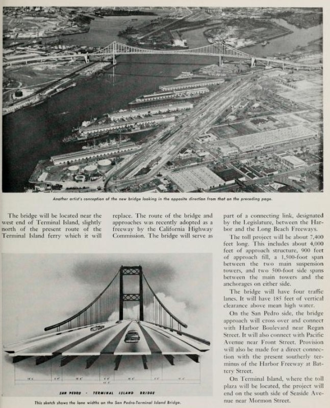
The proposed Terminal Island Bridge appears as a concept drawing in the
May/June 1959 California Highways & Public Works. The article notes the California Highway Commision on April 30th, 1959, decided to fund the Terminal Island Bridge as a tolled facility. The Terminal Island Bridge project area is described as being approximately 7,400 feet. The Terminal Island Bridge is stated to planned for construction a short distance north of the Terminal Island Ferry route in San Pedro at the planned Harbor Freeway extension. The Terminal Island Bridge is stated to be planned to tie into Seaside Avenue on Terminal Island near Mormon Street.

1959 Legislative Chapter 1062 defined LRN 270 over the proposed Industrial Freeway. The initial definition of LRN 270 was "Terminal Island to LRN 173" which incorporated the existing Terminal Island Freeway over the Commodore Schuyler F. Heim Lift Bridge. LRN 167 can be seen extended following a planned routing from Terminal Island west over Los Angeles Channel via a bridging structure to California State Route 11/LRN 165. LRN 270 and extension of LRN 167 first appear on the
1960 Division of Highways Map.
The
July/August 1960 California Highways & Public Works features the beginning of construction of the Terminal Island Bridge. A groundbreaking ceremony commencing construction of the Terminal Island Bridge is stated to have taken place on May 28th, 1960. The Terminal Island Bridge is stated to have an anticipated opening during summer 1963.
The
July/August 1961 California Highways & Public Works notes the Terminal Island Bridge had been renamed the Vicent Thomas Bridge via Assembly Concurrent Resolution 131. Vincent Thomas was as a California Assemblyman from San Pedro who served from 1941-1974.
The
November/December 1963 California Highways & Public Works notes the Vicent Thomas Bridge opened to traffic during November 15th, 1963. The Vincent Thomas Bridge is stated to have cost $21,000,000 dollars to construct and was at the time the only tolled State Highway facility in the Los Angeles Metro Area. Upon the opening of the Vincent Thomas Bridge traffic in both directions were tolled $0.25 cents in each direction. The Vincent Thomas Bridge notably is the only suspension bridge in the world which is supported entirely by piles. Upon the opening of the Vincent Thomas Bridge service on the Terminal Island Ferry ceased.


During the 1964 California State Highway Renumbering all the Legislative Route Numbers were dropped in favor of field signage. LRN 270 was redefined as part of
California State Route 47 (CA 47) with a definition of "Route 7 at Terminal Island to Route 10." The Commodore Schuyler F. Heim Lift Bridge of the Terminal Island Freeway and Industrial Freeway appear as planned CA 47 on the
1964 Division of Highways Map.
The March/April 1964 California Highways & Public Works features CA 7/Seaside Avenue at the Vincent Thomas Bridge toll plaza on Terminal Island.
The
March/April 1964 California Highways & Public Works notes the interchange between CA 7/Vincent Thomas Bridge and CA 11/Harbor Freeway is stated to be in design phases. As originally constructed CA 7 upon entering San Pedro via the Vincent Thomas Bridge followed North Street and Pacific Avenue to reach CA 11/Harbor Freeway. The Vincent Thomas Bridge is stated to be part of the greater scope of the Long Beach Freeway.

1965 Legislative Chapter 1372 extended CA 47 over the Vincent Thomas Bridge to CA 11 and the Harbor Freeway. The extended CA 47 over the Vicent Thomas Bridge first appears on the 1966 Division of Highways Map.
CA 47 and the Vincent Thomas Bridge were connected to CA 11/Harbor Freeway in 1968. The freeway routing of CA 47 north from Terminal Island was adopted by the California Highway Commission on January 22nd, 1969. The adopted freeway routing of CA 47 absorbed the entirety of the Terminal Island Freeway. The shifted planned corridor of CA 47 onto the Terminal Island Freeway appears on the
1970 Division of Highways Map.
The entirety of Terminal Island Freeway first appears as part of CA 47 on the
1979 Caltrans Map.
During 1982 the routing of CA 47 was changed so it would depart the Terminal Island Freeway towards Henry Ford Avenue and Alameda Street. The Terminal Island Freeway north of the Commodore Schuyler F. Heim Lift Bridge to CA 1 was subsequently defined as the second designation of
CA 103 (the original was in the San Diego area) by way of 1984 Legislative Chapter 409. CA 103 appears assigned over the Terminal Island Freeway north of the Commodore Schuyler F. Heim Lift Bridge to CA 1 on the
1986 Caltrans Map. Note: the definition of CA 103 in 1984 as "Route 47 in Long Beach to Route 1" was corrected in 1986 to "Route 47 in Los Angeles."
During 1983 tolling over the Vincent Thomas Bridge was increased to $0.50 for westbound traffic. This increase for westbound traffic was due to offset the removal of the toll plaza on the eastbound San Pedro approach to the Vincent Thomas Bridge.
Notably CA 47 was never actually constructed on Henry Ford Avenue and Alameda Street. The present end of CA 47 can be seen on the Caltrans Postmile Tool as the Terminal Island Freeway crosses Henry Ford Avenue.
The Terminal Island Freeway north of CA 1 to Willow Street was assigned as CA 103U which denoted it was unrelinquished segment of highway. The Terminal Island Freeway declined in importance following the closure of the Long Beach Naval Shipyard during September 1997. The Terminal Island Freeway north of CA 1 was relinquished to the city of Long Beach via trade for the existing freeway corridor which would become part of Interstate 710 south of CA 1 during August 2000. The relinquishment of the Terminal Island Freeway north of CA 1 is reflected in the data on the Caltrans Postmile Tool

Tolling of the Vincent Thomas Bridge ended during 2000 and the facility became free to use in both travel directions. Between 2012 and 2015 the city of Long Beach explored numerous options to dispose of the Terminal Island Freeway north of CA 1. The proposals included converting the Terminal Island Freeway north of CA 1 into a park or into a normal street. During December 2015 it was reported the Long Beach City Council voted to conduct traffic and environmental impact studies pertaining to the effects of removing the Terminal Island Freeway north of CA 1. Since 2015 the city of Long Beach has taken no further steps towards removal of the Terminal Island Freeway north of CA 1.
During 2011 work began on a fixed span replacement for the Commodore Schuyler F. Heim Lift Bridge. The Commodore Schuyler F. Heim Lift Bridge was closed during October 2015. Work on the fixed span (called the Schuyler F. Heim Bridge) was completed during September 2020.
Part 2; a drive on California State Route 47
CA 103 ends and CA 47 begins abruptly without notification as the Terminal Island Freeway crosses over Henry Ford Avenue in Los Angeles.
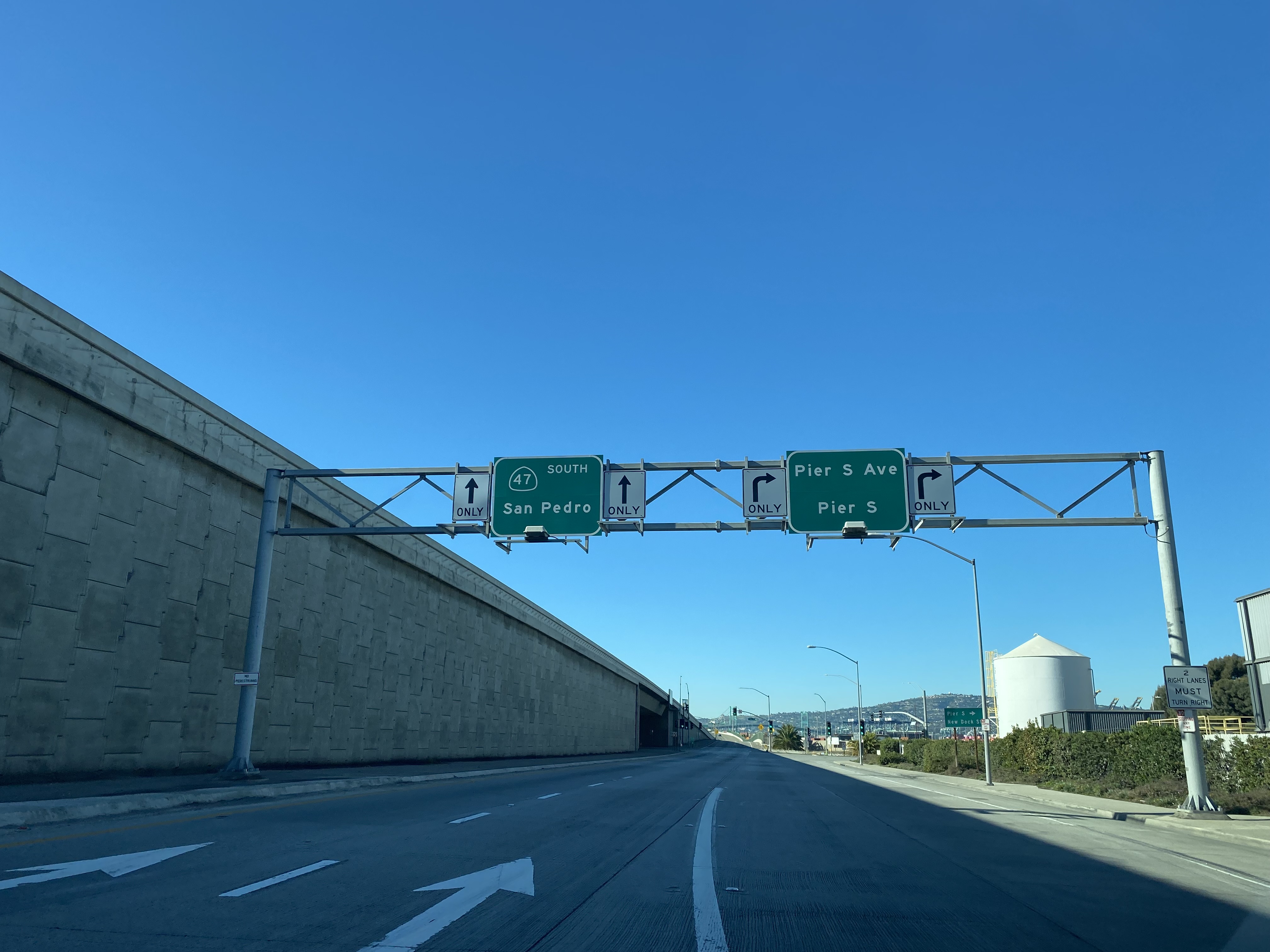
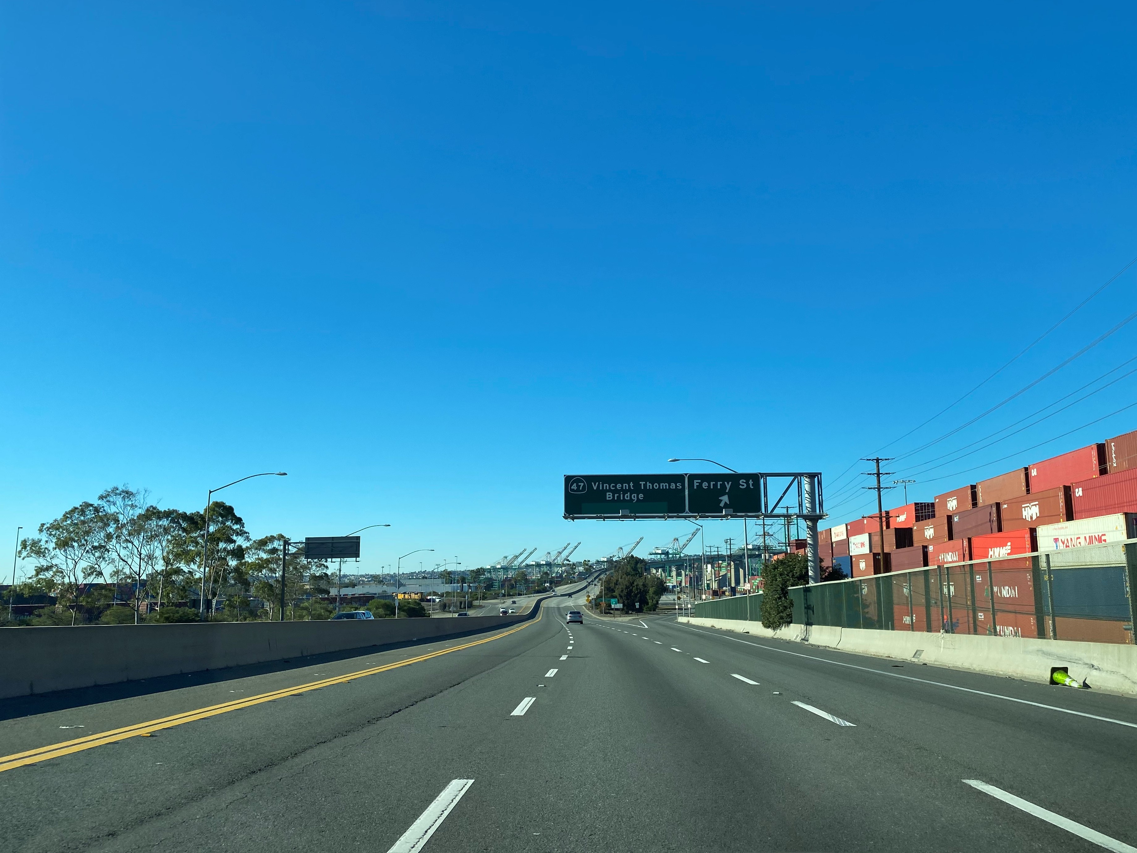
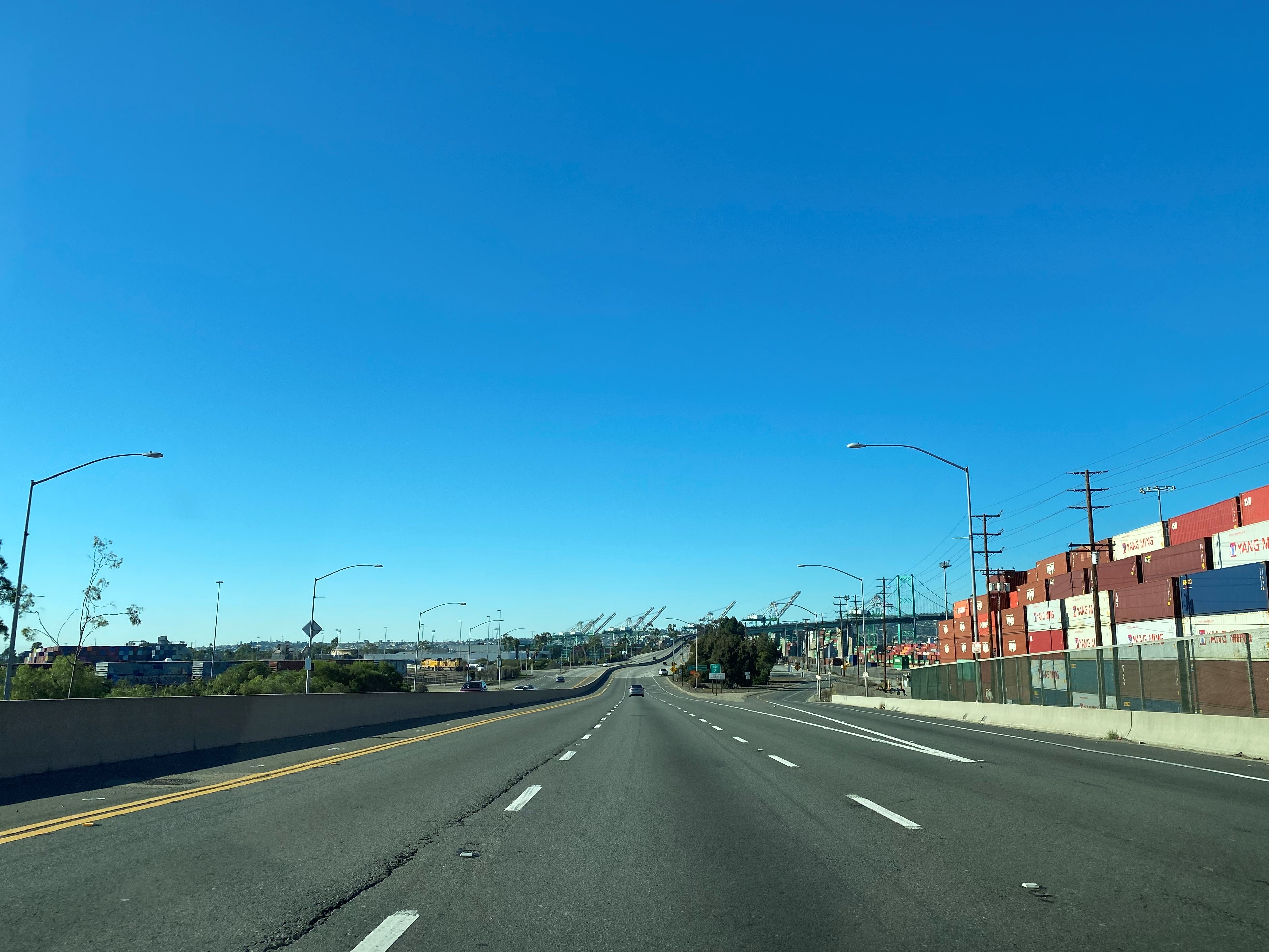
CA 47 follows the Terminal Island Freeway south into Long Beach over Cerritos Channel via Schuyler F. Heim Bridge onward to Seaside Avenue on Terminal Island. Traffic following CA 47 is directed to take Seaside Avenue west towards the Vincent Thomas Bridge whereas traffic heading towards downtown Long Beach is directed to take Interstate 710 via the Long Beach Freeway.
CA 47 follows Seaside Avenue west back into the city of Los Angeles onward to the foot of the Vincent Thomas Bridge.
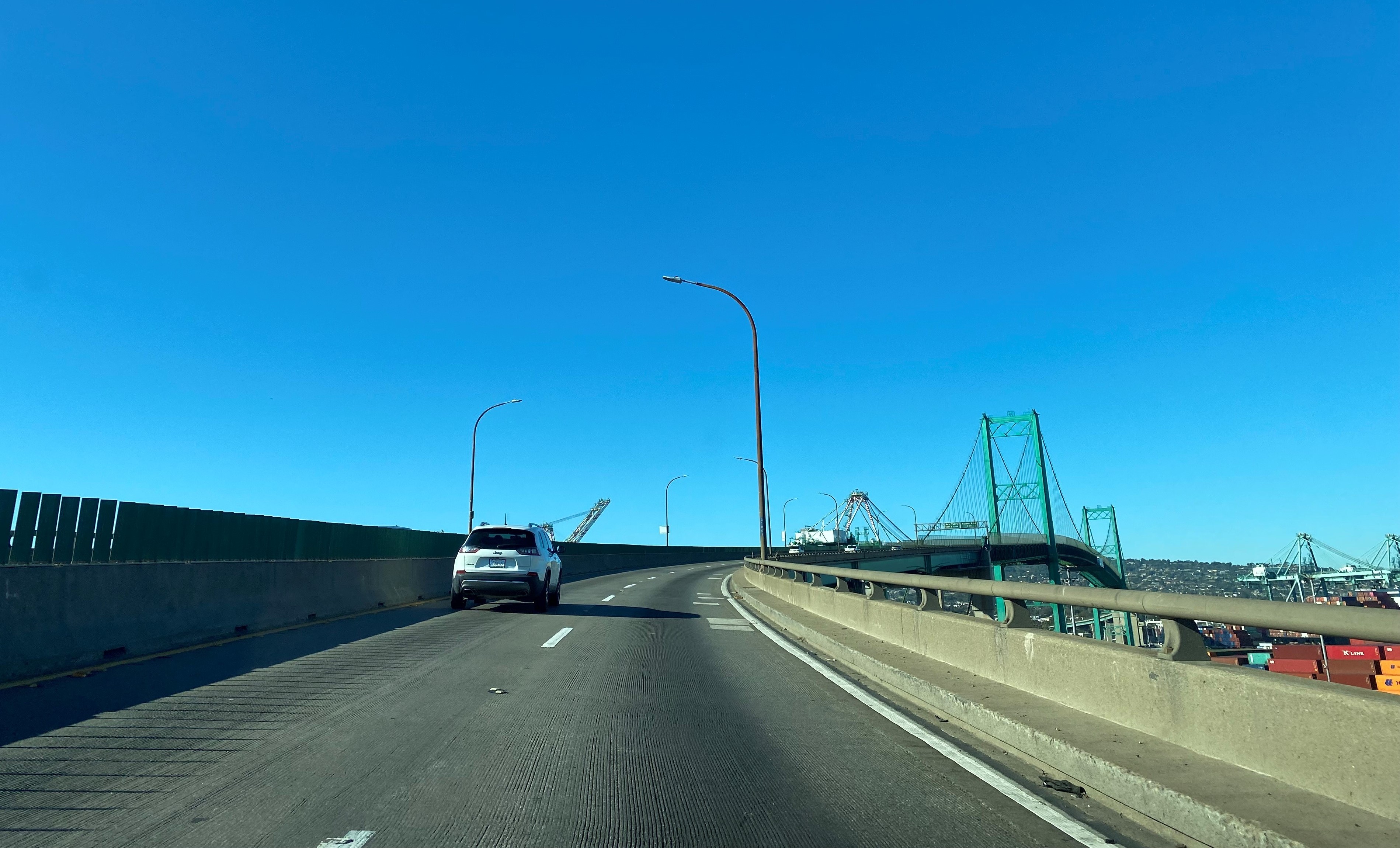
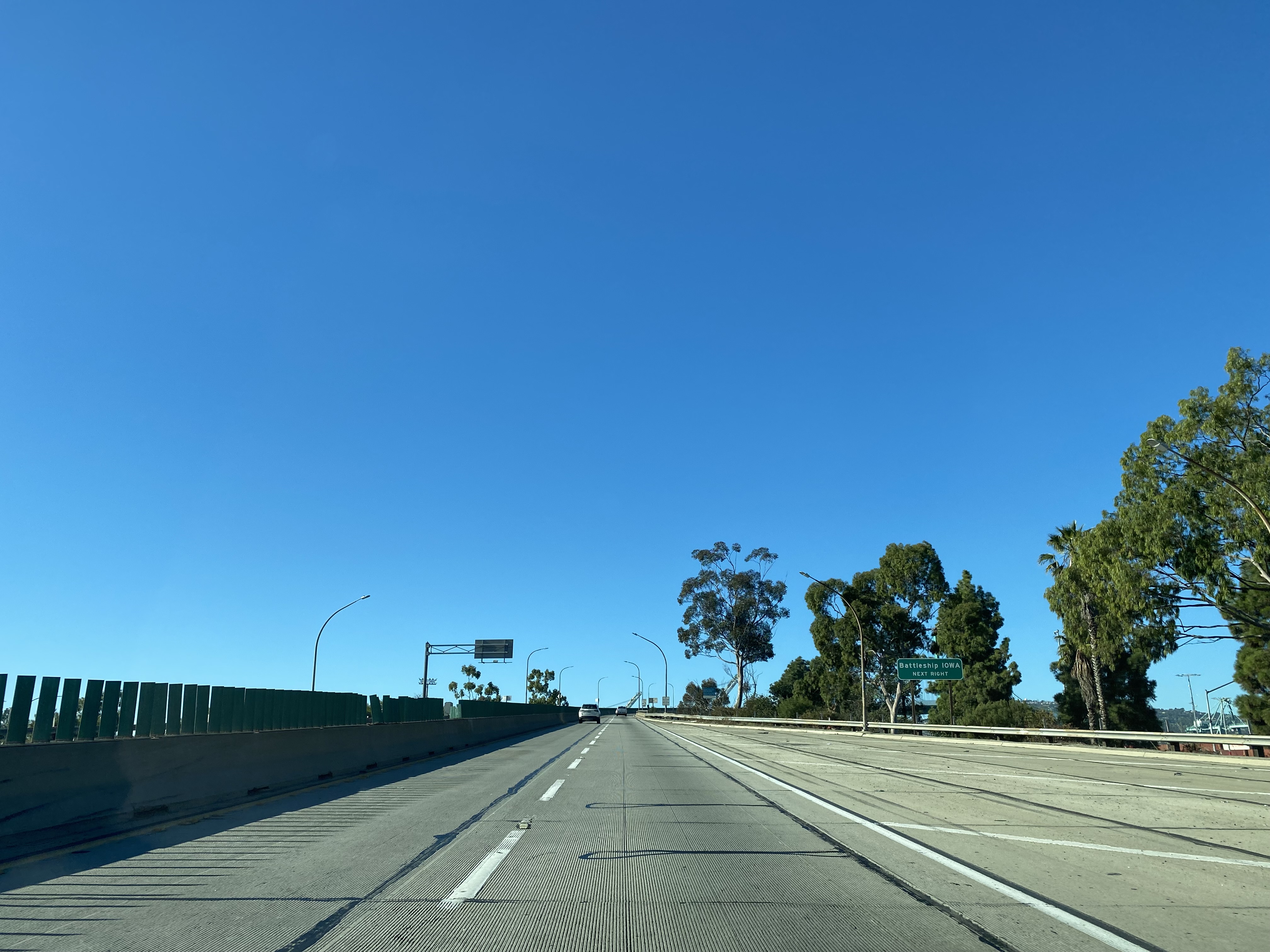
CA 47 crosses Los Angeles Harbor via the 6,060-foot-long Vincent Thomas Bridge into San Pedro.
CA 47 terminates in San Pedro at Interstate 110/Harbor Freeway.
Notably even though Henry Ford Avenue and Alameda Street are not State Maintained signage indicating them as CA 47 can be found. This CA 47 sign directing traffic to Alameda Street can be found on Henry Ford Avenue immediately north of the Terminal Island Freeway.
Another CA 47 shield on northbound Henry Ford Avenue.


Comments