In this edition of Paper Highways we look at the history of the incomplete California State Route 169 and it's origins as part of California State Route 96.

Present CA 169 is a 24 mile State Highway which begins at US 101 near Klamath in Del Norte County and ends at CA 96 in Weitchpec of Humboldt County. CA 169 has a 18 mile gap of unconstructed highway along the Klamath River and Yurok Reservation.

Part 1; The History California State Route 169
The present route of CA 169 was added to State Highway System during the 1919 Third State Highway Bond Act according to CAhighways.org as Legislative Route 46. LRN 46 was plotted as a highway from Legislative Route 3 (future US 99) at the Klamath River Bridge west to Legislative Route 1 (future US 101 at the Klamath River. LRN 46 appears on the 1920 Division of Highways Map plotted as projected by it's 1919 Third State Highway Bond Act Definition.


The 1922 Division of Highways Map shows LRN 46 under the process of being graded immediately west of LRN 3.

The 1924 Division of Highways Map shows LRN 46 under construction from Happy Camp through Klamath National Forest to Somesbar.

LRN 46 is shown as a functional highway from LRN 3/US 99 west to Weitchpec on the 1930 Division of Highways Map. LRN 46 northwest to LRN 1/US 101 is shown to be a planned highway along the Klamath River. Bald Hills Road is shown as a functional connecting local road from LRN 46 in Weitchpec west to LRN 1/US 101.

In the August 1934 California Highways & Public Works Guide the Sign State Routes were announced. CA 96 was announced to be aligned completely over the unfinished LRN 46 from US 101 near Klamath east to US 99 near Yreka via the Klamath River (hence the name; Klamath River Highway). The map provided in the CHPW guide shows CA 96 as it was originally intended to be aligned entirely over LRN 46.


CA 96 as originally planned on LRN 46 appears on the 1935 Goshua Map of California.

The 1935 Division of Highways Map of Del Norte County shows CA 96/LRN 46 completed from US 101/LRN 1 east from Klamath to Klamath Glen.

The 1935 Division of Highways Map of Humboldt County shows CA 96/LRN 46 completed west of Weitchpec to Martins Ferry. Bald Hills Road is shown to be the locale connecting road west to US 101/LRN 1 near Orick. It is unclear if CA 96 was ever signed over Bald Hills Road to US 101.

CA 96 is shown to be realigned off of LRN 46 south of Weitchpec via LRN 84 to US 299 at Willow Creek. LRN 84 was added to the State Highway System during 1933 according to CAhighways.org. It was likely CA 96 was realigned via easier grades of LRN 84 since it followed the Trinity River to US 299. The planned route of LRN 46 west of Weitchpec followed a far more flood prone Klamath River to US 101. The new alignment of CA 96 on LRN 84 can be seen on the 1938 Division of Highways State Map.
Not much happened with LRN 46 between Weitchpec west to Klamath until the 1950s. The January/February 1956 California Highways & Public Works guide discusses floods from December 1955 on the Klamath River which damaged LRN 46 between Weitchpec and Martins Ferry. The floods of December 1955 affected almost all the major highways of Northwestern California and were a driver towards infrastructure improvements.

The September/October 1959 California Highways & Public Works Guide discusses Humboldt County applying for State aid for 43 new bridges. One of the new bridges cited was just off of LRN 46 at Martins Ferry. The new Martins Ferry Bridge is featured along with several other structures. The Martins Ferry Bridge project reconnected Bald Hills Road to LRN 46 but also seems to have been the root of construction west towards Klamath.

The 1960 Division of Highways Map shows LRN 46 extended west along the Klamath River to the Yurok Reservation. The reminder of unbuilt LRN 46 along the Klamath River is shown not to have a determined routing. This is as far as LRN 46 would ever come towards being completed.

During the 1964 State Highway Renumbering LRN 46 from Weitchpec west to Klamath was reassigned as CA 169. CA 169 can be first seen on the 1964 Division of Highways Map.

The driving force behind why CA 169 along the Klamath River was never completed seems to be the massive floods of December 1964 in Northwest California. The floods of December 1964 are referenced heavily in an article about US 101/US 199 on the Redwood Highway in the March/April 1965 California Highways & Public Works Guide. According to CAhighways.org the status of completing CA 169 has largely remained in limbo since 1964. The only major activity regarding CA 169 as of late was a feasibility study regarding finishing the highway gap which was conducted during 2002.
Part 2; A Tour of the West Segment of CA 169
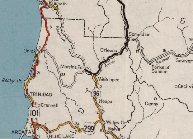
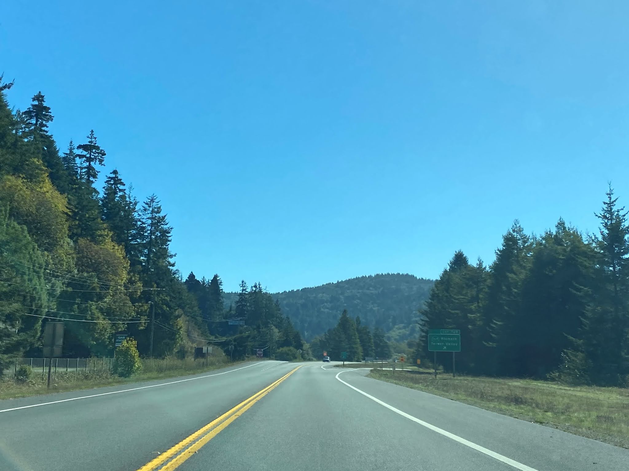
Our virtual tour of CA 169 begins from US 101 southbound at Old Klamath. CA 169 eastbound begins from US 101 southbound Exit 769.


Part 3; A Virtual Tour of the East Segment of CA 169
The virtual tour of the East Segment of CA 169 begins from CA 96 east in Weitchpec at the Klamath River. Interestingly Martins Ferry is shown as a Control City 5 miles west on CA 169 but Orick by way of Bald Hills Road is also displayed at 39 miles west.


CA 169 westbound quickly drops to a one-lane State Highway. The East Segment of CA 169 is one of the few remaining State Highways in California which has one-lane segments.

CA 169 west has an interesting Control City..."End of Road" is a place I've never heard of. Notably Wauteck Village is signed as 20 miles west on CA 169.

At Post Mile HUM 29.955 CA 169 west approaches the Martins Ferry Bridge. End of the Road is signed as 18 miles away on CA 169 west.


CA 169 west of the Martins Ferry Bridge continues as a one-lane State Highway along the east bank of Klamath River.

At Post Mile HUM 28.500 CA 169 west crosses Rube Ranch Creek.

CA 169 west briefly expands to two lanes and crosses Coon Creek at Post Mile HUM 25.800.

CA 169 reduces back down to a single lane upon crossing Coon Creek.

At Post Mile HUM 24.66 CA 169 west crosses Mawah Creek.

CA 169 westbound does have some scenic vistas of the Klamath River.

At Post Mile HUM 23.823 CA 169 crosses Cappell Creek.

At Post Mile HUM 14.968 CA 169 westbound enters the community of Surgone.

Surgone is one of the few places on CA 169 westbound that has a clear tree line.

CA 169 enters Pecwan and crosses Pecwan Creek at Post Mile HUM 14.44.

Approaching Johnsons (AKA Wauteck Village) traffic is advised "End of Road" lies 1,500 feet ahead.

The East Segment of CA 169 ends at Johnsons Road at Post Mile HUM 13.2.


Comments
It has been thought that a river crossing was bei g considered at Pecwan Creek. It has a lot of exposed bedrock and has some tribal event areas I a wide usable area. But I haven't seen any idea of progress toward finishing the 169 that I believe would be beneficial for the Yurok as well as the other tribal entities here as well.