
Old Wards Ferry Road is an approximately 3.6-mile portion of the original alignment of Wards Ferry Road located near the city of Sonora, California. As currently configured this older alignment begins at modern Wards Ferry Road near Curtis Creek and terminates in Sonora at Sanguinetti Road. The Olds Wards Ferry Road corridor is largely defined by the single lane 1914-era arch concrete bridge at Curtis Creek.
Wards Ferry Road is one of the oldest road corridors in Tuolumne County having been set up as a ferry crossing by Joesph Ward during 1850. Wards Ferry Road was once the primary connecting highway between the communities of Big Oak Flat and Sonora. Wards Ferry Road is most well-known from the largely one-lane wide alignment through Murderer's Gulch where it crosses the Tuolumne River via heavily graffitied 1971 Wards Ferry Bridge. Pictured as the blog cover is the 1897 Wards Ferry Bridge as it was during 1951. The 1897 Wards Ferry Bridge was built upon the anchoring piles of the original 1879 Wards Ferry Bridge which had burned during 1891.

Part 1; the history of Old Wards Ferry Road
According to Groveland Museum historian Joe Hopkins a ferry crossing across the Tuolumne River across what is now known as Murderer's Gulch was developed by Joseph Ward during 1850. Joseph Ward was ultimately murdered by the highway robbers during 1854 at the site of his ferry at the Tuolumne River. The murder of Joseph Ward would be the inspiration for the name for what is now known as Murderer's Gulch. The highway between Sonora and Big Oak Flat would ultimately assume the name "Wards Ferry Road" from the site of Joseph Ward's ferry. Below a 2019 ABC 10 interview with Joe Hopkins can be viewed:
Below Wards Ferry Road can be seen as the primary highway connecting Sonora and Big Oak Flat on the 1873 Bancroft's Map of California, Nevada, Utah and Arizona.

During 1879 a tolled suspension bridge was constructed in Murderer's Gulch at the site of Wards Ferry. According to Jon Hicks and Ron P. Parker the 1879 Wards Ferry Bridge was burned by bandits January 31, 1891, to cover the murder toll taker Charles Pease and his friend Byron Lowe. The 1879 Wards Ferry Bridge can be seen in the undated photo below (courtesy Ron P. Parker).

The original northern terminus of Wards Ferry Road was located at Sanguinetti Road in Sonora. This can be seen on the 1893 United States Geological Survey map of Sonora (marked in blue).

According to Ron P. Parker a truss span was completed utilizing the anchoring piles of the 1879 Wards Ferry Bridge on November 12, 1897. Below the 1897 Wards Ferry Bridge can be seen along with a wagon crossing the Tuolumne River (courtesy Ron P. Parker).

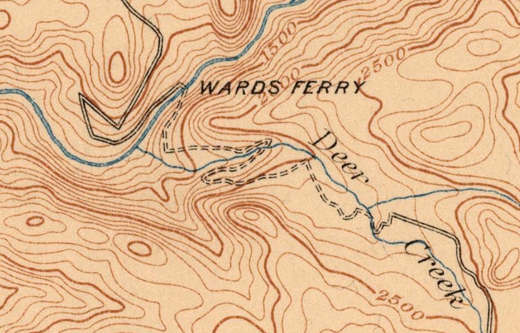
Wards Ferry Road and the site of the 1897 Wards Ferry Bridge can be seen below on the 1912 United States Geological Survey Map of the Sonora Area.
During 1914 Tuolumne County constructed an arch concrete bridge on Wards Ferry Road at Curtis Creek. This 46.9-foot-long single lane structure would be the impedes for the alignment of Wards Ferry Road to shift towards Tuolumne Road.
Wards Ferry Road was largely unaffected by the completion of the first iteration Don Pedro Dam in 1923. The original Don Pedro Reservoir was not large enough to reach the sites of Murderer's Gulch and the 1897 Wards Ferry Bridge. The 1897 Wards Ferry Bridge can be seen during 1951 in a University of California Davis sourced photo.

The 1935 Division of Highway map of Tuolumne County displays Wards Ferry Road realigned north of Curtis Creek towards Tuolumne Road near Standard. This new alignment while less direct to Sonora did not require replacing the Curtis Creek Bridge. The original alignment from near Curtis Creek to Sonora became known as Old Wards Ferry Road.

Olds Wards Ferry Road can be seen in greater detail on the 1948 United States Geological Survey map of Sonora. The split between Old Wards Ferry Road and the realigned Wards Ferry Road is marked in blue.

During 1971 Don Pedro Dam was heighted which led to the catchment area of Don Pedro Reservoir expanding to Murderer's Gulch and the 1897 Wards Ferry Bridge. The 1897 Wards Ferry Bridge truss span was removed which left only the anchoring piles intact. A new Wards Ferry Bridge was constructed downstream which has in modern times come to be known as the "Graffiti Bridge" due to the large amount of vandalism it has been subject to. The site of the 1879 and 1897 Wards Ferry Bridges can be viewed in a photo taken on May 26, 2022.

Old Wards Ferry Road splits from modern Wards Ferry Road near Curtis Creek.


Old Wards Ferry Road widens to two lanes and crosses over a bridge at Sullivan Creek.


Old Wards Ferry Road crosses over the modern California State Route 108 freeway and enters the city of Sonora.


Olds Wards Ferry Road crosses the Sierra Railroad and terminates at Sanguineti Road.

Comments