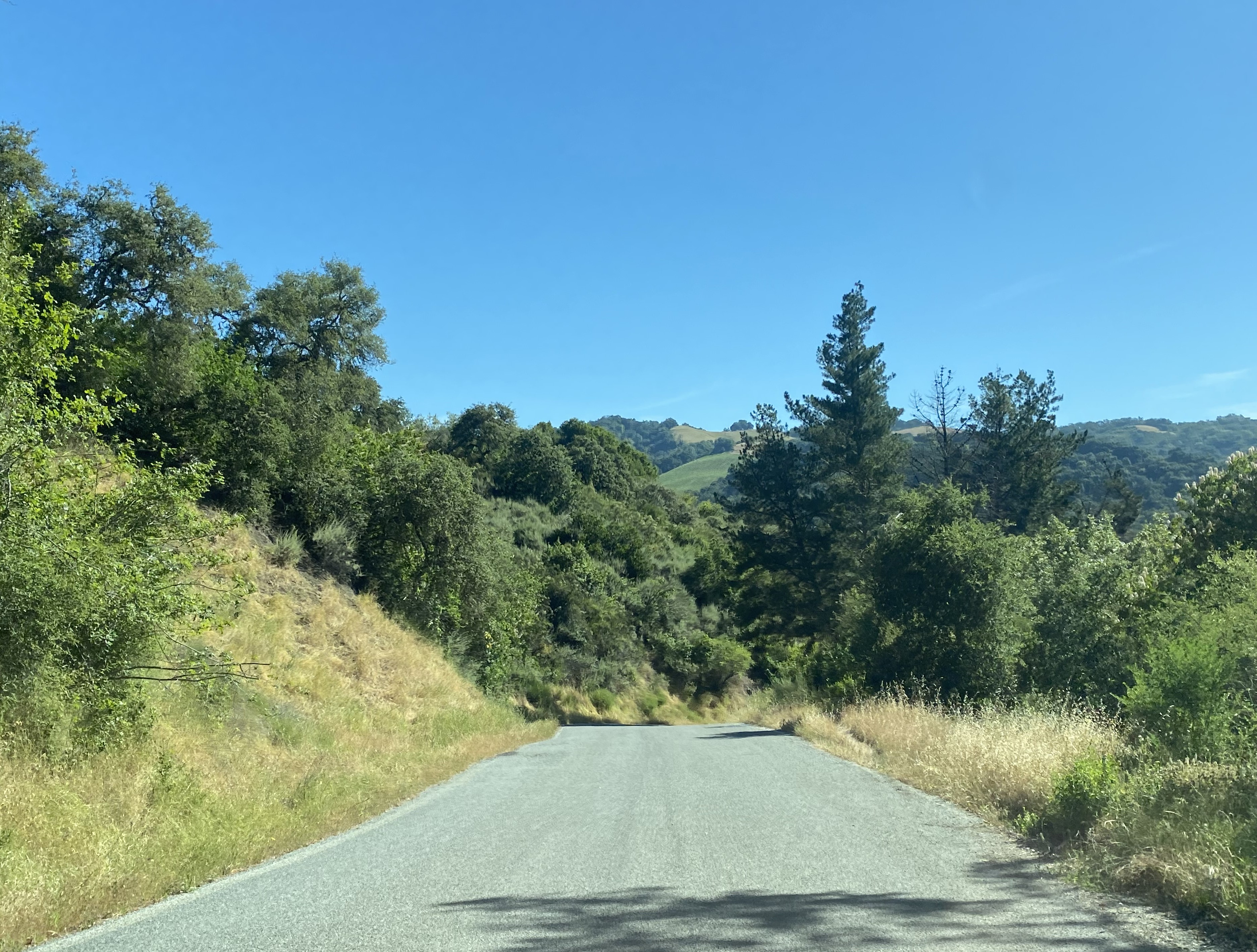
Mount Madonna Road


Mount Madonna Road is a 6.6-mile rural highway which originates at Casserly Road in Santa Cruz County and terminates at Redwood Retreat Road in Santa Clara County. As the name suggests the road climbs over Mount Madonna in the Santa Cruz Mountains.

Mount Madonna Road for a short roadway features numerous varying conditions. The road is mostly single lane with a crest which lies an elevation of 1,714 feet above sea level. Much of the gradient is steep and has inclines as high as 12.9%. There is also a dirt portion north of Summit Road which descends through a Coastal Redwood grove.

Mount Madonna Road is the original highway which connected Watsonville and Gilroy. Traditionally the roadway was known as "Watsonville Road" but was ultimately replaced by Hecker Pass Highway (now California State Route 152) in 1928. The modern road nomenclature appears to have been in place since Mount Madonna Park expanded in 1953.


Part 1; the history of Mount Madonna Road

Mount Madonna Road was the original highway over the Santa Cruz Mountains which connected Gilroy and Watsonville.  Traditionally the roadway was known as "Watsonville Road" through much of duration it served both communities.  The roadway is named after nearby Mount Madonna which lies at an elevation of 1,897 feet above sea level.  

The origin of Gilroy date back to Alta California and the arrival of Scotsman John Gilroy.  John Gilroy was a crew member of armed merchant ship Issac Todd which was sent by the North West Company during the War of 1812 to capture American Fort Astoria.  The Issac Todd arrived in the Spanish port of Monterey in January of 1814 where John Gilroy was either left behind or jumped ship to recover from Scurvy.  

John Gilroy was a barrel maker and spent the next several years plying his trade in northern Alta California.  John Gilroy eventually came to Rancho San Ysidro (which was on the Spanish El Camino Real) where he converted to Catholicism and became the first English speaking naturalized citizen of Alta California.  In 1821 (the same year the Mexican's won independence from Spain) John Gilroy married Maria Clara who was the daughter of rancher Ygnacio Ortega.  Upon the death of Ygnacio Ortega in 1833 Rancho San Ysidro was divided up between his three children.  Following the Mexican-American War of 1848 the property rights to Rancho San Ysidro were granted to John Gilroy.   

John Gilroy's property would soon grow into a town bearing his name.  Given the close proximity of Gilroy to Pacheco Pass it became a stop on the Butterfield Overland Mail route from 1858 to 1861.  In 1868 Gilroy incorporated as a town and successfully lobbied to become a stop on the new Southern Pacific Railroad Line.  The core of Gilroy was relocated westward to where the Southern Pacific Railroad would pass by, and the original town core came to be known as Old Gilroy.  The Southern Pacific reached Gilroy by 1869 and was reincorporated as a city in March of 1870.

During the period of Mexican Alta California, the area that is now Watsonville became Rancho Bolsa del Pajaro.  Rancho Bolsa del Pajaro was granted in 1837 to Sebastian Rodriguez.  The area was attractive to numerous American settlers due to it being close proximity to the fertile fields north of the Pajaro River.  

Rancho Bolsa del Pajaro was sold in 1852 to San Francisco district judge John Watson.  Following the purchase, Watson would resign his position and plot the town site of Watsonville on his new land holdings.  Watsonville would incorporate as a town on March 30, 1868. 

The 1876 Thompson & West Atlas of Santa Cruz County depicts Watsonville Road crossing Mount Madonna west of Gilroy.  Watsonville Road is seen crossing through Solis Rancho and climbing to the Santa Cruz County line in Township 10S, Range 2E.

Watsonville Road can be seen connecting Watsonville-Gilroy via Mount Madonna on the 1882 Bancroft's Map of California.  

In 1875 (visitgilroy.com) rancher Henry Miller would purchase 13,000 acres of land atop Mount Madonna as a summer retreat.  During the late nineteenth century, much of the old growth Coast Redwoods were logged at the Miller property.  In 1901 Miller would construct a summer home at Mount Madonna near Watsonville Road (South Santa Clara County by Sam Shueh).

Following the 1906 San Francisco Earthquake logging at Mount Madonna would cease on the Miller property.  During the early automotive era the use of Watsonville Road as a primary highway was becoming increasingly problematic.  The roadway was narrow and carried grades as high grades near the summit.

Watsonville Road over Mount Madonna is shown as the primary automotive highway between Watsonville-Gilroy on the 1917 California State Automobile Association map.  Watsonville was not served by the State Highway System until Legislative Route Number 67 (now California State Route 129) was defined in 1921 through the Chittenden Pass corridor. 
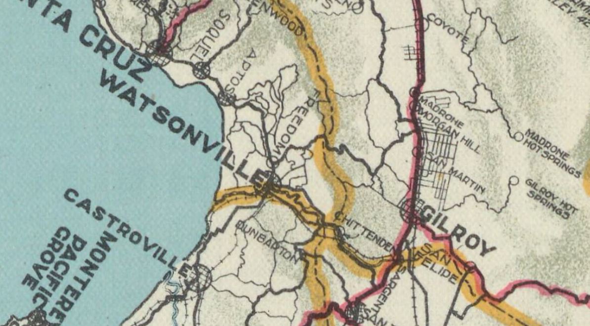
A portion of Miller's estate would be acquired by Santa Clara County in 1927 (visitgilroy.org) to form Mount Madonna Park.  During the late 1920s Santa Cruz County and Santa Clara County would construct Hecker Pass Highway between Watsonville-Gilroy in the Santa Cruz Mountains.  The new highway was dedicated on March 27, 1928 (South Santa Clara County by Sam Shueh).

In 1933 Hecker Pass Highway would be added to the State Highway System as an extension of Legislative Route Number 32 west of Gilroy.  The corridor was assigned as part of California State Route 152 when the initial run of Sign State Routes was announced in the August 1934 California Highways & Public Works.  

Northern Mount Madonna Road can be seen north of California State Route 152 and Hecker Pass Highway on the 1935 Division of Highways Map of Santa Clara County.  


Southern Mount Madonna Road can be seen on the Santa Cruz County Map from the same year.  


In 1953 (visitgilroy.org) Santa Clara County would annex the rest of the Miller estate as an addition to Mount Madonna Park.  The addition included the ruins of the 1901 era Miller summer home.  

The 1955 United States Geological Survey map of Mount Madonna depicts some changes to the name of Watsonville Road.  The road is shown as "Mount Madonna Road" within Santa Cruz County whereas it appears as "Old Watsonville Road" in Santa Clara County.  The renaming of Old Watsonville Road as part of Mount Madonna Road appears to have happened in recent decades.  


According to PJAMMcycling the four miles of Mount Madonna Road between Hazel Dell Road and Redwood Retreat Road has an average gradient of 7.5%.  The peak grade is shown to be 12.9% and the roadway crests at 1,714 feet above sea level.  


Part 2; a drive on Mount Madonna Road

Northbound Mount Madonna Road begins in Santa Cruz County via a right-hand turn from Casserly Road.  


Mount Madonna Road from Casserly Road north to Hazel Dell Road is two-lanes and relatively flat.  


Mount Madonna Road north of Hazel Dell Road makes a rapid ascent into the Santa Cruz Mountains.  The roadway enters a Redwood grove approaching the Santa Clara County line and crests at Summit Road in Mount Madonna Park. 


The dirt portion of Mount Madonna Road north of Summit Road is easily observed by a group of Redwoods which functionally make it a Y junction.  


Mount Madonna Road begins to descend from Summit Road amid a grove of Redwoods.  The roadway becomes a single lane of asphalt upon departing Mount Madonna Park. 


Mount Madonna Road crosses Little Arthur Creek and terminates at Redwood Retreat Road.  


Comments

Popular posts from this blog

Cajon Pass; Cajon Pass Toll Road, National Old Trails Road, US Route 66/91/395 and Interstate 15

This past weekend I spent some time in Cajon Pass traversing the many historic road alignments. Cajon Pass is located in San Bernardino County, California along the San Andreas Fault.  Cajon Pass  serves the boundary line between the Mojave Desert, the San Gabriel Mountains, San Bernardino Mountains and San Bernardino Valley.  Cajon Pass is historically one of the most traveled transportation corridors in American California and presently is served by four rail lines, Interstate 15 and California State Route 138. While Cajon Pass is known mostly for carrying US Route 66 it has carried numerous other signed highways that have had a significant impact on regional and national road travel.  While this is my best attempt to compile everything from the best sources I could find into one single transportation history blog regarding road travel in Cajon Pass I suspect as time goes on this article will be frequently updated.  If you have any information that you ...

Pardee Dam Road

Pardee Dam is a 358-foot-high concrete structure located near Campo Seco at the Calaveras County and Amador County Line.  Pardee Dam impounds the Mokelumne River which forms the namesake Pardee Reservoir.  Pardee Dam was completed during 1929 and is part of the East Bay Municipal Utility District.  Pardee Dam is accessed by the namesake Pardee Dam Road which crosses the structure via the one-lane road seen as the blog cover photo.   Part 1; the history of Pardee Dam Road The closest community to Pardee Dam is that of Campo Seco on the Calaveras County side of the Mokelumne River.  Campo Seco was founded in 1850 by Mexican Miners who worked placer claims in Oregon Gulch during the height of the California Gold Rush.  Campo Seco would reach a population of about three hundred by 1860 spurred by the numerous mining claims in the area.  Main Street of Campo Seco flowed directly into the Campo Seco Turnpike which had been authorized by the California L...

California State Route 82/Old US Route 101 on the El Camino Real from San Francisco to Interstate 380

After completing Interstate 380 I made my way northward into the City Limits of San Francisco to drive the northernmost portion of California State Route 82. CA 82 is 52 mile State Route between I-280 in San Francisco southward to Interstate 880 in San Jose.  CA 82 is significant due to it being part of the historical surface alignment of US Route 101 and the El Camino Real. The "El Camino Real" was a Spanish Highway in Las Californias and Alta California which connected the 21 Catholic Missions along the coast.  Essentially the route of the El Camino Real was plotted out in the late 1700s from two Spanish survey expeditions.  The Missions were plotted approximately 30 miles apart along the 600 mile route so that they would be a single day journey by horse.  The El Camino Real name fell into disuse after the Mexican Revolution of 1821 but was revived by American highway promoters in the 1890s and 1900s.  Today the El Camino Real is mostly associated...