
Coast Road is an approximately 10-mile dirt corridor which loops modern California State Route 1 between the Bixby Creek Bridge to the entrance of Andrew Molera State Park. Coast Road was originally part of a foot trail in the Big Sur region developed during the early 1850s. The Coast Road was declared a public highway in 1855 and was improved during the 1880s to permit wagon travel to Post's Ranch.
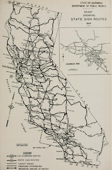
Coast Road would be annexed as part of the interim routing of Legislative Route Number 56 in 1926. The interim State Highway corridor was necessary due to the then ongoing construction of the Carmel-San Simeon Highway throughout the Big Sur region. Coast Road was relinquished in November 1932 when the Bixby Creek Bridge realigned state highway corridor towards the coastal cliffs. The entirety of Legislative Route Number 56 would be assigned as California State Route 1 during August 1934. The Carmel-San Simeon Highway (now Cabrillo Highway) would be completed during June 1937.
Coast Road persisted as a minor local highway after being relinquished in 1932. The modern Bailey truss spans at the forks of the Little Sur River were installed by Monterey County in 1950. Since 1950 the character of Coast Road has changed little as it is often impassable to low clearance traffic due to wet weather.

Part 1; the history of Coast Road
The story of coastal roadways south of the Carmel River in the Big Sur region is surprisingly old. A trail from Monterey southward to El Rancho Sur between the Little Sur and Big Sur River existed as early 1853. This trail was declared a public road by Monterey County in 1855. By 1870 the trail had been improved to a wagon road as far south as Bixby Creek. The 1873 California Geological Survey Map of Central California shows the primitive road south from Mission San Carlos Borromeo de Carmelo to the Little Sur River.

The Coast Road south from the Monterey Peninsula south towards Point Sur can be seen in detail on the 1882 Bancroft's map of California.

The Coast Road south from the Monterey Peninsula south towards Point Sur can be seen in detail on the 1882 Bancroft's map of California.

By 1886 the trail south to the vicinity of Sycamore Canyon at W.B. Post's Ranch had been improved enough to permit wagon travel. The wagon route from Carmel Bay south to Post's Ranch can be seen on the 1896 Blum Map of Central California.

In 1894 Dr. John Roberts traveled out of Monterey to Point Sur to respond to a wrecked ship by of the existing wagon road. The trip ultimately spurred Dr. Roberts to petition the state legislature to build a roadway between Carmel and San Simeon. The crux of the argument for a coastal roadway was that it would aid national defense during World War I. This account is detailed on a historic plaque just south of the Big Creek Bridge at the Big Creek Vista located at Post Mile MON 27.325.

A wagon can be seen traveling the Coast Road in 1900 (Monterey County Historical Society photo).

In 1894 Dr. John Roberts traveled out of Monterey to Point Sur to respond to a wrecked ship by of the existing wagon road. The trip ultimately spurred Dr. Roberts to petition the state legislature to build a roadway between Carmel and San Simeon. The crux of the argument for a coastal roadway was that it would aid national defense during World War I. This account is detailed on a historic plaque just south of the Big Creek Bridge at the Big Creek Vista located at Post Mile MON 27.325.

A wagon can be seen traveling the Coast Road in 1900 (Monterey County Historical Society photo).

In 1919 the Third State Highway Bond Act defined Legislative Route Number 56 as a planned State Highway between Carmel and San Simeon. The existing Coast Road in the Big Sur region was not immediately annexed as State Highway. Planned Legislative Route Number 56 in the Big Sur region appears on the 1920 California Highway Commission map.


In 1921 the Legislature extended Legislative Route Number 56 south to Cambria which is reflected on the 1922 California Highway Commission map. The Division of Highways assumed control of the existing road between Cambria and San Simeon while a section near Ragged Point north to the Monterey County line appear as under construction.

On the 1924 California Highway Commission map a section of Legislative Route Number 56 south of Big Sur appears under construction.

The March 1926 California Highways and Public Works Guide announced that the Division of Highways assumed control of the existing highway from Carmel south to the Big Sur River. Statements like "Bugbear" (which apparently means; a cause of obsessive fear, irritation, or loathing) and "somewhat safer" are amusing to read in a modern context.


Coast Road along Bixby Creek can be seen below as it was in 1926 (Monterey Historical Society photo).

On the 1928 Division of Highways State Map work on Legislative Route Number 56 north from Ragged Point continued into Monterey County approaching Gorda.

The December 1931 California Highways and Public Works detailed the ongoing construction of the Garrapata Creek and Granite Creek Bridges. The Garrapata Creek Bridge is cited to have opened in November 1931, and the Granite Creek Bridge was anticipated to open in early 1932.


In 1931 Legislative Route Number 56 was extended south to San Luis Obispo which is reflective on the 1932 Division of Highways Map. A third construction segment south out of Carmel to Point Sur also appears on this map edition.

The dedication ceremony for the opening the Bixby Creek Bridge was held on November 28, 1932. The opening of the structure was heavily featured in the December 1932 California Highways and Public Works. The opening of the span allowed Legislative Route Number 56 to be realigned off of Coast Road onto a modern routing between Bixby Creek and the Big Sur River. Coast Road was subsequently relinquished from the State Highway System.

The December 1931 California Highways and Public Works detailed the ongoing construction of the Garrapata Creek and Granite Creek Bridges. The Garrapata Creek Bridge is cited to have opened in November 1931, and the Granite Creek Bridge was anticipated to open in early 1932.


In 1931 Legislative Route Number 56 was extended south to San Luis Obispo which is reflective on the 1932 Division of Highways Map. A third construction segment south out of Carmel to Point Sur also appears on this map edition.

The dedication ceremony for the opening the Bixby Creek Bridge was held on November 28, 1932. The opening of the structure was heavily featured in the December 1932 California Highways and Public Works. The opening of the span allowed Legislative Route Number 56 to be realigned off of Coast Road onto a modern routing between Bixby Creek and the Big Sur River. Coast Road was subsequently relinquished from the State Highway System.


Coast Road can be seen east of California State Route 1 between Bixby Creek and the Big Sur River on the 1935 Division of Highways map of Monterey County.

On June 27, 1937, the completed California State Route 1 and the Carmel-San Simeon Highway in Big Sur would open to traffic. The completion of the highway in Big Sur was the cover story in the July 1937 California Highway and Public Works.


The Bixby Creek Bridge and the southbound beginning of Coast Road can be seen below in 1948. The Bixby Inn can be seen on the right, and the caption notes the state highway corridor was renamed as "Roosevelt Highway."

In 1950 Monterey County replaced the two bridges over the forks of Little Sur River on Coast Road. In 1965 Monterey County would place a new bridge on Coast Road at Bixby Creek.
These photos (Craig Philpott) are from the North Fork Little Sur River Bridge on Coast Road. This Bailey truss span measures 91.9 feet in length.


These photos are of the South Fork Little Sur River Bridge (Craig Philpott). This Bailey truss span is only 63 feet in length.


This photo is from a very foggy day during June 2017 facing the southbound beginning of Coast Road at the Bixby Creek Bridge. Signage indicates Coast Road to be impassable during wet weather.

In recent years there was an increasing number of cars parking along the northern extent of Coast Road to visit the Bixby Creek Bridge. The photos are from March 2018 shortly after Monterey County began signing Coast Road as "Local Traffic Only." From the northbound beginning of Coast Road near the Big Sur River the "local traffic" signage is not reciprocated.


This photo from northbound California State Route 1 was taken during January 2020. Cars can be seen parking along the northbound beginning of Coast Road due the lot at Andrew Molera State Park being full.

Comments