

One of the
great engineering achievements of southeast Louisiana – a region of the country
that is no stranger to impressive feats of engineering – is the Lake Pontchartrain
Causeway, or “The Causeway” as its often referred to, spanning the Lake between
suburban Jefferson Parish outside New Orleans and the north shore community of
Mandeville. At a length of 23.9 miles from end to end, it is one of the longest
bridges in the world – long enough to be classified in the Guinness Book of
World Records as the “longest continuous bridge over water in the world” as of January
2024.
The idea for the modern Causeway
was conceived in the years after World War II, when the New Orleans metro area
grew quickly as the suburban development of Jefferson Parish threatened to
spill over into the neighboring parishes. The Greater New Orleans Expressway
Commission (also known as the Causeway Commission) was established in 1948 with
the goal of planning and constructing the cross-lake bridge. Construction of
the initial two-lane bridge took place from 1953-1956 at a cost of $46 million,
including improvements to Causeway Boulevard in Metairie and Mandeville.

The above satellite view shows the greater New Orleans metro area to the bottom of the photo. Lake Pontchartrain, and the Causeway that crosses it, are visible at the center.
The Causeway proved to be a huge success from the beginning. In fact, in some ways it became a victim of its own success, with traffic counts soon proving to be too great for the two-lane bridge to safely handle. In response, planning for the parallel span took place in the early 1960s, with the new span opening in 1969 at a cost of $30 million. Since the completion of the parallel span, southbound traffic crosses on the original bridge, while northbound traffic crosses on the second bridge. While lying mostly level with the lake for its entirety, there are multiple raised navigation spans along the way for taller recreational boating traffic to pass safely under the bridges. A high-level bascule draw span stands near Milepost 17, about 8 miles south of the Mandeville shoreline, enabling larger commercial craft to pass the bridge. (On the Causeway, the mileposts begin with "0" located at the Metairie shoreline.)


These photos from November 2023 are taken from the Metairie shoreline and show how the Causeway starts out over the lake and disappears over the horizon. (Click on each photo to view a larger version.)
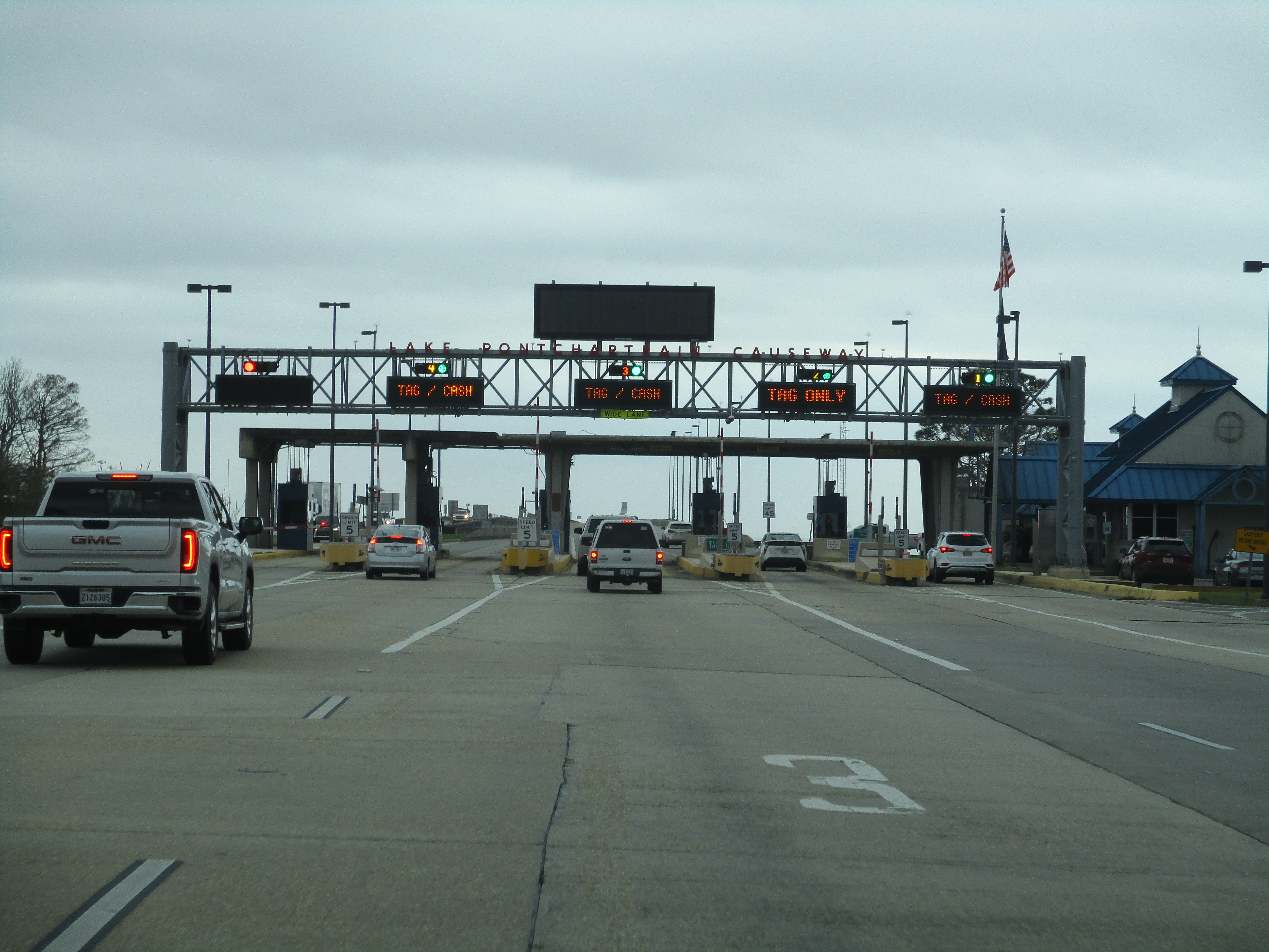
The Causeway
is operated as a toll bridge. As of January 2024, the cost is $6 for passenger
cars, collected in the southbound direction at a toll plaza on the Mandeville
approach to the bridge. Tolls were originally collected in both directions,
however northbound toll collection ceased in 1999 and the original northbound
toll plaza located at the end of Causeway Boulevard in Metairie was removed.
The frequent traffic jams caused by the toll plaza that often spilled over onto
Causeway Boulevard and the nearby intersection thoroughfares played a role in
this decision. In any case, the Causeway is one of the only tolled facilities
in the state of Louisiana. The tolls provide revenue that helps maintain the
bridges as well as fund improvement projects. The most significant of these
took place in 2019, when a $53 project saw the addition of emergency pull off
areas to the bridge in both directions. A separate project carried out later
that year saw the replacement and improvement of the railings and parapet
barriers along the length of the southbound bridge. All the measures taken
lately have significantly improved safety along the Causeway as traffic counts
are now as high as they have ever been.


The immense proportions of the Causeway's length can be appreciated the most from the air. These 2017 photos of the Causeway were taken by yours truly as an airplane passenger above Lake Pontchartrain. (Click on each photo to view a larger version.)
I’ve had the opportunity to drive the Causeway on multiple occasions over the years. My first visit to the crossing came in January 2017 as part of my initial visit to southeast Louisiana. In February 2023, I revisited the Causeway and got to experience a round-trip crossing on the bridge a second time. Crossing this bridge is one of those unique experiences that is both enjoyable and unpredictable at the same time. At a point about 10 miles into the crossing, land in all directions disappears from sight and one has the feeling of being isolated from civilization for a period of time. In the southbound direction, it’s often the case that the first signs of land to appear on the horizon are the skyscrapers of downtown New Orleans off to the southeast (including the roof of the Superdome) and the looming structure of the Lakeway Center located on Causeway Boulevard directly ahead.

Above: The skyline of New Orleans comes into view about 15 miles to the southeast as one travels southbound on the Causeway.
At a length
of 24 miles from end to end, it’s one of the longest stretches of highway in
America without any interchanges or ways to divert to an alternate route in the
event of trouble. Weather conditions often change rapidly over the lake,
meaning that the conditions that one encounters when setting off on the
Causeway can sometimes be very different only a few miles later. In the winter
months, dense fog is not uncommon over parts of the lake, meaning the visibility
can drop rather abruptly with little warning. In the summer months, the
trademark Louisiana thunderstorms can form quickly over the lake and drift over
the Causeway, causing hazardous conditions on a moment’s notice. The variable
weather conditions that can be experienced on any given day, plus the typical
risks for vehicle-related incidents on a bridge of this length, combine to make
for an exciting trip that always requires driver attention due to potential
unforeseen factors.


Bridges, Crossings, and Structures of the Lower Mississippi River
Visit the Bridges of the Lower Mississippi River Home Page
__________________________________________________
Comments