
Hawaii Route 72 is known as the Kalanianaʻole Highway and is located on the Hawaiian Island of O'ahu. Hawaii Route 72 is a 18.5 mile loop of the eastern shore of the Island of O'ahu. Hawaii Route 72 begins at Hawaii Route 61 Maunawili and terminates at the beginning of Interstate H-1 in eastern Honolulu. Much of Interstate H-1 in Honolulu and the future corridor of Interstate H-201 were developed as part of Hawaii Route 72. Kalanianaʻole Highway is named for Johah Kūhiō Kalanianaʻole who was a Hawaiian Prince and later Hawaiian Congressman. The original scale of Hawaii Route 72 through Honolulu to Aiea can be seen below on the 1959 Gousha Map of Hawaii.


The future corridor of Hawaii Route 72 and the Kalanianaʻole Highway can be seen traversing eastern O'ahu from Maunawili to Honolulu he 1881 C.J. Lyons Map of O'ahu during the era of the Kingdom of Hawaii.


Prior to the Statehood the first signed highways within Hawaii Territory came into existence during World War II. During World War II the territory of Hawaii saw an influx of military activity following the attack on Pearl Harbor on December 7th, 1941. Numerous Military Routes and early Hawaii Routes were signed through the Hawaiian Territory to aid military personnel in navigating the islands. Military Highways were assigned US Route style shields whereas lesser highways were assigned an early variation of what is now the Hawaii Route Spade.
A 1946 Army Map of the Island of O'ahu shows the primary road between Honolulu and Maunawili as part of Military Route 1 on Kalanianaʻole Highway. A full version of the 1946 Army Map of O'ahu can be seen on hawaiihighways.com here.


Circa 1955 following the conclusion of World War II the United States Bureau of Public Roads renumbered the Hawaii Route System. The 1955 Hawaii Route Renumbering saw most of the conventions utilized by the current Hawaii State Route System established. Primary Hawaii Routes were given two digit numbers whereas Secondary Hawaii Routes were given three digit numbers. The Hawaii Routes were assigned in sequence for what Island/County they were located on coupled with what Federal Aid Program number they were tied to. In the case of O'ahu the Island was assigned numbers in the range of 60-99. In the case of Kalanianaʻole Highway the Aiea-Maunawili corridor it was assigned part of Hawaii Route 72. A far more detailed explanation of the 1955 Hawaii Route Renumbering can be found at hawaiihighways.com here.
The original scale of Hawaii Route 72 can be seen below on the 1959 Gousha Map of Hawaii.
Hawaii Route 72 can be seen entering Honolulu westbound on Kalanianaʻole Highway and transitioning onto Waiale Avenue. Hawaii Route 72 can be seen following Waiale Avenue and Old Waiale Avenue on an interim alignment to the existing Luanlilo Freeway. Hawaii Route 72 can be seen following the Luanlilo Freeway to Luanlilo Street westward to Hawaii Route 61 Nuuanu Avenue. Hawaii Route 72 westbound is shown following Nuuanu Avenue, Beretania Street, King Street and Moanalua Road from downtown Honolulu to Aiea. Planned freeway alignments of Hawaii Route 72 are shown west from Keeaumoku Street to Moanalua Gardens.


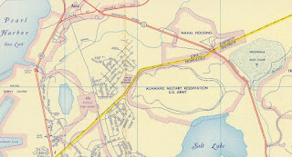

Hawaiihighways.com details the construction history of Interstate H-1 on their O'ahu page. The first segment of the Lunalilo Freeway to be constructed as Interstate H-1 between Exit 25B east to 26A was completed by 1965. This segment can be seen under construction in the 1965 Hawaii Department of Transportation photo below.


The remainder of the Lunalilo Freeway segment of Interstate H-1 in Honolulu was completed by July 1969. During late 1971 work began to convert the corridor of Moanalua Road to a freeway. The Moanalua Road corridor was reassigned as Hawaii Route 78 which reflected it's freeway conversion largely being funded under Federal Aid Primary 78. The conversion of Moanalua Road into the Moanalua Freeway is listed as being fully available to traffic by January 23rd, 1975 in the AASHTO Database. With the construction of the Moanalua Freeway corridor being completed Hawaii Route 72 was truncated to it's current form. A cutout Hawaii Route 72 shield can be seen in 2007 in Aiea on hawaiihighways.com.

On April 6th, 1988 the Honolulu Division Administrator of the Hawaii Department of Transportation submitted a request to the Federal Highway Administration to add entirety of Hawaii Route 78 and the Moanalua Freeway to the Interstate System as Interstate H-1A. On November 1st, 1989 The Federal Highway Administration informed the Hawaii Department of Transportation that Hawaii Route 78/Moanalua Freeway was approved to be added to the Interstate System as Interstate H-1A. The Federal Highway Administration did note that the Middle Street Interchange did not conform to Interstate standards. The Federal Highway Administration further noted the Hawaii Department of Transportation would need to petition the American Association of State Highway and Transportation ("AASHTO") Route Numbering Committee to approve the designation of Interstate H-1A.


On May 18th, 1990 the Hawaii Department of Transportation submitted an application to the AASHTO for Interstate H-1A to be designated over Hawaii Route 78/Moanalua Freeway.


On June 14th, 1990 the AASTHO informed the Hawaii Department of Transportation that the consideration of the approval of the designation of Interstate H-1A was withheld pending further review.

The Federal Highway Administration in a letter to the AASHTO dated June 18th, 1990 noted that it was aware the latter was no longer approving suffixed US Routes and Interstates. The Federal Highway Administration went onto add it would ask the Hawaii Department of Transportation to seek a three digit auxiliary designation for the Moanalua Freeway given it looped to/from Interstate H-1.

On October 24th, 1990 the Hawaii Department of Transportation petitioned to the AASHTO assigned the Moanalua Freeway as Intestate H-101. On December 8th, 1990 the AASHTO Executive Committee approved the designation of Interstate H-201 on the Moanalua Freeway. In the AASHTO's response to the Hawaii Department of Transportation noted it selected H-201 given the Moanalua Freeway was a loop of Interstate H-1 and thusly an even digit auxiliary designation was appropriate. Note; odd three digit Interstate numbers are intended to denote auxiliary spur Intestates.


The designation of Interstate H-201 was not signed on the Moanalua Freeway for numerous years and the existing Hawaii Route 78 signage remained in place. The Hawaii Department of Transportation over years noted several concerns over signing Interstate H-201:

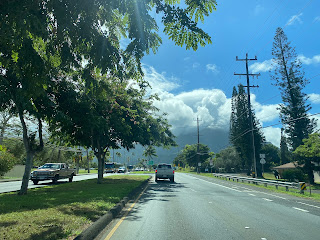


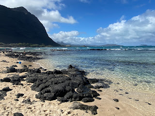
Hawaii Route 72 follows Pukakukui Channel towards Makapu'u Beach. Makapu'u Beach overlooks the Islands of Kāohikaipu (Black Rock) and Mānana (Rabbit Island) facing northward.


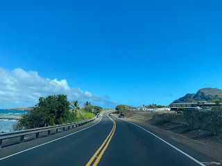


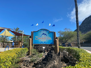
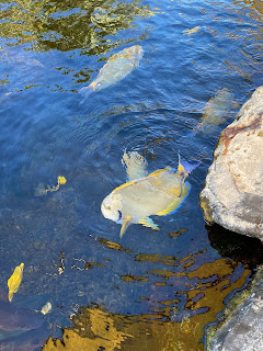
Hawaii Route 72 immediately east of Makapu'u Beach passes by Sea Life Park. Sea Life Park opened during 1964 and is largely known for it's Dolphin and Sea Turtle displays.



Hawaii Route 72 turns southward upon reaching Makapu'u Point.


Hawaii Route 72 enters the City of Honolulu and begins to turn westward near Kaloko Beach.


Hawaii Route 72 follows the southern shore of O'ahu westward along Koko Crater and becomes a four-lane highway approaching Maunalua Bay.


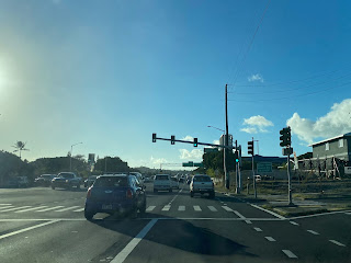
Hawaii Route 72 continues westward and becomes Intestate H-1 upon crossing the Ainakoa Avenue intersection. Hawaii Route 72 terminates with no end signage as Interstate H-1 and the Luanlilo Freeway begins.



Comments