When I’m not on the clock helping to build
or maintain the latest generation of bridges in the New York metro area, you
can typically find me out and about documenting our nation’s many great bridge
structures from coast to coast. While I’ve had the thrill of seeing all of this
country’s greatest engineering achievements in-person over the last ten years
of travel, it’s also true that some of my personal favorite discoveries are the
ones well off the beaten path and far away from the established list of “Greatest
Hits” everyone in road/bridge enthusiasm tends to want to talk about.
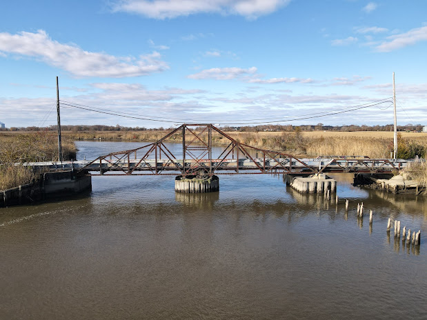
Built in 1905 by the New Jersey Bridge
Company of Manasquan, NJ, this charming little steel swing bridge is located
along New Bridge Road (County Route 623) as it spans Alloway Creek in rural
Salem County, NJ not far from the northern reaches of the Delaware Bay. (The
name “Alloway” is derived from the name of a local Native American chief in
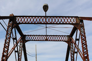
colonial times, known as “Allowas”.) It was built as a center-bearing swing
bridge containing a turntable located centrally beneath the main truss
superstructure that enabled this part of the bridge to rotate 90 degrees to
allow the passage of boat traffic. This moveable component of the structure was
man-powered – a bridge tender would use a hand crank that through a small-diameter
hole in the deck would turn the gears located beneath the deck in the central
turntable, thus enabling the bridge to swing in the desired direction. This
old-fashioned method can still be found in-use today in many locations,
including (but not limited to) on some of the moveable railroad bridges on the
Northeast Corridor. (The bridges on the Susquehanna and Hackensack Rivers come
to mind.) At this location, there is no evidence that this bridge was ever “moved”
for boat traffic at any time in the last 50 years.

A general view at roadway level, looking southward
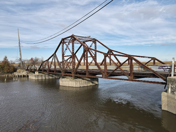
Altogether, this bridge has a total length
about 150 ft; the two halves of the central swing superstructure each measure
about 50 ft apiece. The bridge’s wooden road deck is only 14 ft wide, meaning
it has never been capable of handling two-way vehicle traffic. (It should be
said that traffic counts in this part of the state hardly ever came close to
making this an inadequate arrangement.) Decorative finials once adorned the
four top corners of the central swing span truss above the turntable; none of
them remain standing with the structure – the last of which was lost sometime
in the last 10 years based on recent photography. There may also have been a typical
builders plaque located somewhere on the structure; there is no photographic evidence
of such a piece existing on the structure in the last 20 years. There is also
no definitive answer to the question of what this bridge’s actual name was. It
may have been known simply as “New Bridge” due to the name of the road it
carries, or it may have been called something else entirely. I choose to leave
that question unresolved and hope that future research will be able to provide
a more definitive answer.
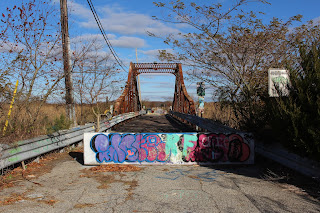
This bridge has been closed to all traffic
since 1991 when it was determined that the structure had deteriorated to the
point where the continued maintenance of traffic on the roadway was no longer
desirable. In the 30 years since that full closure, this bridge has sat idly
and quietly awaiting either a new lease on life or its potential ultimate
demise at the hands of the wrecking ball. Either way, neither Salem County nor
any other entity appears to be in a hurry to do anything about the current situation,
although there are current talks & rumors of a new bridge being built here
to replace the existing one should it be torn down.
As a lover & admirer of bridges going way back to my childhood, I had heard about this particular one for many years (from sources such as our own Doug Kerr and also Steve Alpert of the great road-related website “alpsroads.net”), but I (for whatever reason) never remembered or thought to travel out this way to find this little-known bridge in this little-known corner of the Garden State. It’s the hope of this author that this bridge will continue to stand for many years to come due to its historical significance and engineering landmark status and will someday be reopened to traffic of some kind, whether that be as a pedestrian/bicycle-only facility or some other context-sensitive variation & use to be determined. I hope you enjoy the pictures that follow; this mix of ground-level and aerial shots were taken in November 2021 and show a deteriorating structure that has not yet lost all of its charm. I will gladly add this one to my own “Greatest Hits” collection as a result of this unexpectedly fruitful visit.
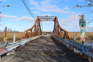
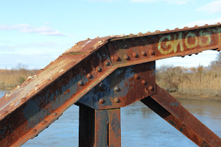
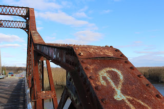
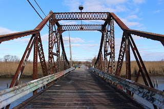
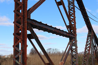
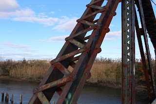
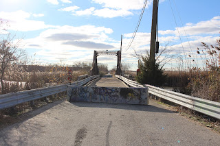
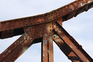


The above photos show various aerial points of view of the existing structure, courtesy of a DJI quadcopter drone. Click on each image to see a larger version.
Comments
Barbara Bradway