2016 Fall Mountain Trip Part 12; Utah State Route 12, Utah State Route 63, Bryce Canyon National Park and the Grand Staircase
Following completing Utah State Route 9 through Zion National Park I joined US 89 at Mount Carmel Junction. I took US 89 to the western terminus of Utah State Route 12 towards Bryce Canyon National Park.

This blog entry serves as Part 12 of the 2016 Fall Mountain Trip Series, Part 11 can be found here:
2016 Fall Mountain Trip Part 11; Zion National Park and Utah State Route 9/The Mount Carmel Highway
Utah State Route 12 is an approximately 122.8 mile state highway from US Route 89 in Garfield County east to UT 24 in Wayne County. Much of UT 12 traverses the Grand Staircase of the Colorado Plateau is is among the most scenic highways in the United States. UT 12 is known "Scenic 12 Byway or A Journey Through Time Scenic Byway." UT 12 is also one of thirty one designated All-American Roads recognized by USDOT.
From US 89 I turned east on UT 12 towards Bryce Canyon.

East of US 89 the route of UT 12 enters Dixie National Forest and Grand Staircase (Escalante) National Monument. Grand Staircase National Monument protects a large swath of the high steps of the Colorado Plateau in southern Utah and was designated in 1996. In 2017 Grand Staircase National Monument was reduced in size by 47% by Presidential Order but remains very large at 1,003,863 acres.
UT 12 eastbound traverses through an area known as Red Rock Canyon. Red Rock Canyon has several sandstone tunnels which UT 12 traverses through and has some of the worn hoodoos similar to those in nearby Bryce Canyon National Park.


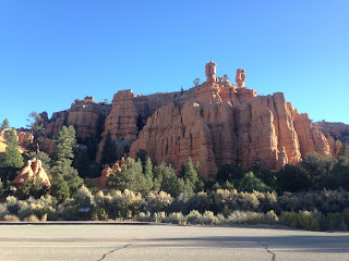


East of Red Rock Canyon UT 12 empties out onto a flat valley along side Mud Spring Creek.

At Jones Valley Road UT 12 has a junction with UT 63. Jones Valley Road despite being gravel to the north is signed as a "To" route to UT 22. UT 63 is a 2.63 mile State Highway which travels south from UT 12 to the boundary of Bryce Canyon National Park.

The story of UT 12 is a complicated one. When UT 12 was first signed in the 1920s it ran from Bryce Junction east to Tropic. By 1931 UT 54 east of Tropic was created along with UT 120 extending from Tropic to Henrieville. By 1935 UT 54 absorbed the routing of UT 120.
By 1935 traffic from Bryce Canyon to Escalante was routed north on Jones Valley Road which was UT 22 to Widtsoe and east on UT 23 following Birch Creek. Access by road to Boulder from Escalante wasn't completed until 1933 when the Civilian Conservation Corps opened Hell's Backbone Road. The route to Hell's Backbone Road north of Escalante was accessed via Pine Creek Road to the vicinity to Posey Lake.
By 1941 UT 23 was extended to from Escalante to Boulder on a new alignment south of Hell's Backbone Road. By 1947 UT 54 was extended to Boulder along what was Henrieville-Escalante Road, UT 23 at the time was completely decomissioned. UT 117 had been created between Teasdale to Grover in 1931 and was extended to Boulder by 1957. The 1957 extension of UT 117 created a full route series of State Routes from US 89 to UT 24 over the Grand Sraircase, but one that consisted of various route designations. In 1969 UT 12 was extended from Tropic to UT 24 creating a singular route over the Grand Staircase. The route of current UT 63 became a spur route of UT 12 that was redesignated as UT 63 in 1975.
This 1950 Utah State Highway Map shows the original extent of UT 12 along with UT 23, the 1935 extension of UT 54, and original route of UT 117.
1950 Utah State Highway Map
From UT 12 I traveled south into Bryce Canyon National Park. The primary feature of Bryce Canyon National Park is the natural amphitheater of sandstone hoodoos. Bryce Canyon National Park generally lies at elevation between 7,500 to 9,000 feet above sea level with the primary section of the park being contained to the eastern flank of the Paunsaugunt Plateau.
Bryce Canyon was discovered in 1850 by Mormon Pioneers, it's name comes from a homesteader in the 1870s. Bryce Canyon was set aside as a National Monument in 1923 and was elevated to a National park by 1928.
In my opinion Bryce Canyon is the best and most scenic of the five Utah National Parks. I did stop all the major view points; Bryce Point, Inspiration Point, and Sunset Point before hiking for an hour or so in the hoodoos.


After leaving Bryce Canyon I continued east on UT 12 through Tropic. UT 12 begins to run alongside the Paria River through Cannonville. UT 12 swings east from Cannonville to Henrieville, I took this below photo from the highway looking back westward towards Bryce Canyon.
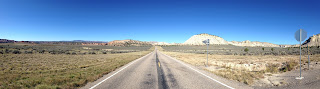
This photo is looking north from UT 12 between Cannonville and Henrieville.

Past Henrieville UT 12 begins to curve northeast through the plateaus to Powell Point Vista.


UT 12 begins to level out approaching Escalante. UT 12 picks up the former route of UT 23 and the Escalante River west of the the City at Old Escalante Road. Escalante is the largest community on UT 12 with an approximate population of about 800.


As stated above Hell's Backbone Road can be accessed from UT 12 in Escalante via Pine Creek Road. Hell's Backbone Road is a graded gravel road that provides access to the Box Death Hollow Wilderness. Hell's Backbone might be passable by car in dry weather but it is considered dangerous with the remote 38 mile roadway through various cliff faces. Hell's Backbone Road most notable feature is the namesake bridge which is 109 feet long with a 1,500 foot drop on either side. More information on Hell's Backbone Road can be found here:
Utah.com on Hell's Backbone Road
East of Escalante UT 12 reenters Grand Staircase National Monument. Near the National Monument marker The Hole-in-the-Rock Road is accessible via BLM Road 200. The Hole in the Rock Road is a 180 mile trail from Escalante eastward to Bluff which follows the path of the 1879 Mormon San Juan Expedition which sought to colonize southeast Utah. The Hole-in-the-Rock refers to a rock formation above Lake Powell. The Hole-in-the-Rock formation was used in 1880 to route over 80 wagons down to the Colorado River.


East of the Hole-in-the-Rock Road UT 12 begins to bend back northeast towards the Escalante River again. There is a significant overlook of the switch-backs at the Head of Rocks Overlook.


The descent to the Escalante River is steep with slow recommended speed limits.

The Escalante River can be observed directly west of the Kiva Coffeehouse on UT 12.

North of the Escalante River UT 12 swings directly north following a ridge between Calf Creek to the west and Boulder Creek to the east. I stopped at the Calf Creek Viewpoint where both creek canyons could be observed with UT 12 running down the center.

UT 12 passes by the east terminus of Hell's Backbone Road and begins to follow Boulder Creek into Boulder.

North of Boulder UT 12 begins to ascend the Aquarius Plateau. The Aquarius Plateau is considered the top step of the Grand Staircase and Colorado Plateau with a maximum height of 11,317 at Boulder Creek. UT 12 traverses the Aquarius Plateau along the eastern flank which provides views of Capitol Reef National Park. The Waterpocket Fold of Capitol Reef can be off the east in the distance.


UT 12 tops out at a summit of 9,600 feet on the Aquarius Plateau.

The descent off the Aquarius Plateau is very steep but a steady 6-8% grade. The grade is good enough that finding an appropriate low gear to provide enough speed is difficult. From the Larb Hollow Overlook Lower Bowns Reservoir can be seen along with the cliffs along side UT 24 in Capitol Reef National Park.

UT 12 gradually descends through Grover and reaches UT 24 in Torrey via Morrill Ranch Road. UT 12 has an eastern terminus at UT 24 and US Bike Route 70.


Part 13 of this series can be found here:
2016 Fall Mountain Trip Part 13; Utah State Route 24, Capitol Reef National Park, and Goblin Valley

This blog entry serves as Part 12 of the 2016 Fall Mountain Trip Series, Part 11 can be found here:
2016 Fall Mountain Trip Part 11; Zion National Park and Utah State Route 9/The Mount Carmel Highway
Utah State Route 12 is an approximately 122.8 mile state highway from US Route 89 in Garfield County east to UT 24 in Wayne County. Much of UT 12 traverses the Grand Staircase of the Colorado Plateau is is among the most scenic highways in the United States. UT 12 is known "Scenic 12 Byway or A Journey Through Time Scenic Byway." UT 12 is also one of thirty one designated All-American Roads recognized by USDOT.
From US 89 I turned east on UT 12 towards Bryce Canyon.

East of US 89 the route of UT 12 enters Dixie National Forest and Grand Staircase (Escalante) National Monument. Grand Staircase National Monument protects a large swath of the high steps of the Colorado Plateau in southern Utah and was designated in 1996. In 2017 Grand Staircase National Monument was reduced in size by 47% by Presidential Order but remains very large at 1,003,863 acres.
UT 12 eastbound traverses through an area known as Red Rock Canyon. Red Rock Canyon has several sandstone tunnels which UT 12 traverses through and has some of the worn hoodoos similar to those in nearby Bryce Canyon National Park.


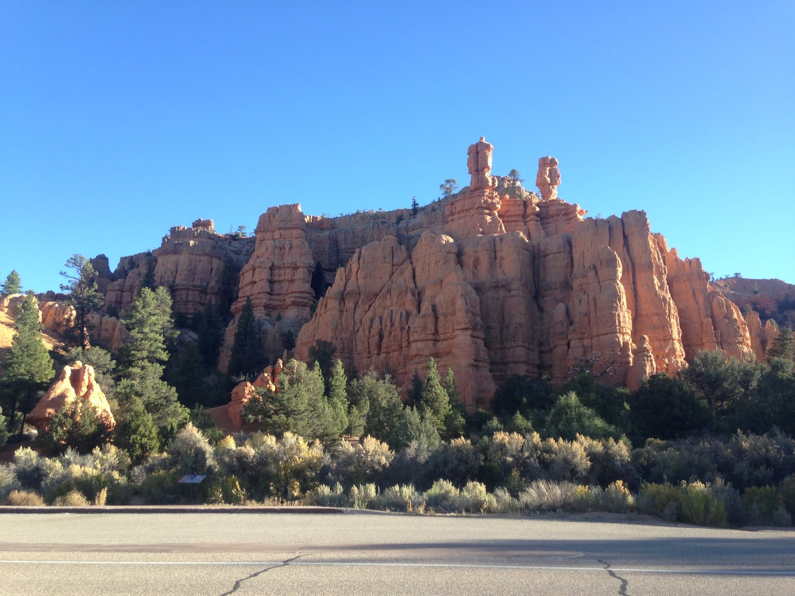


East of Red Rock Canyon UT 12 empties out onto a flat valley along side Mud Spring Creek.

At Jones Valley Road UT 12 has a junction with UT 63. Jones Valley Road despite being gravel to the north is signed as a "To" route to UT 22. UT 63 is a 2.63 mile State Highway which travels south from UT 12 to the boundary of Bryce Canyon National Park.

The story of UT 12 is a complicated one. When UT 12 was first signed in the 1920s it ran from Bryce Junction east to Tropic. By 1931 UT 54 east of Tropic was created along with UT 120 extending from Tropic to Henrieville. By 1935 UT 54 absorbed the routing of UT 120.
By 1935 traffic from Bryce Canyon to Escalante was routed north on Jones Valley Road which was UT 22 to Widtsoe and east on UT 23 following Birch Creek. Access by road to Boulder from Escalante wasn't completed until 1933 when the Civilian Conservation Corps opened Hell's Backbone Road. The route to Hell's Backbone Road north of Escalante was accessed via Pine Creek Road to the vicinity to Posey Lake.
By 1941 UT 23 was extended to from Escalante to Boulder on a new alignment south of Hell's Backbone Road. By 1947 UT 54 was extended to Boulder along what was Henrieville-Escalante Road, UT 23 at the time was completely decomissioned. UT 117 had been created between Teasdale to Grover in 1931 and was extended to Boulder by 1957. The 1957 extension of UT 117 created a full route series of State Routes from US 89 to UT 24 over the Grand Sraircase, but one that consisted of various route designations. In 1969 UT 12 was extended from Tropic to UT 24 creating a singular route over the Grand Staircase. The route of current UT 63 became a spur route of UT 12 that was redesignated as UT 63 in 1975.
This 1950 Utah State Highway Map shows the original extent of UT 12 along with UT 23, the 1935 extension of UT 54, and original route of UT 117.
1950 Utah State Highway Map
From UT 12 I traveled south into Bryce Canyon National Park. The primary feature of Bryce Canyon National Park is the natural amphitheater of sandstone hoodoos. Bryce Canyon National Park generally lies at elevation between 7,500 to 9,000 feet above sea level with the primary section of the park being contained to the eastern flank of the Paunsaugunt Plateau.
Bryce Canyon was discovered in 1850 by Mormon Pioneers, it's name comes from a homesteader in the 1870s. Bryce Canyon was set aside as a National Monument in 1923 and was elevated to a National park by 1928.
In my opinion Bryce Canyon is the best and most scenic of the five Utah National Parks. I did stop all the major view points; Bryce Point, Inspiration Point, and Sunset Point before hiking for an hour or so in the hoodoos.


After leaving Bryce Canyon I continued east on UT 12 through Tropic. UT 12 begins to run alongside the Paria River through Cannonville. UT 12 swings east from Cannonville to Henrieville, I took this below photo from the highway looking back westward towards Bryce Canyon.

This photo is looking north from UT 12 between Cannonville and Henrieville.

Past Henrieville UT 12 begins to curve northeast through the plateaus to Powell Point Vista.


UT 12 begins to level out approaching Escalante. UT 12 picks up the former route of UT 23 and the Escalante River west of the the City at Old Escalante Road. Escalante is the largest community on UT 12 with an approximate population of about 800.

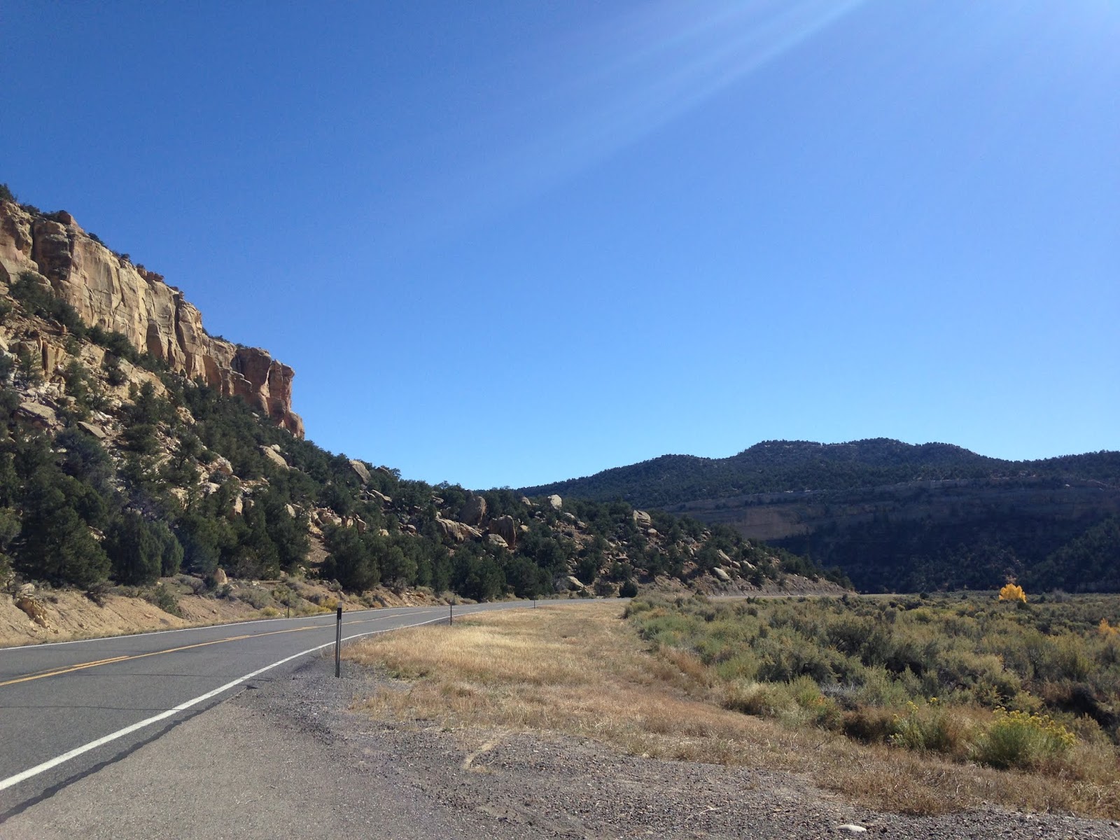
As stated above Hell's Backbone Road can be accessed from UT 12 in Escalante via Pine Creek Road. Hell's Backbone Road is a graded gravel road that provides access to the Box Death Hollow Wilderness. Hell's Backbone might be passable by car in dry weather but it is considered dangerous with the remote 38 mile roadway through various cliff faces. Hell's Backbone Road most notable feature is the namesake bridge which is 109 feet long with a 1,500 foot drop on either side. More information on Hell's Backbone Road can be found here:
Utah.com on Hell's Backbone Road
East of Escalante UT 12 reenters Grand Staircase National Monument. Near the National Monument marker The Hole-in-the-Rock Road is accessible via BLM Road 200. The Hole in the Rock Road is a 180 mile trail from Escalante eastward to Bluff which follows the path of the 1879 Mormon San Juan Expedition which sought to colonize southeast Utah. The Hole-in-the-Rock refers to a rock formation above Lake Powell. The Hole-in-the-Rock formation was used in 1880 to route over 80 wagons down to the Colorado River.


East of the Hole-in-the-Rock Road UT 12 begins to bend back northeast towards the Escalante River again. There is a significant overlook of the switch-backs at the Head of Rocks Overlook.


The descent to the Escalante River is steep with slow recommended speed limits.

The Escalante River can be observed directly west of the Kiva Coffeehouse on UT 12.

North of the Escalante River UT 12 swings directly north following a ridge between Calf Creek to the west and Boulder Creek to the east. I stopped at the Calf Creek Viewpoint where both creek canyons could be observed with UT 12 running down the center.

UT 12 passes by the east terminus of Hell's Backbone Road and begins to follow Boulder Creek into Boulder.

North of Boulder UT 12 begins to ascend the Aquarius Plateau. The Aquarius Plateau is considered the top step of the Grand Staircase and Colorado Plateau with a maximum height of 11,317 at Boulder Creek. UT 12 traverses the Aquarius Plateau along the eastern flank which provides views of Capitol Reef National Park. The Waterpocket Fold of Capitol Reef can be off the east in the distance.


UT 12 tops out at a summit of 9,600 feet on the Aquarius Plateau.

The descent off the Aquarius Plateau is very steep but a steady 6-8% grade. The grade is good enough that finding an appropriate low gear to provide enough speed is difficult. From the Larb Hollow Overlook Lower Bowns Reservoir can be seen along with the cliffs along side UT 24 in Capitol Reef National Park.

UT 12 gradually descends through Grover and reaches UT 24 in Torrey via Morrill Ranch Road. UT 12 has an eastern terminus at UT 24 and US Bike Route 70.


Part 13 of this series can be found here:
2016 Fall Mountain Trip Part 13; Utah State Route 24, Capitol Reef National Park, and Goblin Valley
Comments