Back in the winter of 2012 I took the entirety Arizona State Route 564 from US Route 160 north to Navajo National Monument.

AZ 564 is an approximately 9.1 mile north/south State Route from US 160/BIA 41 in the Navajo Nation of Navajo County. AZ 564 was created in 1970 when it connected to what was US Route 164. US 164 was the second US Route to carry said designation and existed from 1966 to 1970. US 164 was routed between Cortez, CO west to Flagstaff via multiplex of US 89. The history of the endpoints of US 164 can seen seen on USends.com.
USends.com on US 164 (ii)
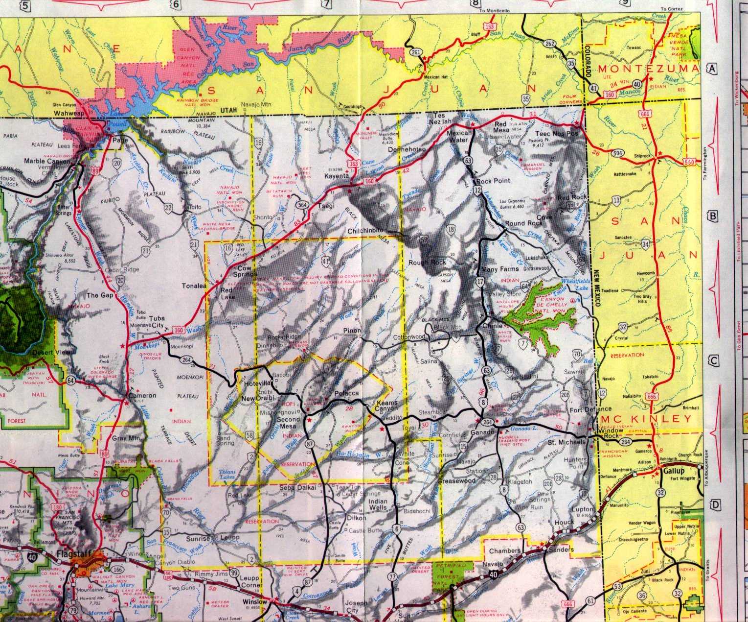
At some point during 1970 US 164 was replaced by US 160 in Arizona. The irony of the previous US 164 designation was that the route east of US 89 originally was part of AZ 64 which essentially made AZ 564 the fifth spur route of said highway. Aside from AZ 264 the routing of AZ 564 is the only child route of AZ 64 that remains. AZ 564 can first be seen on this 1971 State Highway Map of Arizona.
1971 Arizona State Highway Map
AZ 564 doesn't have any significant junctions on it's routing north to Navajo National Monument but the road does become BIA 221 at the National Park Boundary. BIA 221 loops southwest from Navajo National Monument towards AZ 98.
Navajo National Monument is located on the Shonto Plateau sub-region of the Colorado Plateau and protects the well preserved Anasazi cliff-dwellings located there. The cliff dwellings generally are known as Keet Seel and are located near the bottom of Tsegi Canyon. Keet Seel was first occupied around 1250 the structures preserved today were built through the 1270s to 1280s. Keet Seel was rediscovered in 1895 and was designated as a National Monument in 1909.


AZ 564 is an approximately 9.1 mile north/south State Route from US 160/BIA 41 in the Navajo Nation of Navajo County. AZ 564 was created in 1970 when it connected to what was US Route 164. US 164 was the second US Route to carry said designation and existed from 1966 to 1970. US 164 was routed between Cortez, CO west to Flagstaff via multiplex of US 89. The history of the endpoints of US 164 can seen seen on USends.com.
USends.com on US 164 (ii)
At some point during 1970 US 164 was replaced by US 160 in Arizona. The irony of the previous US 164 designation was that the route east of US 89 originally was part of AZ 64 which essentially made AZ 564 the fifth spur route of said highway. Aside from AZ 264 the routing of AZ 564 is the only child route of AZ 64 that remains. AZ 564 can first be seen on this 1971 State Highway Map of Arizona.
1971 Arizona State Highway Map
AZ 564 doesn't have any significant junctions on it's routing north to Navajo National Monument but the road does become BIA 221 at the National Park Boundary. BIA 221 loops southwest from Navajo National Monument towards AZ 98.
Navajo National Monument is located on the Shonto Plateau sub-region of the Colorado Plateau and protects the well preserved Anasazi cliff-dwellings located there. The cliff dwellings generally are known as Keet Seel and are located near the bottom of Tsegi Canyon. Keet Seel was first occupied around 1250 the structures preserved today were built through the 1270s to 1280s. Keet Seel was rediscovered in 1895 and was designated as a National Monument in 1909.


Comments