Back in 2016 I had a chance to drive Nevada State Route 431 from NV 28 at Lake Tahoe northeast to US 395A/NV 341 south of Reno.

NV 431 is a 24.4 mile State Highway and as the sign above states is reputed to be the highest all-year pass in the Sierra Nevada Range at 8,911 feet above sea level. The Mount Rose Highway has been a Signed State Highway for a long time first appearing on the Nevada State Highway Map in 1932 as NV 27.
1932 Nevada State Highway Map
Unlike nearby NV 28 the numbering of NV 27 was reassigned to NV 431 in 1976 during the Nevada State Highway renumbering. The new designation of NV 431 appears alongside NV 27 on the Mount Rose Highway on the 1978 Nevada State Highway Map.
1978 Nevada State Highway Map
NV 431 starts eastward from NV 28 on the northeast shore of Lake Tahoe in Incline Village at approximately 6,350 feet above sea level.

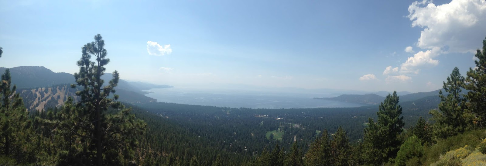
From Incline Village NV 431 begins to ascend quickly and has a massive vista of Lake Tahoe at the first major hairpin.

NV 431 quickly rises to the 8,911 feet Mount Rose Summit.

Truckee Meadows can be seen ahead from Mount Rose northeast on NV 431.

From Mount Rose NV 431 begins to descend rapidly crossing through the Mount Rose Ski Area. NV431 has a minor unsigned junction at NV 878/Slide Mountain Ski Bowl Highway.

The rapid descent of NV 431 to Truckee Meadows continues through a large number of wide switchbacks before straightening out on a steep descent.

NV 431 has a junction with US 395/I-580 before terminating at the junction of NV 341/US 395A.


NV 431 is a 24.4 mile State Highway and as the sign above states is reputed to be the highest all-year pass in the Sierra Nevada Range at 8,911 feet above sea level. The Mount Rose Highway has been a Signed State Highway for a long time first appearing on the Nevada State Highway Map in 1932 as NV 27.
1932 Nevada State Highway Map
Unlike nearby NV 28 the numbering of NV 27 was reassigned to NV 431 in 1976 during the Nevada State Highway renumbering. The new designation of NV 431 appears alongside NV 27 on the Mount Rose Highway on the 1978 Nevada State Highway Map.
1978 Nevada State Highway Map
NV 431 starts eastward from NV 28 on the northeast shore of Lake Tahoe in Incline Village at approximately 6,350 feet above sea level.

From Incline Village NV 431 begins to ascend quickly and has a massive vista of Lake Tahoe at the first major hairpin.
NV 431 quickly rises to the 8,911 feet Mount Rose Summit.

Truckee Meadows can be seen ahead from Mount Rose northeast on NV 431.

From Mount Rose NV 431 begins to descend rapidly crossing through the Mount Rose Ski Area. NV431 has a minor unsigned junction at NV 878/Slide Mountain Ski Bowl Highway.

The rapid descent of NV 431 to Truckee Meadows continues through a large number of wide switchbacks before straightening out on a steep descent.

NV 431 has a junction with US 395/I-580 before terminating at the junction of NV 341/US 395A.

Comments