
Route 66 Wednesdays; Winona ghost bridge

A very early US Route 66 in Arizona ran on Townsend-Winona Road between Flagstaff and the community of Winona.   There is an old abandoned truss bridge known as the "Winona Bridge" located just north of Townsend-Winona Road near Copley Road.


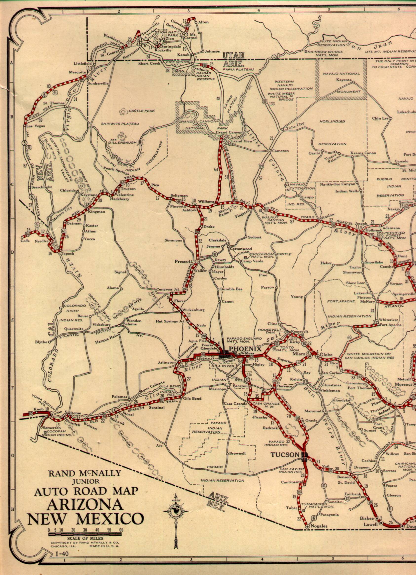
The original alignment of US 66 in Arizona including Townsend-Winona Road can be viewed on this 1927 Highway Map of Arizona.

1927 State Highway Map 

Winona is mostly known for the lyrics "Don't forget Winona" in the Bobby Troup song Route 66.  Winona was apparently established as a small rail siding of the Atlantic & Pacific Railroad known as Walnut near the mount of Walnut Canyon in 1882.  Walnut can be seen between Cosnino and Angell on the 1882 Third Operating Division of the Atlantic & Pacific Railroad map.

1882 A&P Third Operating Division Map


Site Navigation:


Comments

Popular posts from this blog

The Dummy Lights of New York

  A relic of the early days of motoring, dummy lights were traffic lights  that  were  placed  in the middle of a street intersection. In those early days, traffic shuffled through busy intersections with the help of a police officer who stood on top of a pedestal. As technology improved and electric traffic signals became commonplace, they were also  originally  positioned on a platform at the center of the intersection. Those traffic signals became known as  " dummy lights "  and were common until  traffic lights were moved  onto wires and poles that crossed above the intersection.  In New York State, only a handful of these dummy lights exist. The dummy lights  are found  in the Hudson Valley towns of Beacon and Croton-on-Hudson, plus there is an ongoing tug of war in Canajoharie in the Mohawk Valley, where their dummy light has been knocked down and replaced a few times. The dummy light in Canajoharie is currently out of commission, but popular demand has caused the dummy

Former US Route 101 and California State Route 41 through Paso Robles

Paso Robles is a city located on the Salinas River of San Luis Obispo County, California.  As originally configured the surface alignments of US Route 101 and California State Route 41 converged in downtown Paso Robles.  US Route 101 originally was aligned through Paso Robles via Spring Street.  California State Route 41 entered the City of Paso Robles via Union Road and 13th Street where it intersected US Route 101 at Spring Street.  US Route 101 and California State Route 41 departed Paso Robles southbound via a multiplex which split near Templeton.   Pictured above is the cover of the September/October 1957 California Highways & Public Works which features construction of the Paso Robles Bypass.  Pictured below is the 1935 Division of Highways Map of San Luis Obispo County which depicts US Route 101 and California State Route 41 intersecting in downtown Paso Robles.   Part 1; the history of US Route 101 and California State Route 41 in Paso Robles Paso Robles ("Pass of the

The Bayshore Freeway (US Route 101)

The Bayshore Freeway is a 56.4-mile component of US Route 101 located in the San Francisco Bay Area.  The Bayshore Freeway connects the southern extent of San Jose to the Central Freeway in the city of San Francisco.  The corridor was originally developed as the Bayshore Highway between 1923 and 1937.  The Bayshore Highway would serve briefly as mainline US Route 101 before being reassigned as US Route 101 Bypass in 1938.  Conceptually the designs for the Bayshore Freeway originated in 1940 but construction would be delayed until 1947.  The Bayshore Freeway was completed by 1962 and became mainline US Route 101 during June 1963.   Part 1; the history of the Bayshore Freeway Prior the creation of the Bayshore Highway corridor the most commonly used highway between San Jose and San Francisco was El Camino Real (alternatively known as Peninsula Highway).  The  American El Camino Real  began as an early example of a signed as an Auto Trail starting in 1906.  The era of State Highway Mainte