On my recent trip to Washington to I revisited two National Parks I went to in 2015. The first National Parks was the Hurricane Ridge region of Olympic National Park via the Hurricane Ridge Road.

Olympic National Park is located on the varied terrain of the Olympic Peninsula. Olympic National Park has various regions ranging from coastal bluffs on the Pacific Ocean, temperate rain forests like the Hoh Forest and much of the Olympic Range. Olympic National Park was designated in 1938 from the previous Olympic National Monument designation which dated back to 1909.
Hurricane Ridge is located in the Olympic Range at an elevation of 5,242 feet. The Olympic Range is a somewhat moderately high mountain range with a high elevation of 7,962 at Mount Olympus. The Olympic Range is mostly known for being the wettest place in the Continental United States on it's western ridges. Hurricane Ridge is accessed via the 17 mile Hurricane Ridge Road which ascends from Mount Angeles Road in Port Angeles. Normally I would try to attempt a full photo log of a road like the Hurricane Ridge Road but suffice to say looking at this northward view towards the Strait of Juan de Fuca that weather was on the cloudy side.

The Hurricane Ridge Road is actually a fairly gradual incline uphill on the southward trek from Port Angeles. I don't believe there are many sections that exceed a grade of 10% if any. The roadway for the most part is fairly straight with a surprisingly minimal amount of curves. There is actually a series of three tunnels near the Morse Creek Overlook. The cloud line was at about 4,000 feet above elevation this year but back in 2015 it was at about 2,000 feet which permitted far better photo taking conditions.

One of the first things that I did upon reaching Hurricane Ridge was climb over the largely snowbound High Ridge Trail to Sunrise Peak. The full width of the final ascent of the Hurricane Ridge Road can be seen from the vista at Sunrise Peak. Interestingly Sunrise Peak is the top of a skiing and snowboard board area which is open during the winter season.

The Visitor Center is located at the 5,242 foot elevation line.

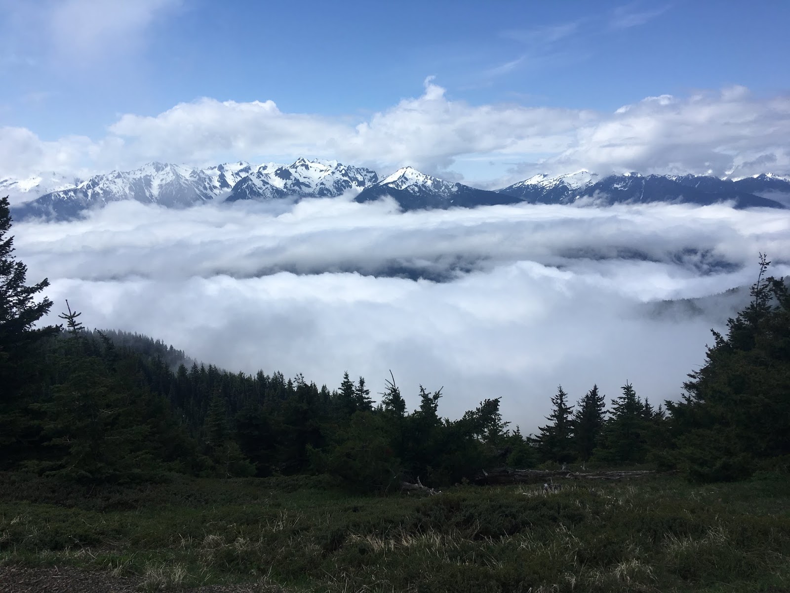
Much of the high peaks of the Olympic Range can be viewed from the Hurricane Ridge Visitor Center. Snow covers most of the peaks through the year and there are a large number of glaciers. Despite it being late May much of the trails in Hurricane Ridge were still covered in snow.


The Hurricane Ridge Road continues about another 1.5 miles west of the Visitor Center to the Hurricane Hill Trail.

The Hurricane Hill Trail is 1.6 miles long and ends at Hurricane Hill which is at 5,757 feet above elevation. The Hurricane Hill Trail isn't particularly steep but extremely narrow in places which was even more so the case with snow lapping the cliff-face. Snow blocked off access to various connecting trails and obstructed the final quarter mile to Hurricane Hill. Regardless there was still a wide open vista of the high peaks of the Olympic Range through the entire Hurricane Hill Trail.


Hurricane Ridge was first documented in 1885. Originally the area had much more mundane names like "Mount Eldridge" in place of the modern Hurricane Hill. Hurricane Ridge came to be known by the modern name when a mining prospector climbed Hurricane Hill in 100 MPH winds in 1897. A more detailed version of the story can be found on exotichikes.com.
Exotichikes on Hurricane Ridge
The earliest reference I could find for the Hurricane Ridge Road was a trail on a 1919 map of Washington State.
1919 Washington Highway Map
It doesn't appear that the Hurricane Ridge Road was built up from a trail at least until the mid-20th century as it does not appear on this 1956 Highway Map of Washington State. I'm not sure when the Hurricane Ridge Road was built but I would like to find some post-1956 maps to narrow down a time frame. If you have maps highway maps from Washington State from post-1956 please send me a note.
1956 Washington Highway Map
Update: I was provided with links by Kniwt on AAroads for the Port Angeles Evening News from 1957 and 1958. The 1957 articles show construction updates for the Hurricane Ridge Road which was originally known as the "Heart o' the Hills National Park Highway." The Hurricane Ridge Road was scheduled to be open New Years Day 1958.
3/8/1957 article
10/15/1957 article
12/17/1957 article
1/1/1958 article
According to Mapmikey on AAroads Race Street and Mount Angeles Road south from US 101 in Port Angeles was signed as Secondary State Highway 9G. In 1970 WA SSH 9G was renumbered to WA 111 which was decommissioned apparently in 1971.

Olympic National Park is located on the varied terrain of the Olympic Peninsula. Olympic National Park has various regions ranging from coastal bluffs on the Pacific Ocean, temperate rain forests like the Hoh Forest and much of the Olympic Range. Olympic National Park was designated in 1938 from the previous Olympic National Monument designation which dated back to 1909.
Hurricane Ridge is located in the Olympic Range at an elevation of 5,242 feet. The Olympic Range is a somewhat moderately high mountain range with a high elevation of 7,962 at Mount Olympus. The Olympic Range is mostly known for being the wettest place in the Continental United States on it's western ridges. Hurricane Ridge is accessed via the 17 mile Hurricane Ridge Road which ascends from Mount Angeles Road in Port Angeles. Normally I would try to attempt a full photo log of a road like the Hurricane Ridge Road but suffice to say looking at this northward view towards the Strait of Juan de Fuca that weather was on the cloudy side.

The Hurricane Ridge Road is actually a fairly gradual incline uphill on the southward trek from Port Angeles. I don't believe there are many sections that exceed a grade of 10% if any. The roadway for the most part is fairly straight with a surprisingly minimal amount of curves. There is actually a series of three tunnels near the Morse Creek Overlook. The cloud line was at about 4,000 feet above elevation this year but back in 2015 it was at about 2,000 feet which permitted far better photo taking conditions.

One of the first things that I did upon reaching Hurricane Ridge was climb over the largely snowbound High Ridge Trail to Sunrise Peak. The full width of the final ascent of the Hurricane Ridge Road can be seen from the vista at Sunrise Peak. Interestingly Sunrise Peak is the top of a skiing and snowboard board area which is open during the winter season.
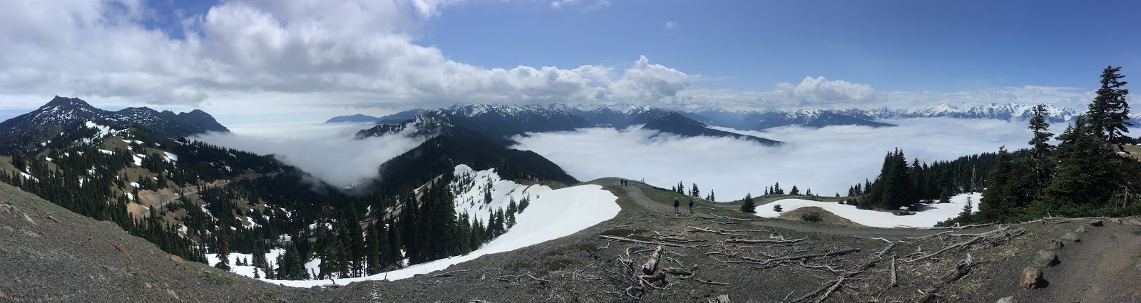
The Visitor Center is located at the 5,242 foot elevation line.

Much of the high peaks of the Olympic Range can be viewed from the Hurricane Ridge Visitor Center. Snow covers most of the peaks through the year and there are a large number of glaciers. Despite it being late May much of the trails in Hurricane Ridge were still covered in snow.


The Hurricane Ridge Road continues about another 1.5 miles west of the Visitor Center to the Hurricane Hill Trail.

The Hurricane Hill Trail is 1.6 miles long and ends at Hurricane Hill which is at 5,757 feet above elevation. The Hurricane Hill Trail isn't particularly steep but extremely narrow in places which was even more so the case with snow lapping the cliff-face. Snow blocked off access to various connecting trails and obstructed the final quarter mile to Hurricane Hill. Regardless there was still a wide open vista of the high peaks of the Olympic Range through the entire Hurricane Hill Trail.


Hurricane Ridge was first documented in 1885. Originally the area had much more mundane names like "Mount Eldridge" in place of the modern Hurricane Hill. Hurricane Ridge came to be known by the modern name when a mining prospector climbed Hurricane Hill in 100 MPH winds in 1897. A more detailed version of the story can be found on exotichikes.com.
Exotichikes on Hurricane Ridge
The earliest reference I could find for the Hurricane Ridge Road was a trail on a 1919 map of Washington State.
1919 Washington Highway Map
It doesn't appear that the Hurricane Ridge Road was built up from a trail at least until the mid-20th century as it does not appear on this 1956 Highway Map of Washington State. I'm not sure when the Hurricane Ridge Road was built but I would like to find some post-1956 maps to narrow down a time frame. If you have maps highway maps from Washington State from post-1956 please send me a note.
1956 Washington Highway Map
Update: I was provided with links by Kniwt on AAroads for the Port Angeles Evening News from 1957 and 1958. The 1957 articles show construction updates for the Hurricane Ridge Road which was originally known as the "Heart o' the Hills National Park Highway." The Hurricane Ridge Road was scheduled to be open New Years Day 1958.
3/8/1957 article
10/15/1957 article
12/17/1957 article
1/1/1958 article
According to Mapmikey on AAroads Race Street and Mount Angeles Road south from US 101 in Port Angeles was signed as Secondary State Highway 9G. In 1970 WA SSH 9G was renumbered to WA 111 which was decommissioned apparently in 1971.
Comments
It replaced the Hurricane Hill Road, built from the Elwha valley by the Civilian Conservation Corps in 1934 on the opposite (south) side of the ridge. This road was used in 1952 to '54 for construction of the Hurricane Ridge Visitors Center, and for construction of the Hurricane Ridge Road above the tunnels. It was later closed and is now the Wolf Creek Trail.
- Rod Farlee, Friends of Olympic National Park, Sequim WA