The Fort McHenry Tunnel is a 1.5-mile underwater structure which is a component of Interstate 95 in the city of Baltimore. The Fort McHenry Tunnel spans under the Patapsco River and Baltimore Harbor from Fort McHenry at Locust Point to Lazarette Point. The Fort McHenry Tunnel opened to traffic on November 23, 1985, as the final segment of Interstate 95 in Baltimore.
Part 1; the history of the Fort McHenry TunnelAs referenced in the introduction the Fort McHenry Tunnel was the final segment of Interstate 95 to be completed in the city of Baltimore. Prior to the completion of the Fort McHenry Tunnel the majority of limited access traffic used the Baltimore Habor Tunnel which had opened to traffic on November 29, 1957, as part of the Harbor Tunnel Throughway. The entirety of the Harbor Tunnel Throughway was designated as Interstate 895 during 1979 as a non-chargeable Interstate.
A bridge was first considered as the final link for Interstate 95 in Baltimore over Baltimore Harbor. The bridge concept was ultimately deemed to be undesirable due to the impact on the aesthetic of Fort McHenry and Locust Point. The final design for Interstate 95 under Baltimore Harbor consisted of four sunken tubes which would span 1.5-miles from Locust Point to Lazarette Point. Construction of the Fort McHenry Tunnel broke ground during June 1980 and would open to traffic on November 23, 1985. The Fort McHenry Tunnel was completed at an approximate cost of $750,000,000.
Part 2; a drive on Interstate 95 through Baltimore and the Fort McHenry Tunnel
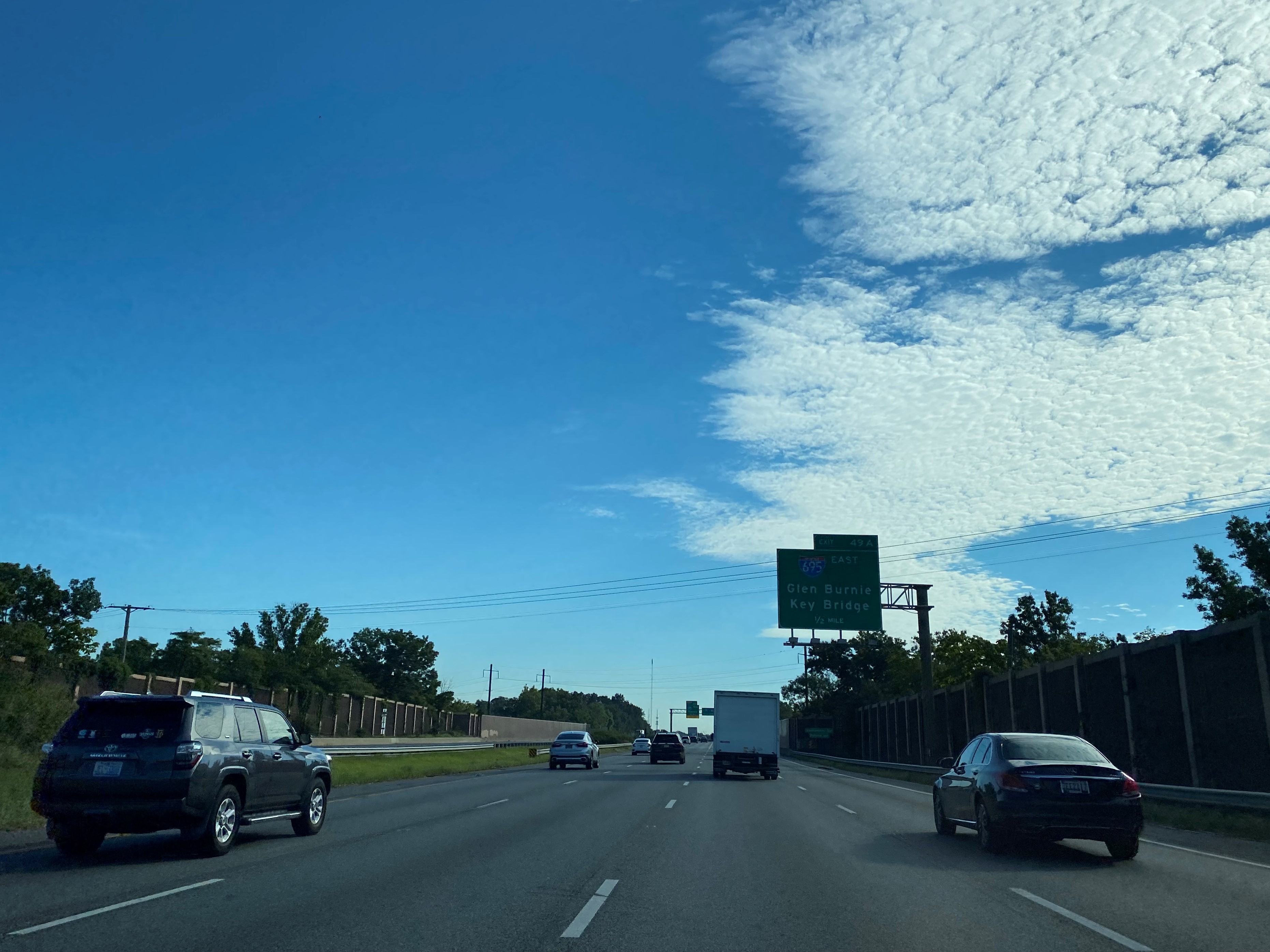
Interstate 95 northbound passes by Interstate 695 at Exit 49A-B and enters the city of Baltimore. From Exit 50A-B traffic can access Canton Avenue. Interstate 95 in Baltimore is designated as the 10.3-mile Fort McHenry Tunnel facility by the Maryland Transportation Authority
Interstate 95 northbound Exit 51 accesses Washington Boulevard.
Interstate 95 northbound Exit 52 accesses Russel Street.
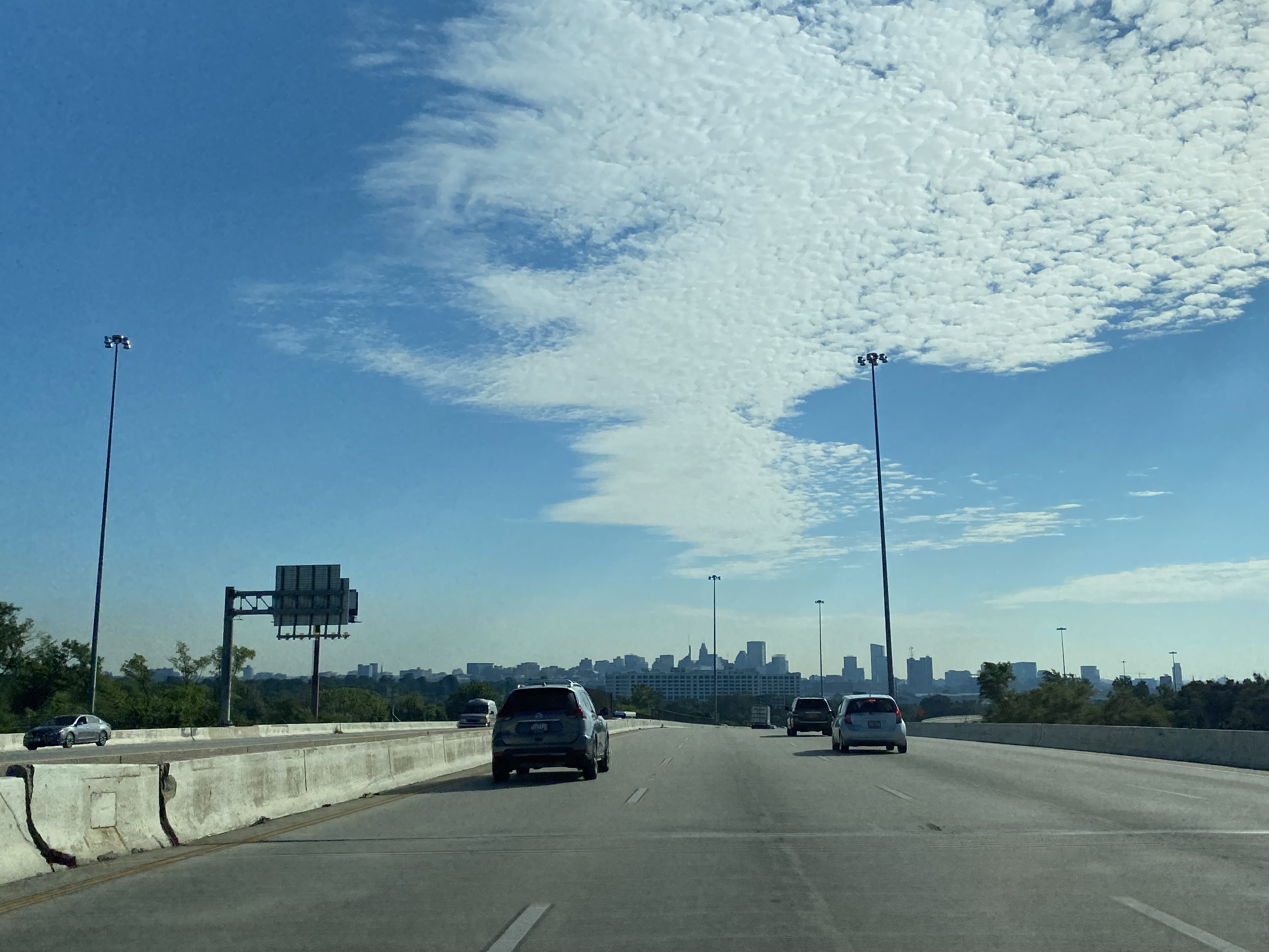
Interstate 95 northbound Exit 53 accesses Interstate 395. Interstate 395 can be used to access downtown Baltimore and Inner Baltimore Harbor.
Interstate 95 northbound Exit 54 accesses Maryland Route 2 at Hanover Street.
Interstate 95 northbound Exit 55 accesses Key Highway and Fort McHenry National Monument. Traffic on northbound Interstate 95 is notified Key Highway is the last Exit before the Fort McHenry Tunnel toll.
Northbound Interstate 95 crosses under the Patapsco River and Baltimore Harbor via Fort McHenry Tunnel tubes 3 and 4. The Fort McHenry Tunnel sees approximately 123,000 vehicles daily according to Maryland Transportation Authority traffic data.
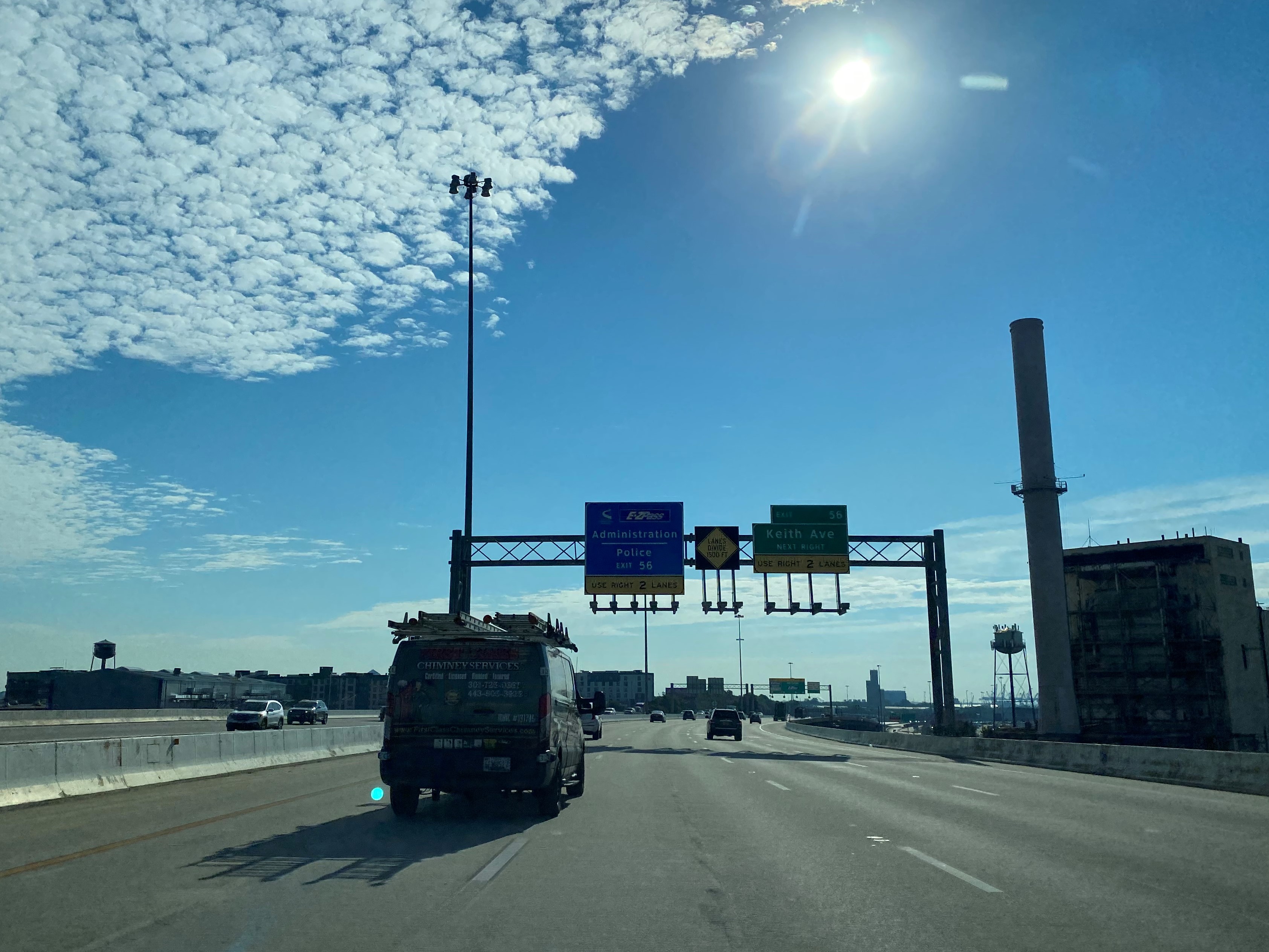
Interstate 95 emerges from the Fort McHenry Tunnel at Lazaretto Point at a series of toll gantries. The current toll rate for use of the Fort McHenry Tunnel is $4.00 for passenger vehicles. All-electric tolling of the Fort McHenry Tunnel was made permanent during August 2020. Traffic wishing to use Exit 56 towards Keith Avenue must stay in the right two lanes of the Fort McHenry Tunnel via tube 4 to reach it beyond the toll gantries.
Interstate 95 northbound Exit 57 accesses Boston Street.
Interstate 95 northbound Exit 58 accesses Dundalk Avenue.
Interstate 95 northbound Exit 59 accesses Maryland Route 150 at Eastern Avenue.
Interstate 95 northbound Exit 60 accesses Moravia Road whereas Exit 61 accesses US Route 40 at Pulaski Highway.
North of US Route 40/Pulaski Highway, Interstate 95 departs the city of Baltimore.
Part 3; Fort McHenry National Monument
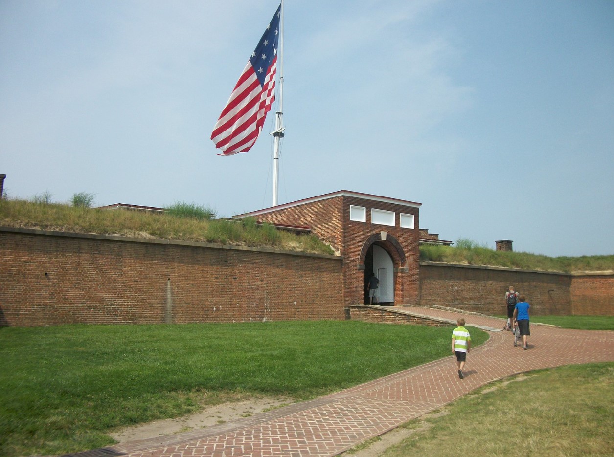
As noted in Part 2, Interstate 95 Exit 55 accesses Fort McHenry National Monument. Fort McHenry is the namesake structure for the Fort McHenry Tunnel.
The site of Fort McHenry sits of what was Fort Whetstone which existed from 1776-1797. Fort McHenry was designed by Jean Foncin as an enhanced fortification of the Port of Baltimore. Construction of Fort McHenry would begin during 1798 and would be completed during 1800. The design of Fort McHenry is a bastioned octagon which furthered fortified by a moat. Fort McHenry was named in honor of James McHenry who was a delegate of Maryland to Continental Congress and a signer of the United States Constitution.
Fort McHenry is most well-known for the role it played during the War of 1812. On September 13, 1814, Fort McHenry came under British warship bombardment via an attack led by Vice Admiral Alexander Cochrane. Fort McHenry withstood bombardment for 25 hours and ultimately repulsed the British invasion of Baltimore Harbor. The garrison flag of Fort McHenry during the Battle of Baltimore would come to be known as the Star-Spangled Banner and was the inspiration for the poem Defense of Fort McHenry. The words of Defense of Fort McHenry set to the tune of To Anacreon of Heaven became the National Athem of the United States during 1931.
Fort McHenry would see military service until World War II when it last served as a Coast Guard installation. During 1933 the historic fortification at Fort McHenry was transferred to the National Park Service. Fort McHenry would be designated a National Monument and National Shrine on August 11, 1939. Fort McHenry remains the only National Park Service unit to designated as a National Shrine.


Comments